ATL: MATTHEW - Post-Tropical - Discussion

Moderator: S2k Moderators

Message
Author
User avatar
GCANE
S2K Supporter
S2K Supporter
Posts: 11617
Joined: Mon Oct 22, 2007 8:03 am

Re: ATL: MATTHEW - Hurricane - Discussion

#2721 Postby GCANE » Sat Oct 01, 2016 9:45 am

1900hurricane wrote:
NDG wrote:[im g]http://i20.photobucket.com/albums/b245/ndgarcia/2014-06/MaracaiboMax_zpsit2sr2lx.gif[/img]

Looks like we may finally be getting some hints of an outer eyewall beginning to develop on radar.


Looks like it has been going on for a few hours

http://tropic.ssec.wisc.edu/real-time/m ... splay.html
0 likes   

NotoSans
Category 5
Category 5
Posts: 1380
Age: 25
Joined: Sun Sep 27, 2015 1:15 am
Location: Toronto
Contact:

Re: ATL: MATTHEW - Hurricane - Discussion

#2722 Postby NotoSans » Sat Oct 01, 2016 9:51 am

NHC went with 125 knots in the latest advisory, but I think they are being generous.
0 likes   
Personal Forecast Disclaimer:
The posts in this forum are NOT official forecast and should not be used as such. They are just the opinion of the poster and may or may not be backed by sound meteorological data. They are NOT endorsed by any professional institution or storm2k.org. For official information, please refer to RSMC and NWS products.

User avatar
mrbagyo
Category 5
Category 5
Posts: 3739
Age: 33
Joined: Thu Apr 12, 2012 9:18 am
Location: 14.13N 120.98E
Contact:

Re: ATL: MATTHEW - Hurricane - Discussion

#2723 Postby mrbagyo » Sat Oct 01, 2016 9:52 am

GCANE wrote:
1900hurricane wrote:
NDG wrote:[im g]http://i20.photobucket.com/albums/b245/ndgarcia/2014-06/MaracaiboMax_zpsit2sr2lx.gif[/img]

Looks like we may finally be getting some hints of an outer eyewall beginning to develop on radar.


Looks like it has been going on for a few hours

http://tropic.ssec.wisc.edu/real-time/m ... splay.html

I agree, there has been a clear moat for several hours.
1 likes   
The posts in this forum are NOT official forecast and should not be used as such. They are just the opinion of the poster and may or may not be backed by sound meteorological data. They are NOT endorsed by any professional institution or storm2k.org. For official information, please refer to RSMC, NHC and NWS products.

User avatar
JaxGator
Category 2
Category 2
Posts: 780
Joined: Sun Jun 12, 2016 3:33 pm
Location: Jacksonville Florida

Re: ATL: MATTHEW - Hurricane - Discussion

#2724 Postby JaxGator » Sat Oct 01, 2016 9:55 am

Though it's weakened some, Matthew remains a powerful Cat 4 hurricane with 145 mph winds. He's also slowed down to 6 mph heading west per NHC. That's slower than the last advisory I believe.
0 likes   
The posts or stuff said are NOT an official forecast. Please look to the NHC and NWS for official forecasts and products.

Floyd-1999, Frances-2004, Jeanne-2004, Fay-2008, Beryl-2012, Debby-2012, Colin-2016, Hermine-2016, Julia-2016, Matthew-2016, Irma-2017, Elsa-2021, Idalia-2023, Debby-2024, Helene-2024.


Go Gators! Go Jags!

User avatar
cycloneye
Admin
Admin
Posts: 146106
Age: 69
Joined: Thu Oct 10, 2002 10:54 am
Location: San Juan, Puerto Rico

Re: ATL: MATTHEW - Hurricane - Discussion

#2725 Postby cycloneye » Sat Oct 01, 2016 9:56 am

Long paragrafh that discuss about the track once it reaches the Atlantic.

Late in the period the track model spread increases, with the ECMWF
on the right and the GFS well to the left. The evolution of the
western Atlantic subtropical ridge late in the period appears to be
sensitive to the track and strength of the mid/upper-level low
currently centered over the Ohio Valley. The ECMWF shows a weaker
ridge, which allows Matthew to move farther east, while the GFS has
a stronger ridge and takes Matthew more north-northwestward. Given
the uncertainty and variability seen in the handling of these
features from cycle to cycle, the NHC forecast continues to lie in
between the two scenarios, and maintains continuity with the
previous official forecast. The new NHC track is well east of the
latest GFS by day 5, but lies west of the consensus aids. Needless
to say, confidence in the details of the track forecast at days 4
and 5 is quite low.
0 likes   
Visit the Caribbean-Central America Weather Thread where you can find at first post web cams,radars
and observations from Caribbean basin members Click Here

User avatar
GCANE
S2K Supporter
S2K Supporter
Posts: 11617
Joined: Mon Oct 22, 2007 8:03 am

Re: ATL: MATTHEW - Hurricane - Discussion

#2726 Postby GCANE » Sat Oct 01, 2016 9:58 am

mrbagyo wrote:
GCANE wrote:
1900hurricane wrote:Looks like we may finally be getting some hints of an outer eyewall beginning to develop on radar.


Looks like it has been going on for a few hours

http://tropic.ssec.wisc.edu/real-time/m ... splay.html

I agree, there has been a clear moat for several hours.


I think we are in the meat of an EWRC judging from some other microwaves and the drop in intensity.

http://tropic.ssec.wisc.edu/real-time/a ... 8_ch16.gif

http://rammb.cira.colostate.edu/product ... 010733.GIF
0 likes   

User avatar
chris_fit
Category 5
Category 5
Posts: 3249
Age: 42
Joined: Wed Sep 10, 2003 11:58 pm
Location: Tampa Bay Area, FL

Re: ATL: MATTHEW - Hurricane - Discussion

#2727 Postby chris_fit » Sat Oct 01, 2016 9:59 am

Bryan Norcross posted this about an hour ago...

Mega Hurricane Matthew Is Misbehaving
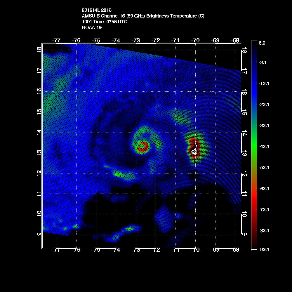
Matthew has turned into a monster. And we don’t know why. Before our eyes on it exploded into a Category 5 hurricane last night. This is even more stunning because there is no conventional wisdom, no models, no nothing that indicated that degree of strengthening. To the contrary, it appeared it would be inhibited from strengthening very rapidly yesterday, but today and tomorrow the pattern seemed that it would be more favorable.

The storm has weakened a bit and is not expected to maintain even this incredible high intensity, based on what we know about these things. Storms go through internal cycles of weakening and restrengthening, and usually end up weaker (in terms of the strongest wind anywhere in the storm) but bigger with strong winds spread over a larger area. Also, since it is a relatively small storm in size it does not control a lot of the atmosphere around it, so external factors like dry air or unfavorable upper winds are more likely to affect it. At least it is supposed to work that way.

But even if it weakens some, all indications are it is going to be very bad for some of our friends in Jamaica, Haiti, eastern Cuba, and the Bahamas. It is only a question of how very bad, and which parts of those countries gets the worst. Unless something completely unexpected happens, they will all feel the storm.
For the U.S., the threat remains for Florida and the East Coast. If anything, it has increased a bit today. And that is NOT because Matthew suddenly turned into a mega monster. It is because the future track is, seemingly, less certain.

There are three big reasons for increased uncertainty:
1) Matthew blew away all the models in intensifying so rapidly. What else don’t the models know? The models still don’t seem to have the intensity right even today.
2) Even bigger, the U.S. GFS has slowed down to be more like the Euro, meaning it will take longer to get through the Bahamas (which unfortunately would prolong the storm there). A slower storm means more forecast uncertainty since the steering pattern has time to change.
3) And annoyingly, since yesterday morning, the GFS has edged closer to Florida and the East Coast, all the way to New England. Sometimes the trend is important to pay attention to.

Having said that, the Euro is on the right side of the National Hurricane Center cone, farther east away from the U.S. And we normally trust the Euro a bit more concerning the general steering pattern. But it has been a bit inconsistent as well, and doesn’t seem to have a grasp on the strength of the storm.

NOAA and the National Hurricane Center are deploying their full resources to make the best forecasts possible for Matthew. They have deployed Hurricane Hunters to take measurements inside the storm essentially around the clock. And they are measuring the atmosphere all around Matthew plus the steering flow upstream to get the best information possible into the computer models. If there are deficiencies, they are in the state of modern science and our innate inclination to force certainty on a situation the science cannot resolve.

The bottom line: The only thing for certain is that a hurricane, possibly a very strong hurricane, is going to affect Jamaica, Haiti, eastern Cuba, and the Bahamas early to midweek. Exactly where the storm will be on Wednesday is unknowable, and where it will be a week from now is less knowable than that. But Wednesday seems to be the time frame when the threat to the U.S. would begin, if it were to materialize.

This is a situation where everybody just needs to accept the uncertainty. Matthew is not going to pounce, so there will be time to prepare if you do common-sense things now. Stay informed. Stay aware. Be prepared.
4 likes   

User avatar
drezee
S2K Supporter
S2K Supporter
Posts: 3664
Joined: Mon Jun 09, 2003 12:49 pm
Location: FL

Re: ATL: MATTHEW - Hurricane - Discussion

#2728 Postby drezee » Sat Oct 01, 2016 10:07 am

chris_fit wrote:Bryan Norcross posted this about an hour ago...

youu should post the link so that his website can get the traffic...
0 likes   

User avatar
chris_fit
Category 5
Category 5
Posts: 3249
Age: 42
Joined: Wed Sep 10, 2003 11:58 pm
Location: Tampa Bay Area, FL

Re: ATL: MATTHEW - Hurricane - Discussion

#2729 Postby chris_fit » Sat Oct 01, 2016 10:08 am

drezee wrote:
chris_fit wrote:Bryan Norcross posted this about an hour ago...

youu should post the link so that his website can get the traffic...


It was on Facebook.... Here is a link to his post.

https://www.facebook.com/TWCBryanNorcro ... 1987415481
0 likes   

User avatar
chris_fit
Category 5
Category 5
Posts: 3249
Age: 42
Joined: Wed Sep 10, 2003 11:58 pm
Location: Tampa Bay Area, FL

Re: ATL: MATTHEW - Hurricane - Discussion

#2730 Postby chris_fit » Sat Oct 01, 2016 10:15 am

I was going to post something along the lines of why is this place so dead today, the GFS is still basically right off the FL Coast, and many models still have the NW bend ESE of FL, and Matthew is still chugging W with a hint of a S component. I don't think any threats to FL have decreased, yet. Mr. Norcross said it well, proceed with caution.
1 likes   

User avatar
1900hurricane
Category 5
Category 5
Posts: 6059
Age: 34
Joined: Fri Feb 06, 2015 12:04 pm
Location: Houston, TX
Contact:

Re: ATL: MATTHEW - Hurricane - Discussion

#2731 Postby 1900hurricane » Sat Oct 01, 2016 10:15 am

GCANE wrote:
mrbagyo wrote:
GCANE wrote:
Looks like it has been going on for a few hours

http://tropic.ssec.wisc.edu/real-time/m ... splay.html

I agree, there has been a clear moat for several hours.


I think we are in the meat of an EWRC judging from some other microwaves and the drop in intensity.

http://tropic.ssec.wisc.edu/real-time/a ... 8_ch16.gif

http://rammb.cira.colostate.edu/product ... 010733.GIF

Those are the same NOAA-19 pass. So is this.

Image

Based on that pass, the spiral can be seen wrapping a little closer to the eyewall, probably signifying an eyewall replacement cycle would soon begin (and is likely underway now), but that NOAA-19 pass was bereft of an outer eyewall.
0 likes   
Contract Meteorologist. TAMU & MSST. Fiercely authentic, one of a kind. We are all given free will, so choose a life meant to be lived. We are the Masters of our own Stories.
Opinions expressed are mine alone.

Follow me on Twitter at @1900hurricane : Read blogs at https://1900hurricane.wordpress.com/

User avatar
1900hurricane
Category 5
Category 5
Posts: 6059
Age: 34
Joined: Fri Feb 06, 2015 12:04 pm
Location: Houston, TX
Contact:

Re: ATL: MATTHEW - Hurricane - Discussion

#2732 Postby 1900hurricane » Sat Oct 01, 2016 10:19 am

Matthew's October ACE (and PDI) is already greater than it was in September.
0 likes   
Contract Meteorologist. TAMU & MSST. Fiercely authentic, one of a kind. We are all given free will, so choose a life meant to be lived. We are the Masters of our own Stories.
Opinions expressed are mine alone.

Follow me on Twitter at @1900hurricane : Read blogs at https://1900hurricane.wordpress.com/

User avatar
NDG
S2K Supporter
S2K Supporter
Posts: 15463
Joined: Sun Jul 09, 2006 10:14 pm
Location: Orlando, FL

Re: ATL: MATTHEW - Hurricane - Discussion

#2733 Postby NDG » Sat Oct 01, 2016 10:19 am

Eye is clearing again.

Image
0 likes   

User avatar
SEASON_CANCELED
Category 3
Category 3
Posts: 887
Joined: Mon Jul 06, 2009 5:17 am
Location: 8 Bit Charlie Sheen

Re: ATL: MATTHEW - Hurricane - Discussion

#2734 Postby SEASON_CANCELED » Sat Oct 01, 2016 10:20 am

pretty sure it went south some more :?:
0 likes   
i am a big stupid ugly moron with an ugly face and a big butt and my butt stinks and i like to kiss my own butt

Sanibel
Category 5
Category 5
Posts: 10375
Joined: Mon Aug 30, 2004 11:06 pm
Location: Offshore SW Florida

Re: ATL: MATTHEW - Hurricane - Discussion

#2735 Postby Sanibel » Sat Oct 01, 2016 10:22 am

GFDL wants to make a 90 degree right turn and almost a straight line north and east of Florida.
0 likes   

User avatar
SEASON_CANCELED
Category 3
Category 3
Posts: 887
Joined: Mon Jul 06, 2009 5:17 am
Location: 8 Bit Charlie Sheen

Re: ATL: MATTHEW - Hurricane - Discussion

#2736 Postby SEASON_CANCELED » Sat Oct 01, 2016 10:23 am

Sanibel wrote:GFDL wants to make a 90 degree right turn and almost a straight line north and east of Florida.


I dont see that happening this has to stop and turn today then.
0 likes   
i am a big stupid ugly moron with an ugly face and a big butt and my butt stinks and i like to kiss my own butt

User avatar
northjaxpro
S2K Supporter
S2K Supporter
Posts: 8900
Joined: Mon Sep 27, 2010 11:21 am
Location: Jacksonville, FL

Re: ATL: MATTHEW - Hurricane - Discussion

#2737 Postby northjaxpro » Sat Oct 01, 2016 10:23 am

chris_fit wrote:I was going to post something along the lines of why is this place so dead today, the GFS is still basically right off the FL Coast, and many models still have the NW bend ESE of FL, and Matthew is still chugging W with a hint of a S component. I don't think any threats to FL have decreased, yet. Mr. Norcross said it well, proceed with caution.


Totally agree with you. There is too much uncertainty past five days for anyone to sound the all-clear.
Last edited by northjaxpro on Sat Oct 01, 2016 10:25 am, edited 1 time in total.
0 likes   
NEVER, EVER SAY NEVER in the tropics and weather in general, and most importantly, with life itself!!

________________________________________________________________________________________

Fay 2008 Beryl 2012 Debby 2012 Colin 2016 Hermine 2016 Julia 2016 Matthew 2016 Irma 2017 Dorian 2019

User avatar
SEASON_CANCELED
Category 3
Category 3
Posts: 887
Joined: Mon Jul 06, 2009 5:17 am
Location: 8 Bit Charlie Sheen

Re: ATL: MATTHEW - Hurricane - Discussion

#2738 Postby SEASON_CANCELED » Sat Oct 01, 2016 10:24 am

NDG wrote:It almost looks like that during the past couple of hours it went back to a more South than due West heading but it could be just a wobble.

Image


Definately went south!!
0 likes   
i am a big stupid ugly moron with an ugly face and a big butt and my butt stinks and i like to kiss my own butt

Alyono
Professional-Met
Professional-Met
Posts: 6961
Joined: Fri Apr 26, 2013 3:52 pm
Location: Texas Coast

Re: ATL: MATTHEW - Hurricane - Discussion

#2739 Postby Alyono » Sat Oct 01, 2016 10:26 am

any flooding for Columbia? There has been a death reported there already. I'm worried about that rainband lingering over the area
0 likes   

User avatar
gatorcane
S2K Supporter
S2K Supporter
Posts: 23693
Age: 47
Joined: Sun Mar 13, 2005 3:54 pm
Location: Boca Raton, FL

Re: ATL: MATTHEW - Hurricane - Discussion

#2740 Postby gatorcane » Sat Oct 01, 2016 10:33 am

Definitely looks like a wobble SW in progress

http://rammb.cira.colostate.edu/ramsdis ... display=12
0 likes   


Return to “2016”

Who is online

Users browsing this forum: No registered users and 6 guests