The posts in this forum are NOT official forecast and should not be used as such. They are just the opinion of the poster and may or may not be backed by sound meteorological data. They are NOT endorsed by any professional institution or

bubba hotep wrote:Ntxw wrote:As orangeblood was saying we have until about Jan 15th to bring in a winter storm as cold slowly pulls back. All about timing and bringing down the pesky PNA. GEFS is shifting to GOA/Pac Nw low which usually spells zonal, milder flow thereafter
EPS has a fully extended flat Pacific jet with a trough in the exit region by D15. That can be an ugly look, for winter wx lovers in TX. Hopefully, the MJO will keep truckng and tropical convection will shake things up. Lag times can be as much as 20 days from extension back to retracted with a healthy wave train. So we might have to write off the last week in January and 1st in February?
I'm still not convinced the MJO will keep trucking...signs it could stay around Phase 2/3 for awhile or fizzle out which is much more favorable than Phase 4/5/6 like the European Model is showing. I believe we really need this Asian Mountain Wave to propagate pole ward to shake things up once again/make it a more interesting February


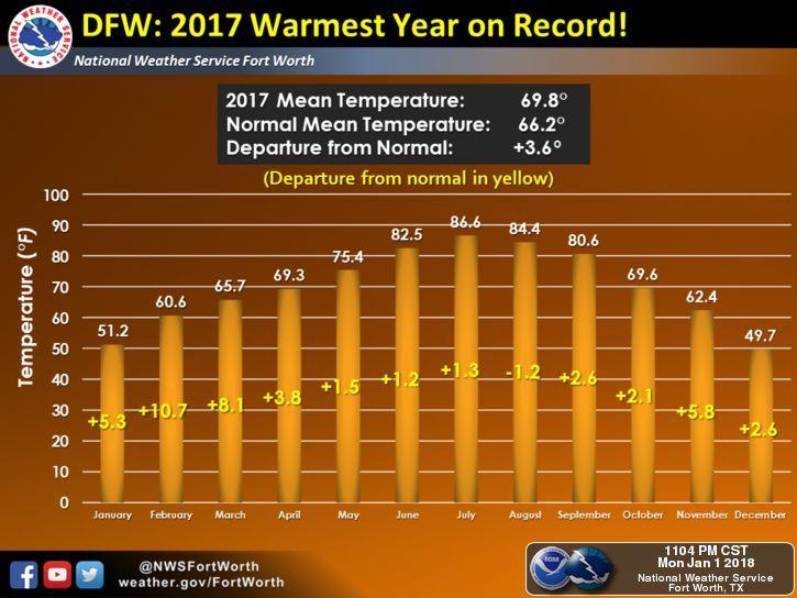
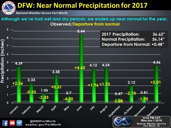
 We were stuck with clouds and drizzle on and off since December 24th lol