
Should hit water within 24 hrs.
SAL is cleared out to 30W.
Looks like it might slip under GFS's radar.
Could get a decent pouch out of this.


Moderator: S2k Moderators


emeraldislenc wrote:Any model support?


GCANE wrote:Strong, persistent MCS approaching Africa's west coast.
Should hit water within 24 hrs.
SAL is cleared out to 30W.
Looks like it might slip under GFS's radar.
Could get a decent pouch out of this.
http://i68.tinypic.com/dm5yci.jpg
http://i66.tinypic.com/2nbt1dx.gif

eastcoastFL wrote:GCANE wrote:Strong, persistent MCS approaching Africa's west coast.
Should hit water within 24 hrs.
SAL is cleared out to 30W.
Looks like it might slip under GFS's radar.
Could get a decent pouch out of this.
How long is that SAL forecast to be in that area? Where it sits its a pretty good blocker for CV storms. Im curious if it will be there for the next month.

GCANE wrote:eastcoastFL wrote:GCANE wrote:Strong, persistent MCS approaching Africa's west coast.
Should hit water within 24 hrs.
SAL is cleared out to 30W.
Looks like it might slip under GFS's radar.
Could get a decent pouch out of this.
How long is that SAL forecast to be in that area? Where it sits its a pretty good blocker for CV storms. Im curious if it will be there for the next month.
A weakening Bermuda High and no Lows in the west Sahara yielding to a flattening pressure gradient.
Looks like dust will start to settle this time next week.


AutoPenalti wrote:Wow, that ridge is parked right where it shouldn’t be...
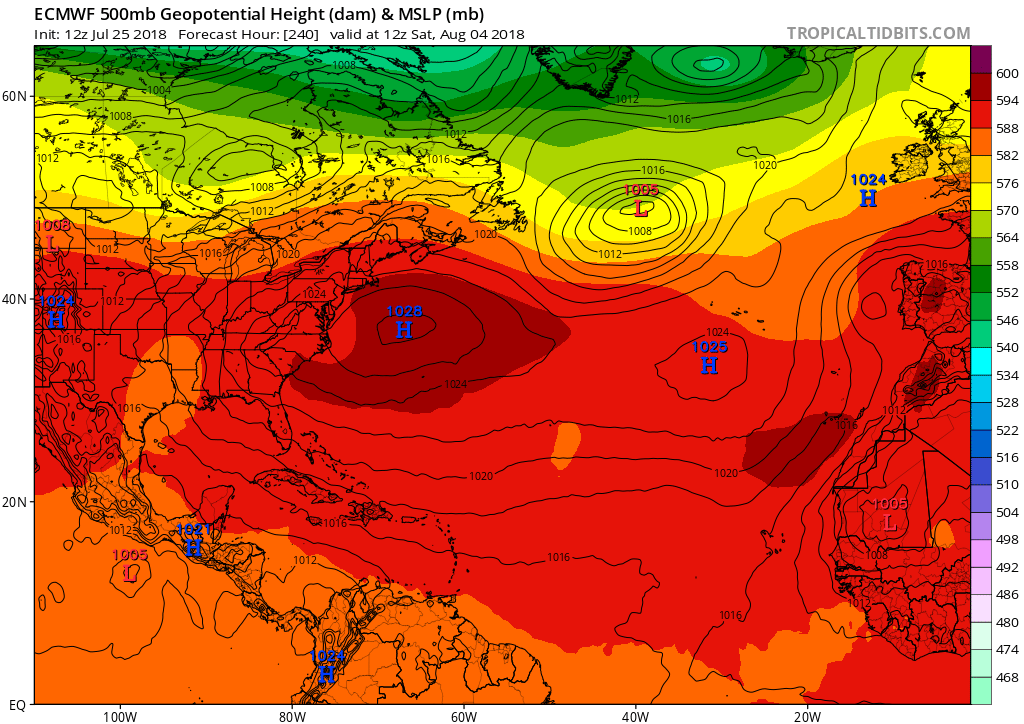
gatorcane wrote:AutoPenalti wrote:Wow, that ridge is parked right where it shouldn’t be...
That’s for sure but nothing out there with this setup thankfully. The GFS shows something similar in its long-range also.

Users browsing this forum: No registered users and 45 guests

