Tropical Wave over the SE Bahamas (Is INVEST 91L)
Moderator: S2k Moderators
Forum rules

The posts in this forum are NOT official forecasts and should not be used as such. They are just the opinion of the poster and may or may not be backed by sound meteorological data. They are NOT endorsed by any professional institution or STORM2K. For official information, please refer to products from the National Hurricane Center and National Weather Service.
Re: Tropical Wave approaching Lesser Antilles
Regarding days 8-10, the 18Z GFS is the most active of at least the last 4 runs in the GOM. However, the GEFS support looks limited to me. More GEFS support would raise confidence.
1 likes
Personal Forecast Disclaimer:
The posts in this forum are NOT official forecasts and should not be used as such. They are just the opinion of the poster and may or may not be backed by sound meteorological data. They are NOT endorsed by any professional institution or storm2k.org. For official information, please refer to the NHC and NWS products.
The posts in this forum are NOT official forecasts and should not be used as such. They are just the opinion of the poster and may or may not be backed by sound meteorological data. They are NOT endorsed by any professional institution or storm2k.org. For official information, please refer to the NHC and NWS products.
-
cycloneye

- Admin

- Posts: 149372
- Age: 69
- Joined: Thu Oct 10, 2002 10:54 am
- Location: San Juan, Puerto Rico
Re: Tropical Wave approaching Lesser Antilles
Closeup loop.

1 likes
Visit the Caribbean-Central America Weather Thread where you can find at first post web cams,radars
and observations from Caribbean basin members Click Here
and observations from Caribbean basin members Click Here
-
gatorcane

- S2K Supporter

- Posts: 23708
- Age: 48
- Joined: Sun Mar 13, 2005 3:54 pm
- Location: Boca Raton, FL
Re: Tropical Wave approaching Lesser Antilles
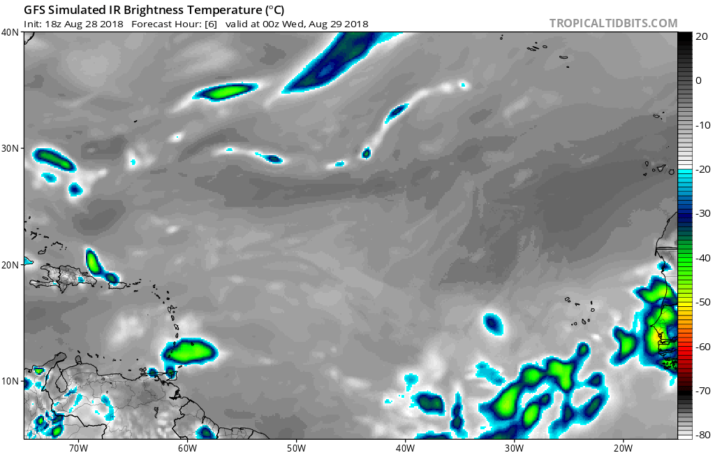
The 18Z GFS simulated IR shows nada between 18z and 00Z. Seems the model may already be underdoing the convection?
1 likes
Re: Tropical Wave approaching Lesser Antilles
gatorcane wrote:Javlin wrote:NavGem alittle further N closed above Orlando area Erin like.
http://moe.met.fsu.edu/cgi-bin/navgemtc ... =Animation
The NAVGEM has a really good upper environment conducive for development on its approach to Florida with a large upper anti-cyclone over the Bahamas:
Looks like the GFS is keeping what appears to be a significant ULL to the NW?
0 likes
-
AJC3

- Admin
- Posts: 4153
- Age: 62
- Joined: Tue Aug 31, 2004 7:04 pm
- Location: Ballston Spa, New York
- Contact:
Re: Tropical Wave approaching Lesser Antilles
Snippets from the afternoon forecast discussions from the
NWS offices in Miami and Key West...
NWS offices in Miami and Key West...
Area Forecast Discussion
National Weather Service Miami FL
357 PM EDT Tue Aug 28 2018
.DISCUSSION...
...
During the upcoming Labor Day weekend, a tropical wave should
be approaching the region which will allow for an increase in
overall moisture which will help to increase the precipitation
chances as well. The GFS and the ECMWF continue to show
disagreements in location, timing, and precipitation chances
as it is still far out in time. This will be something that will be
continued to be monitored as the weekend approaches. Other
than that, ridge will remain in place with easterly wind regime
favoring afternoon and evening showers and storms interior and
west coast and overnight morning along east coast. However,
should a better defined tropical wave more directly impact the
region, precipitation chances could be enhanced just about any
time of the day masking some the diurnal cycle. But that remains
to be seen. Temperature wise it should remain around normal for
this time of year.
Area Forecast Discussion
National Weather Service Key West FL
252 PM EDT Tue Aug 28 2018
.DISCUSSION...
...
.LONG TERM...Friday thru Tuesday, is becoming a bit more
interesting as several global models are indicating a variety of
solutions whereby tropical waves could develop anywhere from the
Bahamas into the Southeastern and Eastern Gulf of Mexico. Given
fairly weak ridging situated across the Florida Peninsula, expect
a more typical gentle east flow with a better shot at more
mesoscale type precip, given deeper PWAT in place across the Keys
and upstream. As such will maintain middle of the road chance
pops, 40% thru the entire period.
2 likes

Re: Tropical Wave approaching Lesser Antilles
gatorcane wrote:Javlin wrote:NavGem alittle further N closed above Orlando area Erin like.
http://moe.met.fsu.edu/cgi-bin/navgemtc ... =Animation
The NAVGEM has a really good upper environment conducive for development on its approach to Florida with a large upper anti-cyclone over the Bahamas:
[img]https://s8.postimg.cc/aqm90yzat/navgem_shear_watl_25.png
The GFS is completely the opposite hence no development:
[img]https://s8.postimg.cc/p9te2g5b9/gfs_shear_watl_25.png
I'd bet against the GFS in this case, it has a bad habit of overdoing troughs both in eastward timing and how far south they get.
2 likes
The above post is not official and should not be used as such. It is the opinion of the poster and may or may not be backed by sound meteorological data. It is not endorsed by any professional institution or storm2k.org. For official information, please refer to the NHC and NWS products.
-
cycloneye
- Admin
- Posts: 149372
- Age: 69
- Joined: Thu Oct 10, 2002 10:54 am
- Location: San Juan, Puerto Rico
Re: Tropical Wave approaching Lesser Antilles
Update this evening from the San Juan NWS:
Area Forecast Discussion
National Weather Service San Juan PR
1003 PM AST Tue Aug 28 2018
UPDATE...An active tropical wave interacting with an upper level
trough will affect the local area through at least Thursday.
Shower activity will increase across the Anegada Passage
overnight and gradually increase on Wednesday across the USVI and
Puerto Rico. Periods of heavy showers and gusty winds are expected
with the wave passage. The potential for urban and small stream
flooding will remain high through at least Thursday. Mudslides in
areas of steep terrain can be triggered with the heaviest
rainfall. No change needed to previous short term grids.
1 likes
Visit the Caribbean-Central America Weather Thread where you can find at first post web cams,radars
and observations from Caribbean basin members Click Here
and observations from Caribbean basin members Click Here
-
Gustywind

- Category 5

- Posts: 12334
- Joined: Mon Sep 03, 2007 7:29 am
- Location: Baie-Mahault, GUADELOUPE
Re: Tropical Wave approaching the Leeward Islands
Hi my friends, Martinica, Guadeloupe, and the Northern Leewards Islands... so those 3 islands are Under an yellow alert for a risk of strong showers and tstorms. Looks like tommorow could be a very rainy day with numerous tstorms too... should the forecast verifies too. Anyway, i will keep your informed if anything happens in the butterfly island. 
http://www.meteofrance.gp/vigilance-antilles-guyane
http://www.meteofrance.gp/vigilance-antilles-guyane
4 likes
-
cycloneye
- Admin
- Posts: 149372
- Age: 69
- Joined: Thu Oct 10, 2002 10:54 am
- Location: San Juan, Puerto Rico
Re: Tropical Wave approaching the Leeward Islands
Gustywind wrote:Hi my friends, Martinica, Guadeloupe, and the Northern Leewards Islands... so those 3 islands are Under an yellow alert for a risk of strong showers and tstorms. Looks like tommorow could be a very rainy day with numerous tstorms too... should the forecast verifies too. Anyway, i will keep your informed if anything happens in the butterfly island.
http://www.meteofrance.gp/vigilance-antilles-guyane
Thanks for the report my friend. Keep us informed as the wave moves thru.
1 likes
Visit the Caribbean-Central America Weather Thread where you can find at first post web cams,radars
and observations from Caribbean basin members Click Here
and observations from Caribbean basin members Click Here
-
Gustywind
- Category 5
- Posts: 12334
- Joined: Mon Sep 03, 2007 7:29 am
- Location: Baie-Mahault, GUADELOUPE
Re: Tropical Wave approaching the Leeward Islands
cycloneye wrote:Gustywind wrote:Hi my friends, Martinica, Guadeloupe, and the Northern Leewards Islands... so those 3 islands are Under an yellow alert for a risk of strong showers and tstorms. Looks like tommorow could be a very rainy day with numerous tstorms too... should the forecast verifies too. Anyway, i will keep your informed if anything happens in the butterfly island.
http://www.meteofrance.gp/vigilance-antilles-guyane
Thanks for the report my friend. Keep us informed as the wave moves thru.
1 likes
-
cycloneye
- Admin
- Posts: 149372
- Age: 69
- Joined: Thu Oct 10, 2002 10:54 am
- Location: San Juan, Puerto Rico
Re: Tropical Wave approaching the Leeward Islands
00z surface analysis has wave tilted from NE to SW between 59W thru 56W.

0 likes
Visit the Caribbean-Central America Weather Thread where you can find at first post web cams,radars
and observations from Caribbean basin members Click Here
and observations from Caribbean basin members Click Here
-
rickybobby
- Tropical Storm

- Posts: 174
- Joined: Fri Sep 18, 2015 11:11 am
- Location: Central Florida
Re: Tropical Wave approaching the Leeward Islands
Per wesh2 at 6 pm. "An open wave as of right now will hit south or central Florida on Monday bringing the rain chances to 80% on Monday."
0 likes
-
Bocadude85

- Category 5
- Posts: 2991
- Age: 39
- Joined: Mon Apr 18, 2005 2:20 pm
- Location: Honolulu,Hi
Re: Tropical Wave approaching the NE Caribbean Islands
0z GFS with no development in the Bahamas, will be interesting to see if the Euro drops the idea of development in the Bahamas or doubles down. This really does remind me of Hermine in 2016.
1 likes

Re: Tropical Wave approaching the NE Caribbean Islands
The GFS is stuck at hour 150 for me. Anyone else having this problem?
0 likes
-
Hurricaneman
- Category 5
- Posts: 7404
- Age: 45
- Joined: Tue Aug 31, 2004 3:24 pm
- Location: central florida
Re: Tropical Wave approaching the NE Caribbean Islands
Looking at the models overall it looks like the GFS vs every other model and usually in that case the GFS is trash and I also notice every model except the GFS has been trending stronger with this wave and also is too weak with the current convection which means the GFS is initializing wrong so if I’m going to go with a model right now the Euro is probably the closest to initializing right so it’s solution is probably closer to reality but as always it could be wrong and the GFS wins against all the models and we get nothing from this but all we can do is keep a watchful eye out on this wave
1 likes
-
Hurricaneman
- Category 5
- Posts: 7404
- Age: 45
- Joined: Tue Aug 31, 2004 3:24 pm
- Location: central florida
Re: Tropical Wave approaching the NE Caribbean Islands
Cpv17 wrote:The GFS is stuck at hour 150 for me. Anyone else having this problem?
Glitch, probably not going to see the rest of the run
0 likes
-
Hurricaneman
- Category 5
- Posts: 7404
- Age: 45
- Joined: Tue Aug 31, 2004 3:24 pm
- Location: central florida
Re: Tropical Wave approaching the NE Caribbean Islands
Looks like the Euro is doubling down as it has an even stronger vort east of the Bahamas than even the 12 z run
1 likes

Re: Tropical Wave approaching the NE Caribbean Islands
Hurricaneman wrote:Looks like the Euro is doubling down as it has an even stronger vort east of the Bahamas than even the 12 z run
What's the end look like, destination wise?
0 likes
Personal Forecast Disclaimer:
The posts in this forum are NOT official forecast and should not be used as such. They are just the opinion of the poster and may or may not be backed by sound meteorological data. They are NOT endorsed by any professional institution or storm2k.org. For official information, please refer to the NHC and NWS products.
The posts in this forum are NOT official forecast and should not be used as such. They are just the opinion of the poster and may or may not be backed by sound meteorological data. They are NOT endorsed by any professional institution or storm2k.org. For official information, please refer to the NHC and NWS products.
-
Brent
- S2K Supporter
- Posts: 38740
- Age: 37
- Joined: Sun May 16, 2004 10:30 pm
- Location: Tulsa Oklahoma
- Contact:
Re: Tropical Wave approaching the NE Caribbean Islands
only 1005 mb this run and much further NE almost landfalling in the Panhandle at 192
Last edited by Brent on Wed Aug 29, 2018 1:46 am, edited 1 time in total.
1 likes
#neversummer
Re: Tropical Wave approaching the NE Caribbean Islands
192 hours, the Euro makes it a Panhandle problem.

1 likes
Personal Forecast Disclaimer:
The posts in this forum are NOT official forecast and should not be used as such. They are just the opinion of the poster and may or may not be backed by sound meteorological data. They are NOT endorsed by any professional institution or storm2k.org. For official information, please refer to the NHC and NWS products.
The posts in this forum are NOT official forecast and should not be used as such. They are just the opinion of the poster and may or may not be backed by sound meteorological data. They are NOT endorsed by any professional institution or storm2k.org. For official information, please refer to the NHC and NWS products.
Who is online
Users browsing this forum: No registered users and 89 guests