
ATL: FLORENCE - Post-Tropical - Discussion
Moderator: S2k Moderators
Re: ATL: FLORENCE - Hurricane - Discussion
Appears to me that although winds have come down some and the SSHS has bumped down, if this was measured on the hurricane severity index it would still be quite high. This expanding wind field on approach to landfall is similar to Sandy (except Florence isn’t becoming extratropical). Hours and hours of Cat 1 sustained winds can be as bad if not worse than a quick brush with a compact Cat 3/4 eyewall.
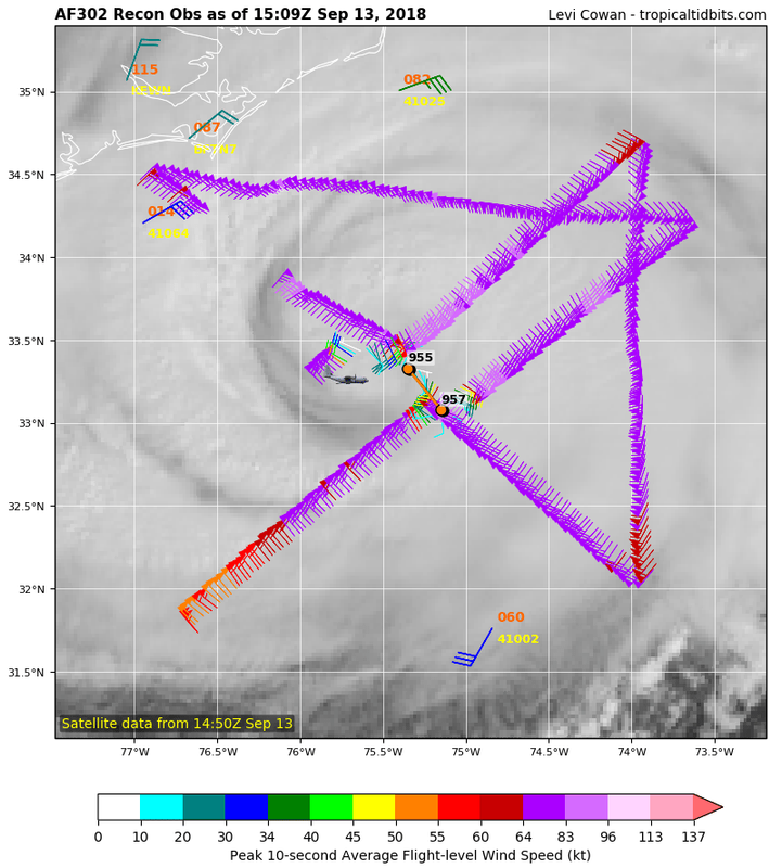
Recon pass still supports Cat 2 btw.
Recon pass still supports Cat 2 btw.
1 likes

Re: ATL: FLORENCE - Hurricane - Discussion
Looks like unchange pressure around 954-955 from the recons pass of the center, going WNW from the last fix, I think.
0 likes
Personal Forecast Disclaimer:
The posts in this forum are NOT official forecast and should not be used as such. They are just the opinion of the poster and may or may not be backed by sound meteorological data. They are NOT endorsed by any professional institution or storm2k.org. For official information, please refer to the NHC and NWS products.
The posts in this forum are NOT official forecast and should not be used as such. They are just the opinion of the poster and may or may not be backed by sound meteorological data. They are NOT endorsed by any professional institution or storm2k.org. For official information, please refer to the NHC and NWS products.
Re: ATL: FLORENCE - Hurricane - Discussion
meriland29 wrote:Do you think there is even a chance she will get stronger instead of using the energy to widen her size?
Fwiw, recon found its highest winds on this latest pass. It is definitely still a Cat 2.
0 likes
-
ScottNAtlanta

- Category 5

- Posts: 2535
- Joined: Sat May 25, 2013 3:11 pm
- Location: Atlanta, GA
Re: ATL: FLORENCE - Hurricane - Discussion
Lowest extrapolated pressure this pass 953.5
0 likes
The posts in this forum are NOT official forecast and should not be used as such. They are just the opinion of the poster and may or may not be backed by sound meteorological data. They are NOT endorsed by any professional institution or storm2k.org. For official information, please refer to the NHC and NWS products.
-
Hurricane Andrew

- S2K Supporter

- Posts: 1891
- Age: 27
- Joined: Sun May 23, 2010 2:53 pm
- Location: KS
Re: ATL: FLORENCE - Hurricane - Discussion
Outage Update
Over 10,000 without power in North Carolina, although part of that is from non-storm related outages in the western part of the state. Expect that number to rise sharply over the next 12-24 hours. South Carolina has a couple hundred, Virginia a little over a thousand.
Over 10,000 without power in North Carolina, although part of that is from non-storm related outages in the western part of the state. Expect that number to rise sharply over the next 12-24 hours. South Carolina has a couple hundred, Virginia a little over a thousand.
0 likes
The Enthusiast
NREMT-AEMT, WX nerd
Irene '11, Sandy '12, Irma '17 (SAR)
"Hard to think we were born to live this way..." -Wage War

-
Hurricane Andrew
- S2K Supporter
- Posts: 1891
- Age: 27
- Joined: Sun May 23, 2010 2:53 pm
- Location: KS
Re: ATL: FLORENCE - Hurricane - Discussion
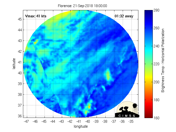
Are these "microwave floaters" extrapolated from the occasional microwave passes we get, or are they realtime accurate?
0 likes
The Enthusiast
NREMT-AEMT, WX nerd
Irene '11, Sandy '12, Irma '17 (SAR)
"Hard to think we were born to live this way..." -Wage War
Re: ATL: FLORENCE - Hurricane - Discussion
marionstorm wrote:Looks like wnw motion may have begun
Yep, heading in the general direction of Jacksonville, NC
0 likes

Re: ATL: FLORENCE - Hurricane - Discussion
Cape Lookout Obs:
NDBC
Location: 34.622N 76.525W
Date: Thu, 13 Sep 2018 14:00:00 UTC
Winds: NNE (30°) at 46.0 kt gusting to 53.0 kt
Atmospheric Pressure: 29.75 in and falling
That's sustained at 53 mph and gusts to 61 mph.
NDBC
Location: 34.622N 76.525W
Date: Thu, 13 Sep 2018 14:00:00 UTC
Winds: NNE (30°) at 46.0 kt gusting to 53.0 kt
Atmospheric Pressure: 29.75 in and falling
That's sustained at 53 mph and gusts to 61 mph.
Last edited by ronjon on Thu Sep 13, 2018 10:19 am, edited 1 time in total.
0 likes
-
1900hurricane

- Category 5
- Posts: 6063
- Age: 34
- Joined: Fri Feb 06, 2015 12:04 pm
- Location: Houston, TX
- Contact:
Re: ATL: FLORENCE - Hurricane - Discussion
artist wrote:Experts here, do I recall correctly that if pressure drops, but winds aren’t it could be the wind field increases?
Generally, yes. It all depends on pressure gradient. If the change in pressure between the environment grows but the core gradient doesn't appreciably change, it is reasonable to conclude that the gradient now encompasses a larger area. In Florence's case, it appears that the r64 and r50 windfields would be most affected by a deepening pressure.
0 likes
Contract Meteorologist. TAMU & MSST. Fiercely authentic, one of a kind. We are all given free will, so choose a life meant to be lived. We are the Masters of our own Stories.
Opinions expressed are mine alone.
Follow me on Twitter at @1900hurricane : Read blogs at https://1900hurricane.wordpress.com/
Opinions expressed are mine alone.
Follow me on Twitter at @1900hurricane : Read blogs at https://1900hurricane.wordpress.com/
-
1900hurricane
- Category 5
- Posts: 6063
- Age: 34
- Joined: Fri Feb 06, 2015 12:04 pm
- Location: Houston, TX
- Contact:
Re: ATL: FLORENCE - Hurricane - Discussion
Hurricane Andrew wrote:
Are these "microwave floaters" extrapolated from the occasional microwave passes we get, or are they realtime accurate?
They get extrapolated between passes and only run up to the most recent microwave pass available.
3 likes
Contract Meteorologist. TAMU & MSST. Fiercely authentic, one of a kind. We are all given free will, so choose a life meant to be lived. We are the Masters of our own Stories.
Opinions expressed are mine alone.
Follow me on Twitter at @1900hurricane : Read blogs at https://1900hurricane.wordpress.com/
Opinions expressed are mine alone.
Follow me on Twitter at @1900hurricane : Read blogs at https://1900hurricane.wordpress.com/


Re: ATL: FLORENCE - Hurricane - Discussion
People are calling the Horry country emergency center to see if they can get back in because the storm weaken so much. People are mad and businesses owners want back in to open there businesses. I knew this was going to happen. Now whenever the next big Hurricane to come might be a 4 or higher they want leave.
2 likes
Re: ATL: FLORENCE - Hurricane - Discussion
Tornado Warning
NCC013-137-131545-
/O.NEW.KMHX.TO.W.0004.180913T1519Z-180913T1545Z/
BULLETIN - EAS ACTIVATION REQUESTED
Tornado Warning
National Weather Service Newport/Morehead City NC
1119 AM EDT THU SEP 13 2018
The National Weather Service in Newport has issued a
* Tornado Warning for...
Southeastern Beaufort County in eastern North Carolina...
Central Pamlico County in eastern North Carolina...
* Until 1145 AM EDT.
* At 1118 AM EDT, a severe thunderstorm capable of producing a
tornado was located near Lowland, or 24 miles northwest of Cedar
Island, moving west at 50 mph.
HAZARD...Tornado.
SOURCE...Radar indicated rotation.
IMPACT...Flying debris will be dangerous to those caught without
shelter. Mobile homes will be damaged or destroyed.
Damage to roofs, windows, and vehicles will occur. Tree
damage is likely.
* This dangerous storm will be near...
South Creek around 1130 AM EDT.
Royal and Maribel around 1135 AM EDT.
Edward around 1140 AM EDT.
Grantsboro and Olympia around 1145 AM EDT.
Other locations impacted by this tornadic thunderstorm include
Aurora, Stonewall, Mesic, Alliance, Bayboro, Vandemere and Bridgeton.
PRECAUTIONARY/PREPAREDNESS ACTIONS...
TAKE COVER NOW! Move to a basement or an interior room on the lowest
floor of a sturdy building. Avoid windows. If you are outdoors, in a
mobile home, or in a vehicle, move to the closest substantial shelter
and protect yourself from flying debris.
Please send your reports of wind and/or hail damage, including trees
or large limbs downed, by calling the National Weather Service office
in Newport at 1-800-889-6889.
0 likes
-
jasons2k

- Storm2k Executive

- Posts: 8290
- Age: 52
- Joined: Wed Jul 06, 2005 12:32 pm
- Location: The Woodlands, TX
Re: ATL: FLORENCE - Hurricane - Discussion
ScottNAtlanta wrote:Lowest extrapolated pressure this pass 953.5
Dropping again. It was 957mb a couple of advisories ago. Gulf stream...
0 likes
Re: ATL: FLORENCE - Hurricane - Discussion
BUD wrote:People are calling the Horry country emergency center to see if they can get back in because the storm weaken so much. People are mad and businesses owners want back in to open there businesses. I knew this was going to happen. Now whenever the next big Hurricane to come might be a 4 or higher they want leave.
So ridiculous. Florence is yet to even reach that area yet.
5 likes
Re: ATL: FLORENCE - Hurricane - Discussion
Mark Sudduth live over in Topsail
https://www.youtube.com/watch?v=wHLkvZpEH_c
https://www.youtube.com/watch?v=wHLkvZpEH_c
0 likes
Who is online
Users browsing this forum: No registered users and 98 guests