Moderator: S2k Moderators

topsail has the edge right now, angle of approach helping topsail toosponger wrote:jlauderdal wrote:a wobble and wrightsville gets the honorsponger wrote:Looks like landfall will be Topsail Beach.
Going to be close!


The potential for historic flooding continues across portions of
Eastern North Carolina due to the prolonged period of heavy rainfall as
Florence slowly moves into the Carolinas. The area has received as
much as 10 to 15 inches over the last 24 hours, and additional rainfall
amounts of 1 to 2 FEET will still be possible through the weekend.
Highest rainfall totals are expected across the southern half to the
area. These rainfall amounts will likely cause catastrophic flash
flooding, followed by significant and prolonged river flooding lasting
well into next week.
Major to potentially record river flooding is expected for rivers and
streams primarily over Duplin, Onslow, Carteret, and Craven Counties
where the heaviest rain is likely to fall. Elsewhere all other rivers
and streams are vulnerable to moderate or major flooding with this
storm. Many will reach flood stage as early as tonight, and will
continue to rise well into next week. Given the generally slow rise of
area rivers, most won't crest until mid to late next week extending the
impacts from this long duration flood event.
Extreme storm surge impacts will continue with Hurricane Florence.
Inundation of up to 7 to 11 feet above ground with locally higher
amounts will be possible near and to the north and east of the center
of the storm across the southern North Carolina coast, including the
Pamlico Sound, Neuse and Pamlico Rivers, as well as adjacent streams
and bays. Catastrophic storm surge has occurred for areas along the
Neuse River, including New Bern where hundreds of water rescues have
occurred and are still underway. Moderate to significant storm surge
flooding will continue over the northern coast with inundation of 3 to
6 feet above ground.
artist wrote:Ok, I’m watching this live feed
https://severestudios.com/live-storm-chasing-map/
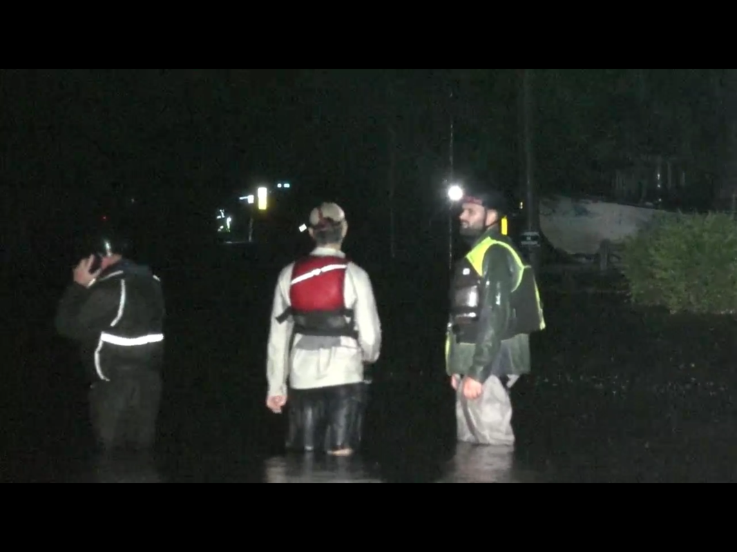
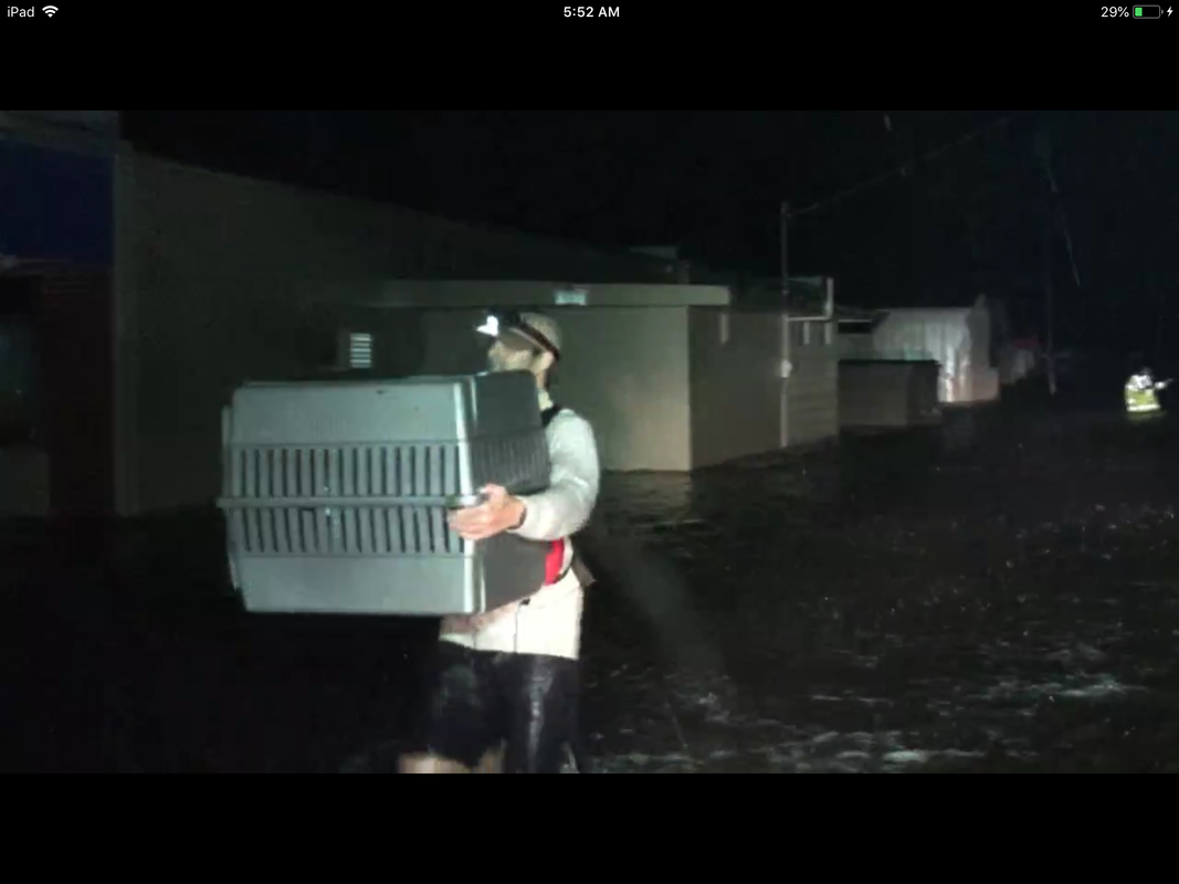
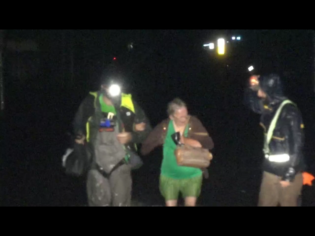
Kip Metcalf, and the water is up to the thighs of firemen trying to go house to house in New Bern. They just rescued some animals and he said they said they found some people, in their attic and it sounded like they didn’t survive. Just now they found a lady the are rescuing. It is near the river.
Hurricane Andrew wrote:artist wrote:Ok, I’m watching this live feed
https://severestudios.com/live-storm-chasing-map/
Kip Metcalf, and the water is up to the thighs of firemen trying to go house to house in New Bern. They just rescued some animals and he said they said they found some people, in their attic and it sounded like they didn’t survive. Just now they found a lady the are rescuing. It is near the river.
Ugh, wet turnout gear.
In all seriousness...New Bern is going to get at least 6-12 more hours of rain, probably more. If this is partially rain flooding, it's going to get worse. If it's just surge, it should start to subside later this afternoon.
Users browsing this forum: No registered users and 163 guests