chris_fit wrote:Basically - Melbourne/Cocoa Beach/Cape Canaveral - Don't wanna be there according to many many of the 12Z Models
To add to that..... that's probably exactly where you WANT to be 3-4 days out LOL
Moderator: S2k Moderators


chris_fit wrote:Basically - Melbourne/Cocoa Beach/Cape Canaveral - Don't wanna be there according to many many of the 12Z Models
Aric Dunn wrote:Jevo wrote:Aric Dunn wrote:4 pages of people arguing about consensus lol
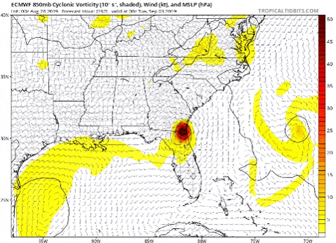
Can we get back to posting the models please..
Would you say that is the consensus opinion?
haha how's it going Aric? What's your take on the shift
Lol.. what consensus?
I just want to see the plot of the ukmet. Im not home and nothing is loading on my phone
petit_bois wrote:Jonny wrote:So GOM is starting to look less likely, but still possible?
14 yrs ago the Katrina models were looking VERY similar to these... remarkable similar.
I'm not going to be surprised on Sunday when the consensus points to the big bend area and then only to be pointing to MS coast on Monday.
All these models have struggled with verifying out beyond 18hrs with this storm... watch the chaos when it loses its steering current.
JMHO


chris_fit wrote:chris_fit wrote:Basically - Melbourne/Cocoa Beach/Cape Canaveral - Don't wanna be there according to many many of the 12Z Models
To add to that..... that's probably exactly where you WANT to be 3-4 days out LOL
BobHarlem wrote:HMON Landfall near Cocoa Beach (6z was Ft. Lauderdale, so huge shift north)
https://i.imgur.com/ANAoBTY.png

NDG wrote:BobHarlem wrote:HMON Landfall near Cocoa Beach (6z was Ft. Lauderdale, so huge shift north)
https://i.imgur.com/ANAoBTY.png
06z run was actually Vero Beach, not Ft Lauderdale!!!!
NDG wrote:BobHarlem wrote:HMON Landfall near Cocoa Beach (6z was Ft. Lauderdale, so huge shift north)
https://i.imgur.com/ANAoBTY.png
06z run was actually Vero Beach, not Ft Lauderdale!!!!


b0tzy29 wrote:NDG wrote:
Anything past its 72-96 hr forecast is going to be inconsistent. By no means the Euro is that good. But it is fairly good in its 72-96 hour compared to other models in that range, except when Dorian was a weak system and didn't see it strengthening and gaining latitude well before Hispaniola
Yes of course... but definitely has moved more east over time


Steve wrote:petit_bois wrote:Jonny wrote:So GOM is starting to look less likely, but still possible?
14 yrs ago the Katrina models were looking VERY similar to these... remarkable similar.
I'm not going to be surprised on Sunday when the consensus points to the big bend area and then only to be pointing to MS coast on Monday.
All these models have struggled with verifying out beyond 18hrs with this storm... watch the chaos when it loses its steering current.
JMHO
I'm thinking that's not going to happen here and probably less than a 1% chance of even hitting west of Panama City if it ever makes it to the gulf anyway. Would have to stall and screw around for several days for it to be a consideration, and that's also extremely unlikely.

Aric Dunn wrote:Jevo wrote:Aric Dunn wrote:4 pages of people arguing about consensus lol
Can we get back to posting the models please..
Would you say that is the consensus opinion?
haha how's it going Aric? What's your take on the shift
Lol.. what consensus?
I just want to see the plot of the ukmet. Im not home and nothing is loading on my phone


Steve wrote:Aric Dunn wrote:Jevo wrote:
Would you say that is the consensus opinion?
haha how's it going Aric? What's your take on the shift
Lol.. what consensus?
I just want to see the plot of the ukmet. Im not home and nothing is loading on my phone
Not that complicated - He said it's a consensus that people get back to talking about models.


petit_bois wrote:Steve wrote:petit_bois wrote:
14 yrs ago the Katrina models were looking VERY similar to these... remarkable similar.
I'm not going to be surprised on Sunday when the consensus points to the big bend area and then only to be pointing to MS coast on Monday.
All these models have struggled with verifying out beyond 18hrs with this storm... watch the chaos when it loses its steering current.
JMHO
I'm thinking that's not going to happen here and probably less than a 1% chance of even hitting west of Panama City if it ever makes it to the gulf anyway. Would have to stall and screw around for several days for it to be a consideration, and that's also extremely unlikely.
yep... that's what they were saying in 2005 too. I remember my local radio station weather guy giving our area the all clear as late as Friday afternoon. total Chaos came on Monday.
Users browsing this forum: No registered users and 158 guests


