
Texas Spring 2020
Moderator: S2k Moderators
Forum rules

The posts in this forum are NOT official forecast and should not be used as such. They are just the opinion of the poster and may or may not be backed by sound meteorological data. They are NOT endorsed by any professional institution or STORM2K.
-
bubba hotep

- S2K Supporter

- Posts: 6014
- Joined: Wed Dec 28, 2016 1:00 am
- Location: Collin County Texas
Re: Texas Spring 2020
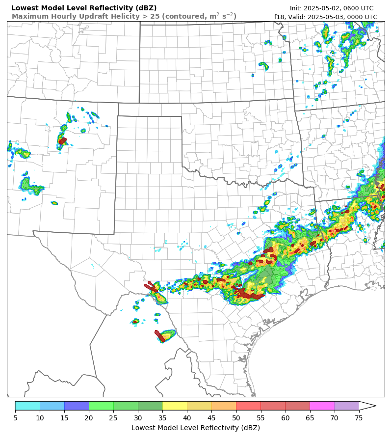
Experimental HRRRv4 shows another batch of storms for the eastern portions of DFW later on this afternoon with the cold front.
1 likes
Winter time post are almost exclusively focused on the DFW area.
-
bubba hotep
- S2K Supporter
- Posts: 6014
- Joined: Wed Dec 28, 2016 1:00 am
- Location: Collin County Texas
Re: Texas Spring 2020
Legit svr wx day for the southern plains with a dryline firing convection west of DFW. Looks like plenty of shear, decent instability, and timing that doesn't push things through too early in the day.

2 likes
Winter time post are almost exclusively focused on the DFW area.
-
captainbarbossa19

- Professional-Met

- Posts: 1094
- Age: 27
- Joined: Wed Aug 21, 2019 11:09 pm
- Location: Beaumont, TX
Re: Texas Spring 2020
There was a really nasty hail storm that hit me yesterday evening. I had quarter size hail from the storm. Fortunately, there was not a lot of damage. I am hoping that today I do not have anymore hail, but the sun is coming out now and there is a strong thunderstorm close to Wharton moving in my direction. Stay safe out there y'all!
1 likes

Re: Texas Spring 2020
captainbarbossa19 wrote:There was a really nasty hail storm that hit me yesterday evening. I had quarter size hail from the storm. Fortunately, there was not a lot of damage. I am hoping that today I do not have anymore hail, but the sun is coming out now and there is a strong thunderstorm close to Wharton moving in my direction. Stay safe out there y'all!
That storm just missed me by about 10-15 miles south of me. El Campo got crushed. I’m 10 miles north of El Campo and 10 miles west of Wharton.
0 likes
-
captainbarbossa19
- Professional-Met
- Posts: 1094
- Age: 27
- Joined: Wed Aug 21, 2019 11:09 pm
- Location: Beaumont, TX
Re: Texas Spring 2020
Cpv17 wrote:captainbarbossa19 wrote:There was a really nasty hail storm that hit me yesterday evening. I had quarter size hail from the storm. Fortunately, there was not a lot of damage. I am hoping that today I do not have anymore hail, but the sun is coming out now and there is a strong thunderstorm close to Wharton moving in my direction. Stay safe out there y'all!
That storm just missed me by about 10-15 miles south of me. El Campo got crushed. I’m 10 miles north of El Campo and 10 miles west of Wharton.
That may have not been a bad thing since there is now a confirmed tornado on the ground in Brazoria County! I hope everyone stays safe!
0 likes
-
weatherdude1108
- Category 5

- Posts: 4228
- Joined: Tue Dec 13, 2011 1:04 pm
- Location: Northwest Austin/Cedar Park, TX
Re: Texas Spring 2020
EXTREME range of relative humidity today. 97% this morning to as low as 13% as of this post. Rose to 14%.
Tropics to desert.lol
Tropics to desert.lol
1 likes
The preceding post is NOT an official forecast, and should not be used as such. It is only the opinion of the poster and may or may not be backed by sound meteorological data. It is NOT endorsed by any professional institution including storm2k.org. For Official Information please refer to the NHC and NWS products.
-
bubba hotep
- S2K Supporter
- Posts: 6014
- Joined: Wed Dec 28, 2016 1:00 am
- Location: Collin County Texas

-
TheProfessor

- Professional-Met
- Posts: 3506
- Age: 29
- Joined: Tue Dec 03, 2013 10:56 am
- Location: Wichita, Kansas
Re: Texas Spring 2020
Anyone else notice the McFarland Signature on the 12z Euro today? Where was that during the winter? 
1 likes
An alumnus of The Ohio State University.
Your local National Weather Service office is your best source for weather information.
Your local National Weather Service office is your best source for weather information.
-
Brent
- S2K Supporter
- Posts: 38740
- Age: 37
- Joined: Sun May 16, 2004 10:30 pm
- Location: Tulsa Oklahoma
- Contact:
Re: Texas Spring 2020
TheProfessor wrote:Anyone else notice the McFarland Signature on the 12z Euro today? Where was that during the winter?
Just our luck

0 likes
#neversummer
-
bubba hotep
- S2K Supporter
- Posts: 6014
- Joined: Wed Dec 28, 2016 1:00 am
- Location: Collin County Texas

-
bubba hotep
- S2K Supporter
- Posts: 6014
- Joined: Wed Dec 28, 2016 1:00 am
- Location: Collin County Texas
Re: Texas Spring 2020
Marginal added across DFW for the possibility of some elevated hailers overnight.

1 likes
Winter time post are almost exclusively focused on the DFW area.
-
bubba hotep
- S2K Supporter
- Posts: 6014
- Joined: Wed Dec 28, 2016 1:00 am
- Location: Collin County Texas
Re: Texas Spring 2020
bubba hotep wrote:Marginal added across DFW for the possibility of some elevated hailers overnight.
https://www.spc.noaa.gov/public/state/images/TX_swody1.png
18z 3k NAM

2 likes
Winter time post are almost exclusively focused on the DFW area.
Re: Texas Spring 2020
Took a much needed cooking break and picked up a Dominos pizza. Damn that was tasty. Looks like real spring storms could happen Wednesday. My dwindling work hours do include a shift that day so it's something to monitor as I try to fight boredom!!! Let it rain!!!
1 likes
-
rwfromkansas
- Category 5
- Posts: 3032
- Joined: Sat Aug 27, 2005 12:47 am
- Location: North Fort Worth
Re: Texas Spring 2020
Tomorrow keeps creeping east, which means western DFW may not get a drop.
1 likes

Re: Texas Spring 2020
3KM NAM, 12Z, sounding for 6PM tomorrow, those CAPE values 

3 likes
The above post and any post by dhweather is NOT an official forecast and should not be used as such. It is just the opinion of the poster and may or may not be backed by sound meteorological data. It is NOT endorsed by any professional institution including storm2k.org. For official information, please refer to NWS products.
-
bubba hotep
- S2K Supporter
- Posts: 6014
- Joined: Wed Dec 28, 2016 1:00 am
- Location: Collin County Texas
Re: Texas Spring 2020
Day 2 upgrade to Enhanced. One thing we have seen the past couple of years in setups like this is for models to mix the dryline eastward too fast in the days leading up to the event. Then they spend the last 12 - 18 hrs correcting back westward, so something to watch in the model runs.

2 likes
Winter time post are almost exclusively focused on the DFW area.
-
Brent
- S2K Supporter
- Posts: 38740
- Age: 37
- Joined: Sun May 16, 2004 10:30 pm
- Location: Tulsa Oklahoma
- Contact:
Re: Texas Spring 2020
bubba hotep wrote:Day 2 upgrade to Enhanced. One thing we have seen the past couple of years in setups like this is for models to mix the dryline eastward too fast in the days leading up to the event. Then they spend the last 12 - 18 hrs correcting back westward, so something to watch in the model runs.
https://www.spc.noaa.gov/public/state/images/TX_swody2.png
DFW bullseye with a hatched tornado we'll see what happens

1 likes
#neversummer
-
rwfromkansas
- Category 5
- Posts: 3032
- Joined: Sat Aug 27, 2005 12:47 am
- Location: North Fort Worth
Re: Texas Spring 2020
Of course, I spoke too soon maybe. Hopefully, we don't have a real bad outbreak.
1 likes
-
bubba hotep
- S2K Supporter
- Posts: 6014
- Joined: Wed Dec 28, 2016 1:00 am
- Location: Collin County Texas
Re: Texas Spring 2020
Texas Tech 3k WRF runs a big hailer across DFW late tonight and now the 18z 3k NAM does something similar.
0 likes
Winter time post are almost exclusively focused on the DFW area.
-
bubba hotep
- S2K Supporter
- Posts: 6014
- Joined: Wed Dec 28, 2016 1:00 am
- Location: Collin County Texas
Re: Texas Spring 2020
Brent wrote:bubba hotep wrote:Day 2 upgrade to Enhanced. One thing we have seen the past couple of years in setups like this is for models to mix the dryline eastward too fast in the days leading up to the event. Then they spend the last 12 - 18 hrs correcting back westward, so something to watch in the model runs.
https://www.spc.noaa.gov/public/state/images/TX_swody2.png
DFW bullseye with a hatched tornado we'll see what happens
https://i.ibb.co/JC2SLMR/CB56-BCED-2-C1-A-4-F0-B-94-EF-56-CF29765-C38.gif
I was going to spend a few minutes breaking down model differences but FWD nails it in the AFD:
ednesday is when things will get interesting. The upper-level
trough will continue its trek eastwards, bringing the surface low,
dryline, and cold front along with it. Widespread thunderstorms
will develop ahead of the dryline. Initial development will
likely occur west of the Dallas/Fort Worth Metropolitan Area
during the mid to late morning hours. This is probably one of the
bigger sources of uncertainty: the extent of morning convection.
The HRRR is the most aggressive model with this convection, with
the NAM being the most conservative. The HREF which takes into
account both of these (and others) seems to have the best picture
though. The HREF develops convection by late morning near or just
west of the Dallas/Fort Worth area, with increasing coverage
through the afternoon as the dryline continues east.
s thunderstorms continue eastward into the afternoon, they will
encounter and increasingly unstable air mass. The rapidly
deepening low tracking through the Red River Valley will draw
lower 70s dewpoints northward. Model guidance forecasts SBCAPE in
excess of 3,000 J/kg by late afternoon near and east of I-35/35E.
The 3 km NAM shows SBCAPE exceeding 4,000 J/kg in a narrow
corridor immediately ahead of the dryline. Meanwhile, as this low
deepens, a strengthening LLJ will lead to increasingly large and
curved hodographs. 0-1 km SRH will likely approach or exceed 200
m2/s2, especially east of I-35/35E and north of I-20. This is the
area where SPC has indicated not just an enhanced risk, but has
drawn in a 10% significant (EF2+) tornado area. The parameter
space and mesoscale setup certainly appears favorable for
tornadoes, with a few strong tornadoes possible. In addition to
the tornado threat, the forecast very large CAPE and mid-level
lapse rates exceeding 7 C/km will support very large hail. One
question however is whether storms will remain discrete. Deep-
layer shear vectors will be oriented orthogonally to the dryline,
which would favor discrete supercells given the large magnitude of
the shear. The issue however is that sometimes very dynamic, and
strongly-forced systems can often result in total cap erosion,
leading to widespread convection. Still, any thunderstorms that do
remain discrete will have the potential to become strong
supercells capable of all the hazards mentioned already.
It will be interesting to watch convective evolution tomorrow because there is a pretty high ceiling tomorrow afternoon, if things aren't kept in check by morning convection and messy storm mode.
0 likes
Winter time post are almost exclusively focused on the DFW area.
Return to “USA & Caribbean Weather”
Who is online
Users browsing this forum: No registered users and 58 guests