


gatorcane wrote:Steve wrote:LOL. I'm not even going to post this one, and props to it if it gets it right. But at 258, GFS has massive Atlantic-wide ridging, and it's showing yet another EPAC development.
https://www.tropicaltidbits.com/analysi ... 612&fh=258
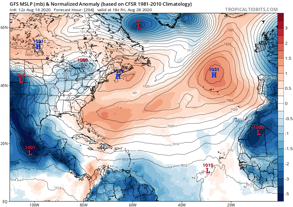
Out a little farther at 288 the GFS looks even more grim for the Atlantic. Has most of the basin in high pressure and all of the favorable conditions failing to get east of the mountains of Central America. The model loves the EPAC and has no love for the Atlantic. Bring back the phantom canes!
https://i.postimg.cc/gcSYccdM/gfs-mslpa-Norm-atl-50.png
It loops the MJO inside of Phase I. It won't budge on that solution. Again, if it gets this all correct, good job. It doesn't seem that realistic to me though, and too many experts have criticized its runs the last several days to ignore them.


