Florida Weather
Moderator: S2k Moderators
Forum rules

The posts in this forum are NOT official forecast and should not be used as such. They are just the opinion of the poster and may or may not be backed by sound meteorological data. They are NOT endorsed by any professional institution or STORM2K.
-
TheStormExpert
Re: Florida Weather
Definitely getting summer/fall vibe tonight with a very gusty NNE wind and lightning with some rumbles of thunder. A sign of the change of the season. Dew points are currently in the mid-upper 70’s.
0 likes
-
TheStormExpert
Re: Florida Weather
Currently dew points are in the mid-60’s tonight here in Palm Beach County with a brisk NE wind. For once we can actually say it feels like fall on the first day of fall in Florida.
https://twitter.com/craigsetzer/status/1308229642193711111
https://twitter.com/craigsetzer/status/1308229642193711111
0 likes
-
FlaWeatherDude

- Tropical Storm

- Posts: 115
- Age: 41
- Joined: Wed Oct 10, 2018 2:57 pm
- Location: Orlando, FL.
Re: Florida Weather
But another cold front is on the horizon.
Indeed! An even stronger front looks poised to sweep through early-mid next week. The large trough responsible for that should interact with Wilburt off the Southeast Coast. Yes #Wilburt could very well come back from the dead!

Last edited by FlaWeatherDude on Tue Sep 22, 2020 8:05 pm, edited 1 time in total.
0 likes
"Windy has wings to fly above the clouds".
-
gatorcane

- S2K Supporter

- Posts: 23708
- Age: 48
- Joined: Sun Mar 13, 2005 3:54 pm
- Location: Boca Raton, FL
Re: Florida Weather
A hint of fall for sure here across South Florida with brisk NE winds and dry air. No afternoon storms.
0 likes
-
TheStormExpert
Re: Florida Weather
gatorcane wrote:A hint of fall for sure here across South Florida with brisk NE winds and dry air. No afternoon storms.
Maybe the Wet Season will end early this year as there looks to be another front set to move through late next week.
0 likes
-
toad strangler

- S2K Supporter
- Posts: 4546
- Joined: Sun Jul 28, 2013 3:09 pm
- Location: Earth
- Contact:
Re: Florida Weather
With La Niña setting in it’s going to be a long warm and dry fall / winter
0 likes
My Weather Station
https://www.wunderground.com/dashboard/pws/KFLPORTS603
https://www.wunderground.com/dashboard/pws/KFLPORTS603
-
gatorcane
- S2K Supporter
- Posts: 23708
- Age: 48
- Joined: Sun Mar 13, 2005 3:54 pm
- Location: Boca Raton, FL
Re: Florida Weather
toad strangler wrote:With La Niña setting in it’s going to be a long warm and dry fall / winter
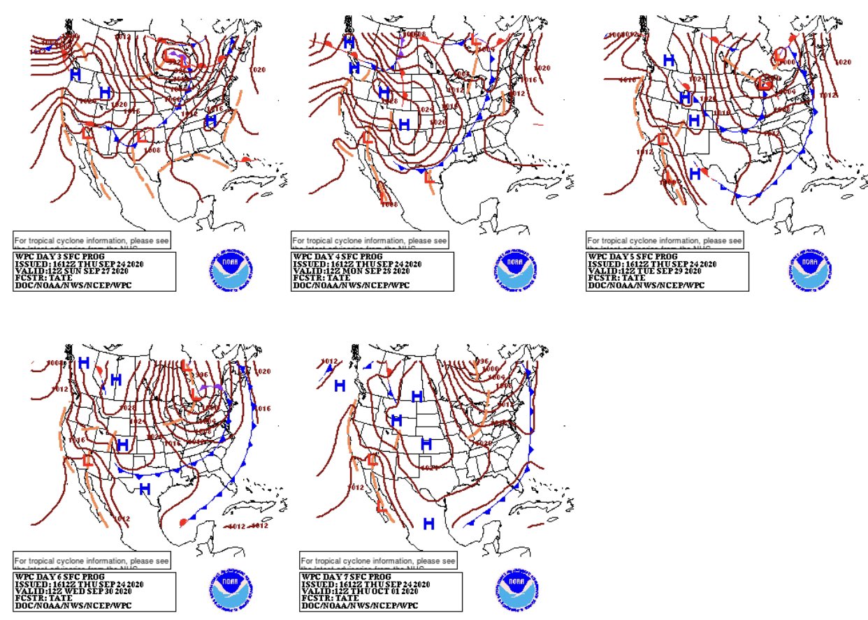
Posted in the models thread but looks like quite a front on the way:
0 likes


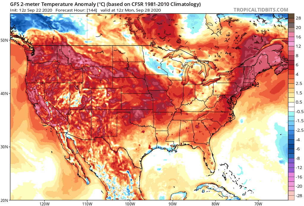
Re: Florida Weather
gatorcane wrote:The GFS has low 60s into Central Florida next week
https://i.postimg.cc/8Pc2xt0J/gfs-T2m-seus-24.png
Overdone,especially for this time of year. Model will moderate most likely.
0 likes
Re: Florida Weather
i actually believe the GFS is predicting a reasonable scenario. this coming cool down is the real deal.
1 likes
-
TheStormExpert
Re: Florida Weather
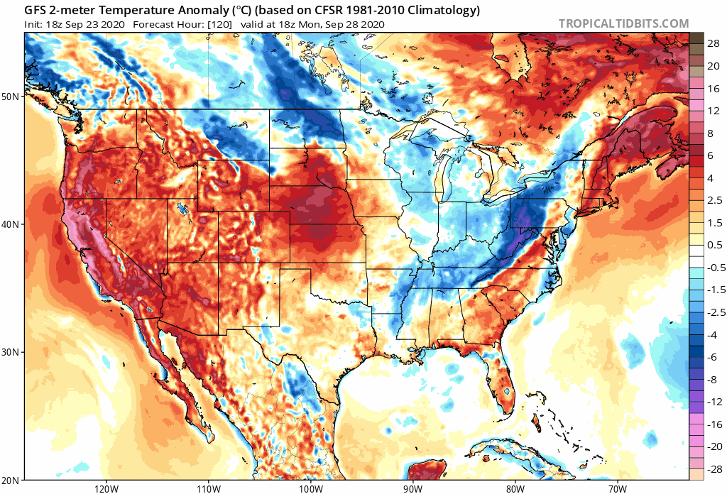
gatorcane wrote:The GFS has low 60s into Central Florida next week
https://i.postimg.cc/8Pc2xt0J/gfs-T2m-seus-24.png
Too bad the front stalls in Central Florida!
0 likes
-
FlaWeatherDude
- Tropical Storm
- Posts: 115
- Age: 41
- Joined: Wed Oct 10, 2018 2:57 pm
- Location: Orlando, FL.
Re: Florida Weather
TheStormExpert wrote:gatorcane wrote:The GFS has low 60s into Central Florida next week
https://i.postimg.cc/8Pc2xt0J/gfs-T2m-seus-24.png
Too bad the front stalls in Central Florida!
Believe me. This trough next week means business. This front will most likely make it all the way into the NW Caribbean. Looks like we will also get reinforcements into the following week! Yes initially, the front could briefly stall across Lake O before being shoved southwards by a reinforcing shot. Also I strongly believe something will spin-up in the western Caribbean along the tail-end of the front where it'll stall by next weekend/early next week(future Gamma?). Where it heads northwards afterwards depends on when the next trough dips.


Last edited by FlaWeatherDude on Fri Sep 25, 2020 11:28 am, edited 1 time in total.
0 likes
"Windy has wings to fly above the clouds".

Re: Florida Weather
Euro says don't hold your breath too much for the "cooler air", keeps trending in delaying its arrival to at least central FL and puts on the breaks before getting to southern FL.

2 likes
-
gatorcane
- S2K Supporter
- Posts: 23708
- Age: 48
- Joined: Sun Mar 13, 2005 3:54 pm
- Location: Boca Raton, FL
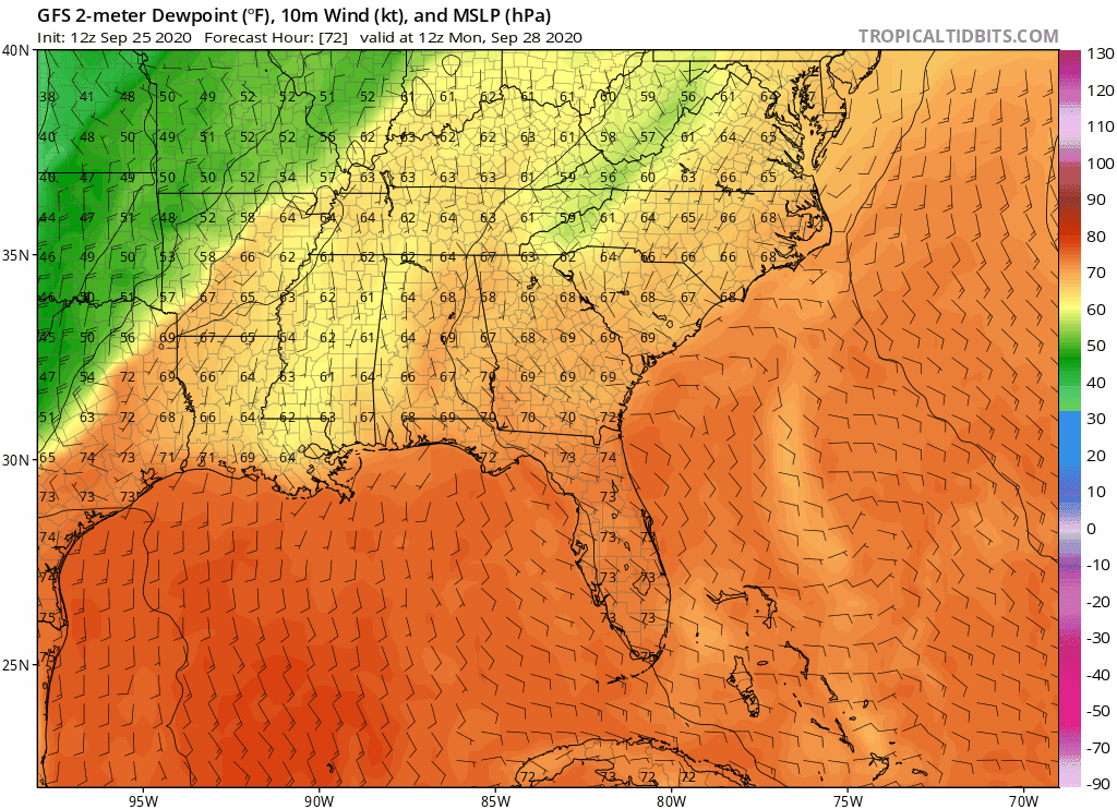
Re: Florida Weather
12z GFS dewpoints from 72 to 168 hours. Looks like the front gets hung up in South-Central Florida:
0 likes
-
TheStormExpert
Re: Florida Weather
FlaWeatherDude wrote:TheStormExpert wrote:gatorcane wrote:The GFS has low 60s into Central Florida next week
https://i.postimg.cc/8Pc2xt0J/gfs-T2m-seus-24.png
Too bad the front stalls in Central Florida!
Believe me. This trough next week means business. This front will most likely make it all the way into the NW Caribbean. Looks like we will also get reinforcements into the following week! Yes initially, the front could briefly stall across Lake O before being shoved southwards by a reinforcing shot. Also I strongly believe something will spin-up in the western Caribbean along the tail-end of the front where it'll stall by next weekend/early next week(future Gamma?). Where it heads northwards afterwards depends on when the next trough dips.
https://pbs.twimg.com/media/Ein9RjTXkAMYp3m?format=jpg&name=small
https://pbs.twimg.com/media/EissSlDWoAIij9q?format=jpg&name=large
That’s a two day old model run bro!
0 likes
-
FlaWeatherDude
- Tropical Storm
- Posts: 115
- Age: 41
- Joined: Wed Oct 10, 2018 2:57 pm
- Location: Orlando, FL.
Re: Florida Weather
TheStormExpert wrote:FlaWeatherDude wrote:TheStormExpert wrote:Too bad the front stalls in Central Florida!
Believe me. This trough next week means business. This front will most likely make it all the way into the NW Caribbean. Looks like we will also get reinforcements into the following week! Yes initially, the front could briefly stall across Lake O before being shoved southwards by a reinforcing shot. Also I strongly believe something will spin-up in the western Caribbean along the tail-end of the front where it'll stall by next weekend/early next week(future Gamma?). Where it heads northwards afterwards depends on when the next trough dips.
https://pbs.twimg.com/media/Ein9RjTXkAMYp3m?format=jpg&name=small
https://pbs.twimg.com/media/EissSlDWoAIij9q?format=jpg&name=large
That’s a two day old model run bro!
They still show it today. The front get briefly gets hung up at Lake Okeechobee before another s/w comes and reinforces it. By the weekend it'll make it all the way to the western Caribbean. This Autumn blast will last too. Also some tropical mischief will spin up up down their along the tail end of the frontal boundary.
0 likes
"Windy has wings to fly above the clouds".
-
TheStormExpert
Re: Florida Weather
FlaWeatherDude wrote:TheStormExpert wrote:FlaWeatherDude wrote:
Believe me. This trough next week means business. This front will most likely make it all the way into the NW Caribbean. Looks like we will also get reinforcements into the following week! Yes initially, the front could briefly stall across Lake O before being shoved southwards by a reinforcing shot. Also I strongly believe something will spin-up in the western Caribbean along the tail-end of the front where it'll stall by next weekend/early next week(future Gamma?). Where it heads northwards afterwards depends on when the next trough dips.
https://pbs.twimg.com/media/Ein9RjTXkAMYp3m?format=jpg&name=small
https://pbs.twimg.com/media/EissSlDWoAIij9q?format=jpg&name=large
That’s a two day old model run bro!
They still show it today. The front get briefly gets hung up at Lake Okeechobee before another s/w comes and reinforces it. By the weekend it'll make it all the way to the western Caribbean. This Autumn blast will last too. Also some tropical mischief will spin up up down their along the tail end of the frontal boundary.
https://pbs.twimg.com/media/EissSlFWoAAnQN5?format=jpg&name=large
The CPC is painting a different picture today with above average precipitation forecasted for parts of the FL peninsula due to the front stalling somewhere in Central Florida week 2 from September 30th-October 6th.
https://twitter.com/nwscpc/status/1309559634596749313
0 likes
-
FlaWeatherDude
- Tropical Storm
- Posts: 115
- Age: 41
- Joined: Wed Oct 10, 2018 2:57 pm
- Location: Orlando, FL.
Re: Florida Weather
TheStormExpert wrote:FlaWeatherDude wrote:TheStormExpert wrote:That’s a two day old model run bro!
They still show it today. The front get briefly gets hung up at Lake Okeechobee before another s/w comes and reinforces it. By the weekend it'll make it all the way to the western Caribbean. This Autumn blast will last too. Also some tropical mischief will spin up up down their along the tail end of the frontal boundary.
https://pbs.twimg.com/media/EissSlFWoAAnQN5?format=jpg&name=large
The CPC is painting a different picture today with above average precipitation forecasted for parts of the FL peninsula due to the front stalling somewhere in Central Florida week 2 from September 30th-October 6th.
https://twitter.com/nwscpc/status/1309559634596749313
That's mainly for thurs. and Fri. before a reinforcing trough pushes the cold front into the Caribbean. For days the models have been forecasting the front to initially stall across south Florida before next weekend.
0 likes
"Windy has wings to fly above the clouds".
Return to “USA & Caribbean Weather”
Who is online
Users browsing this forum: No registered users and 95 guests