ATL: FRED - Post-Tropical - Discussion
Moderator: S2k Moderators
- Weatherboy1
- Category 5

- Posts: 1190
- Age: 50
- Joined: Mon Jul 05, 2004 1:50 pm
- Location: Jupiter/Sarasota, FL
Re: ATL: SIX - Potential Tropical Cyclone - Discussion
I tend to agree with the center reformation idea here. Also I can’t see how it won’t deepen pretty quickly IF that happens. If you zoom out and look at the satellite presentation, it really is impressive
0 likes
-
Aric Dunn
- Category 5

- Posts: 21238
- Age: 43
- Joined: Sun Sep 19, 2004 9:58 pm
- Location: Ready for the Chase.
- Contact:
Re: ATL: SIX - Potential Tropical Cyclone - Discussion
Dont anyone even say it...
Developing vort maxes take time to expand the wind field.... light winds well away from the center is normal.. it is closed.
Developing vort maxes take time to expand the wind field.... light winds well away from the center is normal.. it is closed.
4 likes
Note: If I make a post that is brief. Please refer back to previous posts for the analysis or reasoning. I do not re-write/qoute what my initial post said each time.
If there is nothing before... then just ask
Space & Atmospheric Physicist, Embry-Riddle Aeronautical University,
I believe the sky is falling...
If there is nothing before... then just ask
Space & Atmospheric Physicist, Embry-Riddle Aeronautical University,
I believe the sky is falling...
- Blown Away
- S2K Supporter

- Posts: 10253
- Joined: Wed May 26, 2004 6:17 am
Re: ATL: SIX - Potential Tropical Cyclone - Discussion
jlauderdal wrote:Blown Away wrote:tolakram wrote:No center found this pass. Remember HWRF showed a sharp jump north, so this might be part of it.
https://i.imgur.com/SERrqIN.png
https://i.imgur.com/WoI6vJO.png
NHC had PTC6 at 16.0N/63.1W at 8am, I think they will adjust the estimated center closer to 16.7N at 11am
Is there a center, not really.
Lol, never know exactly how to word that, so I put estimated because I think that's closer to the truth.
1 likes
Hurricane Eye Experience: David 79, Irene 99, Frances 04, Jeanne 04, Wilma 05… Hurricane Brush Experience: Andrew 92, Erin 95, Floyd 99, Matthew 16, Irma 17, Ian 22, Nicole 22…
Re: ATL: SIX - Potential Tropical Cyclone - Discussion
I’m not sure if this should remain a PTC or get an upgrade to Fred, but odds are the NHC sticks with a PTC designation and raises the intensity to 35 kt, and will wait to upgrade it to Fred by the 5pm advisory if there’s better evidence of west winds.
1 likes
Irene '11 Sandy '12 Hermine '16 5/15/2018 Derecho Fay '20 Isaias '20 Elsa '21 Henri '21 Ida '21
I am only a meteorology enthusiast who knows a decent amount about tropical cyclones. Look to the professional mets, the NHC, or your local weather office for the best information.
I am only a meteorology enthusiast who knows a decent amount about tropical cyclones. Look to the professional mets, the NHC, or your local weather office for the best information.
-
AlphaToOmega
- Category 5

- Posts: 1448
- Joined: Sat Jun 26, 2021 10:51 am
- Location: Somewhere in Massachusetts
Re: ATL: SIX - Potential Tropical Cyclone - Discussion
Are the recon wind speeds on Tropical Tidbits adjusted (multiplied by 0.9), or are they the raw numbers coming out of recon?
0 likes
- Category5Kaiju
- Category 5

- Posts: 4338
- Joined: Thu Dec 24, 2020 12:45 pm
- Location: Seattle during the summer, Phoenix during the winter
Re: ATL: SIX - Potential Tropical Cyclone - Discussion
aspen wrote:I’m not sure if this should remain a PTC or get an upgrade to Fred, but odds are the NHC sticks with a PTC designation and raises the intensity to 35 kt, and will wait to upgrade it to Fred by the 5pm advisory if there’s better evidence of west winds.
I think this is a reasonable guess. I mean, 40 mph PTCs have existed in the past (with one in 2019 even being 60 mph at one point but I cannot remember which TS it eventually became).
0 likes
Unless explicitly stated, all information in my posts is based on my own opinions and observations. Tropical storms and hurricanes can be extremely dangerous. Refer to an accredited weather research agency or meteorologist if you need to make serious decisions regarding an approaching storm.
- Evil Jeremy
- S2K Supporter

- Posts: 5463
- Age: 32
- Joined: Mon Apr 10, 2006 2:10 pm
- Location: Los Angeles, CA
Re: ATL: SIX - Potential Tropical Cyclone - Discussion
Category5Kaiju wrote:aspen wrote:I’m not sure if this should remain a PTC or get an upgrade to Fred, but odds are the NHC sticks with a PTC designation and raises the intensity to 35 kt, and will wait to upgrade it to Fred by the 5pm advisory if there’s better evidence of west winds.
I think this is a reasonable guess. I mean, 40 mph PTCs have existed in the past (with one in 2019 even being 60 mph at one point but I cannot remember which TS it eventually became).
Nestor. 60mph PTC while crossing the Gulf from the BoC to the Panhandle.
0 likes
Frances 04 / Jeanne 04 / Katrina 05 / Wilma 05 / Fay 08 / Debby 12 / Andrea 13 / Colin 16 / Hermine 16 / Matthew 16 / Irma 17
-
Sciencerocks
- Category 5

- Posts: 10186
- Age: 40
- Joined: Thu Jul 06, 2017 1:51 am
- Category5Kaiju
- Category 5

- Posts: 4338
- Joined: Thu Dec 24, 2020 12:45 pm
- Location: Seattle during the summer, Phoenix during the winter
Re: ATL: SIX - Potential Tropical Cyclone - Discussion
Evil Jeremy wrote:Category5Kaiju wrote:aspen wrote:I’m not sure if this should remain a PTC or get an upgrade to Fred, but odds are the NHC sticks with a PTC designation and raises the intensity to 35 kt, and will wait to upgrade it to Fred by the 5pm advisory if there’s better evidence of west winds.
I think this is a reasonable guess. I mean, 40 mph PTCs have existed in the past (with one in 2019 even being 60 mph at one point but I cannot remember which TS it eventually became).
Nestor. 60mph PTC while crossing the Gulf from the BoC to the Panhandle.
Oh yeah, Nestor, thanks. I remember people complaining about how it should be a TS with 60 mph winds and some people even asking what would happen if a PTC reached 75 mph winds.
0 likes
Unless explicitly stated, all information in my posts is based on my own opinions and observations. Tropical storms and hurricanes can be extremely dangerous. Refer to an accredited weather research agency or meteorologist if you need to make serious decisions regarding an approaching storm.
Re: ATL: SIX - Potential Tropical Cyclone - Discussion
Looks like they flew straight along the wave axis.
IMHO, not closed off.
IMHO, not closed off.
2 likes
-
AutoPenalti
- Category 5

- Posts: 4091
- Age: 29
- Joined: Mon Aug 17, 2015 4:16 pm
- Location: Ft. Lauderdale, Florida
Re: ATL: SIX - Potential Tropical Cyclone - Discussion
7 likes
The posts in this forum are NOT official forecasts and should not be used as such. They are just the opinion of the poster and may or may not be backed by sound meteorological data. They are NOT endorsed by any professional institution or STORM2K. For official information, please refer to products from the NHC and NWS.
Model Runs Cheat Sheet:
GFS (5:30 AM/PM, 11:30 AM/PM)
HWRF, GFDL, UKMET, NAVGEM (6:30-8:00 AM/PM, 12:30-2:00 AM/PM)
ECMWF (1:45 AM/PM)
TCVN is a weighted averaged
- Blown Away
- S2K Supporter

- Posts: 10253
- Joined: Wed May 26, 2004 6:17 am
Re: ATL: SIX - Potential Tropical Cyclone - Discussion

My guess, Very broad/weak.
0 likes
Hurricane Eye Experience: David 79, Irene 99, Frances 04, Jeanne 04, Wilma 05… Hurricane Brush Experience: Andrew 92, Erin 95, Floyd 99, Matthew 16, Irma 17, Ian 22, Nicole 22…
-
AlphaToOmega
- Category 5

- Posts: 1448
- Joined: Sat Jun 26, 2021 10:51 am
- Location: Somewhere in Massachusetts
Re: ATL: SIX - Potential Tropical Cyclone - Discussion
There is clearly a closed low where PTC 06L is located.


0 likes
- Evil Jeremy
- S2K Supporter

- Posts: 5463
- Age: 32
- Joined: Mon Apr 10, 2006 2:10 pm
- Location: Los Angeles, CA
Re: ATL: SIX - Potential Tropical Cyclone - Discussion
Blown Away wrote:My guess, Very broad/weak.
That would be a fairly notable jump N. Hard to see it running down the middle of the Hispaniola shredder with that kind of relocation.
0 likes
Frances 04 / Jeanne 04 / Katrina 05 / Wilma 05 / Fay 08 / Debby 12 / Andrea 13 / Colin 16 / Hermine 16 / Matthew 16 / Irma 17
Re: ATL: SIX - Potential Tropical Cyclone - Discussion
Blown Away wrote:https://i.imgur.com/aKUrghl.jpg
My guess, Very broad/weak.
That's too far north, recon has been finding the wind shift and lower MSLPs further south by a whole latitude near 16.4N, per the last pass.
3 likes
Re: ATL: SIX - Potential Tropical Cyclone - Discussion
I guess no upgrade because the NHC would had sent out a Tweet by now.
0 likes
Re: ATL: SIX - Potential Tropical Cyclone - Discussion
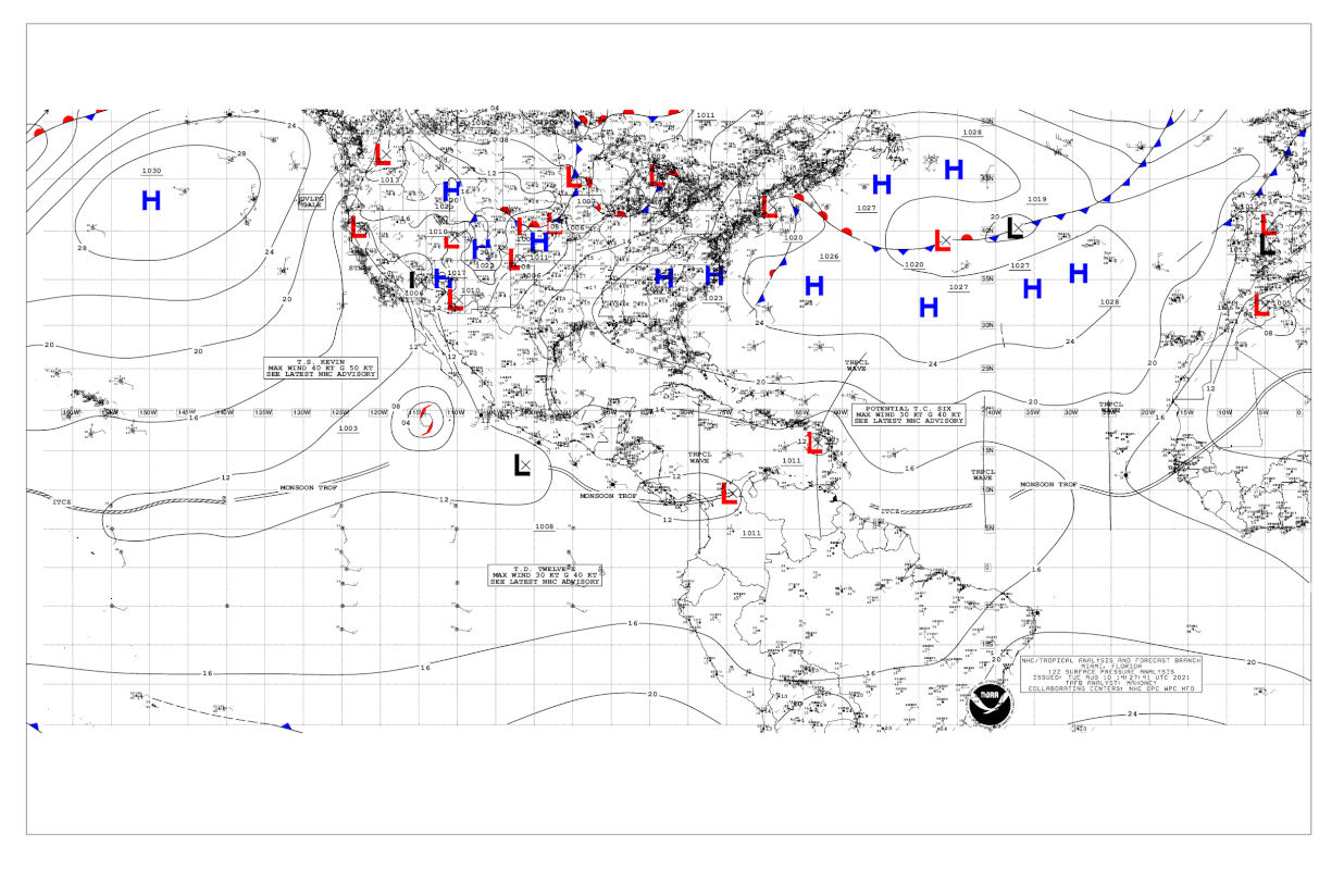
...NOAA HURRICANE HUNTER AIRCRAFT REPORTS THE DISTURBANCE IS NOT YET A TROPICAL CYCLONE... ...LIKELY TO BECOME A TROPICAL STORM LATER TODAY OR TONIGHT...
11:00 AM AST Tue Aug 10
Location: 16.3°N 63.8°W
Moving: WNW at 18 mph
Min pressure: 1012 mb
Max sustained: 35 mph
0 likes
Re: ATL: SIX - Potential Tropical Cyclone - Discussion
So close…some of those new convective bursts should help close this off for good. Not sure if dry air is an issue because the structure of the storm on satellite looks good.
1 likes
Irene '11 Sandy '12 Hermine '16 5/15/2018 Derecho Fay '20 Isaias '20 Elsa '21 Henri '21 Ida '21
I am only a meteorology enthusiast who knows a decent amount about tropical cyclones. Look to the professional mets, the NHC, or your local weather office for the best information.
I am only a meteorology enthusiast who knows a decent amount about tropical cyclones. Look to the professional mets, the NHC, or your local weather office for the best information.
-
AlphaToOmega
- Category 5

- Posts: 1448
- Joined: Sat Jun 26, 2021 10:51 am
- Location: Somewhere in Massachusetts
Re: ATL: SIX - Potential Tropical Cyclone - Discussion
aspen wrote:So close…some of those new convective bursts should help close this off for good. Not sure if dry air is an issue because the structure of the storm on satellite looks good.
Dry air is not an issue for this system. There is very little Sharan dust in the Atlantic.
0 likes
Who is online
Users browsing this forum: No registered users and 17 guests


