In looking at all of the available 00Z global models on TropicalTidbits right now, I honestly don't think that I've ever seen such a tight cluster of landfall locations in the absence of a well-defined, initialized COC. And so far from landfall, timewise, on top of that.
I definitely don't understand what's going on.
ATL: IDA - Models
Moderator: S2k Moderators
-
Craters
- Category 1

- Posts: 428
- Joined: Sat Aug 24, 2013 2:34 pm
- Location: Alvin, TX (south of Houston)
Re: ATL: INVEST 99L - Models
2 likes
Nothing that I post here should ever be treated as a forecast or anything resembling one. Please check with your local NWS office or the NHC for forecasts, watches, and warnings.
-
CrazyC83
- Professional-Met

- Posts: 34315
- Joined: Tue Mar 07, 2006 11:57 pm
- Location: Deep South, for the first time!
Re: ATL: INVEST 99L - Models
The ASCAT-B pass actually has a decent center (elongated but almost a TD) at 13.9N 78.3W. That would throw off everything.
1 likes

Re: ATL: INVEST 99L - Models
SoupBone wrote:Steve wrote:GFS following the CMC's 12z with the next storm just off the Yucatan around 204h.
https://www.tropicaltidbits.com/analysi ... 600&fh=204
I see that. Is that from an existing feature or does it just come to be?
Looks like it comes off Columbia which would probably mean a heat-low interacting with a piece of a wave passing by.
0 likes
-
Shell Mound
- Category 5

- Posts: 2432
- Age: 33
- Joined: Thu Sep 07, 2017 3:39 pm
- Location: St. Petersburg, FL → Scandinavia
Re: ATL: INVEST 99L - Models

The GFS’s simulated IR presentation certainly suggests relatively low vertical wind shear prior to and during landfall. This is likely a Cat-4, given resolution.
0 likes
CVW / MiamiensisWx / Shell Mound
The posts in this forum are NOT official forecasts and should not be used as such. They are just the opinion of the poster and may or may not be backed by sound meteorological data. They are NOT endorsed by any professional institution or STORM2K. For official information, please refer to products from the NHC and NWS.

Re: ATL: INVEST 99L - Models
CrazyC83 wrote:The ASCAT-B pass actually has a decent center (elongated but almost a TD) at 13.9N 78.3W. That would throw off everything.
And that's why this is far from set in stone. We'll end up waking up to Houston being back under the models.
3 likes
Personal Forecast Disclaimer:
The posts in this forum are NOT official forecast and should not be used as such. They are just the opinion of the poster and may or may not be backed by sound meteorological data. They are NOT endorsed by any professional institution or storm2k.org. For official information, please refer to the NHC and NWS products.
The posts in this forum are NOT official forecast and should not be used as such. They are just the opinion of the poster and may or may not be backed by sound meteorological data. They are NOT endorsed by any professional institution or storm2k.org. For official information, please refer to the NHC and NWS products.
-
catskillfire51
- S2K Supporter

- Posts: 480
- Age: 39
- Joined: Sun Aug 26, 2012 5:40 pm
- Location: Lake Jackson, TX
Re: ATL: INVEST 99L - Models

I guess we will see how this plays out but the L and the actual circulation seem way off on the hmon.
0 likes
-
skyline385

- Category 5
- Posts: 2728
- Age: 35
- Joined: Wed Aug 26, 2020 11:15 pm
- Location: Houston TX
Re: ATL: INVEST 99L - Models
SoupBone wrote:CrazyC83 wrote:The ASCAT-B pass actually has a decent center (elongated but almost a TD) at 13.9N 78.3W. That would throw off everything.
And that's why this is far from set in stone. We'll end up waking up to Houston being back under the models.
If you look at 0Z GEFS, 80-90% members are headed for LA and very few get to TX. I am not sure why so many GEFS members are resolving to a NE center...
0 likes
-
Keldeo1997
- Category 2

- Posts: 688
- Joined: Fri Oct 11, 2019 11:35 pm

-
CrazyC83
- Professional-Met
- Posts: 34315
- Joined: Tue Mar 07, 2006 11:57 pm
- Location: Deep South, for the first time!
Re: ATL: INVEST 99L - Models
catskillfire51 wrote:https://i.imgur.com/fxNkNtO.jpg
I guess we will see how this plays out but the L and the actual circulation seem way off on the hmon.
I think HMON can't figure out which is the actual center. It's trying to split this off into two.
3 likes
-
CrazyC83
- Professional-Met
- Posts: 34315
- Joined: Tue Mar 07, 2006 11:57 pm
- Location: Deep South, for the first time!
Re: ATL: INVEST 99L - Models
skyline385 wrote:SoupBone wrote:CrazyC83 wrote:The ASCAT-B pass actually has a decent center (elongated but almost a TD) at 13.9N 78.3W. That would throw off everything.
And that's why this is far from set in stone. We'll end up waking up to Houston being back under the models.
If you look at 0Z GEFS, 80-90% members are headed for LA and very few get to TX. I am not sure why so many GEFS members are resolving to a NE center...
The ASCAT pass wasn't out yet; the assumption was based on the convection.
0 likes

Re: ATL: INVEST 99L - Models
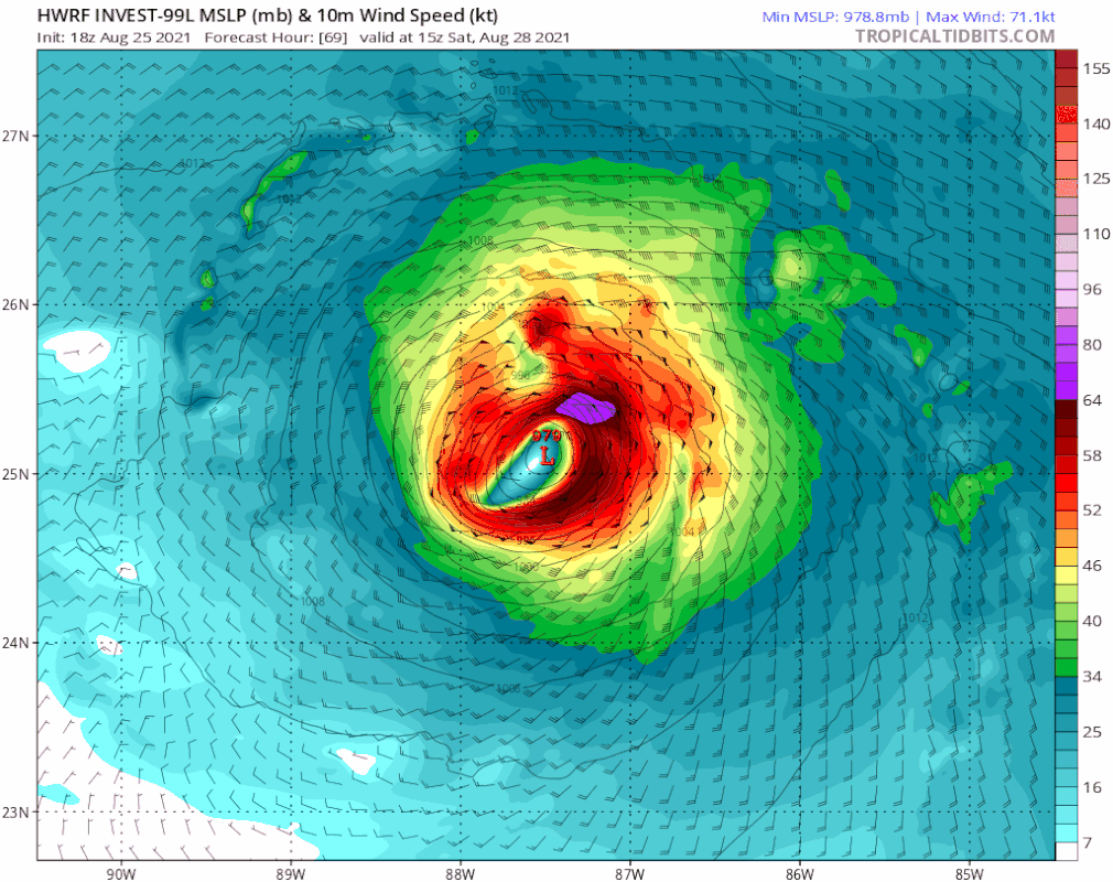
990mb in under 48 hours... this is gonna be another run where it goes bonkers in intensity.Keldeo1997 wrote:
HWRF back west. Might make landfall on the Yucatan
0 likes
-
CrazyC83
- Professional-Met
- Posts: 34315
- Joined: Tue Mar 07, 2006 11:57 pm
- Location: Deep South, for the first time!
Re: ATL: INVEST 99L - Models
Woofde wrote:990mb in under 48 hours... this is gonna be another run where it goes bonkers in intensity.Keldeo1997 wrote:https://www.tropicaltidbits.com/analysis/models/hwrf/2021082600/hwrf_mslp_wind_99L_16.png
HWRF back west. Might make landfall on the Yucatan
Not impossible IMO. If it is almost a TD now...and the southern circulation can consolidate...this could be strong quick.
0 likes
-
galaxy401

- Category 5
- Posts: 2446
- Age: 30
- Joined: Sat Aug 25, 2012 9:04 pm
- Location: Casa Grande, Arizona
Re: ATL: INVEST 99L - Models
It's difficult to get a solid consensus until we have an actual center to track. I'm not really going to look at a path until the NHC posts theirs.
4 likes
Got my eyes on moving right into Hurricane Alley: Florida.
Re: ATL: INVEST 99L - Models
skyline385 wrote:SoupBone wrote:CrazyC83 wrote:The ASCAT-B pass actually has a decent center (elongated but almost a TD) at 13.9N 78.3W. That would throw off everything.
And that's why this is far from set in stone. We'll end up waking up to Houston being back under the models.
If you look at 0Z GEFS, 80-90% members are headed for LA and very few get to TX. I am not sure why so many GEFS members are resolving to a NE center...
These are the wrenches that get thrown when you don't have recon giving us a true center if one even exists. Time and time I recall reading on this very forum, initialization of these models is critical. If it's not initializing on the true center coordinates, things will change. Even with the ensembles honing in, I still don't feel comfortable.
3 likes
Personal Forecast Disclaimer:
The posts in this forum are NOT official forecast and should not be used as such. They are just the opinion of the poster and may or may not be backed by sound meteorological data. They are NOT endorsed by any professional institution or storm2k.org. For official information, please refer to the NHC and NWS products.
The posts in this forum are NOT official forecast and should not be used as such. They are just the opinion of the poster and may or may not be backed by sound meteorological data. They are NOT endorsed by any professional institution or storm2k.org. For official information, please refer to the NHC and NWS products.
-
grapealcoholic
- Category 2
- Posts: 703
- Joined: Tue Aug 10, 2021 3:26 pm

Re: ATL: INVEST 99L - Models
HWRF is noticeably slower and therefore more south. More west and stronger than the last run as well.
Threads the Yucatan Channel.
Threads the Yucatan Channel.
0 likes
Re: ATL: INVEST 99L - Models
Watch the Euro head to Corpus Christi. 
0 likes
Personal Forecast Disclaimer:
The posts in this forum are NOT official forecast and should not be used as such. They are just the opinion of the poster and may or may not be backed by sound meteorological data. They are NOT endorsed by any professional institution or storm2k.org. For official information, please refer to the NHC and NWS products.
The posts in this forum are NOT official forecast and should not be used as such. They are just the opinion of the poster and may or may not be backed by sound meteorological data. They are NOT endorsed by any professional institution or storm2k.org. For official information, please refer to the NHC and NWS products.
-
catskillfire51
- S2K Supporter
- Posts: 480
- Age: 39
- Joined: Sun Aug 26, 2012 5:40 pm
- Location: Lake Jackson, TX
Re: ATL: INVEST 99L - Models
I am amazed by the HWRF track when the 00z guidance shows it going over cuba then louisiana. Why do they differ so much?
0 likes
Re: ATL: INVEST 99L - Models
catskillfire51 wrote:I am amazed by the HWRF track when the 00z guidance shows it going over cuba then louisiana. Why do they differ so much?
I recall last night someone saying that the HWRF and HMON really need a defined center to be more accurate. I don't know how accurate that statement is though. They were bouncing all over the place last night.
4 likes
Personal Forecast Disclaimer:
The posts in this forum are NOT official forecast and should not be used as such. They are just the opinion of the poster and may or may not be backed by sound meteorological data. They are NOT endorsed by any professional institution or storm2k.org. For official information, please refer to the NHC and NWS products.
The posts in this forum are NOT official forecast and should not be used as such. They are just the opinion of the poster and may or may not be backed by sound meteorological data. They are NOT endorsed by any professional institution or storm2k.org. For official information, please refer to the NHC and NWS products.
-
CrazyC83
- Professional-Met
- Posts: 34315
- Joined: Tue Mar 07, 2006 11:57 pm
- Location: Deep South, for the first time!
Re: ATL: INVEST 99L - Models
grapealcoholic wrote:This HWRF run is something else
I think HWRF actually develops the LLC and not allows the MLC (or a relocated center) to drop to the surface. That is why it is so far to the southwest.
3 likes
Who is online
Users browsing this forum: No registered users and 47 guests