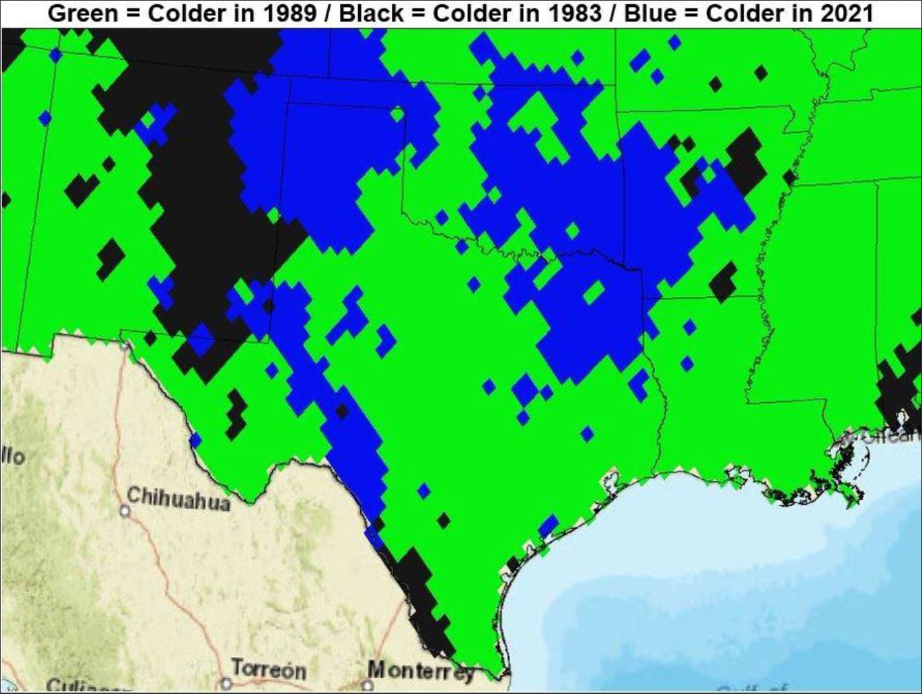
aggiecutter wrote:[url]https://i.ibb.co/gwhGWtF/Flip.jpg [/url]
What did this mean again? As far as Texas is concerned.
Moderator: S2k Moderators
 The posts in this forum are NOT official forecast and should not be used as such. They are just the opinion of the poster and may or may not be backed by sound meteorological data. They are NOT endorsed by any professional institution or STORM2K.

aggiecutter wrote:[url]https://i.ibb.co/gwhGWtF/Flip.jpg [/url]


HockeyTx82 wrote:aggiecutter wrote:[url]https://i.ibb.co/gwhGWtF/Flip.jpg [/url]
What did this mean again? As far as Texas is concerned.

Ntxw wrote:The overnight model suite was very ugly for winter lovers. It's almost wall to wall torch for a lot of the US through mid-December. That ++EPO keeps beating down the cold as it gets closer. I don't like it as much as you all (the +EPO trend the past 60-90 days), but it is the big elephant in the room right now.
Hoping as we turn the calendar things change. I'm slightly optimistic once that SE ridge comes then the Nina climo might at least try to give us a glancing blow of shallow cold from the north.
Iceresistance wrote:Ntxw wrote:The overnight model suite was very ugly for winter lovers. It's almost wall to wall torch for a lot of the US through mid-December. That ++EPO keeps beating down the cold as it gets closer. I don't like it as much as you all (the +EPO trend the past 60-90 days), but it is the big elephant in the room right now.
Hoping as we turn the calendar things change. I'm slightly optimistic once that SE ridge comes then the Nina climo might at least try to give us a glancing blow of shallow cold from the north.
Is the EPO one of the most Positive ever recorded or as it's longest? I've never seen the EPO being this positive for this long.
Also, if the EPO is being extremely Positive right now, it may turn extremely negative later down the road, one extreme leads to another extreme.


Ntxw wrote:The overnight model suite was very ugly for winter lovers. It's almost wall to wall torch for a lot of the US through mid-December. That ++EPO keeps beating down the cold as it gets closer. I don't like it as much as you all (the +EPO trend the past 60-90 days), but it is the big elephant in the room right now.
Hoping as we turn the calendar things change. I'm slightly optimistic once that SE ridge comes then the Nina climo might at least try to give us a glancing blow of shallow cold from the north.

Cerlin wrote:Meh. That's the only word that I can really use to describe my feelings on the upcoming few months. It's just really stagnant. And bland.
That being said, there's a decently strong cold shot on the 9th on both the 12z CMC and the 12z GFS. It was sort of there the past few days. 12z GFS had it yesterday, for example.
I'm not buying into it, but at least the operational models aren't showing a complete torch with the potential for a glancing blow. It is also 10 days out at this point, so I expect it to go poof in the next couple days. But while it feels like Lucy keeps pulling the football before Charlie Brown is getting ready to kick it, at least she keeps holding onto the football instead of throwing it in the fiery pits of a second summer.
EDIT: I'd also like to add the ICON model hasn't been buying into a single cold shot yet. It didn't entertain anything over the week of Thanksgiving and beyond when other models did. It's been right so far. That being said, the 12z ICON has a pretty expansive winter storm over the Great Plains on the 8th. Pretty much aligns with the CMC and GFS. I wouldn't give up just yet folks.
Users browsing this forum: No registered users and 59 guests


