2022 Indicators (SSTs/SAL/MSLP/Shear/Steering/Instability) and >Day 16 Models

This is the general tropical discussion area. Anyone can take their shot at predicting a storms path.

Moderator: S2k Moderators

Forum rules

The posts in this forum are NOT official forecasts and should not be used as such. They are just the opinion of the poster and may or may not be backed by sound meteorological data. They are NOT endorsed by any professional institution or STORM2K. For official information, please refer to products from the National Hurricane Center and National Weather Service.

Help Support Storm2K
Message
Author
User avatar
aspen
Category 5
Category 5
Posts: 8818
Joined: Sat Oct 12, 2019 7:10 pm
Location: Connecticut, USA

Re: 2022 indicators: SSTs / SAL / MSLP / shear / steering / instability / images

#621 Postby aspen » Wed May 04, 2022 3:16 pm

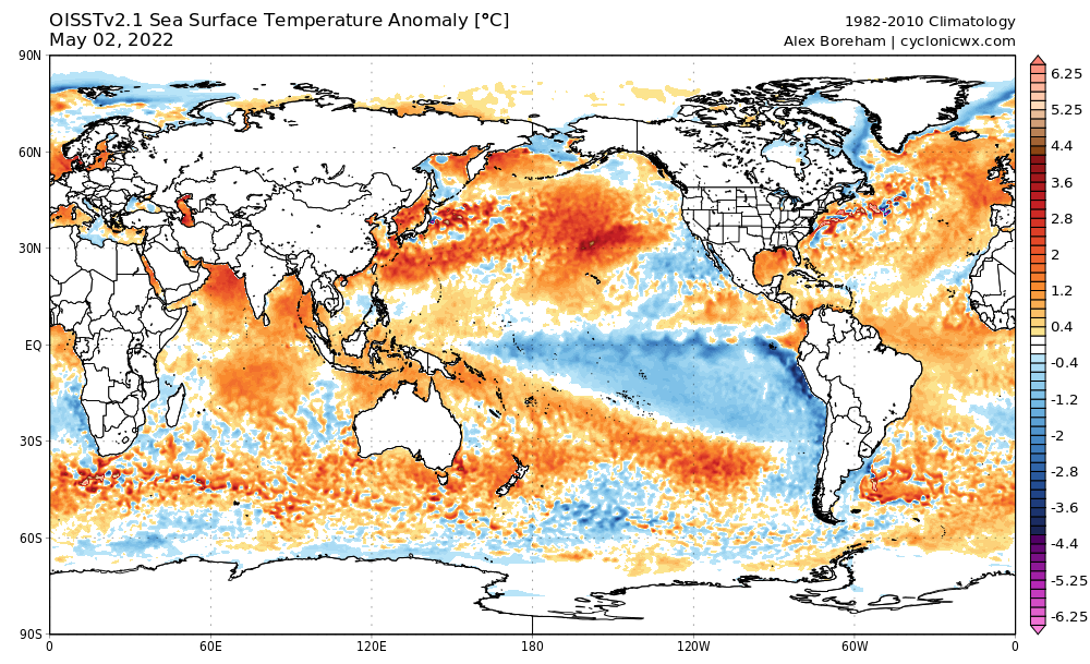
AlphaToOmega wrote:OISST refusing to update (not updated on Climate Reanalyzer either)

https://i.postimg.cc/bJZqYGW4/ssta-global.png

Now that I’ve been watching all the SSTA maps multiple times a day ever since the -NAO kicked in, I noticed that sometimes both OISST and CRW sometimes stop updating for several days. CRW is up to date, thankfully, and shows that the recent cooling trend in the MDR has halted.
1 likes   
Irene '11 Sandy '12 Hermine '16 5/15/2018 Derecho Fay '20 Isaias '20 Elsa '21 Henri '21 Ida '21

I am only a meteorology enthusiast who knows a decent amount about tropical cyclones. Look to the professional mets, the NHC, or your local weather office for the best information.

User avatar
cycloneye
Admin
Admin
Posts: 145313
Age: 68
Joined: Thu Oct 10, 2002 10:54 am
Location: San Juan, Puerto Rico

ENSO Updates

#622 Postby cycloneye » Thu May 05, 2022 7:40 am

1 likes   
Visit the Caribbean-Central America Weather Thread where you can find at first post web cams,radars
and observations from Caribbean basin members Click Here

AutoPenalti
Category 5
Category 5
Posts: 4030
Age: 29
Joined: Mon Aug 17, 2015 4:16 pm
Location: Ft. Lauderdale, Florida

Re: ENSO Updates

#623 Postby AutoPenalti » Thu May 05, 2022 7:47 am


I'm just waiting for someone to say it.
5 likes   
The posts in this forum are NOT official forecasts and should not be used as such. They are just the opinion of the poster and may or may not be backed by sound meteorological data. They are NOT endorsed by any professional institution or STORM2K. For official information, please refer to products from the NHC and NWS.


Model Runs Cheat Sheet:
GFS (5:30 AM/PM, 11:30 AM/PM)
HWRF, GFDL, UKMET, NAVGEM (6:30-8:00 AM/PM, 12:30-2:00 AM/PM)
ECMWF (1:45 AM/PM)

TCVN
is a weighted averaged

User avatar
Category5Kaiju
Category 5
Category 5
Posts: 4097
Joined: Thu Dec 24, 2020 12:45 pm
Location: Seattle

Re: ENSO Updates

#624 Postby Category5Kaiju » Thu May 05, 2022 8:17 am

AutoPenalti wrote:

I'm just waiting for someone to say it.


Me too :D ...

I mean, since when in the many past recent years was there ever a time when models like this showed extremely favorable conditions 100% of the time?
0 likes   
Unless explicitly stated, all info in my posts is based on my own opinions and observations. Tropical storms and hurricanes can be extremely dangerous. Do not think you can beat Mother Nature. Refer to an accredited weather research agency or meteorologist if you need to make serious decisions regarding an approaching storm.

User avatar
Category5Kaiju
Category 5
Category 5
Posts: 4097
Joined: Thu Dec 24, 2020 12:45 pm
Location: Seattle

Re: 2022 indicators: SSTs / SAL / MSLP / shear / steering / instability / images

#625 Postby Category5Kaiju » Thu May 05, 2022 8:22 am

What do ya'll think of this new Euro run? Seems like it is the first "major" unfavorable prediction to really come out for this season's potential. I think the Euro is biased here with a dry Africa, but I'd like to hear others' thoughts on this as well!

Edit: There's this as well:

 https://twitter.com/AndyHazelton/status/1522211855523012609


Last edited by Category5Kaiju on Thu May 05, 2022 8:54 am, edited 2 times in total.
0 likes   
Unless explicitly stated, all info in my posts is based on my own opinions and observations. Tropical storms and hurricanes can be extremely dangerous. Do not think you can beat Mother Nature. Refer to an accredited weather research agency or meteorologist if you need to make serious decisions regarding an approaching storm.

User avatar
SFLcane
S2K Supporter
S2K Supporter
Posts: 10163
Age: 47
Joined: Sat Jun 05, 2010 1:44 pm
Location: Lake Worth Florida

Re: 2022 indicators: SSTs / SAL / MSLP / shear / steering / instability / images

#626 Postby SFLcane » Thu May 05, 2022 8:37 am

Euro be like...

Image
2 likes   

User avatar
cycloneye
Admin
Admin
Posts: 145313
Age: 68
Joined: Thu Oct 10, 2002 10:54 am
Location: San Juan, Puerto Rico

Re: ENSO Updates

#627 Postby cycloneye » Thu May 05, 2022 8:48 am


What a run from ECMWF can cause, a shift to bearish season but that could change next month in the model.
0 likes   
Visit the Caribbean-Central America Weather Thread where you can find at first post web cams,radars
and observations from Caribbean basin members Click Here

tolakram
Admin
Admin
Posts: 20009
Age: 62
Joined: Sun Aug 27, 2006 8:23 pm
Location: Florence, KY (name is Mark)

Re: 2022 indicators: SSTs / SAL / MSLP / shear / steering / instability / images

#628 Postby tolakram » Thu May 05, 2022 8:53 am

My thoughts pre-season are always the same. Since I don't see any strong negative signs I expect an average to slightly above average season, with the potential for very active as long as we're not missing something.
1 likes   
M a r k
- - - - -
Join us in chat: Storm2K Chatroom Invite. Android and IOS apps also available.

The posts in this forum are NOT official forecasts and should not be used as such. Posts are NOT endorsed by any professional institution or STORM2K.org. For official information and forecasts, please refer to NHC and NWS products.

User avatar
SFLcane
S2K Supporter
S2K Supporter
Posts: 10163
Age: 47
Joined: Sat Jun 05, 2010 1:44 pm
Location: Lake Worth Florida

Re: 2022 indicators: SSTs / SAL / MSLP / shear / steering / instability / images

#629 Postby SFLcane » Thu May 05, 2022 9:12 am

New Euro Z500 sterring with a ridge-bridge potentially sending everything into Central America.

Image
Last edited by SFLcane on Thu May 05, 2022 9:15 am, edited 1 time in total.
0 likes   

User avatar
aspen
Category 5
Category 5
Posts: 8818
Joined: Sat Oct 12, 2019 7:10 pm
Location: Connecticut, USA

Re: ENSO Updates

#630 Postby aspen » Thu May 05, 2022 9:13 am


Could something about a third year Nina result in a suppressed ITCZ? What have other models said about the West African Monsoon and ASW?
0 likes   
Irene '11 Sandy '12 Hermine '16 5/15/2018 Derecho Fay '20 Isaias '20 Elsa '21 Henri '21 Ida '21

I am only a meteorology enthusiast who knows a decent amount about tropical cyclones. Look to the professional mets, the NHC, or your local weather office for the best information.

User avatar
skyline385
Category 5
Category 5
Posts: 2728
Age: 35
Joined: Wed Aug 26, 2020 11:15 pm
Location: Houston TX

2022 indicators: SSTs / SAL / MSLP / shear / steering / instability / images

#631 Postby skyline385 » Thu May 05, 2022 9:13 am

Think this tweet is equally important

https://twitter.com/andyhazelton/status/1522205367727443968

Tons of people here and on twitter were taking the CANSIPS bullish run at face value because there is bias amongst the wx community to favor bullish outlook but the fact is we are still more than a month out and a week of MDR warming doesn't mean we are going to have a hyperactive season, especially when the MDR is literally at average SST right now.

This Euro run is also in line with the UKMET April run, both suggesting slightly above average seasons.
Last edited by skyline385 on Thu May 05, 2022 9:13 am, edited 2 times in total.
1 likes   

User avatar
aspen
Category 5
Category 5
Posts: 8818
Joined: Sat Oct 12, 2019 7:10 pm
Location: Connecticut, USA

Re: 2022 indicators: SSTs / SAL / MSLP / shear / steering / instability / images

#632 Postby aspen » Thu May 05, 2022 9:16 am

SFLcane wrote:New Euro Z500 sterring with a ridge-bridge potentially sending everything into Central America.

https://i.postimg.cc/SRpcZDJK/zbb.png

Is this a similar setup to ON 2021 that prevented any Caribbean activity?
0 likes   
Irene '11 Sandy '12 Hermine '16 5/15/2018 Derecho Fay '20 Isaias '20 Elsa '21 Henri '21 Ida '21

I am only a meteorology enthusiast who knows a decent amount about tropical cyclones. Look to the professional mets, the NHC, or your local weather office for the best information.

User avatar
Category5Kaiju
Category 5
Category 5
Posts: 4097
Joined: Thu Dec 24, 2020 12:45 pm
Location: Seattle

Re: 2022 indicators: SSTs / SAL / MSLP / shear / steering / instability / images

#633 Postby Category5Kaiju » Thu May 05, 2022 9:19 am

SFLcane wrote:New Euro Z500 sterring with a ridge-bridge potentially sending everything into Central America.

https://i.postimg.cc/SRpcZDJK/zbb.png


That sort of makes sense, especially given how that model is suppressing all convection to very low latitudes (so imagine seeing what we saw after September last year, only this time it applies to this year). Not sure how much stock I would buy into that though
0 likes   
Unless explicitly stated, all info in my posts is based on my own opinions and observations. Tropical storms and hurricanes can be extremely dangerous. Do not think you can beat Mother Nature. Refer to an accredited weather research agency or meteorologist if you need to make serious decisions regarding an approaching storm.

User avatar
toad strangler
S2K Supporter
S2K Supporter
Posts: 4543
Joined: Sun Jul 28, 2013 3:09 pm
Location: Earth
Contact:

Re: ENSO Updates

#634 Postby toad strangler » Thu May 05, 2022 9:23 am

AutoPenalti wrote:

I'm just waiting for someone to say it.


well, that wraps it up. It's over. See you next May! :wink:

So I'm kinda old school and lean heavily on CSU and NOAA forecasts as the biggest indicators in my thought process over any modeling. Bullish or Bearish don't matter. So I wait patiently for NOAA to help guide my initial thoughts on the season.
0 likes   

User avatar
cycloneye
Admin
Admin
Posts: 145313
Age: 68
Joined: Thu Oct 10, 2002 10:54 am
Location: San Juan, Puerto Rico

Re: 2022 indicators: SSTs / SAL / MSLP / shear / steering / instability / images

#635 Postby cycloneye » Thu May 05, 2022 9:23 am

0 likes   
Visit the Caribbean-Central America Weather Thread where you can find at first post web cams,radars
and observations from Caribbean basin members Click Here

User avatar
SFLcane
S2K Supporter
S2K Supporter
Posts: 10163
Age: 47
Joined: Sat Jun 05, 2010 1:44 pm
Location: Lake Worth Florida

Re: 2022 indicators: SSTs / SAL / MSLP / shear / steering / instability / images

#636 Postby SFLcane » Thu May 05, 2022 9:26 am

Not sure what new EURO data wxman57 was looking at but no way you get an ace near 170-190 with the most recent outlook. Looks barely slightly above average season
0 likes   

User avatar
cycloneye
Admin
Admin
Posts: 145313
Age: 68
Joined: Thu Oct 10, 2002 10:54 am
Location: San Juan, Puerto Rico

Re: 2022 indicators: SSTs / SAL / MSLP / shear / steering / instability / images

#637 Postby cycloneye » Thu May 05, 2022 9:37 am

1 likes   
Visit the Caribbean-Central America Weather Thread where you can find at first post web cams,radars
and observations from Caribbean basin members Click Here

User avatar
NotSparta
Professional-Met
Professional-Met
Posts: 1670
Age: 23
Joined: Fri Aug 18, 2017 8:24 am
Location: Naples, FL
Contact:

Re: ENSO Updates

#638 Postby NotSparta » Thu May 05, 2022 9:55 am

toad strangler wrote:
AutoPenalti wrote:

I'm just waiting for someone to say it.


well, that wraps it up. It's over. See you next May! :wink:

So I'm kinda old school and lean heavily on CSU and NOAA forecasts as the biggest indicators in my thought process over any modeling. Bullish or Bearish don't matter. So I wait patiently for NOAA to help guide my initial thoughts on the season.


Ironically, part of the reason CSU went so high is because of their modeling
0 likes   
This post was probably an opinion of mine, and in no way is official. Please refer to http://www.hurricanes.gov for official tropical analysis and advisories.

My website, with lots of tropical wx graphics, including satellite and recon: http://cyclonicwx.com

User avatar
SFLcane
S2K Supporter
S2K Supporter
Posts: 10163
Age: 47
Joined: Sat Jun 05, 2010 1:44 pm
Location: Lake Worth Florida

Re: ENSO Updates

#639 Postby SFLcane » Thu May 05, 2022 10:01 am

NotSparta wrote:
toad strangler wrote:
AutoPenalti wrote:I'm just waiting for someone to say it.


well, that wraps it up. It's over. See you next May! :wink:

So I'm kinda old school and lean heavily on CSU and NOAA forecasts as the biggest indicators in my thought process over any modeling. Bullish or Bearish don't matter. So I wait patiently for NOAA to help guide my initial thoughts on the season.


Ironically, part of the reason CSU went so high is because of their modeling


+1
0 likes   

User avatar
DorkyMcDorkface
Category 3
Category 3
Posts: 888
Age: 27
Joined: Mon Sep 30, 2019 1:32 pm
Location: Mid-Atlantic

Re: 2022 indicators: SSTs / SAL / MSLP / shear / steering / instability / images

#640 Postby DorkyMcDorkface » Thu May 05, 2022 10:37 am

A little confused at the SEAS5's graphically bearish signal in tandem with an ACE prediction of 130% of average. Unless it's expecting a bunch of Caribbean Cruisers it doesn't make a lot of sense to me...
Image
Image
1 likes   
Please note the thougths expressed by this account are solely those of the user and are from a hobbyist perspective. For more comprehensive analysis, consult an actual professional meteorologist or meteorology agency.


Floyd 1999 | Isabel 2003 | Hanna 2008 | Irene 2011 | Sandy 2012 | Isaias 2020


Return to “Talkin' Tropics”

Who is online

Users browsing this forum: jgh and 26 guests