rwfromkansas wrote:Build west, young storm, build west.
Looking pretty healthy approaching the Red River.
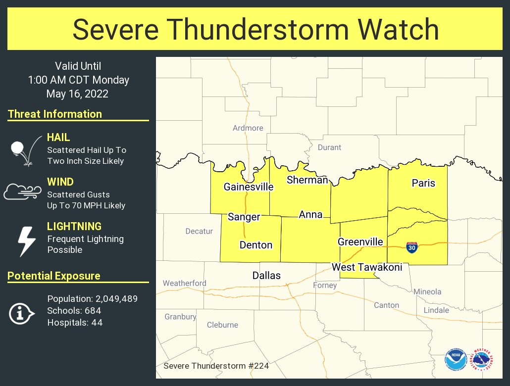
SPC looking at a new watch for N. TX

Mesoscale Discussion 0778
NWS Storm Prediction Center Norman OK
0715 PM CDT Sun May 15 2022
Areas affected...South-central/southeast OK into north TX
Concerning...Severe Thunderstorm Watch 221...
Valid 160015Z - 160145Z
The severe weather threat for Severe Thunderstorm Watch 221
continues.
SUMMARY...Ongoing supercells will continue to pose a threat of very
large hail, with a damaging wind threat potentially increasing
across southeast OK and spreading into north TX. New watch issuance
is likely into north TX.
DISCUSSION...Multiple cell mergers have occurred with the supercell
that earlier produced giant hail across east-central OK, with
additional development noted southwestward into south-central OK.
Strong instability (MLCAPE > 3000 J/kg) and effective shear of 40+
kt will continue to support organized storms, and very large hail
will remain possible this evening with any sustained discrete
supercells. Severe wind gusts will also be possible, with a 68 mph
gust recently noted at a OK Mesonet site in Hughes County.
Ongoing cell mergers may result in an upscale growing cluster, which
will likely move southward into parts of north TX, with a continued
hail and damaging wind threat through this evening. Watch issuance
is likely downstream into parts of north TX in order to cover this
threat.
..Dean/Hart.. 05/16/2022
...Please see
http://www.spc.noaa.gov for graphic product...
ATTN...WFO...TSA...FWD...OUN...
Winter time post are almost exclusively focused on the DFW area.


