Tropical Storm Celia Discussion Number 33
NWS National Hurricane Center Miami FL EP032022
300 PM MDT Fri Jun 24 2022
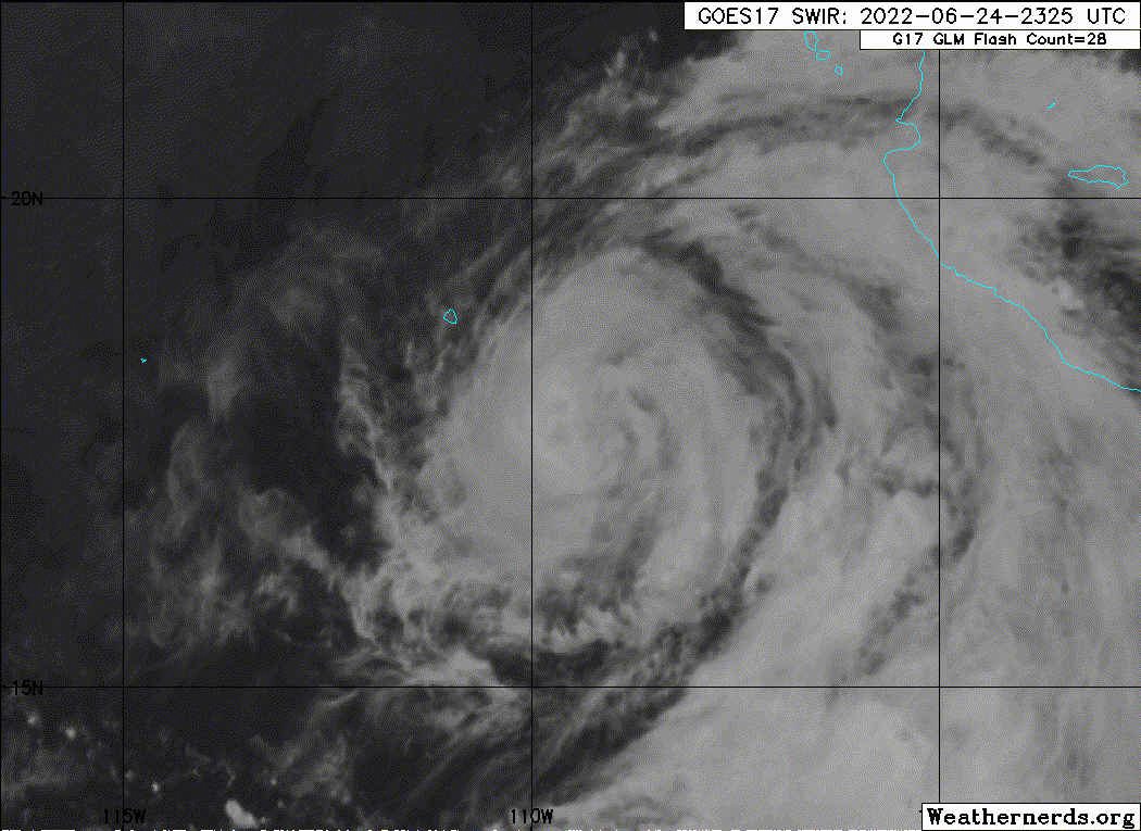
Celia has the appearance of becoming better organized, with
subjective and objective satellite intensity estimates of
T4.0 all suggesting it's at hurricane strength. However, two
recent scatterometer passes only showed winds as high as 35-40 kt,
so any strengthening of the wind field is apparently lagging the
improved convective structure. Because of this large discrepancy
in estimates, the initial intensity is held at 55 kt. The
scatterometer data also indicate that Celia is asymmetric, with no
tropical-storm-force winds on the west side.
Celia's speed has slowed further, and the initial motion estimate
is 285/5 kt. This is about the slowest Celia is expected to move,
and its forward speed is forecast to gradually increase over the
next five days as the ridge to the north strengthens and expands
westward. There are no significant changes to the track forecast
reasoning on this cycle, and the updated NHC track prediction is
basically an update of the morning forecast.
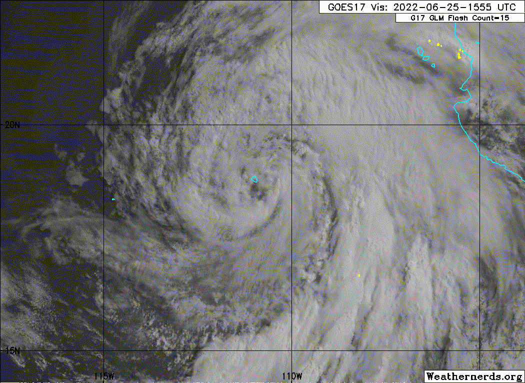
Celia still has a small window of time for the wind field to
strengthen and catch up to the satellite presentation, and the NHC
forecast continues to show it becoming a hurricane in the next 12
to 24 hours. This forecast closely follows the HCCA consensus aid.
However, cooler waters ahead of the storm are expected to induce
weakening after 36 hours, and Celia is likely to become
post-tropical by day 4 when it loses its deep convection.
FORECAST POSITIONS AND MAX WINDS
INIT 24/2100Z 17.2N 108.9W 55 KT 65 MPH
12H 25/0600Z 17.6N 109.7W 60 KT 70 MPH
24H 25/1800Z 18.1N 111.0W 65 KT 75 MPH
36H 26/0600Z 18.6N 112.4W 65 KT 75 MPH
48H 26/1800Z 19.1N 114.0W 60 KT 70 MPH
60H 27/0600Z 19.6N 116.0W 55 KT 65 MPH
72H 27/1800Z 20.2N 118.2W 45 KT 50 MPH
96H 28/1800Z 21.3N 123.2W 35 KT 40 MPH...POST-TROPICAL
120H 29/1800Z 21.9N 128.2W 25 KT 30 MPH...POST-TROP/REMNT LOW
$$
Forecaster Berg
NWS National Hurricane Center Miami FL EP032022
300 PM MDT Fri Jun 24 2022
Celia has the appearance of becoming better organized, with
subjective and objective satellite intensity estimates of
T4.0 all suggesting it's at hurricane strength. However, two
recent scatterometer passes only showed winds as high as 35-40 kt,
so any strengthening of the wind field is apparently lagging the
improved convective structure. Because of this large discrepancy
in estimates, the initial intensity is held at 55 kt. The
scatterometer data also indicate that Celia is asymmetric, with no
tropical-storm-force winds on the west side.
Celia's speed has slowed further, and the initial motion estimate
is 285/5 kt. This is about the slowest Celia is expected to move,
and its forward speed is forecast to gradually increase over the
next five days as the ridge to the north strengthens and expands
westward. There are no significant changes to the track forecast
reasoning on this cycle, and the updated NHC track prediction is
basically an update of the morning forecast.
Celia still has a small window of time for the wind field to
strengthen and catch up to the satellite presentation, and the NHC
forecast continues to show it becoming a hurricane in the next 12
to 24 hours. This forecast closely follows the HCCA consensus aid.
However, cooler waters ahead of the storm are expected to induce
weakening after 36 hours, and Celia is likely to become
post-tropical by day 4 when it loses its deep convection.
FORECAST POSITIONS AND MAX WINDS
INIT 24/2100Z 17.2N 108.9W 55 KT 65 MPH
12H 25/0600Z 17.6N 109.7W 60 KT 70 MPH
24H 25/1800Z 18.1N 111.0W 65 KT 75 MPH
36H 26/0600Z 18.6N 112.4W 65 KT 75 MPH
48H 26/1800Z 19.1N 114.0W 60 KT 70 MPH
60H 27/0600Z 19.6N 116.0W 55 KT 65 MPH
72H 27/1800Z 20.2N 118.2W 45 KT 50 MPH
96H 28/1800Z 21.3N 123.2W 35 KT 40 MPH...POST-TROPICAL
120H 29/1800Z 21.9N 128.2W 25 KT 30 MPH...POST-TROP/REMNT LOW
$$
Forecaster Berg