EPAC: JULIA - Remnants - Discussion
Moderator: S2k Moderators
-
Aric Dunn
- Category 5

- Posts: 21238
- Age: 43
- Joined: Sun Sep 19, 2004 9:58 pm
- Location: Ready for the Chase.
- Contact:
Re: ATL: INVEST 91L - Discussion
They should probably PTC this thing.
6 likes
Note: If I make a post that is brief. Please refer back to previous posts for the analysis or reasoning. I do not re-write/qoute what my initial post said each time.
If there is nothing before... then just ask
Space & Atmospheric Physicist, Embry-Riddle Aeronautical University,
I believe the sky is falling...
If there is nothing before... then just ask
Space & Atmospheric Physicist, Embry-Riddle Aeronautical University,
I believe the sky is falling...
-
Sciencerocks
- Category 5
- Posts: 10181
- Age: 40
- Joined: Thu Jul 06, 2017 1:51 am
-
ouragans

- Category 2

- Posts: 501
- Age: 54
- Joined: Sun Jun 12, 2011 12:09 pm
- Location: Abymes, Guadeloupe F.W.I
- Contact:
Re: ATL: INVEST 91L - Discussion
Aric Dunn wrote:They should probably PTC this thing.
I would, too, for St Vincent and Grenada. Maybe Tobago. This has the potential for an upgrade to TS while crossing the islands
5 likes
Personal forecast disclaimer
This post is a personal point of view, not an information. Please refer to official statements for life-threatening decisions.
David '79, Frederic '79, Hugo '89, Iris, Luis & Marilyn '95, Georges '98, Lenny '99, Dean '07, Irma '17, Maria '17, Fiona '22, Philippe '23, Tammy '23
16°13'33.3,"6N -61°36'39.5"W

Re: ATL: INVEST 91L - Discussion
Does anyone have any idea why the WPC issued the 2 PM TWO? NHC issued the Special TWO 2 hours prior.
Tropical Weather Outlook
NWS National Hurricane Center Miami FL
Issued by the NWS Weather Prediction Center College Park MD
200 PM EDT Tue Oct 4 2022
...
Forecaster Bann
1 likes
The posts in this forum are NOT official forecast and should not be used as such. They are just the opinion of the poster and may or may not be backed by sound meteorological data. They are NOT endorsed by any professional institution or STORM2K. For official information, refer to products from the National Hurricane Center and National Weather Service.
-
floridasun
- Tropical Storm

- Posts: 245
- Joined: Tue Sep 14, 2021 3:59 pm
Re: ATL: INVEST 91L - Discussion
i see plane didnt find low this afternoon want back to base
0 likes
-
cycloneye

- Admin

- Posts: 149219
- Age: 69
- Joined: Thu Oct 10, 2002 10:54 am
- Location: San Juan, Puerto Rico
Re: ATL: INVEST 91L - Discussion
Special Tropical Weather Outlook
NWS National Hurricane Center Miami FL
450 PM EDT Tue Oct 4 2022
For the North Atlantic...Caribbean Sea and the Gulf of Mexico:
The National Hurricane Center has initiated advisories on Tropical
Depression Twelve, located a few hundred miles west of the Cabo
Verde Islands.
1. East of the Windward Islands:
Updated: Data from an Air Force Reserve Hurricane Hunter aircraft
indicate that the broad area of low pressure located a couple of
hundred miles east of the Windward Islands does not have a closed
circulation and the center remains ill defined. In addition, the
associated shower and thunderstorm activity is still displaced to
the southeast of the center. Upper-level winds are likely to
become more conducive for development, and a tropical depression
could form during the next couple of days, if the system stays far
enough away from land while moving westward at about 15 mph across
the Windward Islands and southeastern Caribbean Sea. Conditions
are forecast to become more conducive for development later this
week when the system reaches the central and western Caribbean Sea.
Regardless of development, heavy rainfall with localized flooding,
as well as gusty winds, are expected over portions of the
Windward Islands, northern portions of South America, and the ABC
Islands during the next couple of days, and interests in those
locations should continue to monitor the progress of this system.
* Formation chance through 48 hours...medium...40 percent.
* Formation chance through 5 days...high...70 percent.
Key messages for the disturbance east of the Windward Islands can be
found on the National Hurricane Center website at www.hurricanes.gov
Public Advisories on Tropical Depression Twelve are issued under
WMO header WTNT32 KNHC and under AWIPS header MIATCPAT4.
Forecast/Advisories on Tropical Depression Twelve are issued under
WMO header WTNT22 KNHC and under AWIPS header MIATCMAT2.
Forecaster Berg
0 likes
Visit the Caribbean-Central America Weather Thread where you can find at first post web cams,radars
and observations from Caribbean basin members Click Here
and observations from Caribbean basin members Click Here
-
NotSparta

- Professional-Met

- Posts: 1676
- Age: 24
- Joined: Fri Aug 18, 2017 8:24 am
- Location: Naples, FL
- Contact:
Re: ATL: INVEST 91L - Discussion
Wonder why they issued an STWO if the chances remained the same
2 likes
This post was probably an opinion of mine, and in no way is official. Please refer to http://www.hurricanes.gov for official tropical analysis and advisories.
My website, with lots of tropical wx graphics, including satellite and recon: http://cyclonicwx.com
My website, with lots of tropical wx graphics, including satellite and recon: http://cyclonicwx.com
-
wxman57

- Moderator-Pro Met

- Posts: 23170
- Age: 68
- Joined: Sat Jun 21, 2003 8:06 pm
- Location: Houston, TX (southwest)
Re: ATL: INVEST 91L - Discussion
Since it isn't going to develop east of the Caribbean, no need for TS watches/warnings, so no PTC needed. Give it 3-4 days then watch it go into Central America by Sunday/Monday. No concern to Gulf.
7 likes

-
Aric Dunn
- Category 5
- Posts: 21238
- Age: 43
- Joined: Sun Sep 19, 2004 9:58 pm
- Location: Ready for the Chase.
- Contact:
Re: ATL: INVEST 91L - Discussion
Once the old vort completely finishes dying. the LLC to the SE should pretty quickly become even defined enough for the NHC overnight before entering the carrib. luckily we will have radar. Def should be PTC
1 likes
Note: If I make a post that is brief. Please refer back to previous posts for the analysis or reasoning. I do not re-write/qoute what my initial post said each time.
If there is nothing before... then just ask
Space & Atmospheric Physicist, Embry-Riddle Aeronautical University,
I believe the sky is falling...
If there is nothing before... then just ask
Space & Atmospheric Physicist, Embry-Riddle Aeronautical University,
I believe the sky is falling...
-
Iceresistance

- Category 5
- Posts: 9575
- Age: 22
- Joined: Sat Oct 10, 2020 9:45 am
- Location: Tecumseh, OK/Norman, OK
Re: ATL: INVEST 91L - Discussion
Aric Dunn wrote:Once the old vort completely finishes dying. the LLC to the SE should pretty quickly become even defined enough for the NHC overnight before entering the carrib. luckily we will have radar. Def should be PTC
We don't need to jump the gun yet, the only way it's a PTC is if the system has gale force winds (Or forecasted to have it) without a LLC or a poorly defined one and is a immediate threat to land.
We have one of the criteria met for possible threats to land for a PTC designation, but it does not meet the one for gale-force winds. No PTC like Wxman57 (Heat Miser) said before.
0 likes
Bill 2015 & Beta 2020
Winter 2020-2021
All observations are in Tecumseh, OK unless otherwise noted.
Winter posts are focused mainly for Oklahoma & Texas.
Take any of my forecasts with a grain of salt, refer to the NWS, SPC, and NHC for official information
Never say Never with weather! Because ANYTHING is possible!
Winter 2020-2021
All observations are in Tecumseh, OK unless otherwise noted.
Winter posts are focused mainly for Oklahoma & Texas.
Take any of my forecasts with a grain of salt, refer to the NWS, SPC, and NHC for official information
Never say Never with weather! Because ANYTHING is possible!
-
Aric Dunn
- Category 5
- Posts: 21238
- Age: 43
- Joined: Sun Sep 19, 2004 9:58 pm
- Location: Ready for the Chase.
- Contact:
Re: ATL: INVEST 91L - Discussion
Iceresistance wrote:Aric Dunn wrote:Once the old vort completely finishes dying. the LLC to the SE should pretty quickly become even defined enough for the NHC overnight before entering the carrib. luckily we will have radar. Def should be PTC
We don't need to jump the gun yet, the only way it's a PTC is if the system has gale force winds (Or forecasted to have it) without a LLC or a poorly defined one and is a immediate threat to land.
We have one of the criteria met for possible threats to land for a PTC designation, but it does not meet the one for gale-force winds. No PTC like Wxman57 (Heat Miser) said before.
1. the "Potential" is there
2. both ASCAts showed TS winds farther east then recon sampled.
3. there are more islands/land than just the immediate lesser Antilles.
7 likes
Note: If I make a post that is brief. Please refer back to previous posts for the analysis or reasoning. I do not re-write/qoute what my initial post said each time.
If there is nothing before... then just ask
Space & Atmospheric Physicist, Embry-Riddle Aeronautical University,
I believe the sky is falling...
If there is nothing before... then just ask
Space & Atmospheric Physicist, Embry-Riddle Aeronautical University,
I believe the sky is falling...


Re: ATL: INVEST 91L - Discussion
The PV streamer coming down from the ULL is dissipating quickly ahead of 91L.
May look interesting at DMAX.
May look interesting at DMAX.
1 likes
Re: ATL: INVEST 91L - Discussion
At 10/9 GFS is showing a real nice Anti-Cyclonic Wave Break (ARWB) east of the Yucatan.
91L will be north of Panama then.
Watch out if it tracks into this.
91L will be north of Panama then.
Watch out if it tracks into this.
1 likes
Re: ATL: INVEST 91L - Discussion
Convection coming up on the north end of the wave axis.
The real heavy convection is firing along the east side of the wave axis and outlines the infeed of high TPW air flowing in from the Amazon.
The TPW air is more at the boundary layer and a little above.
Convective debris from pop ups over South America is also beginning to flow in which is mostly at mid levels in the troposphere.
0 likes
-
cycloneye
- Admin
- Posts: 149219
- Age: 69
- Joined: Thu Oct 10, 2002 10:54 am
- Location: San Juan, Puerto Rico
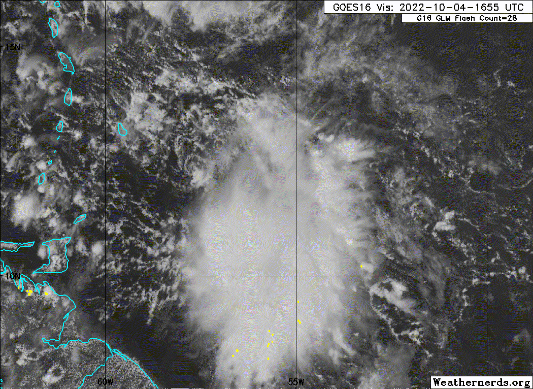
Re: ATL: INVEST 91L - Discussion
0 likes
Visit the Caribbean-Central America Weather Thread where you can find at first post web cams,radars
and observations from Caribbean basin members Click Here
and observations from Caribbean basin members Click Here
-
Aric Dunn
- Category 5
- Posts: 21238
- Age: 43
- Joined: Sun Sep 19, 2004 9:58 pm
- Location: Ready for the Chase.
- Contact:
Re: ATL: INVEST 91L - Discussion
GCANE wrote:Convection coming up on the north end of the wave axis.
The real heavy convection is firing along the east side of the wave axis and outlines the infeed of high TPW air flowing in from the Amazon.
The TPW air is more at the boundary layer and a little above.
Convective debris from pop ups over South America is also beginning to flow in which is mostly at mid levels in the troposphere.
Barbados radar showing the circ coming into view.. def NW inflow into the convection. the llc is growing while the old dies and stretches out.
4 likes
Note: If I make a post that is brief. Please refer back to previous posts for the analysis or reasoning. I do not re-write/qoute what my initial post said each time.
If there is nothing before... then just ask
Space & Atmospheric Physicist, Embry-Riddle Aeronautical University,
I believe the sky is falling...
If there is nothing before... then just ask
Space & Atmospheric Physicist, Embry-Riddle Aeronautical University,
I believe the sky is falling...
-
cheezyWXguy

- Category 5
- Posts: 6280
- Joined: Mon Feb 13, 2006 12:29 am
- Location: Dallas, TX
Re: ATL: INVEST 91L - Discussion
Aric Dunn wrote:GCANE wrote:Convection coming up on the north end of the wave axis.
The real heavy convection is firing along the east side of the wave axis and outlines the infeed of high TPW air flowing in from the Amazon.
The TPW air is more at the boundary layer and a little above.
Convective debris from pop ups over South America is also beginning to flow in which is mostly at mid levels in the troposphere.
Barbados radar showing the circ coming into view.. def NW inflow into the convection. the llc is growing while the old dies and stretches out.
I assume the circulation center is near/under that relatively new -80C burst? Hard to tell on vis so hopefully radar tells a better story

2 likes
-
wxman57
- Moderator-Pro Met
- Posts: 23170
- Age: 68
- Joined: Sat Jun 21, 2003 8:06 pm
- Location: Houston, TX (southwest)
Re: ATL: INVEST 91L - Discussion
35kt winds in a tropical wave do not a tropical storm make. Quite a few moderate to strong tropical waves produce tropical storm force wind in squalls, but that doesn't mean they are tropical storms. Wait until Friday or Saturday for development. I say again, this is not going to be a Gulf threat. Westerly winds across the Gulf are much stronger and farther south than pre-Ian. It's a Central America/southern Mexico storm.
4 likes
Re: ATL: INVEST 91L - Discussion
cheezyWXguy wrote:Aric Dunn wrote:GCANE wrote:Convection coming up on the north end of the wave axis.
The real heavy convection is firing along the east side of the wave axis and outlines the infeed of high TPW air flowing in from the Amazon.
The TPW air is more at the boundary layer and a little above.
Convective debris from pop ups over South America is also beginning to flow in which is mostly at mid levels in the troposphere.
Barbados radar showing the circ coming into view.. def NW inflow into the convection. the llc is growing while the old dies and stretches out.
I assume the circulation center is near/under that relatively new -80C burst? Hard to tell on vis so hopefully radar tells a better story
[url]https://i.ibb.co/PjzXXqV/1-B8375-A9-7-DD6-49-E8-AAA1-7-DD1-C4236993.jpg [/url]
Its doing good on radar
0 likes
Who is online
Users browsing this forum: No registered users and 5 guests