
Discussion on Azores high:
https://twitter.com/dmorris9661/status/1754506355514171542
Moderator: S2k Moderators


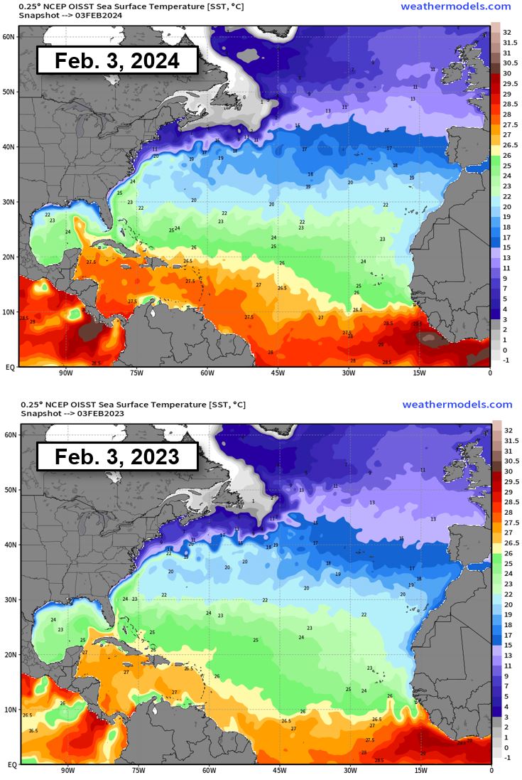


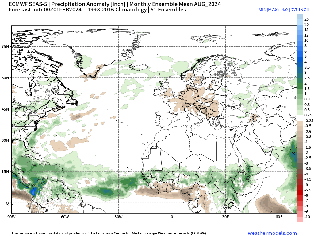
wxman57 wrote:One clue as to the strength of the Azores-Bermuda High this year is SSTs in the deep tropics. The current negative NAO is due to a weaker high center. As a result, SSTs are warmer than last year at this time. Trade winds have been lower than normal, so not much upwelling of cooler water. Will this pattern continue through the season?
El Nino should be declining over the coming months, replaced by neutral conditions then possibly a weak to moderate La Nina by peak season.
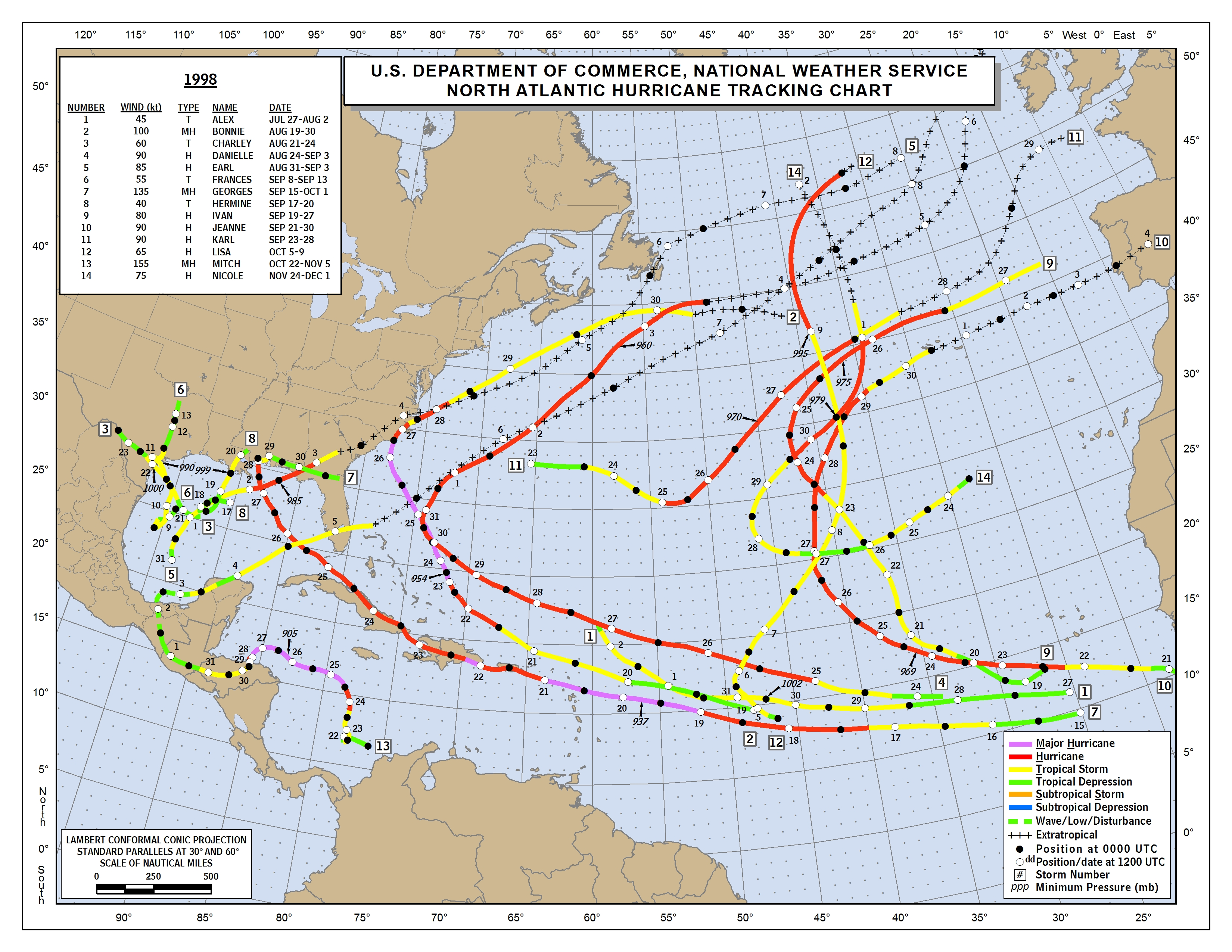
As for analogs, one of the best I could find is 1998. I was talking to Phil Klotzbach. He agrees on 1998 as a good analog. Lots of subtropical activity, indicating a weaker Bermuda High. Georges made a significant impact on the NE Caribbean & Mississippi. Of course, there was also powerful Hurricane Mitch in the western Caribbean. For now, I'm thinking above normal activity with the majority of hurricanes north of the Caribbean again.
1998: https://www.nhc.noaa.gov/data/tracks/tracks-at-1998.png
http://wxman57.com/images/SSTs.JPG
http://wxman57.com/images/SSTs.JPG


SFLcane wrote:wxman57 wrote:One clue as to the strength of the Azores-Bermuda High this year is SSTs in the deep tropics. The current negative NAO is due to a weaker high center. As a result, SSTs are warmer than last year at this time. Trade winds have been lower than normal, so not much upwelling of cooler water. Will this pattern continue through the season?
El Nino should be declining over the coming months, replaced by neutral conditions then possibly a weak to moderate La Nina by peak season.
As for analogs, one of the best I could find is 1998. I was talking to Phil Klotzbach. He agrees on 1998 as a good analog. Lots of subtropical activity, indicating a weaker Bermuda High. Georges made a significant impact on the NE Caribbean & Mississippi. Of course, there was also powerful Hurricane Mitch in the western Caribbean. For now, I'm thinking above normal activity with the majority of hurricanes north of the Caribbean again.
1998: https://www.nhc.noaa.gov/data/tracks/tracks-at-1998.png
http://wxman57.com/images/SSTs.JPG
http://wxman57.com/images/SSTs.JPG
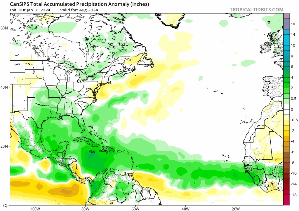
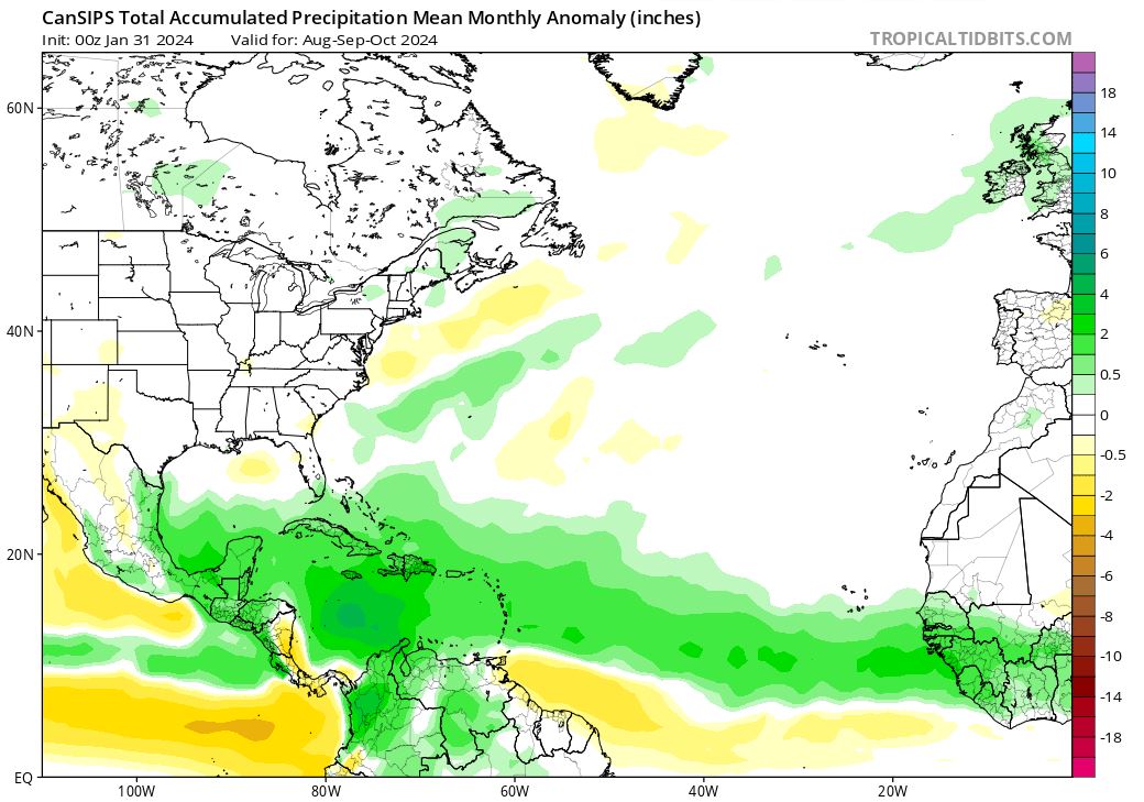
Just for the sake of it i don't see any climate model "for now" suggesting a weak high with tc's tracking north of the caribbean infact the total opposite. Surely one must never rely on precip maps for hurricane tracks but they do provide clues and they did pretty good last season.
https://i.postimg.cc/JnP1K3Pw/ukmet.jpg
https://i.postimg.cc/tgzyCt01/hhh.jpg
https://i.postimg.cc/7hGp7SRn/llloo.png
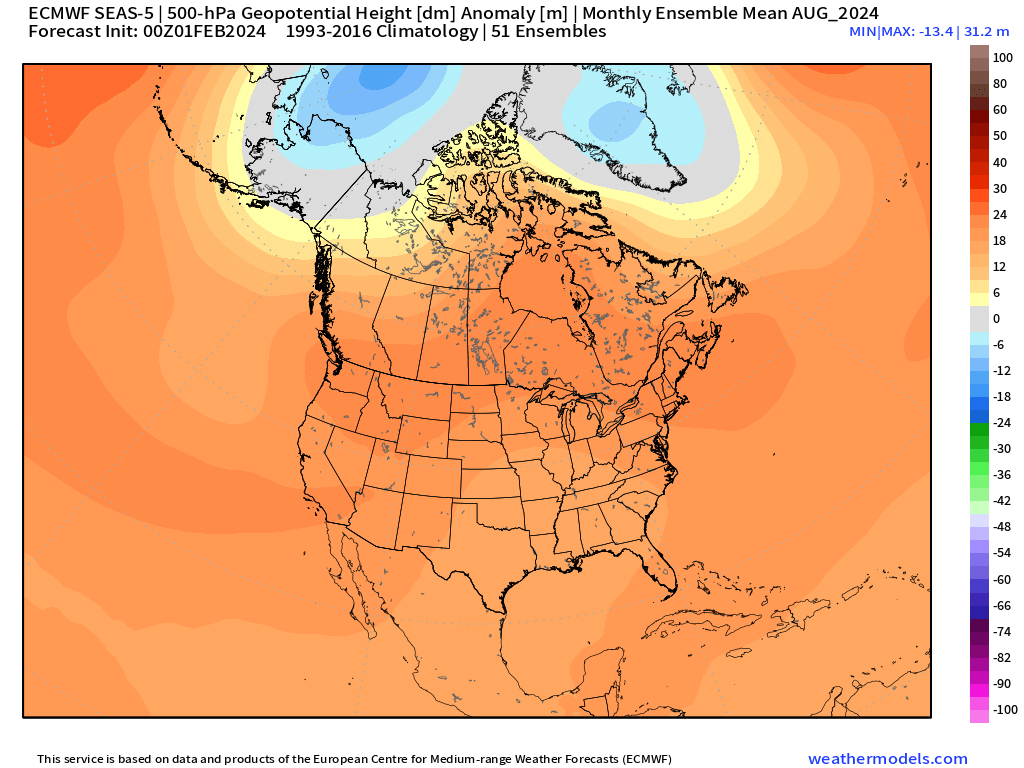
August z500 looks like widespread ridging look that could actually send stuff towards the caribbean.
https://i.postimg.cc/QCQv0jXF/8CUmJCuw.png


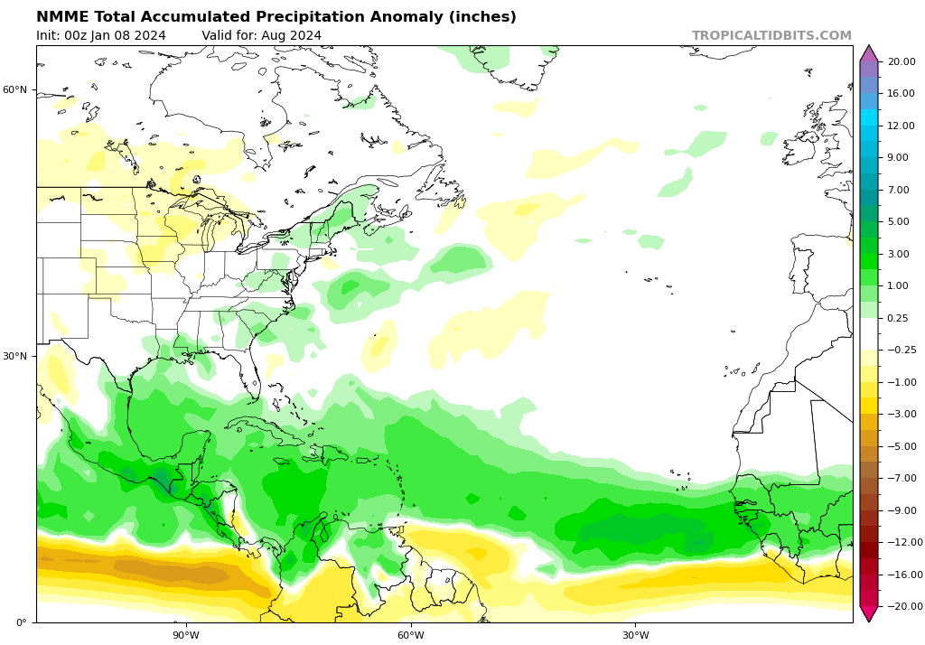
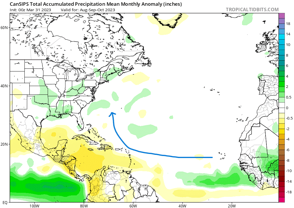
SFLcane wrote:What did the cansips show around this time last year you may ask? A mostly dry caribbean which verified nicely


DorkyMcDorkface wrote:Benchmark in recent times in terms of preseason anomalous warmth is 2010, and it seems we've definitely surpassed that at this point. Granted 2010 didn't start to warm appreciably until the latter half of the month, but with the NAO ready to turn negative again and persist it wouldn't be an unreasonable assessment to assume we'll continue to stay ahead. At this rate widespread +2C anoms in the MDR by the end of the month remains a distinct possibility, as weenie as that may sound. Idk if there's a pre-satellite era year that comes close to this because I don't recall a year from the 60s onward which had such an extreme look so early in the year, regardless of what climo period you use. Could be wrong though.
Long way to go and still many details to iron out in the meantime, but if seasonal guidance is correct this look isn't going anywhere anytime soon.
https://i.ibb.co/Xscn0Hz/ezgif-com-animated-gif-maker.gif

WiscoWx02 wrote:Given the lack of Caribbean activity since 2009 most years except 2020


cycloneye wrote:The hyped 2024 season is causing very much discussions in social media and Storm2k is no exception. The fast pace this 2024 indicators thread is going, if it keeps up, would be the most posted and with the most pages one. The 2023 indicators thread one was only in the second page by this time in Febuary and right now is on page 11. Each page consists of 20 posts.
https://i.imgur.com/fKxhbng.gif
SFLcane wrote:Samething i have been saying in regards to the Conus and Caribbean. Lets hope things change!
https://x.com/OSUWXGUY/status/1754870262070182067
Users browsing this forum: Iceresistance, shah83 and 141 guests

