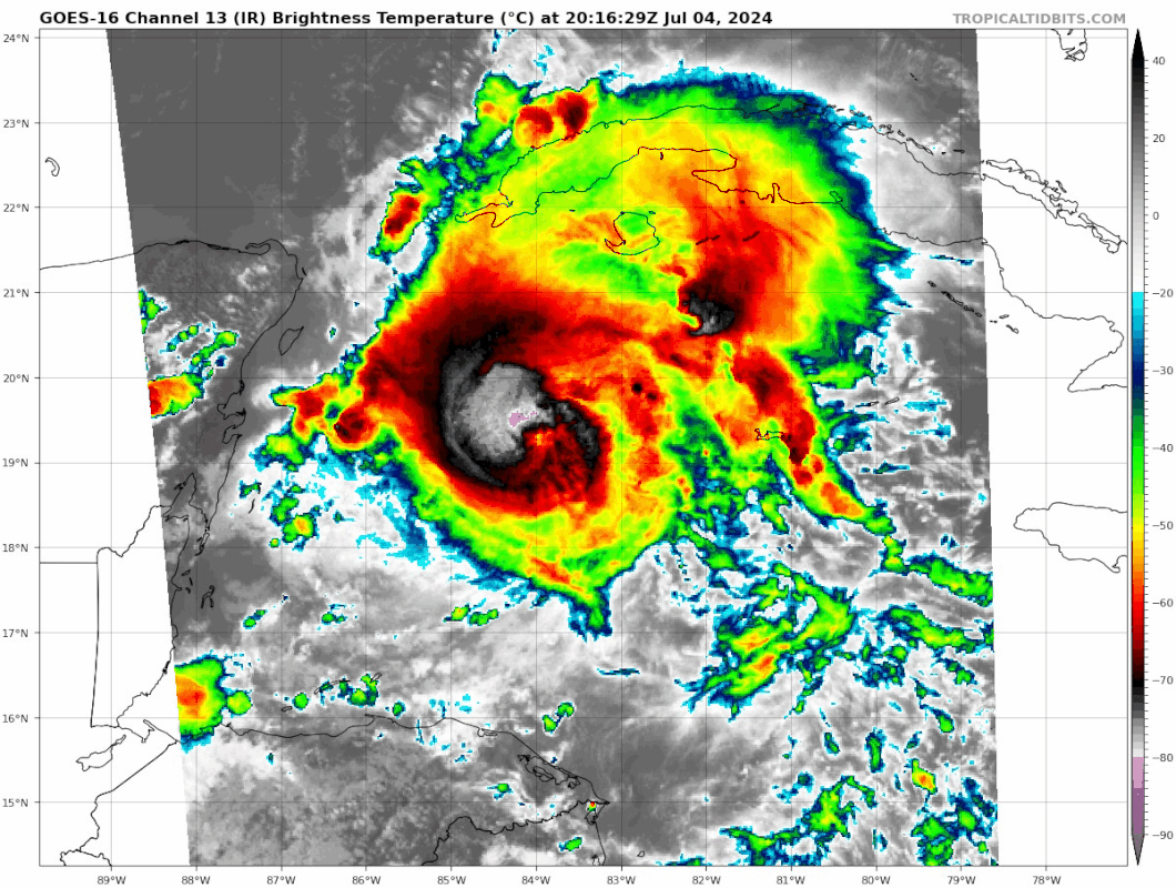
LadyBug72 wrote:MGC wrote:Convection is slowly starting to wrap around the east side of Beryl's circulation and with the eye reemerging shear looks to be relaxing. Landfall looks to be near Cozumel and should exit the trek across the Yucatan near Progresso as a TS. Depending on how badly the core is disrupted will determine how fast the hurricane will reintensify. Landfall north of Rio Grande is a good possibility......MGC
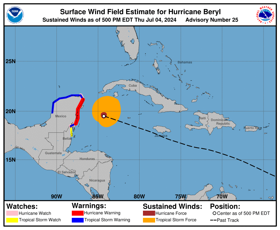
What direction is she currently moving?
From NHC: PRESENT MOVEMENT...WNW OR 285 DEGREES AT 18 MPH...30 KM/H