Keldeo1997 wrote: https://x.com/bennollweather/status/1809704125892088031
EURO saying we are just in the top of the 3rd inning. Also East coast looks to have a huge target
Ooof! Can’t even see FL there. Enjoy the next 2/3 weeks.
Moderator: S2k Moderators


Keldeo1997 wrote: https://x.com/bennollweather/status/1809704125892088031
EURO saying we are just in the top of the 3rd inning. Also East coast looks to have a huge target

Keldeo1997 wrote: https://x.com/bennollweather/status/1809704125892088031
EURO saying we are just in the top of the 3rd inning. Also East coast looks to have a huge target

USTropics wrote:Keldeo1997 wrote: https://x.com/bennollweather/status/1809704125892088031
EURO saying we are just in the top of the 3rd inning. Also East coast looks to have a huge target
I would say we're still in the 1st inning, but had a grand slam. Average hurricane days for July 6th is 0.6 (we're at 5.6), average named storms is 1.6 (we're at 3) and average ACE is 3.1 (we're at 33.5).
Keldeo1997 wrote: https://x.com/bennollweather/status/1809704125892088031
EURO saying we are just in the top of the 3rd inning. Also East coast looks to have a huge target
USTropics wrote:Keldeo1997 wrote: https://x.com/bennollweather/status/1809704125892088031
EURO saying we are just in the top of the 3rd inning. Also East coast looks to have a huge target
I would say we're still in the 1st inning, but had a grand slam. Average hurricane days for July 6th is 0.6 (we're at 5.6), average named storms is 1.6 (we're at 3) and average ACE is 3.1 (we're at 33.5).


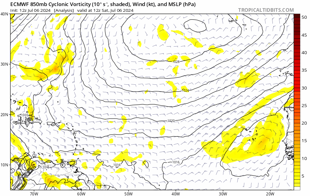
zzzh wrote:https://i.postimg.cc/rFnG0pmx/ec-fast-uv850-vort-eatl-fh0-240.gif
We are seeing the huge sloppy wave issue again.

redingtonbeach wrote:2"anomaly in Florida over 3 months of an active season? Heck, Central Florida is neutral to 1". Doesn't seem like a significant concern? What am I missing?

MEANINGLESS_NUMBERS wrote:redingtonbeach wrote:2"anomaly in Florida over 3 months of an active season? Heck, Central Florida is neutral to 1". Doesn't seem like a significant concern? What am I missing?
We aren’t worried about the rainfall directly. That much moisture implies lots of hurricanes.


CyclonicFury wrote:Here's the July NMME run, it does look a bit less favorable than the June run with less extreme precip anomalies and a weaker +AMO. Interestingly, despite Beryl seeming like a surefire harbinger of a very active season, nearly all of the July climate models came in with a less favorable NATL look than the June runs - wonder if the recent cooling over the eastern Atlantic is why? Still a very favorable look regardless.
https://i.imgur.com/WyoigQn.png
https://i.imgur.com/d2ubrKr.png


AnnularCane wrote:MEANINGLESS_NUMBERS wrote:redingtonbeach wrote:2"anomaly in Florida over 3 months of an active season? Heck, Central Florida is neutral to 1". Doesn't seem like a significant concern? What am I missing?
We aren’t worried about the rainfall directly. That much moisture implies lots of hurricanes.
I'm sure the answer is obvious, but if there are lots of Gulf hurricanes like that map says, how come the central and Gulf states are shown to be drier than normal?
Mainly because usually on maps like these the precip tends to extend into the states as well.


MississippiWx wrote:Beginning to wonder what’s up with the SST anomalies. There has been a lot of SAL lately but wondering if there is something else too causing them to cool.
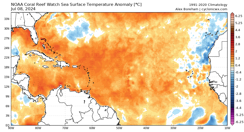

MississippiWx wrote:Beginning to wonder what’s up with the SST anomalies. There has been a lot of SAL lately but wondering if there is something else too causing them to cool.

Users browsing this forum: No registered users and 196 guests


