TomballEd wrote:The Tampa Bay thing, 50 years ago when I was a student in Catholic school I checked out a book from the school library about hurricanes written by a man from Tampa who had shot down a Japanese plane at Pearl Harbor. Anyway, he said Tampa seems to have a protective force field, he recalled several forecast misses and sudden weakening. But 50 years ago people in Tampa thought there was a magic field. Something to do with Native Americans, IIRC.
Of course, a big hurricane will hit Tampa Bay, but the frequency seems low.
I got interested in hurricanes first from my parents' stories of 1938, and then Hurricane Belle in 1976. My Dad wouldn't let me go outside for the eye.
Will the force field hold again?
It’s mainly because of the shape of the coast and the angle it has to come. Most storms that come from the south either take more of a harder right turn toward Port Charlotte or more of a gradual turn toward the big bend or Panhandle. Kinda like Jacksonville in that it’s gotta take that perfect angle which is tough given the coast’s shape.
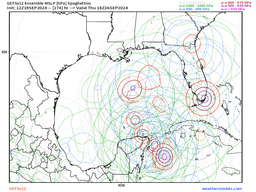
The GFS track is the most likely way a cat 5 would hit TB because it comes more on an ENE track which btw is very rare in the Gulf…usually if a storm moves ENE in the gulf it’s a depression or weak storm. I’ve rarely seen a major Hurricane move ENE or due east in the central gulf. Closest I can think of is Wilma. And the
GFS track is a slightly further north version of Wilma.


