

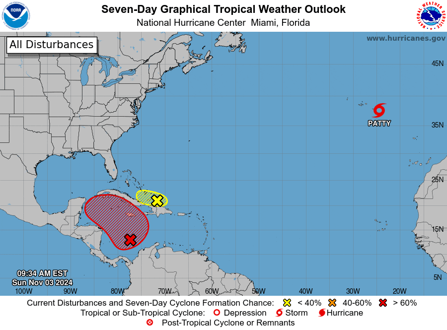
Blown Away wrote:Invest 97L
As of 12:00 UTC Nov 03, 2024:
Location: 12.9°N 77.1°W
Maximum Winds: 25 kt Gusts: N/A
Minimum Central Pressure: 1006 mb
It’s seems the NHC is resetting the “x” farther E following the convection.
Where was it before? I didn't pay attention to the exact lat. and long.


