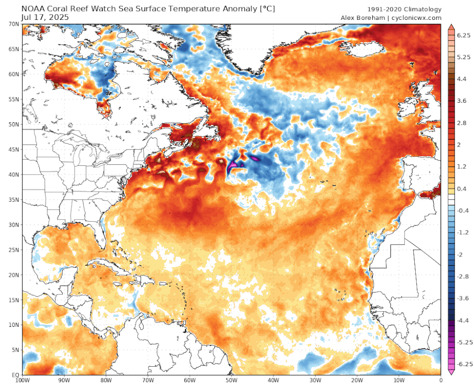
TomballEd wrote:Now that I am seeing the maps of 2013 vs active, I'm noticing a neutral Atlantic subtropics is a feature of busy seasons and we don't have that. Nor do we have a neutral to cool Indian Ocean.
https://i.imgur.com/2oRuuuz.png
You are absolutely right, those signals and others (e.g., Canary Current is slow this season to propagate warmth to the MDR region but we're starting to see that show up now) is a reason most forecasters went with an above-average seasonal forecast last month. A better comparison would be to use the first 20 days of July for active years, I just plotted that below:

Interestingly, we do start to get some warming in the subtropics in July, and we start to get this horseshoe look to the +SSTA pattern (a classic active signal during the positive AMO). So if the subtropics keeps cooling, and the MDR keeps warming the next few weeks (likely given forecasted zonal winds, more on that below), where are we in 2-3 weeks?
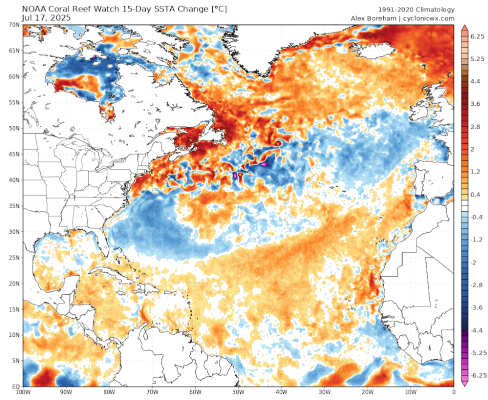
One of the cool things we've seen in July is a complete flip to a more active 'signal'. Literally, just check out how these zonal winds completely flipped in the North Atlantic after the first week of July as the Bermuda high weakened:


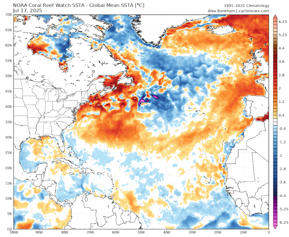
This is what is leading to the subtropics to 'cool' and the MDR to warm quickly.
It's also what broke down the trade wind flow and allowed for a more monsoonal look in the ITCZ (with surface flow even bending back eastwards), providing a decent environment for 94L. If this pattern persists into August and September, we're looking at a very active wave train and just need some sub seasonal forcing (e.g., MJO) to ignite these waves:


