Plus, the last patch of sleet from our crazy winter storm finally melted from my yard a couple of days ago and from my neighbor’s yard yesterday.
So, I guess that means we’ll soon be migrating to the “Texas Spring 2026” discussion thread for the next season on the calendar.
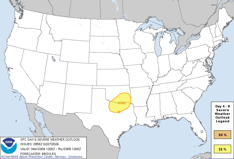
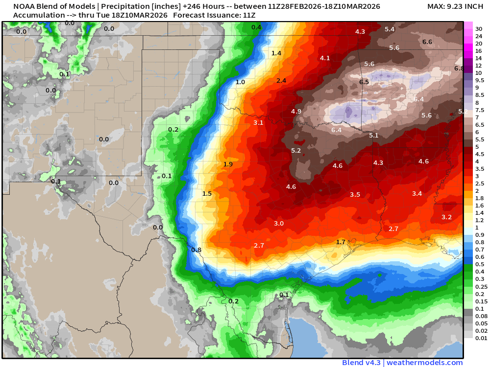
With any luck, we’ll delay talk of spring and instead talk about a snowfall or two before Easter.
Spring cancel? Hey, we can dream, right?!?