Pardon the lack of knowledge, what makes this El Niño different from the El Niño we saw in 2023? If waters are already experiencing rapid warming and we see that spread out from the Gulf to the Caribbean and MDR, would we not have a similar setup to the 20 tropical storms we saw during 2023?
Besides an active development, the good thing is the lack of CONUS landfalls (minus Idalia).
2026 Indicators: SST's, MSLP, Shear, SAL, Steering, Instability (Day 16+ Climate Models)
Moderator: S2k Moderators
Forum rules

The posts in this forum are NOT official forecasts and should not be used as such. They are just the opinion of the poster and may or may not be backed by sound meteorological data. They are NOT endorsed by any professional institution or STORM2K. For official information, please refer to products from the National Hurricane Center and National Weather Service.
-
StPeteMike

- Category 2

- Posts: 655
- Joined: Thu Jun 07, 2018 11:26 pm
Re: 2026 Indicators: SST's, MSLP, Shear, SAL, Steering, Instability (Day 16+ Climate Models)
2 likes
The above post is not official and should not be used as such. It is the opinion of the poster and may or may not be backed by sound meteorological data. It is not endorsed by any professional institution or storm2k.org. For official information, please refer to the NHC and NWS products.
-
mixedDanilo.E
- Tropical Storm

- Posts: 110
- Joined: Sun Nov 21, 2021 8:00 am
- Location: NY
Re: 2026 Indicators: SST's, MSLP, Shear, SAL, Steering, Instability (Day 16+ Climate Models)
cycloneye wrote:The Gulf waters are warming and Josh takes notice.
https://x.com/iCyclone/status/2031567639579959475
I wouldn't be surprised if we have early season close to home development that even impacts the US. I noticed that a lot of early seasons in El Nino years especially, tend to have these quick spinups that happen in the northern gulf and along the gulf stream off the SE Coast, like Ana & Bill in 2015, Alberto and Chris in 2018, Arlene in 2023 and even Arthur in 2014.
3 likes
-
USTropics
- Professional-Met

- Posts: 2738
- Joined: Sun Aug 12, 2007 3:45 am
- Location: Florida State University
Re: 2026 Indicators: SST's, MSLP, Shear, SAL, Steering, Instability (Day 16+ Climate Models)
StPeteMike wrote:Pardon the lack of knowledge, what makes this El Niño different from the El Niño we saw in 2023? If waters are already experiencing rapid warming and we see that spread out from the Gulf to the Caribbean and MDO, would we not have a similar setup to the 20 tropical storms we saw during 2023?
Besides an active development, the good thing is the lack of CONUS landfalls (minus Idalia).
If we're just looking at the current surface analysis and comparing to 2023, you could already see at this time in 2023 that the SSTA configuration would potentially allow for competing vertical ascent between the EPAC and NATL. Let's compare March 10th of both years (2023 and currently). Starting with 2023:

Some things that jump out to me (1) clear MDR SSTA+ configuration, (2) Canary current has a clear warm signal, and (3) ENSO in the eastern Pacific is still a bit muted.
Now current SSTA configuration for 2026

We have (1) MDR SSTA- configuration, (2) subtropics has the +SSTA, and (3) starting to see a stronger El Nino signal in the eastern Pacific.
Yes, both years had a strong +SSTA signal in the GOM, but there is no correlation there as a preseason indicator. That basin is extremely variable to intraseasonal changes. Personally, if we have a +SSTA signal in the eastern Pacific and a +SSTA signal in the subtropical NATL, subsidence dump is going to be concentrated in the MDR. There will be windows for development of course, but it's going to take additional forcing mechanisms (e.g., MJO and CCKW).
I will caveat that I am focusing particularly on the MDR here. This is where we typically see systems generate the most ACE and the ability to at least have some sort of forecast skill at this lead time exists. We can always have 'homegrown' systems in the GOM or in the subtropics, but the ability and forecast skill for that in March is essentially 0.
7 likes
-
weeniepatrol

- Category 5

- Posts: 1343
- Joined: Sat Aug 22, 2020 5:30 pm
- Location: WA State
Re: 2026 Indicators: SST's, MSLP, Shear, SAL, Steering, Instability (Day 16+ Climate Models)
StPeteMike wrote:Pardon the lack of knowledge, what makes this El Niño different from the El Niño we saw in 2023? If waters are already experiencing rapid warming and we see that spread out from the Gulf to the Caribbean and MDR, would we not have a similar setup to the 20 tropical storms we saw during 2023?
Besides an active development, the good thing is the lack of CONUS landfalls (minus Idalia).
The Atlantic is much cooler this year and there’s no signs of an African standing wave like in 2023
3 likes
-
cycloneye

- Admin

- Posts: 149345
- Age: 69
- Joined: Thu Oct 10, 2002 10:54 am
- Location: San Juan, Puerto Rico
2026 Indicators: SST's, MSLP, Shear, SAL, Steering, Instability (Day 16+ Climate Models)
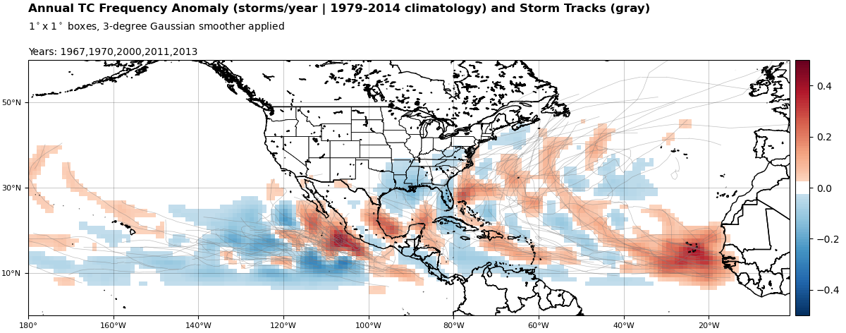
NMME analogs for NATL season based on the models +ENSO forecast are 1972, 1982, 1994, 1997, 2015.
https://www.tropicaltidbits.com/analysis/hsanalog/
https://www.tropicaltidbits.com/analysis/hsanalog/
0 likes
Visit the Caribbean-Central America Weather Thread where you can find at first post web cams,radars
and observations from Caribbean basin members Click Here
and observations from Caribbean basin members Click Here
-
StPeteMike
- Category 2
- Posts: 655
- Joined: Thu Jun 07, 2018 11:26 pm
Re: 2026 Indicators: SST's, MSLP, Shear, SAL, Steering, Instability (Day 16+ Climate Models)
Thanks for the clarification folks! 
0 likes
The above post is not official and should not be used as such. It is the opinion of the poster and may or may not be backed by sound meteorological data. It is not endorsed by any professional institution or storm2k.org. For official information, please refer to the NHC and NWS products.
-
mixedDanilo.E
- Tropical Storm
- Posts: 110
- Joined: Sun Nov 21, 2021 8:00 am
- Location: NY
Re: 2026 Indicators: SST's, MSLP, Shear, SAL, Steering, Instability (Day 16+ Climate Models)
https://www.tropicaltidbits.com/analysis/models/ecmwf/2026031300/ecmwf_u850aMean_atl_11.png
I'm wondering if maybe the Atlantic might have a chance to begin warming up as we get towards the end of March and into April.
I'm wondering if maybe the Atlantic might have a chance to begin warming up as we get towards the end of March and into April.
1 likes
-
DorkyMcDorkface

- Category 4

- Posts: 999
- Age: 28
- Joined: Mon Sep 30, 2019 1:32 pm
- Location: Mid-Atlantic
Re: 2026 Indicators: SST's, MSLP, Shear, SAL, Steering, Instability (Day 16+ Climate Models)
mixedDanilo.E wrote:https://www.tropicaltidbits.com/analysis/models/ecmwf/2026031300/ecmwf_u850aMean_atl_11.png
I'm wondering if maybe the Atlantic might have a chance to begin warming up as we get towards the end of March and into April.
Last I posted these charts they showed the NAO remaining persistently positive, but now it appears there's a good chance it will dip headed into the second half of the month. I think there's a good chance we'll see a rebound of SSTs in the MDR should this verify, but we'll need this to last for quite some time and/or fall further into the negative phase in order to reach anything remotely close to 2023 levels (or at least to a point where it will be warm enough to provide substantial resistance to ENSO effects).


I still think the Pacific configuration being more favorable (or unfavorable for the Atlantic) outside of ENSO this year will put more of a lid on the season than 2023 even if the tropical Atlantic manages to warm to decently above avg levels though.
6 likes
Please note the thoughts expressed by this account are solely those of the user and are from a hobbyist perspective. For more comprehensive analysis, consult an actual professional meteorologist or meteorological agency.
Floyd 1999 | Isabel 2003 | Hanna 2008 | Irene 2011 | Sandy 2012 | Isaias 2020
-
mixedDanilo.E
- Tropical Storm
- Posts: 110
- Joined: Sun Nov 21, 2021 8:00 am
- Location: NY
-
DorkyMcDorkface
- Category 4
- Posts: 999
- Age: 28
- Joined: Mon Sep 30, 2019 1:32 pm
- Location: Mid-Atlantic
Re: 2026 Indicators: SST's, MSLP, Shear, SAL, Steering, Instability (Day 16+ Climate Models)
Was gonna post the following in the ENSO thread in response to this, but it's probably better suited for here:
MDR activity during an El Niño normally isn't a complete wash, it's getting TCG past 55-60W that is the real challenge for these storms, given that's where the TUTT likes to wreck havoc during these years. 2023 really was an anomaly in that regard, I do think the abnormally warm SSTs and persistently entrenched ASW managed to disrupt the typical El Niño atmospheric circulation, providing storms with more ample opportunity to develop and/or thrive. I remember an early Euro run for Lee which showed a damn near picture perfect UL pattern with like quadruple outflow channels NE of the Antilles, and many of the nested hurricane intensity models were bombing it out to sub-900mb in the open Atlantic. It didn't occur of course, but with what they were depicting you would've never believed it was a strong Niño year lol. But the stars basically had to align to produce a 20/7/3 148 ACE season in the face of what is normally very hostile ENSO. I have serious reservations on that being the case yet again this year.
MDR activity during an El Niño normally isn't a complete wash, it's getting TCG past 55-60W that is the real challenge for these storms, given that's where the TUTT likes to wreck havoc during these years. 2023 really was an anomaly in that regard, I do think the abnormally warm SSTs and persistently entrenched ASW managed to disrupt the typical El Niño atmospheric circulation, providing storms with more ample opportunity to develop and/or thrive. I remember an early Euro run for Lee which showed a damn near picture perfect UL pattern with like quadruple outflow channels NE of the Antilles, and many of the nested hurricane intensity models were bombing it out to sub-900mb in the open Atlantic. It didn't occur of course, but with what they were depicting you would've never believed it was a strong Niño year lol. But the stars basically had to align to produce a 20/7/3 148 ACE season in the face of what is normally very hostile ENSO. I have serious reservations on that being the case yet again this year.
7 likes
Please note the thoughts expressed by this account are solely those of the user and are from a hobbyist perspective. For more comprehensive analysis, consult an actual professional meteorologist or meteorological agency.
Floyd 1999 | Isabel 2003 | Hanna 2008 | Irene 2011 | Sandy 2012 | Isaias 2020
Who is online
Users browsing this forum: No registered users and 80 guests