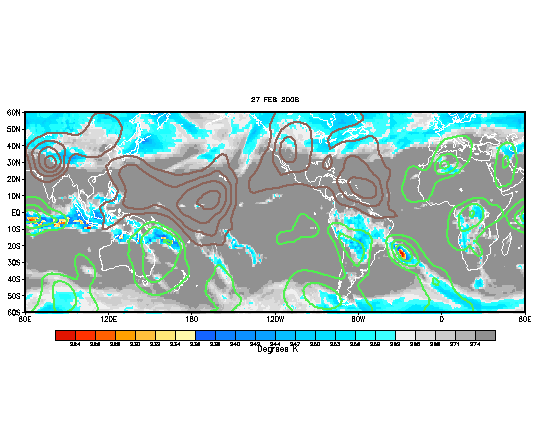
http://www.goes.noaa.gov/HURRLOOPS/huwvloop.html
As we enter the second month of the 2004 season what do we find out there well at least 4 upper level low pressure areas are right now in the Atlantic and it is part of the semipermanent trospospheric trough or the TUTT which is dominating in the Atlantic at this time but when the peak of the season arrives that trough tends to weaken making enviromental conditions more condusive for tropical developments but for now not favorable conditions will continue to be there however july is a slow month anyway.Also another source for shear is the outer side of the anticyclones where the flow causes shear and that is happening in the caribbean and in the tropical atlantic where 2 anticyclones are there.So for now dont expect anything forming but let's wait and see when that TUTT trough will begin to weaken and then a more summerlike pattern will be established and the gates will open with the help of the MJO spilling into the Atlantic.
Shear,shear and more shear still dominates in atlantic basin
Moderator: S2k Moderators
Forum rules

The posts in this forum are NOT official forecasts and should not be used as such. They are just the opinion of the poster and may or may not be backed by sound meteorological data. They are NOT endorsed by any professional institution or STORM2K. For official information, please refer to products from the National Hurricane Center and National Weather Service.
-
cycloneye

- Admin

- Posts: 148758
- Age: 69
- Joined: Thu Oct 10, 2002 10:54 am
- Location: San Juan, Puerto Rico
Shear,shear and more shear still dominates in atlantic basin
0 likes
Visit the Caribbean-Central America Weather Thread where you can find at first post web cams,radars
and observations from Caribbean basin members Click Here
and observations from Caribbean basin members Click Here
-
Hurricanehink

- S2K Supporter

- Posts: 2047
- Joined: Sun Nov 16, 2003 2:05 pm
- Location: New Jersey
-
cycloneye
- Admin
- Posts: 148758
- Age: 69
- Joined: Thu Oct 10, 2002 10:54 am
- Location: San Juan, Puerto Rico
Hurricanehink wrote:BooI want storms now... Oh well, patience is a virtue I don't have....... (twiddles thumbs until they break off).
That is the key word (PATIENCE) that some I think dont have too much.
0 likes
Visit the Caribbean-Central America Weather Thread where you can find at first post web cams,radars
and observations from Caribbean basin members Click Here
and observations from Caribbean basin members Click Here
-
cycloneye
- Admin
- Posts: 148758
- Age: 69
- Joined: Thu Oct 10, 2002 10:54 am
- Location: San Juan, Puerto Rico
Looks like MR SHEAR is doing a great job keeping the systems in check tonight the Bermuda one and the wave at mid atlantic.
0 likes
Visit the Caribbean-Central America Weather Thread where you can find at first post web cams,radars
and observations from Caribbean basin members Click Here
and observations from Caribbean basin members Click Here


Re: Shear,shear and more shear still dominates in atlantic b
cycloneye wrote:http://www.goes.noaa.gov/HURRLOOPS/huwvloop.html
As we enter the second month of the 2004 season what do we find out there well at least 4 upper level low pressure areas are right now in the Atlantic and it is part of the semipermanent trospospheric trough or the TUTT which is dominating in the Atlantic at this time but when the peak of the season arrives that trough tends to weaken making enviromental conditions more condusive for tropical developments but for now not favorable conditions will continue to be there however july is a slow month anyway.Also another source for shear is the outer side of the anticyclones where the flow causes shear and that is happening in the caribbean and in the tropical atlantic where 2 anticyclones are there.So for now dont expect anything forming but let's wait and see when that TUTT trough will begin to weaken and then a more summerlike pattern will be established and the gates will open with the help of the MJO spilling into the Atlantic.
The DRY MJO phase is building over the WPAC and will shut things off again once it gets into the ATL in the next few weeks.
Take a look at all the supperessed convection over the WPAC

0 likes
Who is online
Users browsing this forum: Google Adsense [Bot] and 35 guests