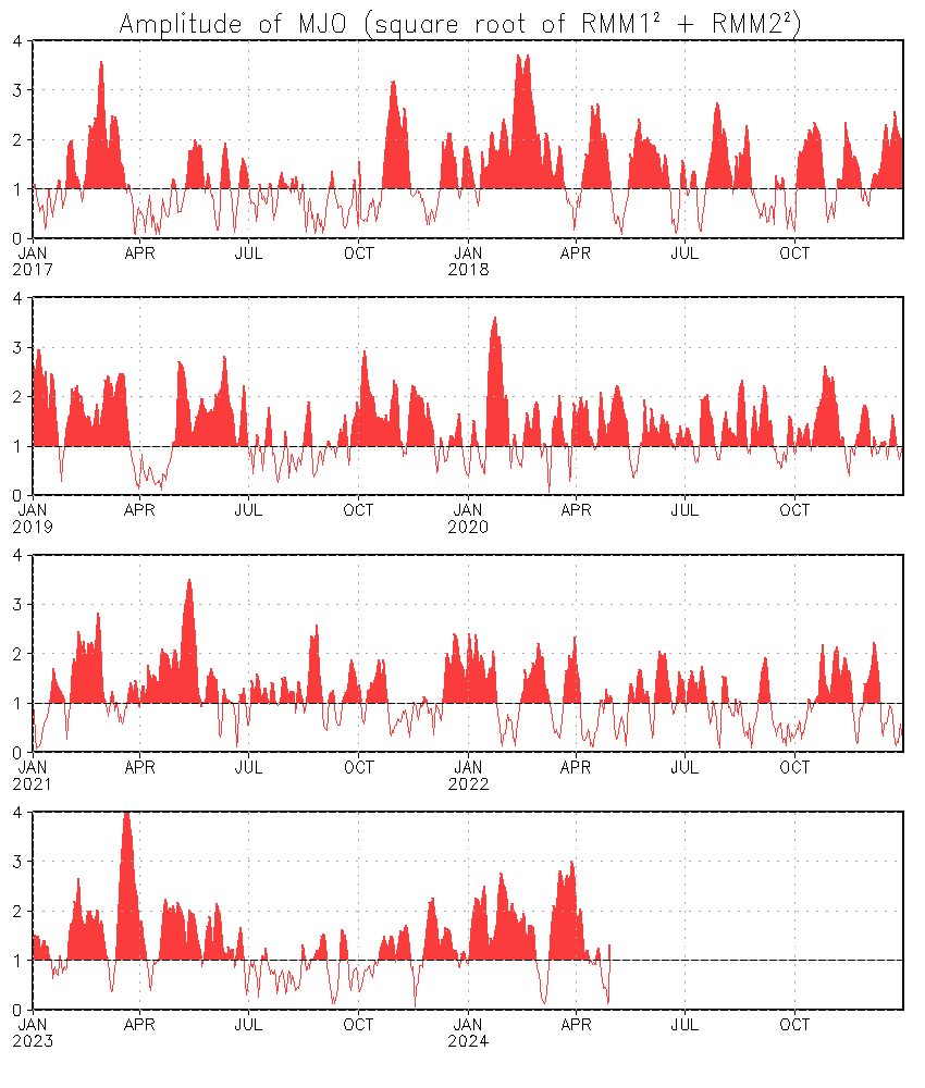
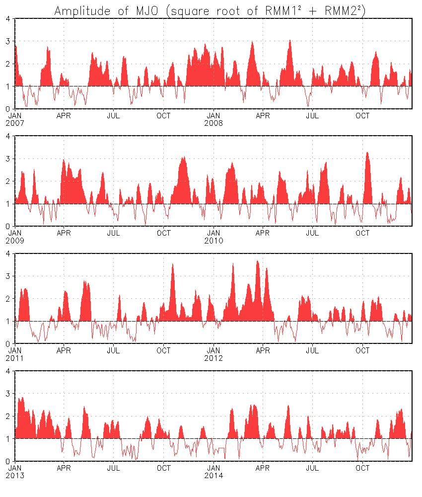
OT: Isn’t the weak MJO signal (amplitude) around the first week of April typically a precursor,
ceteris paribus, to possible La Niña development later on? Both the
GFS and
ECMWF ensembles are in strong agreement that the MJO signal should weaken as we enter the first week of April. Since early February, the
overall amplitude of the MJO appears to have been the weakest for this timeframe since 2011. (Of course, 2011-12 marked a
double-dip Niña, as it followed the Niña of 2010-11—the latter a strong episode, the former moderate.) Overall, the amplitude is quite similar to
that for the same timeframe in 2010, which transitioned out of a strong Niño. So the fact that we are seeing a response similar to that which preceded the last strong Niña, despite coming out of a weak (borderline) Niño, is at least a bit interesting.


