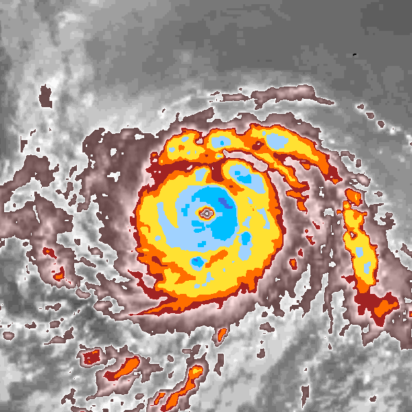
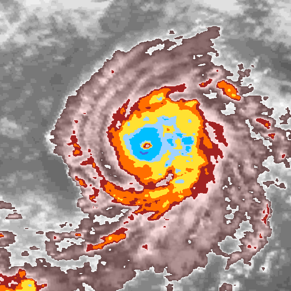
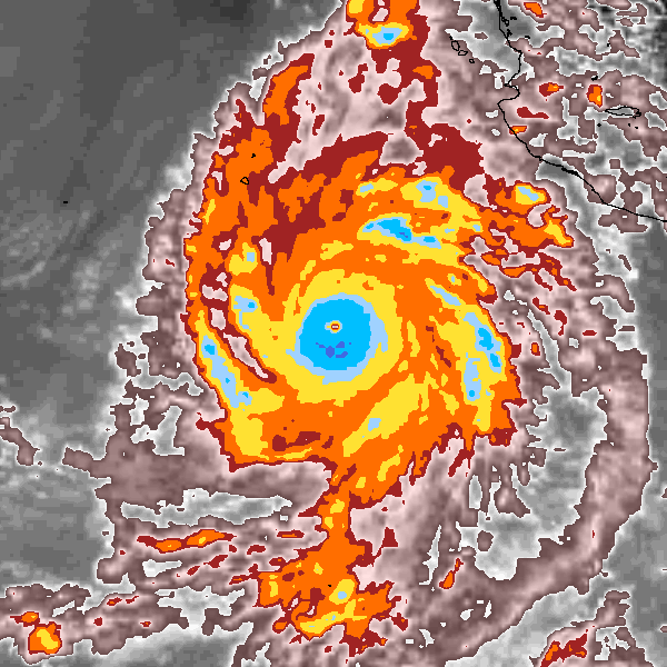
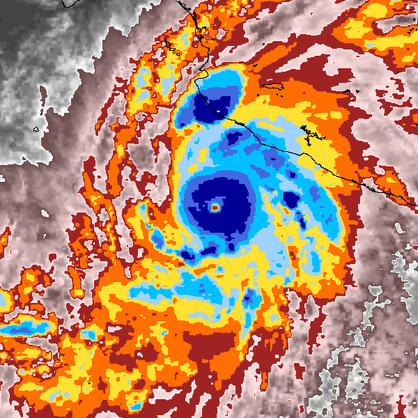
Discussion of Intense Tropical Cyclones

This is the general tropical discussion area. Anyone can take their shot at predicting a storms path.

Moderator: S2k Moderators

Forum rules

The posts in this forum are NOT official forecasts and should not be used as such. They are just the opinion of the poster and may or may not be backed by sound meteorological data. They are NOT endorsed by any professional institution or STORM2K. For official information, please refer to products from the National Hurricane Center and National Weather Service.

Help Support Storm2K
Message
Author
User avatar
FireRat
Category 5
Category 5
Posts: 1138
Age: 36
Joined: Sun Sep 26, 2010 11:38 pm
Location: North Carolina

Re: Discussion of Intense Tropical Cyclones

#481 Postby FireRat » Mon Jun 22, 2020 2:47 am

NotoSans wrote:
FireRat wrote:Typhoons are definitely the kings of the tropics, 898, gosh! Amazing the ship even survived that one! :eek:

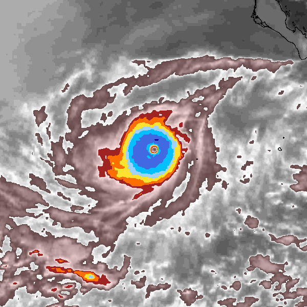
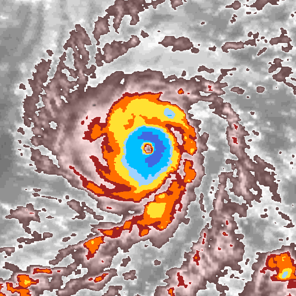
As for landfallers, I remember reading once that the typhoon of Nov 1987, Nina I believe, struck the Philippines as a maxed-out Cat 5 and a pressure of 891 mb was measured at landfall. Always was curious about that one and if that reading was indeed real.

Edit: I found some info on this, and yeah it looks like it may have been that low according to the link below:

https://enacademic.com/dic.nsf/enwiki/1874548


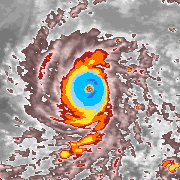
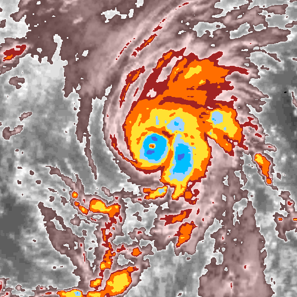
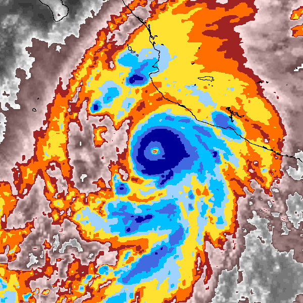
The 891mb pressure was derived from the Atkinson-Holiday wind-pressure relationship and the 145KT JTWC best track intensity. Lowest pressure recorded in the Philippines at landfall should be 909.5mb for Nina.


I see! 891 is crazy, would've edged out the Labor Day hurricane landfall by 1 mb. Thanks for the clarification!

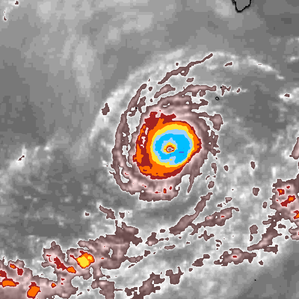
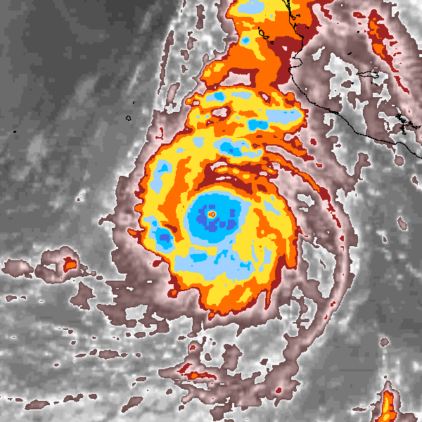
909 is still quite powerful for a landfall, ouch!
Easily among the top landfallers.
0 likes   
Georges '98, Irene '99, Frances '04, Jeanne '04, Katrina '05, Wilma '05, Gustav '08, Isaac '12, Matthew '16, Florence '18, Michael '18, Ian '22

CrazyC83
Professional-Met
Professional-Met
Posts: 33393
Joined: Tue Mar 07, 2006 11:57 pm
Location: Deep South, for the first time!

Re: Discussion of Intense Tropical Cyclones

#482 Postby CrazyC83 » Wed Jun 24, 2020 6:47 pm

FireRat wrote::uarrow: Oh yeah, Rita was a monster indeed! You know, she kind of resembles 1996 Edouard in size and overall shape, but with an even more circular cdo. 180 MPH certainly seems accurate for her.

Wow those 1980s EPAC hurricanes were def underestimated. Norma, Olivia, Kiko, Raymond and Tico take the cake IMO. Easy Cat 5's, probably between 140kt and 150kt.


1982 and 1983 was a strong El Nino period so we'd expect monster EPAC storms then.

My estimates looking at the satellite:

1981 Norma: 140 kt
1982 Daniel: 145 kt (at first picture; second picture was probably 130 kt or so)
1982 John: 150 kt
1982 Olivia: 160 kt
1983 Henriette: 145 kt (at first picture; second picture was probably about 125 kt)
1983 Kiko: 165 kt (probably 2nd place in the EPAC)
1983 Raymond: 160 kt (incredible cloud tops but not symmetrical - if it was symmetrical, it would be just under Patricia)
1983 Tico: 140 kt
2 likes   

User avatar
aspen
Category 5
Category 5
Posts: 8057
Joined: Sat Oct 12, 2019 7:10 pm
Location: Connecticut, USA

Re: Discussion of Intense Tropical Cyclones

#483 Postby aspen » Wed Jun 24, 2020 6:56 pm

CrazyC83 wrote:
FireRat wrote::uarrow: Oh yeah, Rita was a monster indeed! You know, she kind of resembles 1996 Edouard in size and overall shape, but with an even more circular cdo. 180 MPH certainly seems accurate for her.

Wow those 1980s EPAC hurricanes were def underestimated. Norma, Olivia, Kiko, Raymond and Tico take the cake IMO. Easy Cat 5's, probably between 140kt and 150kt.


1982 and 1983 was a strong El Nino period so we'd expect monster EPAC storms then.

My estimates looking at the satellite:

1981 Norma: 140 kt
1982 Daniel: 145 kt (at first picture; second picture was probably 130 kt or so)
1982 John: 150 kt
1982 Olivia: 160 kt
1983 Henriette: 145 kt (at first picture; second picture was probably about 125 kt)
1983 Kiko: 165 kt (probably 2nd place in the EPAC)
1983 Raymond: 160 kt (incredible cloud tops but not symmetrical - if it was symmetrical, it would be just under Patricia)
1983 Tico: 140 kt

Are there any Dvorak images for Olivia, Kiko, and Raymond?
0 likes   
Irene '11 Sandy '12 Hermine '16 5/15/2018 Derecho Fay '20 Isaias '20 Elsa '21 Henri '21 Ida '21

I am only a meteorology enthusiast who knows a decent amount about tropical cyclones. Look to the professional mets, the NHC, or your local weather office for the best information.

User avatar
1900hurricane
Category 5
Category 5
Posts: 6044
Age: 32
Joined: Fri Feb 06, 2015 12:04 pm
Location: Houston, TX
Contact:

Re: Discussion of Intense Tropical Cyclones

#484 Postby 1900hurricane » Wed Jun 24, 2020 8:25 pm

aspen wrote:
CrazyC83 wrote:
FireRat wrote::uarrow: Oh yeah, Rita was a monster indeed! You know, she kind of resembles 1996 Edouard in size and overall shape, but with an even more circular cdo. 180 MPH certainly seems accurate for her.

Wow those 1980s EPAC hurricanes were def underestimated. Norma, Olivia, Kiko, Raymond and Tico take the cake IMO. Easy Cat 5's, probably between 140kt and 150kt.


1982 and 1983 was a strong El Nino period so we'd expect monster EPAC storms then.

My estimates looking at the satellite:

1981 Norma: 140 kt
1982 Daniel: 145 kt (at first picture; second picture was probably 130 kt or so)
1982 John: 150 kt
1982 Olivia: 160 kt
1983 Henriette: 145 kt (at first picture; second picture was probably about 125 kt)
1983 Kiko: 165 kt (probably 2nd place in the EPAC)
1983 Raymond: 160 kt (incredible cloud tops but not symmetrical - if it was symmetrical, it would be just under Patricia)
1983 Tico: 140 kt

Are there any Dvorak images for Olivia, Kiko, and Raymond?

The images of these storms on the previous page actually follow the BD curve, although in a colorized version instead of black and white. Here is the scale so you can compare.

Image
2 likes   
Contract Meteorologist. TAMU & MSST. Fiercely authentic, one of a kind. We are all given free will, so choose a life meant to be lived. We are the Masters of our own Stories.
Opinions expressed are mine alone.

Follow me on Twitter at @1900hurricane : Read blogs at https://1900hurricane.wordpress.com/

Shell Mound
Category 5
Category 5
Posts: 2434
Age: 31
Joined: Thu Sep 07, 2017 3:39 pm
Location: St. Petersburg, FL → Scandinavia

Re: Discussion of Intense Tropical Cyclones

#485 Postby Shell Mound » Thu Jun 25, 2020 6:15 am

Some additional EPAC cases (images courtesy of ibTRACS):

Image
Image
Douglas 1984 (official peak in HURDAT2: 125 kt; my estimate: 140-145 kt)

Image
Elida 1984 (official peak in HURDAT2: 115 kt; my estimate: 145-150 kt)

Image
Norbert 1984 (official peak in HURDAT2: 115 kt; my estimate: 155-160 kt)

Image
Blanca 1985 (official peak in HURDAT2: 105 kt; my estimate: 140-145 kt)

Image
Ignacio 1985 (official peak in HURDAT2: 115 kt; my estimate: 140-145 kt)

Image
Image
Rick 1985 (official peak in HURDAT2; 125 kt; my estimate: 155-160 kt)

Image
Image
Sandra 1985 (official peak in HURDAT2: 110 kt; my estimate: 160-165 kt)

Image
Xina 1985 (official peak in HURDAT2: 100 kt; my estimate: 140-145 kt)

...

Fifteen (proposed) new Cat-5s in the EPAC, 1981–4 (based on analyses here and here):

1981 Norma
1982 Daniel
1982 John
1982 Olivia
1983 Henriette
1983 Kiko
1983 Raymond
1983 Tico
1984 Douglas
1984 Elida
1984 Norbert
1985 Blanca
1985 Ignacio
1985 Sandra
1985 Xina
1 likes   
CVW / MiamiensisWx / Shell Mound
The posts in this forum are NOT official forecasts and should not be used as such. They are just the opinion of the poster and may or may not be backed by sound meteorological data. They are NOT endorsed by any professional institution or STORM2K. For official information, please refer to products from the NHC and NWS.

User avatar
aspen
Category 5
Category 5
Posts: 8057
Joined: Sat Oct 12, 2019 7:10 pm
Location: Connecticut, USA

Re: Discussion of Intense Tropical Cyclones

#486 Postby aspen » Thu Jun 25, 2020 7:13 am

Shell Mound wrote:Some additional EPAC cases (images courtesy of ibTRACS):

http://ibtracs.unca.edu/hursat/1984/1984177N10254.DOUGLAS.1984.06.28.1200.24.GOE-6.101.hursat-b1.v07.png
http://ibtracs.unca.edu/hursat/1984/1984177N10254.DOUGLAS.1984.06.28.2100.23.GOE-6.108.hursat-b1.v07.png
Douglas 1984 (official peak in HURDAT2: 125 kt; my estimate: 140-145 kt)

http://ibtracs.unca.edu/hursat/1984/1984180N10258.ELIDA.1984.07.01.0000.34.GOE-6.092.hursat-b1.v07.png
Elida 1984 (official peak in HURDAT2: 115 kt; my estimate: 145-150 kt)

http://ibtracs.unca.edu/hursat/1984/1984259N19245.NORBERT.1984.09.20.0900.31.GOE-6.093.hursat-b1.v07.png
Norbert 1984 (official peak in HURDAT2: 115 kt; my estimate: 155-160 kt)

http://ibtracs.unca.edu/hursat/1985/1985158N10267.BLANCA.1985.06.13.2100.21.GOE-6.090.hursat-b1.v07.png
Blanca 1985 (official peak in HURDAT2: 105 kt; my estimate: 140-145 kt)

http://ibtracs.unca.edu/hursat/1985/1985202N13226.IGNACIO.1985.07.23.0600.53.GOE-6.088.hursat-b1.v07.png
Ignacio 1985 (official peak in HURDAT2: 115 kt; my estimate: 140-145 kt)

http://ibtracs.unca.edu/hursat/1985/1985244N14254.RICK.1985.09.08.1500.49.GOE-6.103.hursat-b1.v07.png
http://ibtracs.unca.edu/hursat/1985/1985244N14254.RICK.1985.09.08.2100.50.GOE-6.105.hursat-b1.v07.png
Rick 1985 (official peak in HURDAT2; 125 kt; my estimate: 155-160 kt)

http://ibtracs.unca.edu/hursat/1985/1985249N13265.SANDRA.1985.09.08.1500.22.GOE-6.079.hursat-b1.v07.png
http://ibtracs.unca.edu/hursat/1985/1985249N13265.SANDRA.1985.09.08.2100.23.GOE-6.092.hursat-b1.v07.png
Sandra 1985 (official peak in HURDAT2: 110 kt; my estimate: 160-165 kt)

http://ibtracs.unca.edu/hursat/1985/1985298N12249.XINA.1985.10.29.1200.31.GOE-6.079.hursat-b1.v07.png
Xina 1985 (official peak in HURDAT2: 100 kt; my estimate: 140-145 kt)

...

Fifteen (proposed) new Cat-5s in the EPAC, 1981–4 (based on analyses here and here):

1981 Norma
1982 Daniel
1982 John
1982 Olivia
1983 Henriette
1983 Kiko
1983 Raymond
1983 Tico
1984 Douglas
1984 Elida
1984 Norbert
1985 Blanca
1985 Ignacio
1985 Sandra
1985 Xina

Sandra ‘85 was one of those systems that really popped out as being underestimated. A pinhole eye within a compact CDO and surrounded by excellent outflow...it just screams an extremely powerful Cat 5. 110 kt is ridiculously low; it’s probably within the Top 5 of the EPac and could’ve been sub-900 mbar if recon was able to go into it.
2 likes   
Irene '11 Sandy '12 Hermine '16 5/15/2018 Derecho Fay '20 Isaias '20 Elsa '21 Henri '21 Ida '21

I am only a meteorology enthusiast who knows a decent amount about tropical cyclones. Look to the professional mets, the NHC, or your local weather office for the best information.

User avatar
aspen
Category 5
Category 5
Posts: 8057
Joined: Sat Oct 12, 2019 7:10 pm
Location: Connecticut, USA

Re: Discussion of Intense Tropical Cyclones

#487 Postby aspen » Sat Jun 27, 2020 8:46 pm

Has anyone attempted to estimate the peak intensity of Parma ‘09, like what 1900hurricane did with Hagibis ‘19?
0 likes   
Irene '11 Sandy '12 Hermine '16 5/15/2018 Derecho Fay '20 Isaias '20 Elsa '21 Henri '21 Ida '21

I am only a meteorology enthusiast who knows a decent amount about tropical cyclones. Look to the professional mets, the NHC, or your local weather office for the best information.

CrazyC83
Professional-Met
Professional-Met
Posts: 33393
Joined: Tue Mar 07, 2006 11:57 pm
Location: Deep South, for the first time!

Re: Discussion of Intense Tropical Cyclones

#488 Postby CrazyC83 » Sat Jun 27, 2020 10:03 pm

My estimates of those mid-80s storms:

1984 Douglas: 130 kt (doesn't wrap entirely around and eye wasn't that warm; second image estimate 115 kt)
1984 Elida: 145 kt
1984 Norbert: 160 kt
1985 Blanca: 140 kt
1985 Ignacio: 140 kt
1985 Rick: 160 kt (first image; second image estimate 155 kt)
1985 Sandra: 160 kt (low confidence - eye resolution is hard to resolve but it looked warm)
1985 Xina: 125 kt (eye not as clear as could be, but that could be a resolution issue - reminiscent of Joaquin 2015)
0 likes   

User avatar
Yellow Evan
Professional-Met
Professional-Met
Posts: 15952
Age: 25
Joined: Fri Jul 15, 2011 12:48 pm
Location: Henderson, Nevada/Honolulu, HI
Contact:

Re: Discussion of Intense Tropical Cyclones

#489 Postby Yellow Evan » Sat Jun 27, 2020 11:17 pm

The most obvious EPAC cases (in years of periodically browsing these storms) of the 80s are Kiko 1983, Olivia 1982, and Max 1987. A couple others look quite close (130-135 knots which given how frequent 130-135 knot EPAC hurricanes have been in recent years, wouldn't be unrealistic). But honestly not sure these storms met the standard Dvorak constraints (Raymond 83 in particular comes to mind if I'm recalling its evolution correctly) or in some cases actually had a sufficient W ring to qualify for a T7.0 though hard to tell without a longitude latitude grid (Daniel and John 82 don't even have thick B ring).
2 likes   

User avatar
EquusStorm
Category 5
Category 5
Posts: 1649
Age: 33
Joined: Thu Nov 07, 2013 1:04 pm
Location: Jasper, AL
Contact:

Re: Discussion of Intense Tropical Cyclones

#490 Postby EquusStorm » Sun Jun 28, 2020 12:15 am

I hadn't looked too strongly into those mid 1980s EPac storms before... wow. Genuinely hope we get a good basin reanalysis there eventually. Had no idea just how dramatically underestimated those were. I'm gonna assume no recon on those at anywhere near peak
0 likes   
Colors of lost purpose on the canvas of irrelevance

Not a meteorologist, in fact more of an idiot than anything. You should probably check with the NHC or a local NWS office for official information.

User avatar
Yellow Evan
Professional-Met
Professional-Met
Posts: 15952
Age: 25
Joined: Fri Jul 15, 2011 12:48 pm
Location: Henderson, Nevada/Honolulu, HI
Contact:

Re: Discussion of Intense Tropical Cyclones

#491 Postby Yellow Evan » Sun Jun 28, 2020 1:16 am

Yellow Evan wrote:The most obvious EPAC cases (in years of periodically browsing these storms) of the 80s are Kiko 1983, Olivia 1982, and Max 1987. A couple others look quite close (130-135 knots which given how frequent 130-135 knot EPAC hurricanes have been in recent years, wouldn't be unrealistic). But honestly not sure these storms met the standard Dvorak constraints (Raymond 83 in particular comes to mind if I'm recalling its evolution correctly) or in some cases actually had a sufficient W ring to qualify for a T7.0 though hard to tell without a longitude latitude grid (Daniel and John 82 don't even have thick B ring).


Looking into this more (again after not browsing this sort of stuff for a couple years) I'm not sure the resolution (even lack of long/lat grid aside) is sufficient enough to even tell the eye temp on many of these.

For example, BD's of two of the suspected Cat 5 cases listed above near peak:

Image

Image

Good luck with the eye temp on both.
0 likes   

Shell Mound
Category 5
Category 5
Posts: 2434
Age: 31
Joined: Thu Sep 07, 2017 3:39 pm
Location: St. Petersburg, FL → Scandinavia

Re: Discussion of Intense Tropical Cyclones

#492 Postby Shell Mound » Mon Jun 29, 2020 7:35 am

Out of all the intense EPAC systems I’ve mentioned, none really comes close to Patricia’s in terms of its CDO:

Image
Image
Image

All these images occurred from 03:00–09:00 UTC on 23 October, during the time of Patricia’s peak intensity.
3 likes   
CVW / MiamiensisWx / Shell Mound
The posts in this forum are NOT official forecasts and should not be used as such. They are just the opinion of the poster and may or may not be backed by sound meteorological data. They are NOT endorsed by any professional institution or STORM2K. For official information, please refer to products from the NHC and NWS.

SconnieCane
Category 4
Category 4
Posts: 913
Joined: Thu Aug 02, 2018 5:29 pm
Location: Madison, WI

Re: Discussion of Intense Tropical Cyclones

#493 Postby SconnieCane » Tue Jun 30, 2020 8:18 am

:uarrow: Now that right there (along with Haiyan) is the poster child for an "intense tropical cyclone."
2 likes   

User avatar
HurricaneEdouard
Tropical Storm
Tropical Storm
Posts: 140
Joined: Sun May 03, 2015 11:09 am

Re: Discussion of Intense Tropical Cyclones

#494 Postby HurricaneEdouard » Wed Jul 22, 2020 4:43 am

I quite like going into the murky, silty depths of paleotempestology when pondering intense tropical cyclones; it might be because palaeontology and meteorology are my great interests in life, but there's something about looking for geological evidence of unreported historic or even prehistoric hurricanes that might make even the Labor Day Hurricane look banal (not that there is evidence so specific, or at least not yet, but the search itself, and the highly speculative nature of estimating landfalling intensity, is tantalising) that massively appeals to me.

Take, for example, this study, indicating a hurricane far more powerful than Hurricane Hattie (and six other paleotempestologically indicated hurricanes approximately equivalent to Hattie in intensity i.e. Category 4-5, which is what makes this ancient freak stand out so much) made landfall in Belize before 1500.

http://www.oceanography.lsu.edu/liu/pal ... r_2008.pdf
9 likes   
You know you're a hurricane nut, when your main source of adrenaline is reading old hurricane advisories...

User avatar
1900hurricane
Category 5
Category 5
Posts: 6044
Age: 32
Joined: Fri Feb 06, 2015 12:04 pm
Location: Houston, TX
Contact:

Re: Discussion of Intense Tropical Cyclones

#495 Postby 1900hurricane » Mon Jul 27, 2020 5:35 pm

The SAR instrument aboard Sentinel-1 got another clean pass, this time of Hurricane Douglas. Douglas had come down off peak intensity, but the significance of this pass is that recon made their first center fix in Douglas less than 1.5 hours later. The SAR estimate is the same as the SFMR estimate: 93 kt. The location was also almost identical: in the NW quadrant about 10 nm from the center (9 nm for SAR and 11 nm for recon). It's not the magic remote sensing answer key, SAR still occasionally throws out weird estimates, but this particular pass shows how good the instrument can be.

Image

Image

EP, 08, 202007250349, 70, SEN1, CIR, , 1788N, 14526W, 10 , , 93, 1, , , SEN1, 34, NEQ, 74, 46, 45, 62, , , , , , , , E, STAR, SAR, SAR, 202007250348, 202007250350, , , SENTINEL-1A, STAR Synthetic Aperture Radar 3KM Wind Speed Analysis
EP, 08, 202007250349, 70, SEN1, CIR, , 1788N, 14526W, 10 , , 93, 1, , , SEN1, 50, NEQ, 41, 28, 26, 38, , , , , , , , E, STAR, SAR, SAR, 202007250348, 202007250350, , , SENTINEL-1A, STAR Synthetic Aperture Radar 3KM Wind Speed Analysis
EP, 08, 202007250349, 70, SEN1, CIR, , 1788N, 14526W, 10 , , 93, 1, , , SEN1, 64, NEQ, 28, 19, 15, 28, , , , , , , , E, STAR, SAR, SAR, 202007250348, 202007250350, , , SENTINEL-1A, STAR Synthetic Aperture Radar 3KM Wind Speed Analysis


EP, 08, 202007250511, 50, AIRC, CI, , 1802N, 14567W, , 1, 93, 2, 972, , , , , , , , , , , , , , , , , PHFO, JJ, , 700, 2839, 93, 328, 11, 60, 108, 139, 13, 972, 8, 17, 2, , E, CO, , 16, , , 12, 1, Max FL Wind 108 kt / 15 NM 0506Z. Splash wind 9 kt.
6 likes   
Contract Meteorologist. TAMU & MSST. Fiercely authentic, one of a kind. We are all given free will, so choose a life meant to be lived. We are the Masters of our own Stories.
Opinions expressed are mine alone.

Follow me on Twitter at @1900hurricane : Read blogs at https://1900hurricane.wordpress.com/

User avatar
WAcyclone
Category 1
Category 1
Posts: 349
Joined: Sat Jul 01, 2017 1:56 pm
Location: Perth, Western Australia

Re: Discussion of Intense Tropical Cyclones

#496 Postby WAcyclone » Tue Jul 28, 2020 9:23 am

:uarrow: Interestingly, SMAP captured Douglas at around the same time (0315Z) and measured a very similar max wind of 98 kt (or 86 kt 10-minute). It is quite amazing to see both instruments being so close to the SFMR estimate.

EP, 08, 202007250315, 30, SMAP, IR, , 1820N, 14590W, , 1, 86, 1, , , , 34, NEQ, 0, 0, 0, 0, , , , , 1, 0, , E, NASA, RSS, , , , , , , , , , , , , , , , , , , , , , , , , , , , 1, max. wind is 10 minute sustained
EP, 08, 202007250315, 30, SMAP, IR, , 1820N, 14590W, , 1, 86, 1, , , , 50, NEQ, 0, 0, 0, 0, , , , , 1, 0, , E, NASA, RSS, , , , , , , , , , , , , , , , , , , , , , , , , , , , 1, max. wind is 10 minute sustained
EP, 08, 202007250315, 30, SMAP, IR, , 1820N, 14590W, , 1, 86, 1, , , , 64, NEQ, 0, 0, 0, 0, , , , , 1, 0, , E, NASA, RSS, , , , , , , , , , , , , , , , , , , , , , , , , , , , 1, max. wind is 10 minute sustained
5 likes   

User avatar
storm_in_a_teacup
Category 1
Category 1
Posts: 348
Joined: Wed Aug 16, 2017 5:01 pm
Location: Huntsville, Alabama
Contact:

Re: Discussion of Intense Tropical Cyclones

#497 Postby storm_in_a_teacup » Tue Jul 28, 2020 3:41 pm

HurricaneEdouard wrote:I quite like going into the murky, silty depths of paleotempestology when pondering intense tropical cyclones; it might be because palaeontology and meteorology are my great interests in life, but there's something about looking for geological evidence of unreported historic or even prehistoric hurricanes that might make even the Labor Day Hurricane look banal (not that there is evidence so specific, or at least not yet, but the search itself, and the highly speculative nature of estimating landfalling intensity, is tantalising) that massively appeals to me.

Take, for example, this study, indicating a hurricane far more powerful than Hurricane Hattie (and six other paleotempestologically indicated hurricanes approximately equivalent to Hattie in intensity i.e. Category 4-5, which is what makes this ancient freak stand out so much) made landfall in Belize before 1500.

http://www.oceanography.lsu.edu/liu/pal ... r_2008.pdf


I have to wonder how many of these intense storms passed into the realm of oral history and myth. After all, the great 1700 earthquake of the Pacific Northwest was first heard about by scientists studying indigenous legends, which lead to paleoseismic investigations of the shoreline that found the layers of sand deposited by the tsunamis.

As a kid in elementary school, I read a book of Mayan mythology, but the only story that stuck with me from it was a legend about the storm god Hurakan (you know, the one hurricanes are named after). Hurakan put the corn god through three trials, a room full of flying arrows, a room full of fire, and some other trial I don't remember. When the corn god managed to survive the trials, Hurakan promised he would always ensure there was enough rain for the corn crop to grow, as a sort of admission of the corn god's worth.

Given the article mentions how much intense hurricanes would have affected the productivity of corn fields in the Mayan civilization...
2 likes   
I know I can't straddle the atmosphere...just a tiny storm in your teacup, girl.

User avatar
1900hurricane
Category 5
Category 5
Posts: 6044
Age: 32
Joined: Fri Feb 06, 2015 12:04 pm
Location: Houston, TX
Contact:

Re: Discussion of Intense Tropical Cyclones

#498 Postby 1900hurricane » Tue Jul 28, 2020 7:46 pm

WAcyclone wrote::uarrow: Interestingly, SMAP captured Douglas at around the same time (0315Z) and measured a very similar max wind of 98 kt (or 86 kt 10-minute). It is quite amazing to see both instruments being so close to the SFMR estimate.

EP, 08, 202007250315, 30, SMAP, IR, , 1820N, 14590W, , 1, 86, 1, , , , 34, NEQ, 0, 0, 0, 0, , , , , 1, 0, , E, NASA, RSS, , , , , , , , , , , , , , , , , , , , , , , , , , , , 1, max. wind is 10 minute sustained
EP, 08, 202007250315, 30, SMAP, IR, , 1820N, 14590W, , 1, 86, 1, , , , 50, NEQ, 0, 0, 0, 0, , , , , 1, 0, , E, NASA, RSS, , , , , , , , , , , , , , , , , , , , , , , , , , , , 1, max. wind is 10 minute sustained
EP, 08, 202007250315, 30, SMAP, IR, , 1820N, 14590W, , 1, 86, 1, , , , 64, NEQ, 0, 0, 0, 0, , , , , 1, 0, , E, NASA, RSS, , , , , , , , , , , , , , , , , , , , , , , , , , , , 1, max. wind is 10 minute sustained

SMAP also got a few more hit in over the following couple days which continued to line up well with recon data. Not a bad few days for satellite based remote sensing and estimation!
2 likes   
Contract Meteorologist. TAMU & MSST. Fiercely authentic, one of a kind. We are all given free will, so choose a life meant to be lived. We are the Masters of our own Stories.
Opinions expressed are mine alone.

Follow me on Twitter at @1900hurricane : Read blogs at https://1900hurricane.wordpress.com/

User avatar
HurricaneEdouard
Tropical Storm
Tropical Storm
Posts: 140
Joined: Sun May 03, 2015 11:09 am

Re: Discussion of Intense Tropical Cyclones

#499 Postby HurricaneEdouard » Mon Aug 03, 2020 12:51 am

Not sure if it's been posted here before, but thought some might like to read this unofficial reanalysis of the most powerful tropical cyclones, using the most up-to-date (as of 2017) version of the Advanced Dvorak Technique (unlike previous unofficial reanalyses, which either compared apples-to-apples but used older versions that no longer allow for comparisons to Patricia or Haiyan, or simply compared apples-to-oranges), as well as compensating for several biases (such as latitude and eye size): https://journals.ametsoc.org/mwr/article/145/3/971/103374/Reprocessing-the-Most-Intense-Historical-Tropical Click on the PDF button to read the whole thing!

The reanalysis' final calibrated ADT rankings:

1 Patricia (2015) 8.4 182 876
2 Haiyan (2013) 8.2 176 878
3 Tip (1979) 8.1 173 873
3 Gay (1992) 8.1 173 883
5 Gilbert (1988) 8.0 170 887
5 Yuri (1991) 8.0 170 887
5 Nida (2009) 8.0 170 892
8 Linda (1997) 7.9 167 884
8 Allen (1980) 7.9 167 886
8 Vanessa (1984) 7.9 167 886
8 Wilma (2005) 7.9 167 888
8 Angela (1995) 7.9 167 889

Note that this reanalysis retains Tip as having the lowest minimum pressure (although it underestimates it by 3mb), although Patricia and Haiyan beat it for windspeed! I am faintly thrilled Gilbert was analysed so high; I always thought Gilbert peaked in between recon passes (888mb, 889mb six hours later) - the original 885mb the NHC scrapped in post-season analysis was probably closer to its true peak - and always thought its satellite presentation was the most beautiful and powerful-looking I'd ever seen, alongside Haiyan and Tip. Nice to know there's an objective satellite analysis to support that subjective observation!
5 likes   
You know you're a hurricane nut, when your main source of adrenaline is reading old hurricane advisories...

User avatar
HurricaneEnzo
Category 2
Category 2
Posts: 723
Joined: Wed Mar 14, 2018 12:18 pm
Location: Newport, NC (Hurricane Alley)

Re: Discussion of Intense Tropical Cyclones

#500 Postby HurricaneEnzo » Mon Aug 03, 2020 6:19 am

HurricaneEdouard wrote:Not sure if it's been posted here before, but thought some might like to read this unofficial reanalysis of the most powerful tropical cyclones, using the most up-to-date (as of 2017) version of the Advanced Dvorak Technique (unlike previous unofficial reanalyses, which either compared apples-to-apples but used older versions that no longer allow for comparisons to Patricia or Haiyan, or simply compared apples-to-oranges), as well as compensating for several biases (such as latitude and eye size): https://journals.ametsoc.org/mwr/article/145/3/971/103374/Reprocessing-the-Most-Intense-Historical-Tropical Click on the PDF button to read the whole thing!

The reanalysis' final calibrated ADT rankings:

1 Patricia (2015) 8.4 182 876
2 Haiyan (2013) 8.2 176 878
3 Tip (1979) 8.1 173 873
3 Gay (1992) 8.1 173 883
5 Gilbert (1988) 8.0 170 887
5 Yuri (1991) 8.0 170 887
5 Nida (2009) 8.0 170 892
8 Linda (1997) 7.9 167 884
8 Allen (1980) 7.9 167 886
8 Vanessa (1984) 7.9 167 886
8 Wilma (2005) 7.9 167 888
8 Angela (1995) 7.9 167 889

Note that this reanalysis retains Tip as having the lowest minimum pressure (although it underestimates it by 3mb), although Patricia and Haiyan beat it for windspeed! I am faintly thrilled Gilbert was analysed so high; I always thought Gilbert peaked in between recon passes (888mb, 889mb six hours later) - the original 885mb the NHC scrapped in post-season analysis was probably closer to its true peak - and always thought its satellite presentation was the most beautiful and powerful-looking I'd ever seen, alongside Haiyan and Tip. Nice to know there's an objective satellite analysis to support that subjective observation!


To me from a visual standpoint Gilbert has always been more impressive than Wilma. The only storm in the Atlantic to ever record an 8.0 that is saying something! Nice to see adjustments made so now Wilma is at a 7.9. As this analysis indicates I think Wilma and Gilbert were both neck and neck for strength. Just to me personally Gilbert has the more impressive presentation. Also, WOW at Linda from 97. It was obviously a beast but could have been stronger than I even imagined.
4 likes   
Bertha 96' - Fran 96' - Bonnie 98' - Dennis 99' - Floyd 99' - Isabel 03' - Alex 04' - Ophelia 05' - Irene 11' - Arthur 14' - Matthew 16' - Florence 18' - Dorian 19' - Isaias 20' (countless other tropical storms and Hurricane swipes)

I am not a Professional Met just an enthusiast. Get your weather forecasts from the Pros!


Return to “Talkin' Tropics”

Who is online

Users browsing this forum: cainjamin, Hurricane2022, SteveM and 213 guests