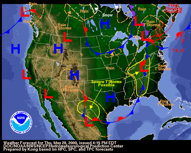
Cookie wrote:so what are the chances out of 100% of Ana forming in the next 24 hrs?
I'd say maybe 20%. I highly doubt it. If it's going to happen it'll be before daybreak tomorrow. Water gets cold fast soon.
Moderator: S2k Moderators

Cookie wrote:so what are the chances out of 100% of Ana forming in the next 24 hrs?


Ed Mahmoud wrote:Even when we were in the middle of nowhere, they'd be wasting all kinds of jet fuel, just getting the pilots and air crews, and flight deck crews, some practice. The pilots were required to do a minimum number of day and night launches and traps to remain proficient.
Now, on the one hand, nothing is scheduled today, and the system will be getting pretty far out to sea by the time they could schedule a flight for tomorrow, but if they have a WC-130J scheduled to fly a training mission today anyway, they could top off the tanks and get some realistic training.
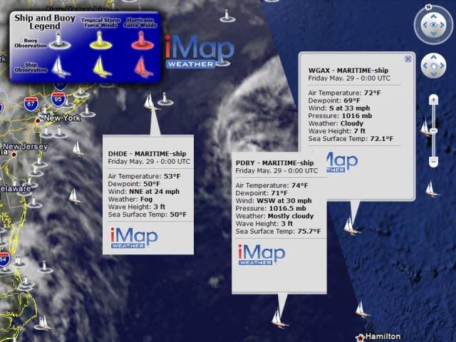
Chacor wrote:We do really need to stop obsessing over ADT numbers. It's unhelpful and misleading, especially if the NHC pays no attention to them because they may be inaccurate.
tailgater wrote:Chacor wrote:We do really need to stop obsessing over ADT numbers. It's unhelpful and misleading, especially if the NHC pays no attention to them because they may be inaccurate.
What will they use if it not Sat. estimates.

Code: Select all
The posts in this forum are NOT official forecast and should not be used as such. They are just the opinion of the poster and may or may not be backed by sound meteorological data. They are NOT endorsed by any professional institution or storm2k.org. For official information, please refer to the NHC and NWS products.

Users browsing this forum: No registered users and 228 guests