I actually have a number of thoughts I've recently developed that I'd like to express regarding the estimation of very intense tropical cyclones. Much of this has to do with JTWC's intensity estimates for Super Typhoon Meranti, but it also goes beyond that as well.
First off, I want to say that I appreciate JTWC trying to expand their suite of intensity analysis beyond the Dvorak Technique for the most intense storms. The Dvorak Technique is certainly has the most data and verification behind it, but as stated earlier in this thread, the intensities at the upper end of the scale are a little more uncertain, and is generally thought to underestimate the most intense storms to some degree. Data from storms like Rita '05, Megi '10, and Patricia '15 seem to support that. (Random note,
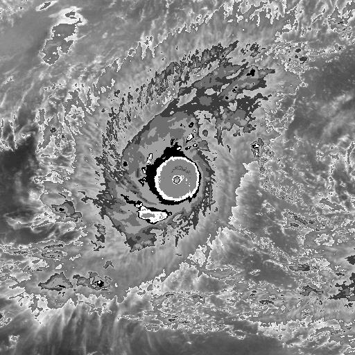
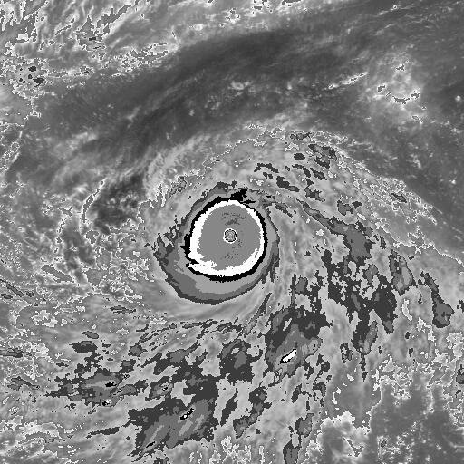
Megi and
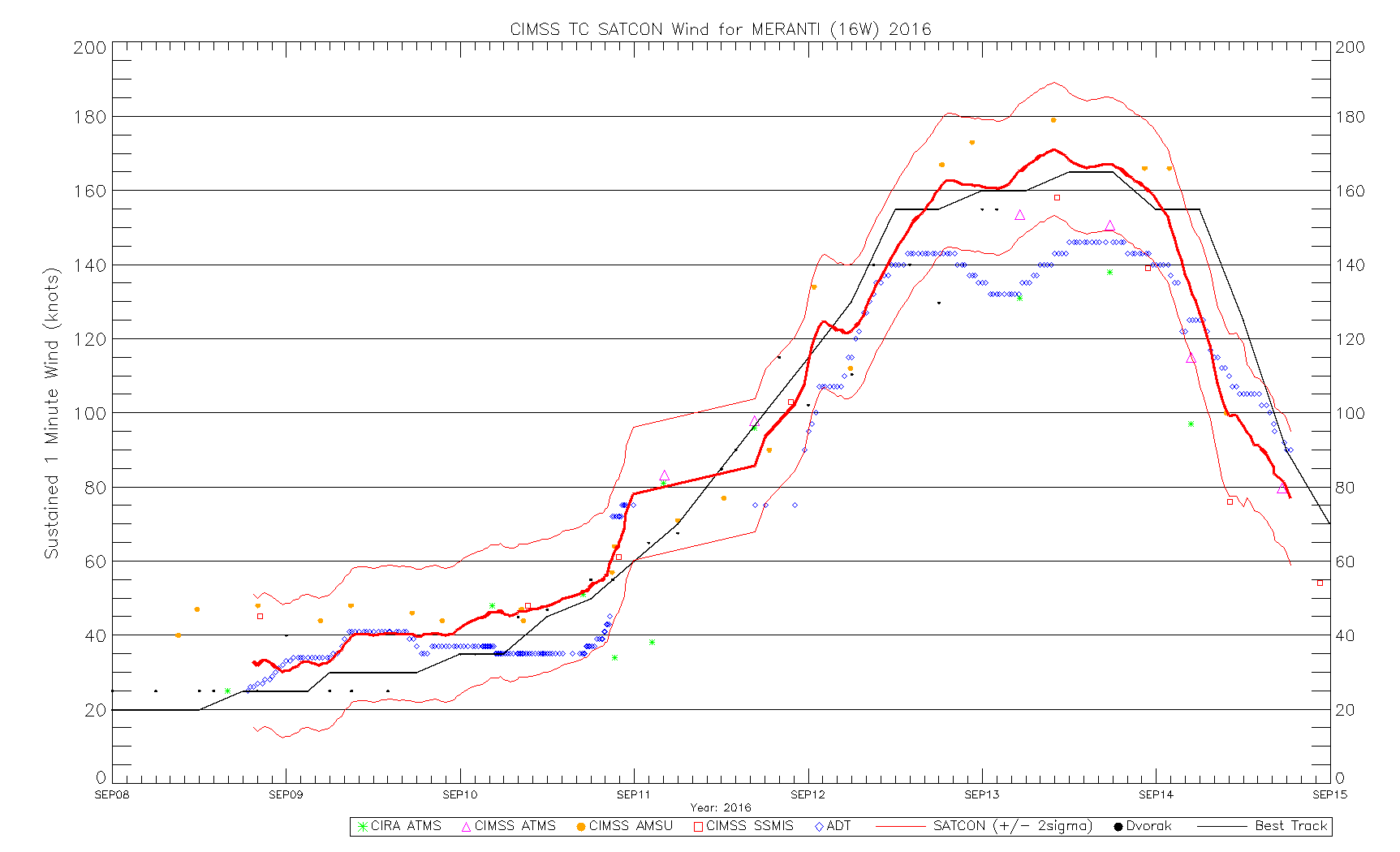
Meranti actually had very similar CDOs near peak intensity). That's just the nature of the technique due to the limited number of cases available to Vernon Dvorak when he completed the framework of the technique. In Meranti's case, DTs of 7.5 would only yield an intensity estimate of 155 kt. However, between 06Z and 18Z on September 13th, all intensity estimates that were reliant on microwave data instead of IR (AMSU, ATMS, and SSMIS) ranged between 154 kt to 179 kt, generally higher than the DTs, and sometimes considerably. JTWC took note of this and factored it into their intensity estimates, which is fine with me.
Second, while I appreciate JTWC using a wider range of intensity estimates with the more intense storms, they've opened up a whole new can of worms with it: constraint rules. The big question for me is as follows: should a tropical cyclone whose intensity was derived from multiple members of an intensity analysis suite be limited by the same Dvorak constraints that a tropical cyclone whose intensity is derived primarily from the Dvorak Technique would be subject to? Honestly, I'm not sure I have a good answer, and research may need to be done in this area. In Meranti's case, I personally suspect that JTWC used the Dvorak constraints to hold Meranti at too high of an intensity beginning on 00Z of September 14th. The storm had begun to degrade on IR by that point, and the SATCON members also began to plummet by then, leaving JTWC outside the +2 sigma confidence interval. However, it could be argued that JTWC should have broken all Dvorak constraints anyway due to the interaction with Taiwan.
Third, JTWC has stepped beyond a basic wind to pressure relationship! This personally is exciting to me since they have for so long just plugged their intensity estimates into Atkinson-Holliday or some other simple wind to pressure relationship to output a (oftentimes probably very inaccurate) pressure. They don't appear to be very good at it yet, especially when they go back and revise an intensity up or down (see
trackfile for Meranti, particularly 12Z September 13th), but it's a step in the right direction.
Last for now, but I do not like how ADT 8.2.1 handles the intense tropical cyclones in the Tropical Western Pacific at all. ADT was a low outlier for Meranti, often sitting well below the -2 sigma SATCON intensity estimates and only just clipping above 140 kt. On the other hand, ADT 8.2.1 seems to run a little hot in the Tropical Eastern Pacific. The most notable case in that basin belongs to Patricia '15, where it constantly spit out values well above 8.0 despite poor eye temperature inputs. It is true that it ended up being fairly close to the intensity inferred by recon measurements, but I do question the methodology. Anyway, it is obvious that ADT 8.2.1 is calibrated differently for the Pacific on either side of the International Dateline, which is odd to me. This came to be an issue in the intensity analysis for Winston this year. Upon crossing the International Dateline,
the raw Ts dropped .7 points (from 8.0 to 7.3) for no other reason than crossing the International Dateline. That just doesn't seem like sound intensity analysis. Either the algorithm is underestimating to the west, overestimating to the east, or both.


