WeatherGuesser wrote:Just got to wondering what boardies here will do if there's a significant TC anywhere near the SE US coastline on that day.
Good question?! I guess one first need decide which event they'd prefer to stick around and watch, the hurricane or the eclipse?
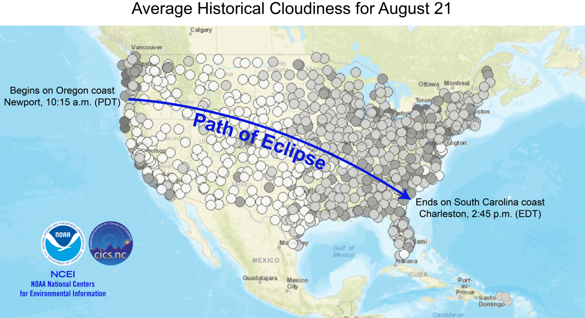
I've kicked that thought around a bit. For instance, what if there's an approaching T.D. or stronger in the Gulf? Upper level blow off could easily push hundreds of miles to the north and east while an approaching system might be still well away from the coast yet. Tropical systems aside, there's always the possibility of some southern branch jet mid-level CONUS low that just happens to be getting enhanced by a deep fetch of Gulf moisture. Finally, there's those typically localized events that under certain conditions might cause boundary layer or diurnal convective activity for the wrong couple hours of the day. All in all, it seems to me that the best plan to view the eclipse is one that kinda incorporates a storm chasing philosophy (where possible lol). Therefore, ideally allowing myself some type of "central point" of planned "pre-eclipse location", but a location where not only does it allow major thoroughfares in and out of that spot but more importantly, a relatively accessible thoroughfare "in and out" along the path of the eclipse in the event of overcast sky conditions. Example: Take I-24 which stretches from Paducah Kentucky, southeast all the way to Chattanooga Tenn. I could choose to stake out any small town motel along the eclipse path (or any restaurant parking lot) somewhere well West of Nashville TN the day prior. Depending on local or regional weather conditions and the overall accuracy of very short term weather forecasts, I might choose to just back on I-24 during the late evening of the night before and simply "slide" more or less East or West to some spot where at least I'm pretty guaranteed of clear sky conditions for the eclipse event. If I want to really get fancy such as perhaps picking a spot like Sparta Tenn. as "my ground zero", then I allow myself highway 40 as an East/West "escape route" along the path of the eclipse.... but also providing myself a spot with a secondary roadway/path such as Interstate 70 which at least locally there, parallels highway 40 in a relative East/West direction close too and along the path of the eclipse.
In doing this, I've best positioned myself to optimize any need for last minute (well, couple hour prior to eclipse totality) driving adjustment if very localized weather conditions appear to risk impacting ideal viewing conditions. Given an influx of people coming from all over to see this event and the potential of local and micro-scale weather/climate conditions (i.e. forest canopy, bodies of water/diurnal cloud condensation, valley/smog, etc), I figure the best that one can do is pick a final "plan A" spot that generally speaking provides a several hour drive access in either direction along the path of the eclipse, but additionally offers at least two additional localized East/West thoroughfares for any additional but more localized (perhaps 20 mile in either direction) for last minute spot adjustment. Lastly, never wait until the very last second to commit to a spot. At some point, time and traffic will only get worse and the last thing one wants to do is being caught on the road or stuck in some spot where they'll miss the very short couple of minutes of totality. Oh and for any REAL risk takers out there seeking that miracle shot of viewing a total eclipse from within the eye of a land-falling hurricane, feel free to join me at some local bar off N US-17 south of McClellanville SC that day! I'll be sitting by the window and will have a cold one waiting for ya


