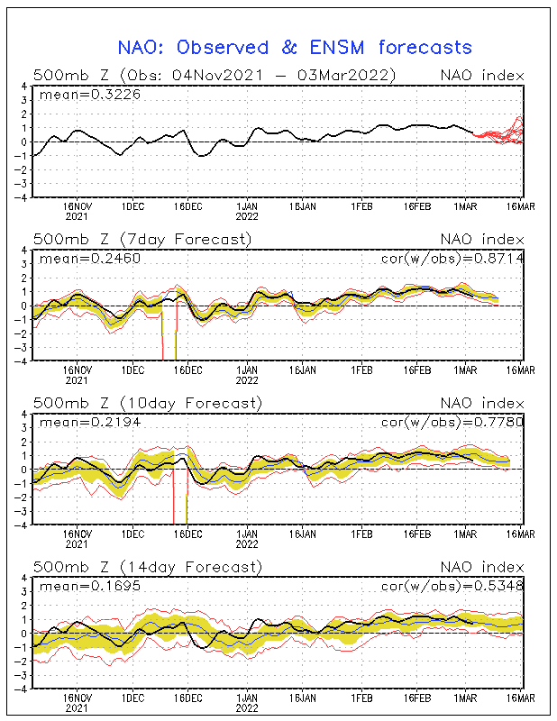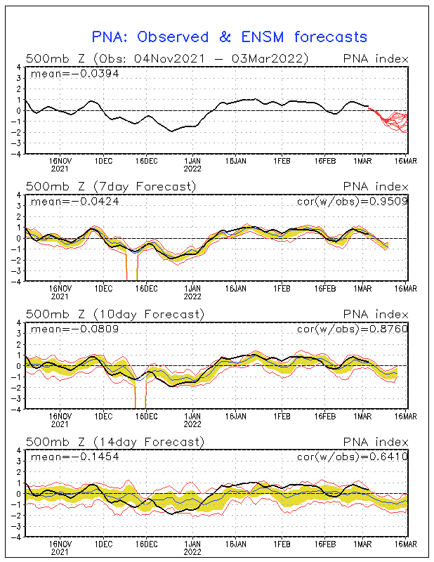
GFS Finally starting to sniff it out...
Moderator: S2k Moderators
Forum rules
 The posts in this forum are NOT official forecast and should not be used as such. They are just the opinion of the poster and may or may not be backed by sound meteorological data. They are NOT endorsed by any professional institution or STORM2K.
 The posts in this forum are NOT official forecast and should not be used as such. They are just the opinion of the poster and may or may not be backed by sound meteorological data. They are NOT endorsed by any professional institution or STORM2K.
- Stormsfury
- Category 5

- Posts: 10549
- Age: 53
- Joined: Wed Feb 05, 2003 6:27 pm
- Location: Summerville, SC
- FLguy
- Professional-Met

- Posts: 799
- Joined: Mon Dec 29, 2003 5:36 pm
- Location: Daytona Beach FL
- Contact:
Ji wrote:FLguy wrote:also the D7 ECM showed the STJ loading up once again for what may be another attack on the east coast later on in the day 8-11 period.
you really believe a strong NEG NAO can go +NAO in a matter of a few days?
the GFS ensembles are starting to come around to it. notice the rise in the NAO index after FEB 1.

now whether or not it happens remains to be seen. but im more enclined to go with the EC in the MR as compared to the GFS unless it appears that the EC is completely off course.
but interestingly enough the ensembles are trying to say that the PNA begins to trend back toward positive.

so lets say the NAO does head back toward positive in the next week to week and a half, its NOT going to last long given the SSTA profile, and with the PNA heading back toward positive, the trough is in the east.
0 likes
-
weatherfan
- Tropical Depression

- Posts: 89
- Joined: Wed Dec 17, 2003 7:50 pm
HM posted a good point with the modles.The modles are trying to slow the block up way to quilk.Which as you state forms a Postive NAO from this strong negative NAO in a few days.However I just don't see this happening as fast as the Ec and Gfs moldes are indercateing.Once again the modles I beleave as has been the case this winter are having serious trouble with the Stj and also with the s/w.So this there is no way in imo that neather of those storms cuts off up into the lakes And this the storms will be force further east word with the strong block and negative NAO and 50/50 low.We will see.Diffentey will be interisting to watch over the next week.
0 likes
- Stormsfury
- Category 5

- Posts: 10549
- Age: 53
- Joined: Wed Feb 05, 2003 6:27 pm
- Location: Summerville, SC
With the PNA turning around and trending back towards POS ... what MIGHT be possibly progged, IF the OV low is correct, and as strong as some of the guidance suggests ... the warmup would be VERY BRIEF, induced by the low which would hence, tap straight into that cold dome that's been in Canada, just waiting for the trigger, and the brief rise in the NAO indices would be but just a fading memory ... That's all speculation at this point ...
SF
SF
0 likes
Who is online
Users browsing this forum: Brent and 58 guests

