Southern Plains winter wx thread (2008-2009)

Winter Weather Discussion

Moderator: S2k Moderators

Forum rules

The posts in this forum are NOT official forecast and should not be used as such. They are just the opinion of the poster and may or may not be backed by sound meteorological data. They are NOT endorsed by any professional institution or STORM2K.

Help Support Storm2K
Message
Author
User avatar
amawea
S2K Supporter
S2K Supporter
Posts: 385
Age: 73
Joined: Mon Aug 09, 2004 3:36 pm
Location: Horseshoe Bend, Ar. but from Baytown, Tx

Re: Several cold shots on the horizon (Plains and East)

#101 Postby amawea » Fri Nov 14, 2008 1:56 pm

Extremeweatherguy wrote:12pm 11/14/08 Update on the modeling...

-The 12z GFS is now suddenly much warmer for next week. It only shows a glancing cool shot for the plains, with most of the coldest air staying toward the north and east part of the country. The coldest period for the plains, according to this run of the GFS, would be early next week. More flip flops are possible in future runs of the model though, so stay tuned!

-The 00z ECMWF shows a strong high (1040mb+) moving down the plains early next week, with another strong high then set to follow late in the week. Both of these highs will probably bring a period of chilly weather to the central and eastern US.


That stinking GFS! You never can depend on that model. I'm beginning to think it's useless beyond 4 days out. :x
0 likes   

User avatar
Extremeweatherguy
Category 5
Category 5
Posts: 11095
Joined: Mon Oct 10, 2005 8:13 pm
Location: Florida

#102 Postby Extremeweatherguy » Fri Nov 14, 2008 4:07 pm

The models definitely appear to be giving the NWS offices a hard time. Here is part of the latest AFD from the Norman, OK weather office...

OVERALL THE PATTERN THROUGH THE FORECAST PERIOD WILL BE
CHARACTERIZED WITH RIDGING TO THE WEST AND TROUGHING TO THE EAST.
VARIOUS SHORTWAVES DROPPING SOUTHEAST ON THE BACK SIDE OF THE TROF
WILL HELP PUSH OCCASIONAL COLD FRONTS INTO THE AREA... CURRENTLY
EXPECTED TO BE SUNDAY NIGHT AND WEDNESDAY NIGHT/THURSDAY. HOWEVER
THE LATEST GFS HANGS THE MID WEEK FRONT OVER THE AREA AND
THEREFORE KEEPS WARMER TEMPERATURES INTO THE AREA THURSDAY AND
EVEN THURSDAY NIGHT. ALTHOUGH THE SPREAD IN THE FRONTAL POSITION
OF THE GFS ENSEMBLE MEMBERS IS NOT LARGE... THE SPREAD IS ACROSS
OUR CWA. ABOUT A THIRD AGREE WITH THE ECMWF AND PUSH THE FRONT
THROUGH THE AREA INTO TEXAS... ABOUT A THIRD KEEP IT OVER THE
SOUTH PART OF OUR AREA BY 00Z/FRIDAY... AND THE LAST THIRD HAVE IT
OVER NORTHWEST OKLAHOMA. WITH THIS SPREAD AM CURRENTLY INCLINED TO
LEAN TOWARD THE ECMWF AND PREVIOUS GFS IN PUSHING THE FRONT
THROUGH THE AREA... AND WILL KEEP TEMPERATURES CLOSER TO THE
PREVIOUS FORECAST THAN THE 12Z MEX.
0 likes   

User avatar
iorange55
Category 5
Category 5
Posts: 2388
Joined: Thu Nov 13, 2008 9:47 pm
Location: Big D

Re: Several cold shots on the horizon (Plains and East)

#103 Postby iorange55 » Fri Nov 14, 2008 6:18 pm

This winter looks more confusing than ever. I'm not trusting anything till the actual day it happens.
0 likes   

User avatar
gboudx
S2K Supporter
S2K Supporter
Posts: 4080
Joined: Thu Sep 04, 2003 1:39 pm
Location: Rockwall, Tx but from Harvey, La

Re: Several cold shots on the horizon (Plains and East)

#104 Postby gboudx » Fri Nov 14, 2008 8:15 pm

iorange55 wrote:This winter looks more confusing than ever. I'm not trusting anything till the actual day it happens.


My motto for wintry precip here in Dallas is, "I'll believe it when I see it falling from the sky." :D
0 likes   

User avatar
iorange55
Category 5
Category 5
Posts: 2388
Joined: Thu Nov 13, 2008 9:47 pm
Location: Big D

Re: Several cold shots on the horizon (Plains and East)

#105 Postby iorange55 » Fri Nov 14, 2008 8:41 pm

gboudx wrote:
iorange55 wrote:This winter looks more confusing than ever. I'm not trusting anything till the actual day it happens.


My motto for wintry precip here in Dallas is, "I'll believe it when I see it falling from the sky." :D


Lol that's what I'm going by for now on, too many times I've been disappointed. I'm still waiting for another sleet storm like we had in 2003? I think or 2004.
0 likes   

Ed Mahmoud

Re: Several cold shots on the horizon (Plains and East)

#106 Postby Ed Mahmoud » Fri Nov 14, 2008 11:04 pm

amawea wrote:
Extremeweatherguy wrote:12pm 11/14/08 Update on the modeling...

-The 12z GFS is now suddenly much warmer for next week. It only shows a glancing cool shot for the plains, with most of the coldest air staying toward the north and east part of the country. The coldest period for the plains, according to this run of the GFS, would be early next week. More flip flops are possible in future runs of the model though, so stay tuned!

-The 00z ECMWF shows a strong high (1040mb+) moving down the plains early next week, with another strong high then set to follow late in the week. Both of these highs will probably bring a period of chilly weather to the central and eastern US.


That stinking GFS! You never can depend on that model. I'm beginning to think it's useless beyond 4 days out. :x


I believe the GFS has a weakness with the shallow cold air masses that sometimes produce Texas' most exciting weather because it is a global model and has some grid scale issues.

I don't know what the vertical resolution of the GFS is, compared to other global models and meso models. Maybe a pro-met will wander by and tell us.
0 likes   

jinftl
Category 5
Category 5
Posts: 4312
Joined: Tue Aug 31, 2004 4:47 pm
Location: fort lauderdale, fl

Re: Several cold shots on the horizon (Plains and East)

#107 Postby jinftl » Sat Nov 15, 2008 6:16 am

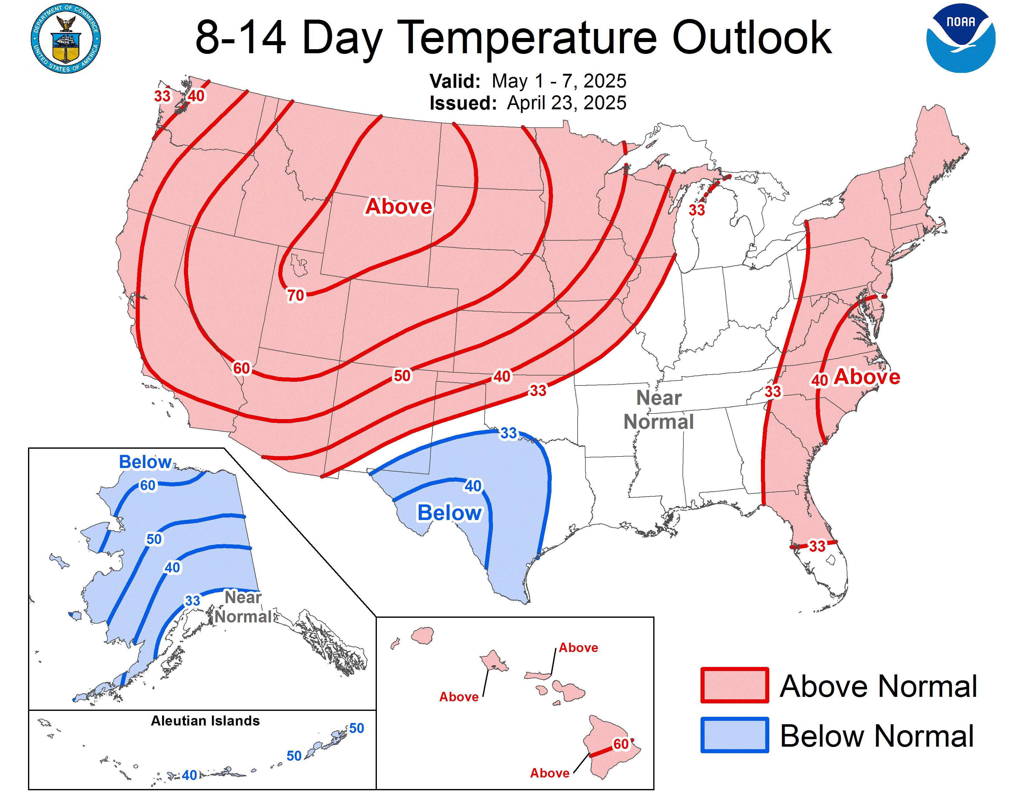
CPC temp forecast for nex 8-14 days....cold east being chased away in time by building ridge from the west

Image

iorange55 wrote:This winter looks more confusing than ever. I'm not trusting anything till the actual day it happens.
0 likes   

Ed Mahmoud

Re: Several cold shots on the horizon (Plains and East)

#108 Postby Ed Mahmoud » Sat Nov 15, 2008 12:14 pm

-------------------------Freeze Warning----------------------------

URGENT - WEATHER MESSAGE
NATIONAL WEATHER SERVICE AUSTIN/SAN ANTONIO TX
429 AM CST SAT NOV 15 2008

...A FREEZE WARNING IS IN EFFECT FROM 9 PM THIS EVENING UNTIL
9 AM SUNDAY MORNING FOR THE HILL COUNTRY AND MUCH OF SOUTH
CENTRAL TEXAS...

.A STRONG COLD FRONT OVERNIGHT HAS USHERED IN COLD...VERY DRY
AIR. THIS WILL RESULT IN A HARD FREEZE TONIGHT OVER THE HILL
COUNTRY AND A FREEZE OVER MUCH OF SOUTH CENTRAL TEXAS. THE FREEZE
WARNING IS GENERALLY ALONG AND NORTH OF INTERSTATE 10 EAST OF SAN
ANTONIO...AND HIGHWAY 90 WEST OF SAN ANTONIO.

TXZ171>173-183>194-202>209-152130-
/O.CON.KEWX.FZ.W.0002.081116T0300Z-081116T1500Z/
LLANO-BURNET-WILLIAMSON-VAL VERDE-EDWARDS-REAL-KERR-BANDERA-
GILLESPIE-KENDALL-BLANCO-HAYS-TRAVIS-BASTROP-LEE-KINNEY-UVALDE-
MEDINA-BEXAR-COMAL-GUADALUPE-CALDWELL-FAYETTE-
INCLUDING THE CITIES OF...LLANO...BURNET...GEORGETOWN...DEL RIO...
ROCKSPRINGS...LEAKEY...KERRVILLE...BANDERA...FREDERICKSBURG...
BOERNE...BLANCO...SAN MARCOS...AUSTIN...BASTROP...GIDDINGS...
BRACKETTVILLE...UVALDE...HONDO...SAN ANTONIO...NEW BRAUNFELS...
SEGUIN...LOCKHART...LA GRANGE
429 AM CST SAT NOV 15 2008

...FREEZE WARNING REMAINS IN EFFECT FROM 9 PM THIS EVENING TO
9 AM CST SUNDAY...

A STRONG COLD FRONT OVERNIGHT HAS USHERED IN COLD DRY AIR THAT WILL
RESULT IN A HARD FREEZE TONIGHT OVER THE TEXAS HILL COUNTRY...AND
A FREEZE OVER MUCH OF SOUTH CENTRAL TEXAS. THE FREEZE WARNING IS
GENERALLY ALONG AND NORTH OF INTERSTATE 10 EAST OF SAN ANTONIO...AND
HIGHWAY 90 WEST OF SAN ANTONIO. WITH CLEAR SKIES AND WINDS BECOMING
LIGHT...TEMPERATURES WILL PLUMMET THIS EVENING AND DIP TO BELOW
FREEZING TONIGHT.

LOW TEMPERATURES BY SUNRISE SUNDAY IN THE HILL COUNTRY WILL FALL
INTO THE MID AND UPPER 20S...WITH EVEN LOWER 20S POSSIBLE IN SOME
LOW LYING AREAS. TEMPERATURES ACROSS MUCH OF HE REST OF SOUTH CENTRAL
TEXAS WILL FALL INTO THE UPPER 20S AND LOWER 30S. PRECAUTIONS SHOULD
BE TAKE TO PROTECT EXPOSED PIPES...PETS AND PLANTS TODAY.

THE REMAINDER OF SOUTH CENTRAL TEXAS THAT IS NOT UNDER THE FREEZE
WARNING WILL EXPERIENCE LOWS IN THE MID 30S TONIGHT. HOWEVER THE FREEZE
WARNING COULD BE EXPANDED SOUTHWARD OVER THIS AREA AS WELL LATER
TODAY.

A FREEZE WARNING MEANS SUB-FREEZING TEMPERATURES ARE IMMINENT OR
HIGHLY LIKELY. THESE CONDITIONS WILL KILL CROPS AND OTHER
SENSITIVE VEGETATION.
0 likes   

User avatar
Extremeweatherguy
Category 5
Category 5
Posts: 11095
Joined: Mon Oct 10, 2005 8:13 pm
Location: Florida

#109 Postby Extremeweatherguy » Sat Nov 15, 2008 12:30 pm

It is a chilly one here in Oklahoma City today! At 11:30am, temperatures are in the lower 40s with wind chills near freezing. The NWS has lowered our high today to 48F under partly sunny (and breezy) skies, and if that forecast holds, then this will be our coldest day so far this autumn.
0 likes   

Ed Mahmoud

Re: Several cold shots on the horizon (Plains and East)

#110 Postby Ed Mahmoud » Sat Nov 15, 2008 1:22 pm

41ºF in Lawrence, KS right now. Cool weather, and maybe a 3rd string freshmen center, has Texas looking less than sharp against a not that bad Jayhawk football team.

Edit to add- GFS still callling for cool, not cold (13ºC, mid-upper 50s w/o doing the math) with rain late for the Cowboys football game.

Looks like rain and upper 50s for the a&m at Texas game.
0 likes   

Ed Mahmoud

Re: Several cold shots on the horizon (Plains and East)

#111 Postby Ed Mahmoud » Sat Nov 15, 2008 2:07 pm

Snow flurries at the Texas game, and judging from quick halftime highlights, more serious snow in Ann Arbor for Northwestern at The Wolverines.

ETA:

Image
0 likes   

User avatar
Extremeweatherguy
Category 5
Category 5
Posts: 11095
Joined: Mon Oct 10, 2005 8:13 pm
Location: Florida

#112 Postby Extremeweatherguy » Sat Nov 15, 2008 3:35 pm

46F here in OKC at 2:30pm with a wind chill of 39F.
0 likes   

User avatar
Portastorm
Storm2k Moderator
Storm2k Moderator
Posts: 9914
Age: 62
Joined: Fri Jul 11, 2003 9:16 am
Location: Round Rock, TX
Contact:

Re: Several cold shots on the horizon (Plains and East)

#113 Postby Portastorm » Sat Nov 15, 2008 4:29 pm

Ed, the American Meteorological Society defines a "killing freeze" as follows:

killing freeze—The occurrence of air temperature below 0°C (32°F) that kills annual vegetation without formation of frost crystals on surfaces.

So I guess technically you are correct per your post from the other day. In my mind, I have always equated a hard freeze as a killing freeze which the AMS defines as "a freeze in which seasonal vegetation is destroyed, the ground surface is frozen solid underfoot, and heavy ice is formed on small water surfaces such as puddles and water containers."

I wouldn't be surprised to see mid 20s in the Hill Country. Not so sure we will see it here in the Austin metro area. Winds are still breezy and will have see calm conditions in the next 6-12 hours to really bottom us out. Nevertheless, you gotta love this true autumn weather in Texas. Feels great! :D
0 likes   

Ed Mahmoud

Re: Several cold shots on the horizon (Plains and East)

#114 Postby Ed Mahmoud » Sat Nov 15, 2008 4:33 pm

Portastorm wrote:Ed, the American Meteorological Society defines a "killing freeze" as follows:

killing freeze—The occurrence of air temperature below 0°C (32°F) that kills annual vegetation without formation of frost crystals on surfaces.

So I guess technically you are correct per your post from the other day. In my mind, I have always equated a hard freeze as a killing freeze which the AMS defines as "a freeze in which seasonal vegetation is destroyed, the ground surface is frozen solid underfoot, and heavy ice is formed on small water surfaces such as puddles and water containers."

I wouldn't be surprised to see mid 20s in the Hill Country. Not so sure we will see it here in the Austin metro area. Winds are still breezy and will have see calm conditions in the next 6-12 hours to really bottom us out. Nevertheless, you gotta love this true autumn weather in Texas. Feels great! :D


Bergstrom, near a river valley, tends to get colder at night than the old AUS, Mueller Airport. May get an official freeze without freezing in the most of the city.
0 likes   

User avatar
tropicana
Category 5
Category 5
Posts: 8056
Joined: Sat Sep 27, 2003 6:48 pm
Location: Niagara Falls, Ontario, Canada
Contact:

Re: Several cold shots on the horizon (Plains and East)

#115 Postby tropicana » Sat Nov 15, 2008 6:35 pm

44F here in Niagara Falls, ON.. been raining for the entire day, foggy at times, temperatures started off near 53 F 12C at midnight but have been slowly falling throughout the day.
Just a wet and cold night.
We should be entering our coldest stretch of the new season starting tomorrow. Snow is a good bet as temperatures fall to near the freeze mark.
wooohoooo~
Bring it on.

-justin-
0 likes   

User avatar
Extremeweatherguy
Category 5
Category 5
Posts: 11095
Joined: Mon Oct 10, 2005 8:13 pm
Location: Florida

#116 Postby Extremeweatherguy » Sat Nov 15, 2008 7:05 pm

It is cooling off quickly tonight in central Oklahoma. As of 7:20pm, Oklahoma City is already down to 35-36 degrees...

Image
0 likes   

User avatar
iorange55
Category 5
Category 5
Posts: 2388
Joined: Thu Nov 13, 2008 9:47 pm
Location: Big D

Re: Several cold shots on the horizon (Plains and East)

#117 Postby iorange55 » Sun Nov 16, 2008 12:47 am

Looks like the weather is going to be a lot more active starting around thanksgiving. Just have to get by the next boring 5-10 days.
0 likes   

User avatar
Extremeweatherguy
Category 5
Category 5
Posts: 11095
Joined: Mon Oct 10, 2005 8:13 pm
Location: Florida

#118 Postby Extremeweatherguy » Sun Nov 16, 2008 2:25 am

Oklahoma City, Will Rogers World Airport
Lat: 35.41 Lon: -97.6 Elev: 1280
Last Update on Nov 16, 12:52 am CST

Fair

28°F
(-2°C)

Humidity: 75 %
Wind Speed: S 5 MPH
Barometer: 30.30" (1026.6 mb)
Dewpoint: 21°F (-6°C)
Wind Chill: 23°F (-5°C)
Visibility: 10.00 mi.
More Local Wx: 3 Day History:
0 likes   

User avatar
somethingfunny
ChatStaff
ChatStaff
Posts: 3926
Age: 36
Joined: Thu May 31, 2007 10:30 pm
Location: McKinney, Texas

#119 Postby somethingfunny » Sun Nov 16, 2008 5:01 am

BRRRRRR! I haven't been this cold since last week! :ggreen:
0 likes   

User avatar
Dave
Retired Staff
Retired Staff
Posts: 13442
Age: 74
Joined: Tue Aug 01, 2006 3:57 pm
Location: Milan Indiana
Contact:

#120 Postby Dave » Sun Nov 16, 2008 8:14 am

Covington / Cincinnati / Northern Kentucky
Lat: 39.05 Lon: -84.67 Elev: 886
Last Update on Nov 16, 7:52 am EST

Light Snow

33°F
(1°C) Humidity: 85 %
Wind Speed: W 12 MPH
Barometer: 30.04" (1017.6 mb)
Dewpoint: 29°F (-2°C)
Wind Chill: 24°F (-4°C)
Visibility: 9.00 mi.

Ok we've had enough snow for the season, let's go back to spring now. :lol:
0 likes   


Return to “Winter Weather”

Who is online

Users browsing this forum: No registered users and 97 guests