The posts in this forum are NOT official forecast and should not be used as such. They are just the opinion of the poster and may or may not be backed by sound meteorological data. They are NOT endorsed by any professional institution or

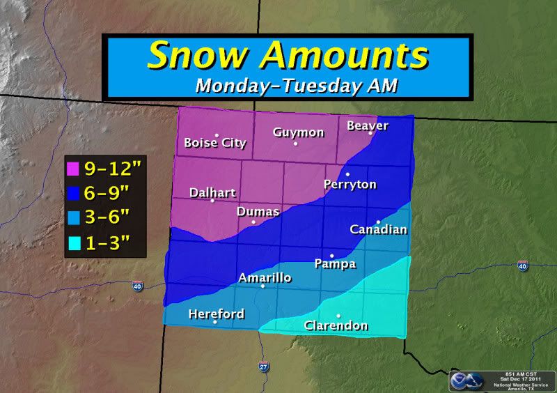
orangeblood wrote:ndale wrote:wxman57 wrote:Euro has temps 15-30 deg above normal across the Northern Plains and western/central Canada next week. Hard to get snow very far south with those temps. Temps across the central Rockies are forecast to be 5-20 deg below normal next week. Possible for some snow in the TX Panhandle/northern OK.
Ok, thanks guys, I just wondered why the models or at least the gfs, keeps trying to show something in our area when there is no source for really cold air. The rain part I could accept more easily.
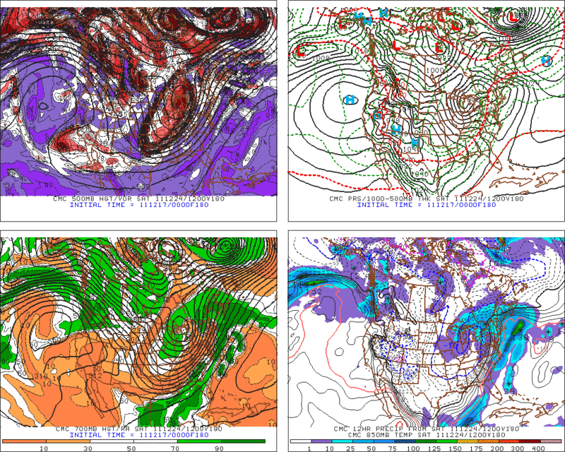
I don't believe you necessarily need below normal temps in Canada to get cold enough air for snow deep into Texas this time of year. The high pressure seems to originate over Montana, slide south and build as it anchors itself over Colorado next weekend...both the Euro and GFS are showing this. The 12Z GFS now shows quite a winter storm over Texas on Christmas day. I realize it's over a week out but the GFS operational and Euro nailed this last system sitting over the southwest now from almost 10 days out, while the ensembles showed a very different scenario. (GFS operational has had a pretty good track record of late)
This scenario seems plausible considering the very low sun angle/long nights this time of year, snow cover building across the plains, and the orientation of the trough forecast across the southwest late next week...some 500 mb heights are forecast to be over 3 standard deviations below normal!!! The pieces are on the playing field, now lets see if they can all come together.
The following post is NOT an official forecast and should not be used as such. It is just the opinion of the poster and may or may not be backed by sound meteorological data. It is NOT endorsed by any professional institution including storm2k.org. For official information, please refer to NWS products.
I noticed that exact same thing on the GFS this morning around Christmas. It contradicted what I have seen with the most recent extended forecasts. Maybe we will have a white Christmas.