Southern Plains winter wx thread (2008-2009)

Winter Weather Discussion

Moderator: S2k Moderators

Forum rules

The posts in this forum are NOT official forecast and should not be used as such. They are just the opinion of the poster and may or may not be backed by sound meteorological data. They are NOT endorsed by any professional institution or STORM2K.

Help Support Storm2K
Message
Author
User avatar
Portastorm
Storm2k Moderator
Storm2k Moderator
Posts: 9914
Age: 62
Joined: Fri Jul 11, 2003 9:16 am
Location: Round Rock, TX
Contact:

Re: Several cold shots on the horizon (Plains and East)

#121 Postby Portastorm » Sun Nov 16, 2008 8:42 am

Ed Mahmoud wrote:
Portastorm wrote:Ed, the American Meteorological Society defines a "killing freeze" as follows:

killing freeze—The occurrence of air temperature below 0°C (32°F) that kills annual vegetation without formation of frost crystals on surfaces.

So I guess technically you are correct per your post from the other day. In my mind, I have always equated a hard freeze as a killing freeze which the AMS defines as "a freeze in which seasonal vegetation is destroyed, the ground surface is frozen solid underfoot, and heavy ice is formed on small water surfaces such as puddles and water containers."

I wouldn't be surprised to see mid 20s in the Hill Country. Not so sure we will see it here in the Austin metro area. Winds are still breezy and will have see calm conditions in the next 6-12 hours to really bottom us out. Nevertheless, you gotta love this true autumn weather in Texas. Feels great! :D


Bergstrom, near a river valley, tends to get colder at night than the old AUS, Mueller Airport. May get an official freeze without freezing in the most of the city.


And that is EXACTLY what has happened here this morning at AUS. At 7 am, Bergstrom is sitting at 26 degrees while the rest of the metro area is generally at the mid to upper 30s, including the Camp Mabry reporting site at 36 degrees. Mabry is located in west central Austin.
0 likes   

User avatar
Extremeweatherguy
Category 5
Category 5
Posts: 11095
Joined: Mon Oct 10, 2005 8:13 pm
Location: Florida

#122 Postby Extremeweatherguy » Sun Nov 16, 2008 12:03 pm

Very interesting discussion from the Norman, OK NWS office this morning...

AREA FORECAST DISCUSSION
NATIONAL WEATHER SERVICE NORMAN OK

.PREV DISCUSSION... /ISSUED 302 AM CST SUN NOV 16 2008/

DISCUSSION...
MAIN CHALLENGE IS TEMPERATURES THROUGH THE NEXT 7 DAYS. THERE ARE
INDICATIONS THAT THE MODELS - AND HENCE THE GUIDANCE - ARE NOT
GIVING THE MID-LATE WEEK COLD INTRUSION QUITE ENOUGH CREDIT.

QUICK WARMUP TODAY AFTER A COLD START. LOCAL SHELTERED AND LOW-
LYING AREAS FALLING INTO THE LOWER 20S THIS MORNING BUT INSOLATION
AND DOWNSLOPE WINDS WILL LIKELY RESULT IN A DIURNAL WARMUP OF 40
DEGS OR MORE. MEANWHILE THE FIRST OF 2 CANADIAN AIR INTRUSIONS IS
MOVING SE AS AN ALBERTA CLIPPER NOW PASSING THROUGH DAKOTAS/MN.
ASSOCIATED FRONT IS FORECAST INTO N OK LATE TONIGHT AND TO NEAR
THE RED RIVER BY MON EVENING... ALLOWING FOR ANOTHER WARM DAY IN
THE S MONDAY BUT NOTICEABLY COOLER NORTH. SFC RIDGE POKING SW
ACROSS OK INTO NW TX MON NIGHT WILL LEAD TO ANOTHER CHILLY MORNING
TUESDAY ESPECIALLY N OK.

MODIFICATION OF THIS AIR MASS AND EVENTUAL RETURN TO S WINDS WILL
BRING A WARMING TREND TUE-WED. DESPITE LOW-LEVEL WINDS VEERING TO
SE-S BY LATE TUE... WE STILL WILL BE RECYCLING MODIFIED AIR OF
CANADIAN ORIGIN AND THUS THE HIGHS ON TUE LIKELY WILL STILL BE ON
THE COOL SIDE. MORE WARMING LIKELY WED AS AIR MASS CONTINUES TO
MODIFY/WARM AND SFC WINDS VEER TO A MORE FAVORABLE DOWNSLOPE
TRAJECTORY.

2ND CANADIAN AIR INTRUSION BEGINS WED... AND THIS IS WHERE THE
PLOT THICKENS. ECMWF IS PREFERRED HERE... LOADING UP THE
ASSOCIATED SFC HIGH TO 1045 MB OVER W/CENTRAL CANADA AND PUSHING THE
COLD AIR EVENTUALLY S/SE ACROSS ALL AREAS E OF THE ROCKIES. MODELS
QUITE OFTEN DO NOT GIVE THE RELATIVELY SHALLOW COLD AIR MASSES THE
RESPECT THEY DESERVE IN THIS SCENARIO... ESPECIALLY OVER THE
PLAINS. SO WE THINK THE MEX TEMPS WED NIGHT AND BEYOND ARE MUCH
TOO HIGH. THERE ALSO IS CONCERN THAT THE ASSOCIATED COLD FRONT...
NOW DUE INTO OK BY LATE WED AND THROUGH THE CWA BY THU MORNING...
MAY COME IN FASTER THAN DEPICTED BY ANY OF THE MODELS. THIS WOULD
REQUIRE LOWERING THE HIGHS ON WED AT LEAST ACROSS N OK. FOR WED
NIGHT AND BEYOND WE LOOK FOR STRONG COLD ADVECTION TO HOLD DIURNAL
RANGES TO AROUND 15 DEG OR LESS FROM WED NIGHT INTO THU... TYPICAL
FOR THESE `BLUE NORTHERS`... FOLLOWED BY THE COLDEST NIGHT YET
THU NIGHT AS THE SFC RIDGE AGAIN POKES DOWN ACROSS THE AREA. THIS
AIR MASS IS UNLIKELY TO SET ANY RECORDS... GIVEN THAT MOST OF THE
COLDEST AIR WILL STAY WELL TO OUR N AND E. AND... THE CANADIAN COLD-
AIR FACTORY... SUPPORTED INITIALLY BY AN UPPER RIDGE BUILDING INTO
W CANADA TUE-WED... WILL BREAK DOWN AS THE LARGE-SCALE FLOW
DEAMPLIFIES. BUT THERE IS ADEQUATE EVIDENCE TO SUPPORT TEMPS GOING
DOWN TO AT LEAST 10 DEG OR SO BELOW CLIMATOLOGY WED NIGHT AND
BEYOND. THUS HIGHS THU IN 40S/50S OR ABOUT 20 DEG LOWER THAN WED.


EVENTUAL FLATTENING OF THE UPPER PATTERN WILL SUPPORT A WARMING
TREND AGAIN GOING INTO LATE NEXT WEEK... BUT THE OFTEN-STUBBORN
NATURE OF THESE AIR MASSES SUGGESTS THAT THE WARMUP WILL BE
GRADUAL. LONGWAVE TRENDS INDICATE BROAD LOW-AMPLITUDE TROFING
BECOMING ESTABLISHED OUT W BY NEXT WEEKEND... WITH RETURN FLOW
BRINGING MODIFIED AIR AND AN INCREASE IN LOW-LEVEL MOISTURE. WILL
KEEP THE FORECAST DRY THROUGH SAT... BUT WILL NEED TO CONSIDER
INTRODUCING PRECIP AROUND NEXT SUNDAY IN THE NEXT FORECAST PACKAGE.


If they are right, then it may be getting quite chilly around these parts by the end of the week. :cold:
0 likes   

User avatar
Extremeweatherguy
Category 5
Category 5
Posts: 11095
Joined: Mon Oct 10, 2005 8:13 pm
Location: Florida

#123 Postby Extremeweatherguy » Sun Nov 16, 2008 6:25 pm

Today's 18z run of the GFS is looking chilly for next weekend across the southern plains...

126 hrs (Fri. evening)
Image
^^Front charging through the southern plains as a 1040mb+ high pressure system drops out of Canada.^^

138 hrs (Sat. morning)
Image
^^Freeze line reaches NW Oklahoma and the Texas Panhandle by sunrise Saturday.^^

144 hrs (Sat. afternoon)
Image
^^High temperatures struggle to get above 50F all the way south to the Oklahoma/Texas border on Saturday afternoon.^^

162 hrs (Sun. morning)
Image
^^Freeze line extends southward into northern Texas by Sunday morning. (27F in OKC)^^

168 hrs (Sun. afternoon)
Image
^^High temperatures struggle to get above 50F well south into Texas on Sunday afternoon.^^
0 likes   

User avatar
iorange55
Category 5
Category 5
Posts: 2388
Joined: Thu Nov 13, 2008 9:47 pm
Location: Big D

Re: Several cold shots on the horizon (Plains and East)

#124 Postby iorange55 » Sun Nov 16, 2008 6:55 pm

Extremeweatherguy wrote:Today's 18z run of the GFS is looking chilly for next weekend across the southern plains...

126 hrs (Fri. evening)
Image
^^Front charging through the southern plains as a 1040mb+ high pressure system drops out of Canada.^^

138 hrs (Sat. morning)
Image
^^Freeze line reaches NW Oklahoma and the Texas Panhandle by sunrise Saturday.^^

144 hrs (Sat. afternoon)
Image
^^High temperatures struggle to get above 50F all the way south to the Oklahoma/Texas border on Saturday afternoon.^^

162 hrs (Sun. morning)
Image
^^Freeze line extends southward into northern Texas by Sunday morning. (27F in OKC)^^

168 hrs (Sun. afternoon)
Image
^^High temperatures struggle to get above 50F well south into Texas on Sunday afternoon.^^


Awesome, thanks for the info. Weather.com has it looking really warm. I always wondered are they just too scared to trust certain models or what? It seems like they always go with the warm models.
0 likes   

User avatar
Lowpressure
S2K Supporter
S2K Supporter
Posts: 2032
Age: 58
Joined: Sun Sep 14, 2003 9:17 am
Location: Charlotte, North Carolina

Re: Several cold shots on the horizon (Plains and East)

#125 Postby Lowpressure » Sun Nov 16, 2008 9:31 pm

GFS does not have much support at this time in regards to the strom developing. It is considered an outlier in CLT.

LONG TERM /WEDNESDAY NIGHT THROUGH SUNDAY/...
AS OF 150 PM EST SUNDAY...THE MEDIUM RANGE BEGINS WITH REINFORCEMENT
OF THE EASTERN TROUGH...AS ANOTHER CLIPPER-TYPE SHORT WAVE TRACKS
FROM THE OHIO VALLEY INTO THE MID-ATLANTIC. THIS COULD RESULT IN
ANOTHER BRIEF NORTHWEST FLOW SNOW EVENT THURSDAY AND THU NIGHT...SO
SLIGHT CHANCE POPS WILL BE ADVERTISED DURING THIS TIME. THE MAIN
EFFECT OF THIS WAVE WILL BE TO ALLOW UNSEASONABLY COOL WEATHER TO
PERSIST THROUGH THE END OF THE FORECAST CYCLE. BASED UPON GFS
ENSEMBLE GUIDANCE AND OTHER MEDIUM RANGE MODELS...THE OPERATIONAL
GFS APPEARS TO BE A MAJOR OUTLIER IN DIGGING A SW TROUGH INTO THE
LOWER MISS VALLEY EARLY IN THE WEEKEND...AND DEVELOPING A RATHER WET
CYCLONE FOR THE SOUTHEAST. THIS SOLUTION WILL THEREFORE BE IGNORED
IN FAVOR OF THE VERY DRY/COOL PATTERN OFFERED BY THE MAJORITY OF
MEDIUM RANGE GUIDANCE.
0 likes   

User avatar
Extremeweatherguy
Category 5
Category 5
Posts: 11095
Joined: Mon Oct 10, 2005 8:13 pm
Location: Florida

#126 Postby Extremeweatherguy » Mon Nov 17, 2008 12:02 am

The 00z GFS looks a little bit wetter for this weekend compared to previous runs. It still shows a decent front arriving in the southern plains Friday evening into Saturday morning, but it now also adds some precipitation to the mix along and behind the wind shift. The post-frontal airmass does not look quite as cold as on the 18z, but the clouds should help to keep daytime highs chilly on Saturday, and a freeze still appears likely southward to the TX/OK border by Sunday morning as the clouds clear.

Also of note - The GFS is showing a second shot of cold air arriving Thanksgiving week. The plains gets chilly Monday through Wednesday, with the east and southeast then feeling the chilly by Wednesday through Thanksgiving day and into Friday.
0 likes   

User avatar
Extremeweatherguy
Category 5
Category 5
Posts: 11095
Joined: Mon Oct 10, 2005 8:13 pm
Location: Florida

#127 Postby Extremeweatherguy » Mon Nov 17, 2008 12:20 am

I just logged onto the Norman, OK NWS Page and saw this:

Image

If I would have known that this was going on yesterday morning, then I would have made a point to be outside at 9am! Unfortunately though, this was not forecasted, so I had no idea it would happen.
0 likes   

User avatar
Extremeweatherguy
Category 5
Category 5
Posts: 11095
Joined: Mon Oct 10, 2005 8:13 pm
Location: Florida

Re: Several cold shots on the horizon (Plains and East)

#128 Postby Extremeweatherguy » Mon Nov 17, 2008 9:23 am

Here is the latest Norman, OK NWS AFD. They seem to still be very confused about this upcoming pattern, and they claim that the forecast for this weekend is basically a crap shoot. They also continue to be very aggressive with a mid to late week cool-down, and are showing lows dipping into the 20s by Thursday night...

AREA FORECAST DISCUSSION
NATIONAL WEATHER SERVICE NORMAN OK

.PREV DISCUSSION... /ISSUED 348 AM CST MON NOV 17 2008/

DISCUSSION...
COLD FRONT HAS ENTERED N OK BUT HAS SHOWN SOME DOUBLE STRUCTURE...
WITH A LEADING WIND SHIFT AND DEWPOINT GRADIENT LYING FROM NW CORNER
OF OK ESE TO JUST N/NE OF OKC FOR MUCH OF THE NIGHT. TRUE FRONT...
WHICH HAS SHOWN UP AS A SERIES OF FINE LINES ON RADAR MOSAICS IN KS...
IS A LITTLE FARTHER N OVER N OK. THE TWO WILL MOVE SLOWLY SSW TODAY
WITH THE INITIAL WIND SHIFT REACHING S OK BY 18Z AND EXTREME N TX
BY 00Z. ALTHOUGH THE POST-FRONTAL AIR MASS IS NOT TERRIBLY COLD...
INCREASING COLD ADVECTION SHOULD HOLD TEMPS DOWN IN N OK WHILE S
OK AND N TX SQUEEZE ANOTHER WARM DAY OUT AHEAD OF THE FRONT. WINDS
WILL VEER GRADUALLY BACK TO SE-S BY TUESDAY... BUT ONLY TO RECYCLE
MODIFIED COOL AIR. MOST AREAS LIKELY TO BE EVEN COOLER ON HIGHS
TUE BUT A WARMING TREND SHOULD START IN THE FAR W AND NW ZONES.
MODERATE S-SW WINDS WILL MAINTAIN ENOUGH MIXING TO KEEP MINS TUE
NIGHT A BIT HIGHER THAN IN RECENT NIGHTS. WARMING TREND WILL BE IN
FULL SWING ON WED WITH DRY SW/DOWNSLOPE WINDS SUPPORTING 70S OVER
MUCH OF THE AREA AND PERHAPS SOME 80-ISH HIGHS DOWN S. FORECAST
850MB TEMPS WOULD SUPPORT MORE 80S BUT SOUNDINGS DEPICT MIXING
ONLY UP TO AROUND 900 MB.

NEXT COLD FRONT AROUND MIDWEEK CONTINUES TO POSE A CHALLENGE. RIGHT
NOW IT ISN`T ALL THAT FRIGID OVER CANADA... AND THE W-COAST UPPER
RIDGE DEAMPLIFYING AND MOVING MORE E BY MIDWEEK IS NOT EXACTLY A
PATTERN SUPPORTIVE OF A STRONG CANADIAN/ARCTIC INTRUSION THIS FAR S.
BUT EXPERIENCE IS SUCH THAT IT USUALLY IS HARD TO GET THESE KINDS OF
FRONTS TO SIMPLY PULL UP AND STOP OVER N OK... AS PROGGED BY THE 00Z
AND 06Z NAM DESPITE A 1040+ HIGH PUSHING ON IT. THUS WE WILL LEAN TO
THE MORE AGGRESSIVE ECMWF AND BRING THE FRONT THROUGH THE N 1/3 OF
THE CWA BY 00Z WED EVENING AND KEEP IT MOVING S OVERNIGHT INTO N TX
THU MORNING. THIS FASTER TIMING MAY HAVE IMPLICATIONS REGARDING THE
HIGHS WED ACROSS N OK. FOR NOW WE THINK THE ONSET OF STRONGER COLD
ADVECTION WILL BE WED NIGHT... AND THUS THE HIGHS WED WILL NOT BE
AFFECTED VERY MUCH EVEN ALONG THE KS BORDER. IN ANY CASE... THERE
ARE CONTINUING CONCERNS THAT THE GFS - ALONG WITH THE NAM - IS BEING
TOO TIMID WITH THE COLD AIR. IN ORDER TO BLEND IN THE ECMWF AND
ACCOUNT FOR PROJECTED STRONGER COLD ADVECTION WED NIGHT INTO THU...
WE WILL LOWER THE MEX TEMPS QUITE A BIT IN ALL AREAS WED NIGHT
THROUGH THU NIGHT. RESULTING NUMBERS ARE BELOW CLIMATOLOGY 5-10 DEG
AND SUPPORT A TYPICAL LOW DIURNAL `WARMUP` OF 10-15 DEG OR LESS FROM
WED NIGHT INTO THU. WARMUP AND RECOVERY WILL BEGIN WITH RETURN OF S
WINDS FRIDAY BUT WILL LIKELY BE SLOW INITIALLY DUE TO THE TYPICAL
STUBBORNNESS OF THESE CANADIAN AIR MASSES.

EVEN MORE CHALLENGING IS THE FORECAST INTO NEXT WEEKEND. MODELS HAVE
BEEN OFFERING UP A MULTITUDE OF DIFFERENT SOLUTIONS FOR DAYS
5-7/FRI-SUN... AND NONE OF THEM HAVE BEEN CONSISTENT ENOUGH TO TRUST
FULLY. LATEST GFS IS AMONG THE WORST OF THE BUNCH... WITH A
SIGNIFICANTLY-AMPLIFIED TROUGH DIVING INTO THE CENTRAL CONUS AS
EARLY AS FRIDAY. THIS ONE HAS LITTLE OR NO SUPPORT FROM EVEN ITS OWN
ENSEMBLE MEMBERS... AND THUS WE HAVE ESSENTIALLY DITCHED IT FOR NOW.
GIVEN THE HIGH VARIANCE AND PREVAILING LOW CONFIDENCE IN ANY OF THE
SOLUTIONS NOW ON THE TABLE... WE HAVE ELECTED TO DEFER TO
PERSISTENCE FOR THE MOST PART ON DAYS 6-7. TO MAINTAIN BETTER
CONSISTENCY WITH NEIGHBORING GRIDS WE HAVE LOADED WIND GRIDS FROM
LATEST HPC GUIDANCE. WE ALSO WILL ADD SOME SLIGHT CHANCE POPS IN THE
E SAT NIGHT INTO SUNDAY. 24
0 likes   

User avatar
Portastorm
Storm2k Moderator
Storm2k Moderator
Posts: 9914
Age: 62
Joined: Fri Jul 11, 2003 9:16 am
Location: Round Rock, TX
Contact:

Re: Several cold shots on the horizon (Plains and East)

#129 Postby Portastorm » Mon Nov 17, 2008 9:40 am

EWG, I was going to post after seeing this morning's 0z GFS run and suggest it was a departure from what we saw over the weekend. Not much consistency there so it's hard to say, and I haven't looked at the ensembles, either.

It never ceases to amaze me how talented the NWS Norman forecasters when it comes to winter discussions for the southern Plains. I know we bring this up this time each year but I always look to Norman, Amarillo, and Fort Worth to get a sense of what is coming or what may be coming for south central Texas. They just always provide a great discussion and examine all of the models, not just the GFS. Perhaps most importantly, they use good old-time forecasting skills and none biases of the models. That Norman discussion is a good example of what I'm talking about.
0 likes   

User avatar
Extremeweatherguy
Category 5
Category 5
Posts: 11095
Joined: Mon Oct 10, 2005 8:13 pm
Location: Florida

#130 Postby Extremeweatherguy » Mon Nov 17, 2008 11:03 am

The 12z models seem to be shifting toward the ideas presented by the Norman NWS office. Both the 12z NAM and the 12z GFS are now looking much more aggressive with a late week cool down into the southern plains.

To see just how much the GFS has changed between the 00z run and the 12z run, check out the following...

Thursday Afternoon
00z run = http://www.nco.ncep.noaa.gov/pmb/nwprod ... n_090l.gif
12z run = http://www.nco.ncep.noaa.gov/pmb/nwprod ... n_078l.gif

Friday Morning
00z run = http://www.nco.ncep.noaa.gov/pmb/nwprod ... n_108l.gif
12z run = http://www.nco.ncep.noaa.gov/pmb/nwprod ... n_096l.gif

Definitely a trend toward a colder scenario.

It will now be interesting to see if the 18z and 00z runs later today and tonight continue this trend, and perhaps begin to look even colder than the 12z run.
0 likes   

Ed Mahmoud

Re: Several cold shots on the horizon (Plains and East)

#131 Postby Ed Mahmoud » Mon Nov 17, 2008 11:19 am

Posted on wrong thread.


More on topic for a winter thread...

Image
Last edited by Ed Mahmoud on Mon Nov 17, 2008 11:46 am, edited 1 time in total.
0 likes   

jinftl
Category 5
Category 5
Posts: 4312
Joined: Tue Aug 31, 2004 4:47 pm
Location: fort lauderdale, fl

Re: Several cold shots on the horizon (Plains and East)

#132 Postby jinftl » Mon Nov 17, 2008 12:59 pm

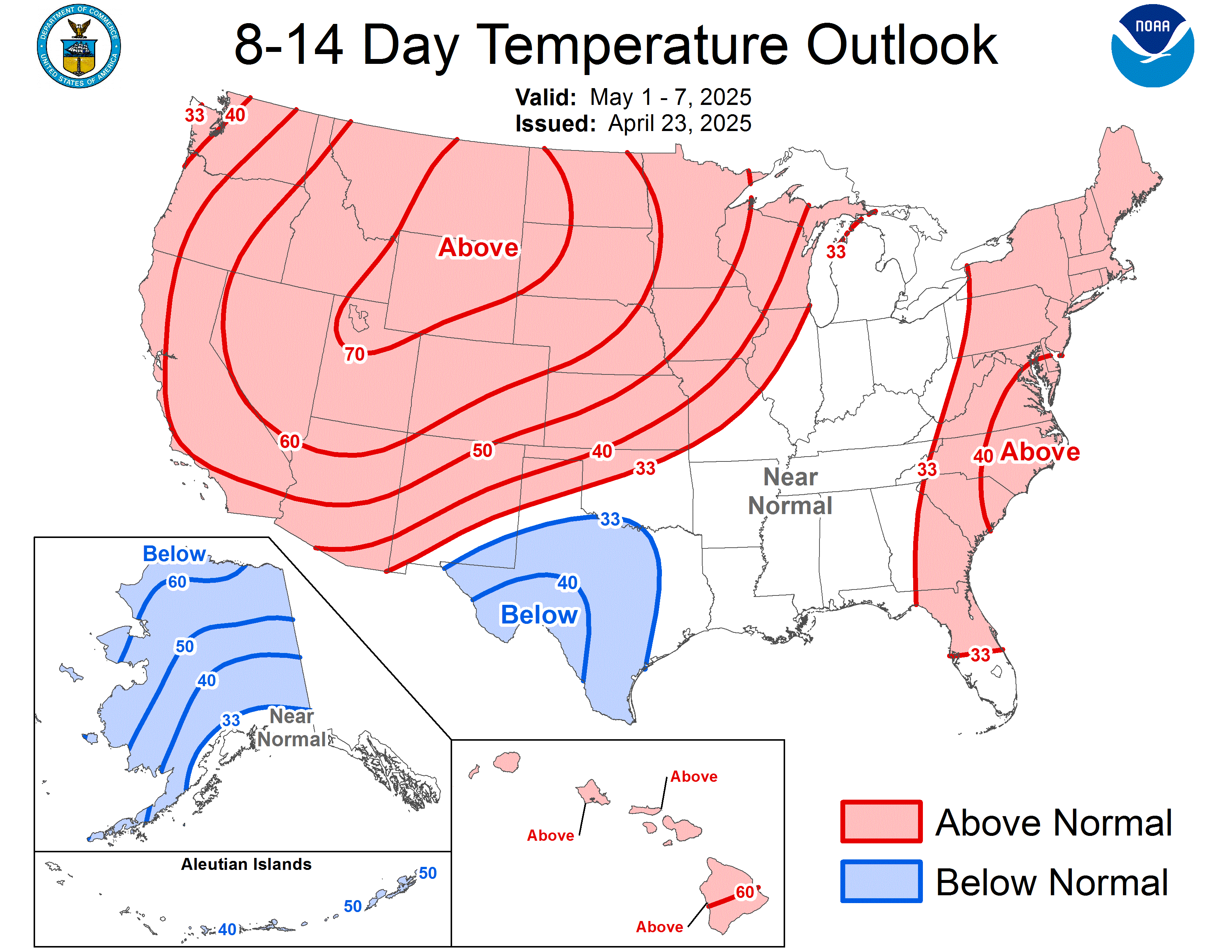
CPC Outlook holds onto to below normal temps along the east coast....and ridging from the mississippi west...in 8-14 day temp outlook issued yesterday. This has been a steady forecast for the last week from the CPC for the extended period.

Image
0 likes   

User avatar
tropicana
Category 5
Category 5
Posts: 8056
Joined: Sat Sep 27, 2003 6:48 pm
Location: Niagara Falls, Ontario, Canada
Contact:

Re: Several cold shots on the horizon (Plains and East)

#133 Postby tropicana » Mon Nov 17, 2008 2:16 pm

Mon Nov 17 2008
Almost 2 feet of snow has fallen in western New York and more is coming along the southern shore of Lake Erie from Cleveland, Ohio, to Buffalo.
The latest lake-effect storm dropped 23 inches on Ellicottville, New York, 40 miles south of Buffalo, as of 10:15 a.m. Monday and 20 inches on nearby South Dayton.

Roads are snow-covered and slippery.
An additional 6 inches of snow could come by evening.
The National Weather Service posted lake-effect snow warnings from Buffalo to Cleveland, Ohio, through Tuesday afternoon.
Lake-effect snow occurs when cold air passes over a warmer body of water, in this case Lake Erie. The cold air sucks up the moisture and heat from the water, dropping it as snow when it moves over land.
Wind and snow showers with temperatures in the 20s are forecast for the NFL "Monday Night Football" game between the Buffalo Bills and the Cleveland Browns.

Three to five inches of snow are expected in northeastern Ohio, for a total accumulation of up to 10 inches.
0 likes   

User avatar
amawea
S2K Supporter
S2K Supporter
Posts: 385
Age: 73
Joined: Mon Aug 09, 2004 3:36 pm
Location: Horseshoe Bend, Ar. but from Baytown, Tx

Re: Several cold shots on the horizon (Plains and East)

#134 Postby amawea » Mon Nov 17, 2008 3:41 pm

We need some of that snow pack to get laid down further west so the cold air coming down doesn't get modified as much. The more the better if we are to have a good old fashion winter.
0 likes   

jinftl
Category 5
Category 5
Posts: 4312
Joined: Tue Aug 31, 2004 4:47 pm
Location: fort lauderdale, fl

Re: Several cold shots on the horizon (Plains and East)

#135 Postby jinftl » Mon Nov 17, 2008 4:14 pm

Not much of a snowpack in the lower 48 quite yet...according to NOAA, 7.3% of the continental U.S. has snowpack. On the link to the site below, you can also track snowpacks from prior years....on today's date in 2007, 5.6% had snowpack and in 2006, 10.0% had snowpack. Today's snowpack is pretty much in the middle of those 2 comparison years for the same date.

http://www.nohrsc.noaa.gov/nsa/

Image

amawea wrote:We need some of that snow pack to get laid down further west so the cold air coming down doesn't get modified as much. The more the better if we are to have a good old fashion winter.
0 likes   

User avatar
gboudx
S2K Supporter
S2K Supporter
Posts: 4080
Joined: Thu Sep 04, 2003 1:39 pm
Location: Rockwall, Tx but from Harvey, La

Re: Several cold shots on the horizon (Plains and East)

#136 Postby gboudx » Mon Nov 17, 2008 5:20 pm

If we look a bit further north into Canada, here is the snow cover from 2008 and 2007 on the same date. Much more this year than last.

2007
Image

2008
Image
0 likes   

User avatar
iorange55
Category 5
Category 5
Posts: 2388
Joined: Thu Nov 13, 2008 9:47 pm
Location: Big D

Re: Several cold shots on the horizon (Plains and East)

#137 Postby iorange55 » Mon Nov 17, 2008 6:10 pm

GFS 18 model showing maybe some snow for northern oklahoma a day or two after Thanksgiving?
0 likes   

jinftl
Category 5
Category 5
Posts: 4312
Joined: Tue Aug 31, 2004 4:47 pm
Location: fort lauderdale, fl

Re: Several cold shots on the horizon (Plains and East)

#138 Postby jinftl » Mon Nov 17, 2008 9:58 pm

Compared to a year ago, where's the snow for northern new england? Also, you can see Lake Effect events are not uncommon in November....snowpack in the same regions as a year ago (although deeper this year, except in Adirondacks).


Image

Image
0 likes   

User avatar
tropicana
Category 5
Category 5
Posts: 8056
Joined: Sat Sep 27, 2003 6:48 pm
Location: Niagara Falls, Ontario, Canada
Contact:

Re: Several cold shots on the horizon (Plains and East)

#139 Postby tropicana » Tue Nov 18, 2008 8:42 am

First (sticking) snowfall of the season here in Niagara Falls last night, it began around 1130pm and continued sporadically through the overnight. Just a dusting really, but picturesque.

-justin-
0 likes   

User avatar
Extremeweatherguy
Category 5
Category 5
Posts: 11095
Joined: Mon Oct 10, 2005 8:13 pm
Location: Florida

Re: Several cold shots on the horizon (Plains and East)

#140 Postby Extremeweatherguy » Tue Nov 18, 2008 12:12 pm

The latest GFS MOS guidance (12z) looks pretty chilly for OKC late this week and this weekend. It is showing a high of 54F on Thursday, 47F on Friday, 46F on Saturday, and 52F on Sunday. These numbers are not exceptionally cold, but they would still make for a nice cool down if they play out..especially since we are expecting a high into the 70s tomorrow!

It is worth noting that the operational GFS is slightly colder, showing highs only in the lower 40s for Friday and Saturday, and then in the mid to upper 40s for Sunday.
0 likes   


Return to “Winter Weather”

Who is online

Users browsing this forum: No registered users and 101 guests