TX winter wx thread: Spring-like pattern
Moderator: S2k Moderators
Forum rules
 The posts in this forum are NOT official forecast and should not be used as such. They are just the opinion of the poster and may or may not be backed by sound meteorological data. They are NOT endorsed by any professional institution or STORM2K.

The posts in this forum are NOT official forecast and should not be used as such. They are just the opinion of the poster and may or may not be backed by sound meteorological data. They are NOT endorsed by any professional institution or STORM2K.
-
Ed Mahmoud
Re: TX winter wx thread: Winter Precipitation Thurs/Fri?
Last, desperate gasp- is that some slight cloud cooling starting between CDS and SPS?
0 likes
-
Ed Mahmoud
Re: TX winter wx thread: Winter Precipitation Thurs/Fri?
Ed Mahmoud wrote:Last, desperate gasp- is that some slight cloud cooling starting between CDS and SPS?
Is that some weak echoes developing near FDR WSR-88D?
0 likes
-
jasons2k

- Storm2k Executive

- Posts: 8290
- Age: 52
- Joined: Wed Jul 06, 2005 12:32 pm
- Location: The Woodlands, TX
Re: TX winter wx thread: Winter Precipitation Thurs/Fri?
cwp419 wrote:
Where is that? Looks like my old Apt. complex but I didn't think that much snow fell in Frisco.
0 likes
-
Extremeweatherguy

- Category 5

- Posts: 11095
- Joined: Mon Oct 10, 2005 8:13 pm
- Location: Florida
http://adds.aviationweather.noaa.gov/sa ... g&itype=ir
http://adds.aviationweather.noaa.gov/sa ... e&itype=wv
Moisture continues to increase to our SW, and it is now looking more and more likely that a second round of (light) precipitation is on the way for tonight.
http://adds.aviationweather.noaa.gov/sa ... e&itype=wv
Moisture continues to increase to our SW, and it is now looking more and more likely that a second round of (light) precipitation is on the way for tonight.
Last edited by Extremeweatherguy on Thu Mar 06, 2008 8:50 pm, edited 1 time in total.
0 likes


Re: TX winter wx thread: Winter Precipitation Thurs/Fri?
It better be headed straight for Tyler, Texas. I promised my 3 boys.

Please!
Please!
0 likes
Re: TX winter wx thread: Winter Precipitation Thurs/Fri?
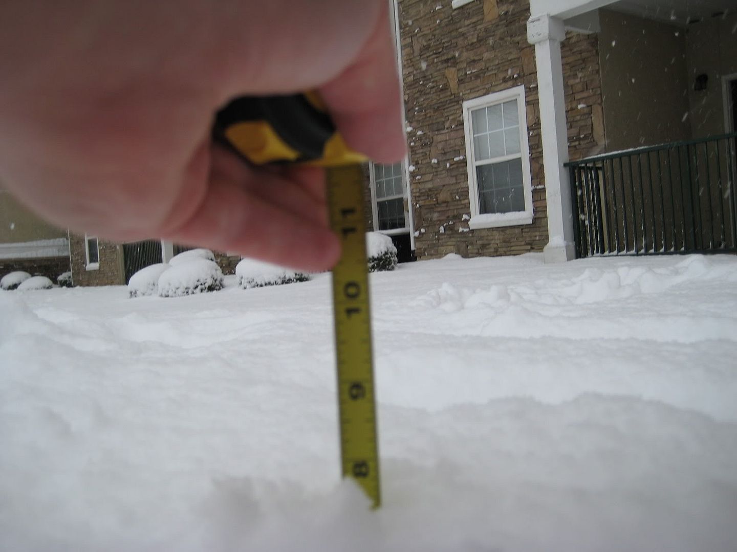
Right now I'm at a hotel in Sherman. Where I am, their is app. 7 to 9 inches of some awesome snow! Very much worth the drive. I'll post pics when I get home. This is the most snow I have seen since my trip to Durango in the early 90's.
0 likes
-
Texas Snowman

- Storm2k Moderator

- Posts: 6197
- Joined: Fri Jan 25, 2008 11:29 am
- Location: Denison, Texas
Re: TX winter wx thread: Winter Precipitation Thurs/Fri?
Yep, cooler cloud tops are definitely blosoming to the SW near the Big Bend region. Also, radar echoes are holding their own out west as energy rotates through.
I seem to remember a situation back in the mid 1980s when a December surface low bombed out in the NW Gulf, pulled moisture out with it, and as upper low moved across that afternoon, it suprisingly dumped 2-3 inches of snow.
Hopefully a repeat of that will occur overnight so the rest of you N. and E. Texas snow geese can honk tomorrow morning.
BTW, snow is over for the moment, but up here in the Sherman/Denison area, snowfall amounts were generally in the 5-6 inch range with a few higher reports including one 9 inch report at Lake Kiowa in SE Cooke County.
50 miles to the south in Plano where my wife's sister lives, nothing.
Tx Snowman
0 likes
-
Texas Snowman
- Storm2k Moderator
- Posts: 6197
- Joined: Fri Jan 25, 2008 11:29 am
- Location: Denison, Texas
Re: TX winter wx thread: Winter Precipitation Thurs/Fri?
From FW NWS:
SPECIAL WEATHER STATEMENT
NATIONAL WEATHER SERVICE FORT WORTH TX
801 PM CST THU MAR 6 2008
TXZ091>095-100>107-115>123-129>135-141>148-156>162-174-175-071100-
ANDERSON-BELL-BOSQUE-COLLIN-COMANCHE-COOKE-CORYELL-DALLAS-DELTA-
DENTON-EASTLAND-ELLIS-ERATH-FALLS-FANNIN-FREESTONE-GRAYSON-HAMILTON-
HENDERSON-HILL-HOOD-HOPKINS-HUNT-JACK-JOHNSON-KAUFMAN-LAMAR-LAMPASAS-
LEON-LIMESTONE-MCLENNAN-MILAM-MILLS-MONTAGUE-NAVARRO-PALO PINTO-
PARKER-RAINS-ROBERTSON-ROCKWALL-SOMERVELL-STEPHENS-TARRANT-VAN ZANDT-
WISE-YOUNG-
801 PM CST THU MAR 6 2008
...COLD WITH LIGHT SNOW POSSIBLE LATE TONIGHT...
ANOTHER UPPER AIR DISTURBANCE WILL MOVE ACROSS NORTH TEXAS LATER
TONIGHT. THIS SYSTEM IS NOT AS STRONG AS THE ONE EARLIER TODAY...
BUT HAS THE POTENTIAL TO PRODUCE LIGHT SNOW SHOWERS OR FLURRIES
BEFORE DAYBREAK. ANY ADDITIONAL SNOW ACCUMULATION WILL BE LIGHT
AND GENERALLY LESS THAN ONE HALF INCH WHERE TEMPERATURES
DROP TO OR BELOW FREEZING.
AREAS NORTH AND WEST OF A LAMPASAS TO FORT WORTH...BONHAM LINE
WILL DROP TO OR BELOW FREEZING TONIGHT. ANY RESIDUAL WATER
OR SNOW MELT REMAINING ON ROADS WILL FREEZE...PRODUCING ICY
SPOTS FOR THE EARLY MORNING COMMUTE. DRIVERS ARE ADVISED TO APPROACH
SNOW COVERED OR ICY BRIDGES AND OVERPASSES WITH CAUTION UNTIL THE SUN
WARMS THE ROAD SURFACE AND MELTS THE ICE FRIDAY MORNING.
AREAS SOUTH AND EAST OF A LAMPASAS TO FORT WORTH...BONHAM LINE
SHOULD REMAIN ABOVE FREEZING TONIGHT. LIGHT SNOW OR FLURRIES MAY
PASS OVER THE AREA AFTER MIDNIGHT...BUT WITH LITTLE OR NO
ACCUMULATION. ROADS SHOULD STAY PASSABLE...HOWEVER A FEW MIGHT
RECEIVE A LIGHT DUSTING OF SNOW BEFORE DAYBREAK. THIS COULD
AFFECT BRIDGES AND OVERPASSES BRIEFLY DURING THE EARLY MORNING
COMMUTE.
Hopefully, this upper level feature will be stronger than expected.
Tx Snowman
0 likes
-
cheezyWXguy

- Category 5
- Posts: 6282
- Joined: Mon Feb 13, 2006 12:29 am
- Location: Dallas, TX
Re: TX winter wx thread: Winter Precipitation Thurs/Fri?
Texas Snowman wrote:Yep, cooler cloud tops are definitely blosoming to the SW near the Big Bend region. Also, radar echoes are holding their own out west as energy rotates through.
I seem to remember a situation back in the mid 1980s when a December surface low bombed out in the NW Gulf, pulled moisture out with it, and as upper low moved across that afternoon, it suprisingly dumped 2-3 inches of snow.
Hopefully a repeat of that will occur overnight so the rest of you N. and E. Texas snow geese can honk tomorrow morning.
BTW, snow is over for the moment, but up here in the Sherman/Denison area, snowfall amounts were generally in the 5-6 inch range with a few higher reports including one 9 inch report at Lake Kiowa in SE Cooke County.
50 miles to the south in Plano where my wife's sister lives, nothing.
Tx Snowman
wow, thats funny because I live in plano and we have generally 1-2 inches around, with up to an inch of slush in the roads. As long as we can get below freezing, with a little snow overnight, theres a chance i could get school at least delayed...i hope
0 likes
-
TexasStooge

- Category 5
- Posts: 38127
- Joined: Tue Mar 25, 2003 1:22 pm
- Location: Irving (Dallas County), TX
- Contact:
All Winter Weather Alerts have been cancelled. The storm that has prompted the WINTER STORM WARNING has lost its big punch, however it has maintained the wintry precip. It's moving into the Midwest areas as we speak. There is another round of snow flurries in the TX Panhandle, but we don't know if it's gonna come to DFW or not.
I liked the snow, I just can do without the pelting sleet.
I liked the snow, I just can do without the pelting sleet.
0 likes
-
Extremeweatherguy
- Category 5
- Posts: 11095
- Joined: Mon Oct 10, 2005 8:13 pm
- Location: Florida
AREA FORECAST DISCUSSION
NATIONAL WEATHER SERVICE HOUSTON/GALVESTON TX
901 PM CST THU MAR 6 2008
.DISCUSSION...
AT 8 PM...A STRONG COLD FRONT EXTENDED FROM FROM NEAR SHREVEPORT
TO GALVESTON TO JUST SOUTH OF ALICE. STRONG STORMS ARE NOW WELL
EAST OF THE REGION WITH JUST A FEW POCKETS OF LIGHT RAIN LINGERING
BEHIND THE MAIN SYSTEM. MUCH COLDER AIR IS WORKING INTO SOUTHEAST
TEXAS WITH TEMPS IN THE UPPER 30S OVER THE NORTHWEST ZONES...MID
40S CENTRAL ZONES AND LOWER 50S NEAR THE COAST. COLD AIR ADVECTION
TO PERSIST OVERNIGHT INTO EARLY FRIDAY. A VERY TIGHT PRESSURE
GRADIENT WILL PERSIST OVERNIGHT AND WITH COLD AIR RIDING OVER
WARMER GULF WATERS...FEEL IT IS BEST TO MAINTAIN WIND ADVISORY FOR
COASTAL COUNTIES TONIGHT.
A REAL TRICKY FORECAST LATER TONIGHT INTO EARLY FRIDAY MORNING. A
700 MB TROUGH WILL APPROACH THE REGION. PRECIPITATION IS EXPECTED
TO REDEVELOP BETWEEN 06-09Z AND LINGER THROUGH 15Z. THICKNESS
LEVELS DROP BELOW 540 DM AND 850 MB TEMPS FALL BELOW 0 C MAINLY
NORTH OF A BRENHAM TO LIVINGSTON LINE. THE RUC KEEPS THE MOISTURE
NORTHEAST OF THE HGX CWA BUT OTHER (12Z) GLOBAL MODELS SHOW A
BURST OF LIGHT PRECIP OVERNIGHT JUST LIKE THE 00Z NAM. IF THE NAM
IS CORRECT... SOME LIGHT SNOW ACCUMULATIONS ARE POSSIBLE OVER THE
EXTREME NORTHEAST EDGE OF THE CWA (HOUSTON/TRINITY COUNTIES). HATE
TO MAKE A BIG ADJUSTMENT BASED ON ONE MODEL SOLUTION SO WILL TWEAK
THE WEATHER GRIDS TO SHOW MORE LIGHT SNOW VS A RAIN/SNOW MIX OVER
THE NORTHERN THIRD OF THE CWA BUT WILL LEAVE OUT ACCUMULATIONS.
FURTHER SOUTH...FCST SOUNDINGS SHOW SOME LIGHT RAIN PROBABLY MIXED
WITH SOME ICE PELLETS AS FAR SOUTH AS THE CITY OF HOUSTON. PRECIP
SHOULD BE VERY LIGHT AND TEMPERATURES AT THE SURFACE WILL REMAIN
ABOVE FREEZING..SO NOT EXPECTING ANY ICE ACCUMULATIONS OR OTHER
HAZARDS. WILL BE CLEANING UP THE ZONES...TWEAKING TEMPS AND WINDS.
NEW ZONES OUT BY 1000 PM.
Rain/sleet now forecasted for Houston with snow just to our north and possibly some light accumulations in far northern sections of SE Texas!!! Could be a fun night and morning ahead!
Last edited by Extremeweatherguy on Thu Mar 06, 2008 10:16 pm, edited 1 time in total.
0 likes
-
Texas Snowman
- Storm2k Moderator
- Posts: 6197
- Joined: Fri Jan 25, 2008 11:29 am
- Location: Denison, Texas
Re: TX winter wx thread: Winter Precipitation Thurs/Fri?
Well, she actually lives on the far SE side of Plano nearer to Garland. All I know is my wife said they hadn't seen anything down there.
Also, beginning to see some returns on the NWS radar down in the Big Bend country, moving NE towards N. Texas.
http://radar.weather.gov/radar_lite.php ... R&loop=yes
Don't give up hope just yet on the east side of the Metroplex.
Tx Snowman
Also, beginning to see some returns on the NWS radar down in the Big Bend country, moving NE towards N. Texas.
http://radar.weather.gov/radar_lite.php ... R&loop=yes
Don't give up hope just yet on the east side of the Metroplex.
Tx Snowman
0 likes
-
Extremeweatherguy
- Category 5
- Posts: 11095
- Joined: Mon Oct 10, 2005 8:13 pm
- Location: Florida
Here is the latest forecast for my location in northern Harris county!!! 
Rain, SNOW, and sleet! Yes, it is only a 40% chance and no accumulations are expected, but hey that's better than nothing, especially considering this is North Houston!
Tonight: A slight chance of rain before 3am, then a chance of rain and snow possibly mixed with sleet. Cloudy, with a low around 38. North wind between 15 and 20 mph, with gusts as high as 20 mph. Chance of precipitation is 40%.
Friday: A 20 percent chance of light snow before 10am. Mostly cloudy, with a high near 52. North wind between 15 and 20 mph, with gusts as high as 25 mph.
Rain, SNOW, and sleet! Yes, it is only a 40% chance and no accumulations are expected, but hey that's better than nothing, especially considering this is North Houston!
0 likes
-
serenata09
- Tropical Storm

- Posts: 166
- Joined: Fri Jan 18, 2008 7:55 pm
- Location: Dallas, TX
Re: TX winter wx thread: Winter Precipitation Thurs/Fri?
Any chance those new echoes out west will reach Austin? I was really hoping to see at a little winter out of this.
0 likes
-
Texas Snowman
- Storm2k Moderator
- Posts: 6197
- Joined: Fri Jan 25, 2008 11:29 am
- Location: Denison, Texas
Re: TX winter wx thread: Winter Precipitation Thurs/Fri?
Definitely some enhancement of moisture on the water vapor loop - things do appear to be blossoming from the Rio Grande to the northeast. Also looks like dry air slot is moving ENE ahead of that moisture. Now if that upper level energy approaching can actually provide enough lift and squeeze out some more flakes.
Local TV met on KXII said perhaps another inch overnight in the Red River Valley as that energy moves through.
Keep your fingers crossed Dallas!
http://adds.aviationweather.noaa.gov/sa ... e&itype=wv
Tx Snowman
Local TV met on KXII said perhaps another inch overnight in the Red River Valley as that energy moves through.
Keep your fingers crossed Dallas!
http://adds.aviationweather.noaa.gov/sa ... e&itype=wv
Tx Snowman
0 likes
-
Texas Snowman
- Storm2k Moderator
- Posts: 6197
- Joined: Fri Jan 25, 2008 11:29 am
- Location: Denison, Texas
Re: TX winter wx thread: Winter Precipitation Thurs/Fri?
If these radar returns continue to increase, then Austin may get some of the snow JB talked about, although I don't see 3" at Lake Travis out of these returns.
http://radar.weather.gov/radar_lite.php ... R&loop=yes
Tx Snowman
http://radar.weather.gov/radar_lite.php ... R&loop=yes
Tx Snowman
0 likes
-
Texas Snowman
- Storm2k Moderator
- Posts: 6197
- Joined: Fri Jan 25, 2008 11:29 am
- Location: Denison, Texas
Re: TX winter wx thread: Winter Precipitation Thurs/Fri?
I think I'm the only one still up watching this (what can I say, read my handle, I dig snow!).
Also some returns beginning to blossom over portions of Oklahoma - these appear to be rotating from north to south around the backside of the main precip shield in eastern Oklahoma and western Arkansas.
So, with returns to the north and returns to the SW and upper level energy moving in, maybe, just maybe, there will be another inch or two for Dallas and points east in the overnight hours.
http://radar.weather.gov/radar_lite.php ... R&loop=yes
Tx Snowman
0 likes
Who is online
Users browsing this forum: No registered users and 218 guests