Texas Winter 2011-2012...

Winter Weather Discussion

Moderator: S2k Moderators

Forum rules

The posts in this forum are NOT official forecast and should not be used as such. They are just the opinion of the poster and may or may not be backed by sound meteorological data. They are NOT endorsed by any professional institution or STORM2K.

Help Support Storm2K
Message
Author
User avatar
Ptarmigan
Category 5
Category 5
Posts: 5316
Joined: Wed Aug 16, 2006 9:06 pm

Re: Texas Winter 2011-2012...

#1521 Postby Ptarmigan » Wed Dec 28, 2011 11:27 pm

wxman57 wrote:At the office, I'm known as a "warm-mongerer", a term we coined. With so many "cold-mongerers" in the office, someone had to speak up for the joys of hot weather. ;-)

Canada can keep its cold air where it belongs - in Canada! Meanwhile, my dreams involve 90+ deg temps in February like back in 1986. Those were the days...


There was +90 degree days in February of 1996. It was a La Nina Winter.
0 likes   

User avatar
Ptarmigan
Category 5
Category 5
Posts: 5316
Joined: Wed Aug 16, 2006 9:06 pm

Re: Texas Winter 2011-2012...

#1522 Postby Ptarmigan » Wed Dec 28, 2011 11:29 pm

Ntxw wrote:
I think those 90+ days in winter will be harder to come by in cold PDO's ;). The 90s were friendly for winter warmth too! Long term wise do you think we enter a third nina next winter? Go neutral? Or weak Nino?

75-76, 76-77 seems to be some analog years people use for the period we are in, and of course we all know about the infamous cold PDO nino of 77-78, so I was wondering if it matched.


1975 was borderline weak to neutral La Nina. There was a strong La Nina in 1974, which is like 2010-2011. 1972-1973 was cold. We are in a second 1976 went from La Nina to El Nino. The winter of 1976-1977 and 1977-1978 were very cold. They were back to back winters! I think we are in this phase again. 2009-2010 was very cold as well. This reminds me of the 1970s.

National Temperate Ranking December to February 1895-2011
1971-1972 33.17°F 58th La Nina
1972-1973 31.74°F 29th El Nino
1973-1974 33.85°F 79th La Nina
1974-1975 33.61°F 70th La Nina
1975-1976 35.21°F 101st La Nina
1976-1977 30.67°F 11th El Nino
1977-1978 29.68°F 7th El Nino
1978-1979 27.29°F 1st Neutral

1979-1980 33.95°F 84th Neutral

The late 1970s were cold, especially from 1976 to 1979. 1978-1979 is the coldest winter on record! :cold: The winter of 1975-1976 was quite warm and one of the warmest on record. Interesting how it went from warm to cold.


2008-2009 33.65°F 76th La Nina
2009-2010 31.12°F 15th El Nino
2010-2011 32.15°F 37th La Nina
2011-2012 La Nina

1973-1974 and 2010-2011 had strong La Nina, yet they were not warm winters.


Temperature Ranking
http://www.ncdc.noaa.gov/temp-and-precip/ranks.php

ENSO
http://www.cpc.ncep.noaa.gov/products/a ... ears.shtml
Last edited by Ptarmigan on Wed Dec 28, 2011 11:57 pm, edited 6 times in total.
0 likes   

User avatar
Ntxw
Storm2k Moderator
Storm2k Moderator
Posts: 22789
Joined: Wed Oct 21, 2009 6:34 pm
Location: DFW, Texas

Re: Texas Winter 2011-2012...

#1523 Postby Ntxw » Wed Dec 28, 2011 11:39 pm

Ptarmigan wrote:1976 went from La Nina to El Nino. The winter of 1976-1977 and 1977-1978 were very cold. They were back to back winters! I think we are in this phase again. 2009-2010 was very cold as well.


It seems to be a pattern. 09-10 Nino was after a Moderate nina of 07-08 and a weak nina/neutral of 08-09. Ninos after double ninas are special!
0 likes   
The above post and any post by Ntxw is NOT an official forecast and should not be used as such. It is just the opinion of the poster and may or may not be backed by sound meteorological data. It is NOT endorsed by any professional institution including Storm2k. For official information, please refer to NWS products.

  Help support Storm2K!
Help Support Storm2K

User avatar
Kelarie
Category 5
Category 5
Posts: 1074
Age: 54
Joined: Mon Dec 20, 2004 1:18 pm
Location: Hobbs, NM

Re: Texas Winter 2011-2012...

#1524 Postby Kelarie » Thu Dec 29, 2011 8:22 am

from Shreveport NWS...

00Z ECMWF HAS BACKED OFF A BIT ON THE COLD AIR INTRUSION FOR NEXT
WEEK. IT STILL APPEARS ANOTHER STRONG BLAST OF COLD AIR IS IN
STORE AS A CANADIAN SFC HIGH SETTLES INTO THE SRN PLAINS BY MID
WEEK. PROGRESSIVE NW FLOW WILL CONTINUE WITH ANOTHER COLD FRONT
AND UPPER TROUGH MOVING THROUGH THE AREA LATE NEXT WEEK. PARADE OF
COLD FRONTS SHOULD KEEP TEMPS NEAR OR BELOW CLIMO THROUGH MOST OF
NEXT WEEK. /09/
0 likes   

User avatar
wxman57
Moderator-Pro Met
Moderator-Pro Met
Posts: 22984
Age: 67
Joined: Sat Jun 21, 2003 8:06 pm
Location: Houston, TX (southwest)

Re: Texas Winter 2011-2012...

#1525 Postby wxman57 » Thu Dec 29, 2011 8:27 am

Yep, 00Z Euro was 2F-10F warmer than the 12Z across SE TX and the Gulf Coast for next week. Just a moderate cold front that may bring near-freezing temps to SE TX and south LA and freezing temps for north FL next week. No big deal.
0 likes   

User avatar
amawea
S2K Supporter
S2K Supporter
Posts: 385
Age: 73
Joined: Mon Aug 09, 2004 3:36 pm
Location: Horseshoe Bend, Ar. but from Baytown, Tx

Re: Texas Winter 2011-2012...

#1526 Postby amawea » Thu Dec 29, 2011 9:13 am

There is some very cold air up in Alaska right now. Deadhorse in northeast Alaska has -36ºF this a.m. and Nome over on the west coast has -30ºF. There just isn't any hieghts building up there to bring the cold air down. The highest pressure I could find was 1004mb in extreme n.e. Alaska on a weather map at this site.

http://climate.gi.alaska.edu/wx/current.html
0 likes   

User avatar
wxman57
Moderator-Pro Met
Moderator-Pro Met
Posts: 22984
Age: 67
Joined: Sat Jun 21, 2003 8:06 pm
Location: Houston, TX (southwest)

Re: Texas Winter 2011-2012...

#1527 Postby wxman57 » Thu Dec 29, 2011 9:34 am

Yes, temps across Alaska are 20-25F below normal presently. However, temps in western Canada are warmer than normal. Forecast is for temps to steadily rise in Alaska and western Canada over the next few weeks through the 3rd week of January. That would preclude any significant Arctic outbreak.

I'm looking at some high-res European model data that goes out 4 weeks now. You can't get this online (for free). The data include surface temperature anomalies and 850mb temperature anomalies through January 23rd. Here's what I see:

Week 1 (Dec 27-Jan 2)
Surface temps 1-2F above normal across SE TX through next Monday and 15-20F above normal across the Northern Plains.

Week 2 (Jan 3-9)
Surface temps near normal across SE TX and 15-20F above normal from the Central Plains through western Canada

Week 3 (Jan 10-16)
Surface temps 2-4F above normal across SE TX and 4-8F above normal from Nebraska through southwest Canada.

Week 4 (Jan 17-23)
Surface temps 4F above normal across SE TX and 6-8F above normal across most of the central and northern U.S. east of the Rockies through the Ohio Valley. Temps in western and NW Canada dropping to 2-4F below normal.

At 850mb (5000 ft), temps are well above normal across the U.S. and western Canada through the next 3 weeks. dropping to 2-3C below normal across western Canada in week 4.

The GFS is in basic agreement with the European model, which would mean no significant cold outbreaks through at least the first 3 weeks of January and possibly through January. There are forecasts of cooling in western Canada by the 4th week of January, though. This could lead to a cold outbreak early in February that might drop our temps significantly below freezing down south.
0 likes   

User avatar
Portastorm
Storm2k Moderator
Storm2k Moderator
Posts: 9914
Age: 63
Joined: Fri Jul 11, 2003 9:16 am
Location: Round Rock, TX
Contact:

Re: Texas Winter 2011-2012...

#1528 Postby Portastorm » Thu Dec 29, 2011 11:59 am

Thanks for the preview, wxman57! If you can, please keep us posted.

If these high-res models continue to show this over the next couple of days ... sounds like we may have a good idea on what to expect weatherwise for the first 2-3 weeks of 2012.

It will be interesting also to see how the indices respond over the next week in terms of the AO, NAO, PNA, and the MJO. Some good weather minds on other forums see the AO and NAO eventually going negative later in January as the polar vortex weakens and is displaced from its current location. This could set us up for some "excitement" later in January/early February as you are opining. Meanwhile, sounds like you and hriverajr are gonna have some good cycling weather.
0 likes   
Any forecasts under my name are to be taken with a grain of salt. Get your best forecasts from the National Weather Service and National Hurricane Center.

orangeblood
S2K Supporter
S2K Supporter
Posts: 3714
Joined: Tue Dec 15, 2009 6:14 pm
Location: Fort Worth, TX

Re: Texas Winter 2011-2012...

#1529 Postby orangeblood » Thu Dec 29, 2011 12:32 pm

wxman57 wrote:Yes, temps across Alaska are 20-25F below normal presently. However, temps in western Canada are warmer than normal. Forecast is for temps to steadily rise in Alaska and western Canada over the next few weeks through the 3rd week of January. That would preclude any significant Arctic outbreak.

I'm looking at some high-res European model data that goes out 4 weeks now. You can't get this online (for free). The data include surface temperature anomalies and 850mb temperature anomalies through January 23rd. Here's what I see:

Week 1 (Dec 27-Jan 2)
Surface temps 1-2F above normal across SE TX through next Monday and 15-20F above normal across the Northern Plains.

Week 2 (Jan 3-9)
Surface temps near normal across SE TX and 15-20F above normal from the Central Plains through western Canada

Week 3 (Jan 10-16)
Surface temps 2-4F above normal across SE TX and 4-8F above normal from Nebraska through southwest Canada.

Week 4 (Jan 17-23)
Surface temps 4F above normal across SE TX and 6-8F above normal across most of the central and northern U.S. east of the Rockies through the Ohio Valley. Temps in western and NW Canada dropping to 2-4F below normal.

At 850mb (5000 ft), temps are well above normal across the U.S. and western Canada through the next 3 weeks. dropping to 2-3C below normal across western Canada in week 4.

The GFS is in basic agreement with the European model, which would mean no significant cold outbreaks through at least the first 3 weeks of January and possibly through January. There are forecasts of cooling in western Canada by the 4th week of January, though. This could lead to a cold outbreak early in February that might drop our temps significantly below freezing down south.


No offense wxman57 but those Euro weeklies have been less than stellar so far this winter and back in November were plain garbage. They were forecasting, for the first week of December, 10-15 above normal for the southern plains into the southern rockies (2-3 weeks out) and it ended up being 10-15 below normal in that area. Not sure why you'd reference this longer term European model that far out given its track record of late?

The pattern seems to be priming itself for an Arctic outbreak starting around the 3rd week of January...NAO tanking, AO falling off its crazy positives, Stratospheric warming working its way across Canada and the MJO moving across the Pacific!!
0 likes   

User avatar
TeamPlayersBlue
Category 5
Category 5
Posts: 3445
Joined: Tue Feb 02, 2010 1:44 am
Location: Denver/Applewood, CO

#1530 Postby TeamPlayersBlue » Thu Dec 29, 2011 1:18 pm

I read a tweet from JB recently saying that he expects next winter to be pretty brutal. This is inline with his prediction last year (10-11) that 10-11 would be cold, 11-12 winter would be on the warm side, then the following two winters (12-13) and (13-14) would be on the cold side.
0 likes   
Personal Forecast Disclaimer:
The posts in this forum are NOT official forecast and should not be used as such. They are just the opinion of the poster and may or may not be backed by sound meteorological data. They are NOT endorsed by any professional institution or storm2k.org. For official information, please refer to the NHC and NWS products.

User avatar
Rgv20
S2K Supporter
S2K Supporter
Posts: 2466
Age: 39
Joined: Wed Jan 05, 2011 5:42 pm
Location: Edinburg/McAllen Tx

#1531 Postby Rgv20 » Thu Dec 29, 2011 1:33 pm

The operational GFS has been pretty consisting on building up some cold air along with a pretty substantial High Pressure (1050mb+) in the longer range. However most of the GFS Ensembles don't agree with the 500mb pattern the operational is forecasting during the longer range.

12zOperational GFS 850mb forecast for Wednesday 01-12-2012
Image
0 likes   
The following post is NOT an official forecast and should not be used as such. It is just the opinion of the poster and may or may not be backed by sound meteorological data. It is NOT endorsed by any professional institution including storm2k.org For Official Information please refer to the NHC and NWS products.

User avatar
wxman57
Moderator-Pro Met
Moderator-Pro Met
Posts: 22984
Age: 67
Joined: Sat Jun 21, 2003 8:06 pm
Location: Houston, TX (southwest)

Re: Texas Winter 2011-2012...

#1532 Postby wxman57 » Thu Dec 29, 2011 1:39 pm

orangeblood wrote:No offense wxman57 but those Euro weeklies have been less than stellar so far this winter and back in November were plain garbage. They were forecasting, for the first week of December, 10-15 above normal for the southern plains into the southern rockies (2-3 weeks out) and it ended up being 10-15 below normal in that area. Not sure why you'd reference this longer term European model that far out given its track record of late?

The pattern seems to be priming itself for an Arctic outbreak starting around the 3rd week of January...NAO tanking, AO falling off its crazy positives, Stratospheric warming working its way across Canada and the MJO moving across the Pacific!!


Depends on what data you're looking at. Taking a look at the European forecasts, both the NAO and AO remain positive through the 13th. No prediction of either going negative. Stratospheric warming fades away by mid January (GFS). GFS operational does indicate temperatures across western Canada finally cooling down to well below normal by the 13th. But the GFS has been quite poor in its long-range predictions as well. GFS ensembles have the air 5-10F above normal in western Canada the 2nd week of January where the operational run has temps 20-30F below normal. In fact, none of the models has done really well in the long-term with the current pattern.

And, by the way, my post above was merely my observations of what was depicted by the European model, not necessarily my forecast of what was going to happen. However, one thing appears certain. There isn't much cold air currently in Canada and there isn't much snow cover across the U.S., which means we're not likely to see much cold air down south through at least the 2nd week of January.
0 likes   

User avatar
Ntxw
Storm2k Moderator
Storm2k Moderator
Posts: 22789
Joined: Wed Oct 21, 2009 6:34 pm
Location: DFW, Texas

#1533 Postby Ntxw » Thu Dec 29, 2011 2:23 pm

Well, Euro and Canadian says January is the new November! Come on mother nature! After the summer we had to pay I think it's time we get a little back! :wink:
0 likes   
The above post and any post by Ntxw is NOT an official forecast and should not be used as such. It is just the opinion of the poster and may or may not be backed by sound meteorological data. It is NOT endorsed by any professional institution including Storm2k. For official information, please refer to NWS products.


  Help support Storm2K!

Help Support Storm2K


weatherdude1108
Category 5
Category 5
Posts: 4228
Joined: Tue Dec 13, 2011 1:04 pm
Location: Northwest Austin/Cedar Park, TX

#1534 Postby weatherdude1108 » Thu Dec 29, 2011 5:37 pm

Does anyone have any insight on the supposed collapse of the polar vortex? I came across some YouTube video recently through an unrelated search I did for some other weather thing I was looking into. Anyway, I'm ignorant about it. Just curious of any ideas on it's effect on Texas' weather(?). :idea:

Back to La Nina sunny and dry for the time being. 8-) But I prefer rain since we're in a drought.
0 likes   
The preceding post is NOT an official forecast, and should not be used as such. It is only the opinion of the poster and may or may not be backed by sound meteorological data. It is NOT endorsed by any professional institution including storm2k.org. For Official Information please refer to the NHC and NWS products.

User avatar
hriverajr
Professional-Met
Professional-Met
Posts: 786
Joined: Tue Jul 19, 2005 12:16 am

Re: Texas Winter 2011-2012...

#1535 Postby hriverajr » Thu Dec 29, 2011 5:59 pm

wxman57 wrote:And, by the way, my post above was merely my observations of what was depicted by the European model, not necessarily my forecast of what was going to happen. However, one thing appears certain. There isn't much cold air currently in Canada and there isn't much snow cover across the U.S., which means we're not likely to see much cold air down south through at least the 2nd week of January.


Yep its only common sense, you don't even have to look at the models. You have to have the cold air really build up. Takes time at least 5-7 days. Then it has to be dislodged and move south another 3-7 days. So at a minimum that is over a week. Right now we don't even have any indications of that happening short term. i would say we are safe from significant cold air intrusions (Texas) at least through the 7th of January and most likely longer.
Last edited by Portastorm on Thu Dec 29, 2011 6:17 pm, edited 1 time in total.
Reason: Fixed quote
0 likes   

User avatar
Portastorm
Storm2k Moderator
Storm2k Moderator
Posts: 9914
Age: 63
Joined: Fri Jul 11, 2003 9:16 am
Location: Round Rock, TX
Contact:

Re:

#1536 Postby Portastorm » Thu Dec 29, 2011 6:10 pm

weatherdude1108 wrote:Does anyone have any insight on the supposed collapse of the polar vortex? I came across some YouTube video recently through an unrelated search I did for some other weather thing I was looking into. Anyway, I'm ignorant about it. Just curious of any ideas on it's effect on Texas' weather(?). :idea:

Back to La Nina sunny and dry for the time being. 8-) But I prefer rain since we're in a drought.


Far from an expert, I can tell you that WHERE the so-called "polar vortex" is located is one of the keys to how it impacts our weather. For example, if the vortex sets up shop just above or near the Hudson Bay ... you can bet your winter toque hat and gloves that it will help pull down air from the Arctic into the continental US. I'm also thinking that if the polar vortex weakens and is not strong, that also helps.

The recent chatter online suggests that the polar vortex may be getting displaced from where it has set up its location. When the polar vortex breaks down, per se, it is usually accompanied by sudden stratospheric warming (SSW) which altogether can create a major turn to bitter cold for the continental US.

Here is a link to a decent article on the subject:

http://www.aer.com/science-research/climate-weather/climate-dynamics/polar-vortex-impact-winter-weather
0 likes   
Any forecasts under my name are to be taken with a grain of salt. Get your best forecasts from the National Weather Service and National Hurricane Center.

User avatar
Ntxw
Storm2k Moderator
Storm2k Moderator
Posts: 22789
Joined: Wed Oct 21, 2009 6:34 pm
Location: DFW, Texas

Re: Re:

#1537 Postby Ntxw » Thu Dec 29, 2011 6:17 pm

Portastorm wrote:The recent chatter online suggests that the polar vortex may be getting displaced from where it has set up its location. When the polar vortex breaks down, per se, it is usually accompanied by sudden stratospheric warming (SSW) which altogether can create a major turn to bitter cold for the continental US.

Here is a link to a decent article on the subject:

http://www.aer.com/science-research/climate-weather/climate-dynamics/polar-vortex-impact-winter-weather


To add, SSW is not the only mechanism that can displace the PV. Tropical forcing (MJO) can too as well. Many times we focus on SSW as a precursor to cold outbreaks but it can also come from other places as well not involving the stratosphere! :wink:
0 likes   
The above post and any post by Ntxw is NOT an official forecast and should not be used as such. It is just the opinion of the poster and may or may not be backed by sound meteorological data. It is NOT endorsed by any professional institution including Storm2k. For official information, please refer to NWS products.


  Help support Storm2K!

Help Support Storm2K


User avatar
Texas Snowman
Storm2k Moderator
Storm2k Moderator
Posts: 6179
Joined: Fri Jan 25, 2008 11:29 am
Location: Denison, Texas

#1538 Postby Texas Snowman » Thu Dec 29, 2011 7:13 pm

KXII-TV met Steve LaNore's take on what the cold front will mean here in the Red River Valley this weekend:

http://www.kxii.com/blogs/weatherblog/A ... 84873.html

Update: Thu 29 Dec 2011 / 5:45 p.m.

A mild end to 2011 on Saturday is quickly followed by a very windy and chilly start to the New Year on Sunday.

In fact, a stout cold frontal boundary will probably pass through Texoma between sunset and midnight Saturday, so it will probably become windy and colder before the ball drops at 12 a.m. Sunday.

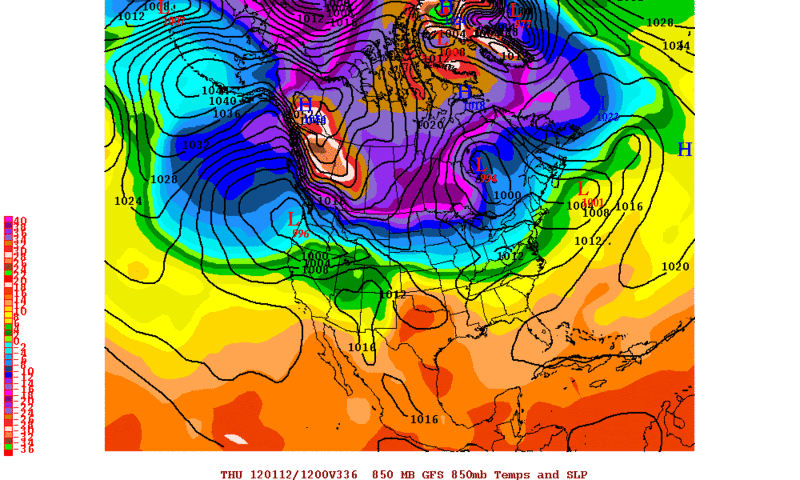
A stiff northerly wind will rake Texoma Sunday and it will be quite chilly as well. Temperatures will be quite cold but nowhere near records. We are just getting a glancing blow from this arctic air mass, which is turning out to be a little less intense than earlier trends.

I’m still expecting low 20s and possibly some upper teens on Tuesday morning. This will be about as cold as the morning of December 6th, which is so far the coldest morning of this winter season.

Outlook:

Sunday, Jan 1, 2012: Very windy / gusty to 35mph falling temperatures to 30s by evening

Monday, Jan 2, 2012: Sunny, breezy, cold: Highs low 40s

Tuesday, Jan 3, 2012: Very cold start lows 15 to 20, sunny with highs upper 40s
0 likes   
The above post and any post by Texas Snowman is NOT an official forecast and should not be used as such. It is just the opinion of the poster and may or may not be backed by sound meteorological data. It is NOT endorsed by any professional institution including storm2k.org. For official information, please refer to NWS products.

orangeblood
S2K Supporter
S2K Supporter
Posts: 3714
Joined: Tue Dec 15, 2009 6:14 pm
Location: Fort Worth, TX

Re: Texas Winter 2011-2012...

#1539 Postby orangeblood » Thu Dec 29, 2011 7:17 pm

hriverajr wrote:
wxman57 wrote:And, by the way, my post above was merely my observations of what was depicted by the European model, not necessarily my forecast of what was going to happen. However, one thing appears certain. There isn't much cold air currently in Canada and there isn't much snow cover across the U.S., which means we're not likely to see much cold air down south through at least the 2nd week of January.


Yep its only common sense, you don't even have to look at the models. You have to have the cold air really build up. Takes time at least 5-7 days. Then it has to be dislodged and move south another 3-7 days. So at a minimum that is over a week. Right now we don't even have any indications of that happening short term. i would say we are safe from significant cold air intrusions (Texas) at least through the 7th of January and most likely longer.


I'm going to have to respectfully disagree with you on this....cold air building in Canada isn't the only way we can get cold air intrusions down here. One way is from Alaska...there is plenty of cold air building in Alaska and the Bering Straight right now (25-30 below normal in some places) and if that Alaskan Vortex retrogrades to the west any, then look out in the lower 48 because some of that Alaskan cold has a chance to make it this way. All you need is help from the polar jet to break off a piece of that cold high pressure, bringing it quickly through Canada directly down the spine of the Rockies and into the southern plains (sometimes making it down here in less than 3 days). And sure enough that is exactly what the 18Z GFS is showing for next weekend.

There is plenty of cold air close enough to tap into and if the polar jet reconfigures itself just right then look out below. Now, it'll be hard to get sustained cold around here (we need the PV to entrain itself north of the Great Lakes for that) but it can get quite cold for a couple of days with a shot like the one I'm describing above. This is just something I've noticed looking back at past Upper Level and surface maps over the years.
0 likes   

User avatar
Texas Snowman
Storm2k Moderator
Storm2k Moderator
Posts: 6179
Joined: Fri Jan 25, 2008 11:29 am
Location: Denison, Texas

Re: Texas Winter 2011-2012...

#1540 Postby Texas Snowman » Thu Dec 29, 2011 10:01 pm

Larry Cosgrove: "...but yet another surge of colder values looks to reach Texas by the end of next week."

http://www.examiner.com/weather-in-hous ... 12-30-2011
0 likes   
The above post and any post by Texas Snowman is NOT an official forecast and should not be used as such. It is just the opinion of the poster and may or may not be backed by sound meteorological data. It is NOT endorsed by any professional institution including storm2k.org. For official information, please refer to NWS products.


Return to “Winter Weather”

Who is online

Users browsing this forum: No registered users and 11 guests