Major Winter Storm/Blizzard Potential for this Weekend
Moderator: S2k Moderators
Forum rules
 The posts in this forum are NOT official forecast and should not be used as such. They are just the opinion of the poster and may or may not be backed by sound meteorological data. They are NOT endorsed by any professional institution or STORM2K.

The posts in this forum are NOT official forecast and should not be used as such. They are just the opinion of the poster and may or may not be backed by sound meteorological data. They are NOT endorsed by any professional institution or STORM2K.
-
NWS Forecaster
- Professional-Met

- Posts: 8
- Age: 40
- Joined: Sat Nov 24, 2007 9:44 pm
- Location: Milwaukee, WI
- Contact:
Re: Major Winter Storm/Blizzard Potential for this Weekend
I think the band of 12+ inches will lie from near or just south of Minneapolis to near or north of LaCrosse to near or just south of Green Bay. The northern sections of the MKX area are likely to see above 8 inches, and if the system actually pushes a little south, Milwaukee could also see around 8 inches. Just as PurdueWX80 mentioned, 75 to 80 knots at 850 mb spells major trouble. There may be severely heavy thundersnow with hourly rates of 2-4 inches within the heaviest bands. The biggest trouble remains when the precip transitions to sleet, then freezing rain, then to all rain. I suspect we will have a much better idea tomorrow afternoon with winter storm watches issued...
0 likes
-
NWS Forecaster
- Professional-Met
- Posts: 8
- Age: 40
- Joined: Sat Nov 24, 2007 9:44 pm
- Location: Milwaukee, WI
- Contact:
Re: Major Winter Storm/Blizzard Potential for this Weekend
Ed Mahmoud wrote:Just curious, how does a professional met get the bolded font nic? Because I noticed NWS Forecaster doesn't have one.
Good question, how do I become qualified as a professional met on this forum??
0 likes
-
vbhoutex

- Storm2k Executive

- Posts: 29143
- Age: 74
- Joined: Wed Oct 09, 2002 11:31 pm
- Location: Cypress, TX
- Contact:
Re: Major Winter Storm/Blizzard Potential for this Weekend
NWS Forecaster wrote:Ed Mahmoud wrote:Just curious, how does a professional met get the bolded font nic? Because I noticed NWS Forecaster doesn't have one.
Good question, how do I become qualified as a professional met on this forum??
You already are. We always check out our professional mets prior to gining them the pro-met tag and the privileges that come with that. We will have the pro-met tag up with your nick later today hopefully.
Welcome to STORM2K!!!
0 likes
-
Ed Mahmoud
Re: Major Winter Storm/Blizzard Potential for this Weekend
Whoooo-Hooooo
NWS Forecaster got blog promoted to NWS Forecaster!
NWS Forecaster got blog promoted to NWS Forecaster!
0 likes
-
PurdueWx80
- Professional-Met
- Posts: 2720
- Joined: Fri Aug 13, 2004 8:33 pm
- Location: Madison, WI
- Contact:
Re: Major Winter Storm/Blizzard Potential for this Weekend
while the north trend continues, i'm concerned about the MUCH further south route the 00z and 06z GEFS ensembles and the 00z GFS ensembles are showing. still, the excellent agreement among the global models for the further north solution is a bit hard to argue against.
i'd have to concur on the heaviest totals being across central portions of wisconsin, or roughly from the twin cities to green bay into northern michigan. that's, of course, with the current projections. i really don't know we'll know what's gonna happen for sure until friday evening - once the upper low is over the southwest and is absorbed into the trough.
i'd have to concur on the heaviest totals being across central portions of wisconsin, or roughly from the twin cities to green bay into northern michigan. that's, of course, with the current projections. i really don't know we'll know what's gonna happen for sure until friday evening - once the upper low is over the southwest and is absorbed into the trough.
0 likes
-
PurdueWx80
- Professional-Met
- Posts: 2720
- Joined: Fri Aug 13, 2004 8:33 pm
- Location: Madison, WI
- Contact:
Re:
RL3AO wrote:Where do you think the most likely area to see that band of 12+ inches? Southern Wisconsin?
it's going to be VERY close to you, the way it stands now. heaviest might be just north, especially since models are showing a changeover to sleet saturday evening/night at red wing.
0 likes

Watches issued for most of the upper midwest.
NATIONAL WEATHER SERVICE TWIN CITIES/CHANHASSEN MN
205 PM CST THU NOV 29 2007
...FIRST WINTER STORM OF THE SEASON EXPECTED ON SATURDAY...
.A POWERFUL LOW PRESSURE SYSTEM WILL MOVE ACROSS THE UPPER MIDWEST
THIS WEEKEND...AND LIKELY BRING SIGNIFICANT WINTRY WEATHER TO MUCH
OF MINNESOTA AND WISCONSIN. THE SNOW IS EXPECTED TO BEGIN ON SATURDAY
MORNING...AND BECOME HEAVY ACROSS CENTRAL AND SOUTH CENTRAL
MINNESOTA AND WEST CENTRAL WISCONSIN ON SATURDAY AFTERNOON AND
EARLY EVENING. A PERIOD OF SLEET OR FREEZING RAIN IS EXPECTED ON
SATURDAY AFTERNOON AND EVENING...MAINLY ALONG AND SOUTH OF A NEW
ULM TO RED WING LINE.
BY SATURDAY NIGHT...SNOW ACCUMULATIONS EXCEEDING SIX INCHES APPEAR
POSSIBLE ACROSS MUCH OF CENTRAL AND SOUTH CENTRAL
MINNESOTA AND WEST CENTRAL WISCONSIN...INCLUDING IN THE
ALEXANDRIA...ST CLOUD...MANKATO...TWIN CITIES...AND EAU CLAIRE
COMMUNITIES.
STRONG WINDS ALSO APPEAR LIKELY WITH THIS STORM...WHICH WILL MAKE
TRAVEL EVEN MORE DANGEROUS.
0 likes
-
Extremeweatherguy

- Category 5

- Posts: 11095
- Joined: Mon Oct 10, 2005 8:13 pm
- Location: Florida
-
NWS Forecaster
- Professional-Met
- Posts: 8
- Age: 40
- Joined: Sat Nov 24, 2007 9:44 pm
- Location: Milwaukee, WI
- Contact:
Re: Major Winter Storm/Blizzard Potential for this Weekend
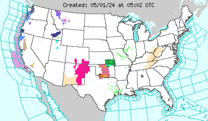
Busy day today and another, more busy day tomorrow. Now it looks like it will be primarily be an ice event for far southern Wisconsin with a major snow storm for central and northern Wisconsin. Could get over a half an inch of ice here with 12-15 inches of snow north. Extremeweatherguy, looking at that national NWS map gets me excited 
0 likes
-
Pebbles

- S2K Supporter

- Posts: 1994
- Joined: Tue Jul 08, 2003 1:42 pm
- Location: New Lenox, IL (SW of Chicago)
Re: Major Winter Storm/Blizzard Potential for this Weekend
I just drove on I80 from orland park to the new I355 extention. It is definately freezing rain here and very icy on the roads. Saw several cars and a pickup slide through red light intersections. There are already many reports of accidents in the Chicago/Joliet area. We are home for the rest of the day. We live only a few blocks south from where the new I355 extension ends and meets I80.
0 likes


-
Aquawind

- Category 5
- Posts: 6714
- Age: 62
- Joined: Mon Jun 16, 2003 10:41 pm
- Location: Salisbury, NC
- Contact:
Snowy night in Wisconsin with lotsa Heavy snow already falling.. 
Click on DHL.. 1/4 mile and snow in Sodak yet.
http://www.rap.ucar.edu/weather/surface/
Click on DHL.. 1/4 mile and snow in Sodak yet.
http://www.rap.ucar.edu/weather/surface/
0 likes

-
Aquawind
- Category 5
- Posts: 6714
- Age: 62
- Joined: Mon Jun 16, 2003 10:41 pm
- Location: Salisbury, NC
- Contact:
Re: Major Winter Storm/Blizzard Potential for this Weekend
Yep.. my bad. Duluth and many areas around..it's a big storm.
0 likes

Both the terms Blizzard and 12+ inches of snow have started showing up in the Maine forecasts as well due to an expected coastal redevelopment.
http://www.weather.gov/view/prodsByStat ... discussion
First major storm is often rough because people aren't prepared and forget how to (not) drive in the snow.
http://www.weather.gov/view/prodsByStat ... discussion
First major storm is often rough because people aren't prepared and forget how to (not) drive in the snow.
0 likes
-
Pebbles
- S2K Supporter
- Posts: 1994
- Joined: Tue Jul 08, 2003 1:42 pm
- Location: New Lenox, IL (SW of Chicago)
Re: Major Winter Storm/Blizzard Potential for this Weekend
Anyone wanna come iceskate on my driveway? 
PRELIMINARY LOCAL STORM REPORT
NATIONAL WEATHER SERVICE CHICAGO/ROMEOVILLE IL
652 PM CST SAT DEC 01 2007
.TIME... ...EVENT... ...CITY LOCATION... ...LAT.LON .DATE... ....MAG.... ..COUNTY LOCATION..ST.. ...SOURCE. ..REMARKS.. 0643 PM
ICE STORM NEW LENOX 41.52N 87.98W 12/01/2007 WILL IL TRAINED SPOTTER 0.40 INCHES OF ICE ACCUMULATION FROM FREEZING RAIN.
0 likes
Who is online
Users browsing this forum: Brent and 49 guests