
Jb underestimated the El Nino from the very beginning and believed in very hard crash of it by now, neither of which worked out. He kept insisting it would not be a super Nino and intended a 1.2-1.5C event.
That said, any winter it would be ill advised to give up on winter before Feb as last year and many years have proven (bipolar wxman57) and really until the second week of March.
Texas Winter 2015-2016
Moderator: S2k Moderators
Forum rules
 The posts in this forum are NOT official forecast and should not be used as such. They are just the opinion of the poster and may or may not be backed by sound meteorological data. They are NOT endorsed by any professional institution or STORM2K.

The posts in this forum are NOT official forecast and should not be used as such. They are just the opinion of the poster and may or may not be backed by sound meteorological data. They are NOT endorsed by any professional institution or STORM2K.
Re: Texas Winter 2015-2016
0 likes
The above post and any post by Ntxw is NOT an official forecast and should not be used as such. It is just the opinion of the poster and may or may not be backed by sound meteorological data. It is NOT endorsed by any professional institution including Storm2k. For official information, please refer to NWS products.
Help support Storm2K!
-
wxman57

- Moderator-Pro Met

- Posts: 23175
- Age: 68
- Joined: Sat Jun 21, 2003 8:06 pm
- Location: Houston, TX (southwest)
Re: Texas Winter 2015-2016
Portastorm wrote:If anyone had doubts about the GFS' ability to handle the current pattern ... just compare the overnight 0z op run with the just issued 12z run. Look at the surface low depiction for this weekend over Texas. The 0z run had the surface low just west of Austin. The 12z run has it 125 miles south of Brownsville. What's a difference of 400-some miles between friends, right?!
What time frame, Portastorm? I'm seeing a similar double low structure in both the 00Z and 12Z GFS, though there are slight differences. But I still see a lot of run-to-run differences in the GFS. It isn't handling this pattern well. Not unless it forecasts temps in the 80s will I believe it beyond about 3 days.
HA! Heatmiser avatar has returned!
12Z Today:

00Z Last Evening:

0 likes

Re: Texas Winter 2015-2016
orangeblood wrote:Great Article explaining our frustrations with the GFS, why the Euro is King, and why the lack of leadership and vision has hindered the GFS from earning the throne!!!
http://scitation.aip.org/content/aip/magazine/physicstoday/article/69/1/10.1063/PT.3.3046
Realistically, the problem boils down to Congress and funding. The ONLY reason NOAA got the money to buy two new Cray's was because it was attached to the bill for Sandy relief. Had it not been for that, NCEP is probably still running solely on old IBM Power 4 or Power 5 series systems today. There are some very good points in there, primarily the discussion of legacy products. With everything tied to the GFS run, they cannot significantly change the GFS code without causing significant trickle down effects. Consolidation of IT resources often makes financial sense, but is terrible for science. This is one glaring example of that.
0 likes
The above post and any post by dhweather is NOT an official forecast and should not be used as such. It is just the opinion of the poster and may or may not be backed by sound meteorological data. It is NOT endorsed by any professional institution including storm2k.org. For official information, please refer to NWS products.
-
Portastorm

- Storm2k Moderator

- Posts: 9955
- Age: 63
- Joined: Fri Jul 11, 2003 9:16 am
- Location: Round Rock, TX
- Contact:
Re: Texas Winter 2015-2016
wxman57, I am disturbed that Heat Miser has returned. You are now guilty of piling it on. Where's the flag?! 
The period in question to which I was referring was 18z Saturday. Here is the 0z GFS followed by the 12z GFS.


The period in question to which I was referring was 18z Saturday. Here is the 0z GFS followed by the 12z GFS.
0 likes
Any forecasts under my name are to be taken with a grain of salt. Get your best forecasts from the National Weather Service and National Hurricane Center.
-
wxman57
- Moderator-Pro Met
- Posts: 23175
- Age: 68
- Joined: Sat Jun 21, 2003 8:06 pm
- Location: Houston, TX (southwest)
Re: Texas Winter 2015-2016
Those two maps are pretty similar. Both have a low in the Austin area, though one has it deeper than the other. Precip areas are similar. Neither indicates much of anything in the D-FW area. Cold rain with possibly a few snow flakes mixed in near the end.
12Z Euro keeps the snow NW of Dallas-Ft. Worth. Very light, too.
12Z Euro keeps the snow NW of Dallas-Ft. Worth. Very light, too.
0 likes
-
orangeblood
- S2K Supporter

- Posts: 3895
- Joined: Tue Dec 15, 2009 6:14 pm
- Location: Fort Worth, TX
Re: Texas Winter 2015-2016
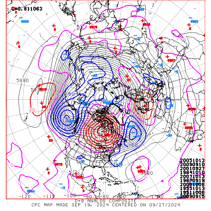
Yikes!!!  1998 is all over the 6-10 and 8-14 day analogs.....very depressing for winter weather lovers!!!
0 likes
-
wxman57
- Moderator-Pro Met
- Posts: 23175
- Age: 68
- Joined: Sat Jun 21, 2003 8:06 pm
- Location: Houston, TX (southwest)
Re: Texas Winter 2015-2016
orangeblood wrote:Yikes!!!
Sorry that all of you have to suffer at the hands of the few that insulted me. The Heat Miser has arisen!
0 likes
-
TheProfessor

- Professional-Met

- Posts: 3506
- Age: 29
- Joined: Tue Dec 03, 2013 10:56 am
- Location: Wichita, Kansas
Re: Texas Winter 2015-2016
0 likes
An alumnus of The Ohio State University.
Your local National Weather Service office is your best source for weather information.
Your local National Weather Service office is your best source for weather information.
-
srainhoutx

- S2K Supporter
- Posts: 6919
- Age: 68
- Joined: Sun Jan 14, 2007 11:34 am
- Location: Haywood County, NC
- Contact:
Re: Texas Winter 2015-2016
Yet the top Analog year 1960 delivered one of the heaviest snowfall recorded in Houston on February 12th. Dug out an old black and white photo of me playing in the snow from that event... 
0 likes
Carla/Alicia/Jerry(In The Eye)/Michelle/Charley/Ivan/Dennis/Katrina/Rita/Wilma/Ike/Harvey
Member: National Weather Association
Wx Infinity Forums
http://wxinfinity.com/index.php
Facebook.com/WeatherInfinity
Twitter @WeatherInfinity
Member: National Weather Association
Wx Infinity Forums
http://wxinfinity.com/index.php
Facebook.com/WeatherInfinity
Twitter @WeatherInfinity
Re: Texas Winter 2015-2016
TheProfessor wrote::uarrow: This is why you don't poke a sleeping bear.
Sleeping? This bear has been growling and clawing for months now. He needs to sleep but the temps have been too warm to hibernate. The warm weather has just made him more hungry and restless. Only a Fab Feb can rescue us from the deep claw clinches of the warm loving bear beast.
0 likes
-
orangeblood
- S2K Supporter
- Posts: 3895
- Joined: Tue Dec 15, 2009 6:14 pm
- Location: Fort Worth, TX
Re: Texas Winter 2015-2016
srainhoutx wrote:Yet the top Analog year 1960 delivered one of the heaviest snowfall recorded in Houston on February 12th. Dug out an old black and white photo of me playing in the snow from that event...
Giving the ENSO state, 1998 analog fits much better than 1960....does it not ? I believe 1960 was a neutral to slightly negative ENSO
The Pacific fire hose is just crushing any Arctic Air that attempts to get into this pattern....
0 likes
-
northjaxpro

- S2K Supporter
- Posts: 8900
- Joined: Mon Sep 27, 2010 11:21 am
- Location: Jacksonville, FL
Re: Texas Winter 2015-2016
gpsnowman wrote:TheProfessor wrote::uarrow: This is why you don't poke a sleeping bear.
Sleeping? This bear has been growling and clawing for months now. He needs to sleep but the temps have been too warm to hibernate. The warm weather has just made him more hungry and restless. Only a Fab Feb can rescue us from the deep claw clinches of the warm loving bear beast.
LOL... I love this post. I really enjoy you all here on the Texas Thread every day! I love to see you all jokingly taking on the ole Heat Miser!
0 likes
NEVER, EVER SAY NEVER in the tropics and weather in general, and most importantly, with life itself!!
________________________________________________________________________________________
Fay 2008 Beryl 2012 Debby 2012 Colin 2016 Hermine 2016 Julia 2016 Matthew 2016 Irma 2017 Dorian 2019
________________________________________________________________________________________
Fay 2008 Beryl 2012 Debby 2012 Colin 2016 Hermine 2016 Julia 2016 Matthew 2016 Irma 2017 Dorian 2019
-
northjaxpro
- S2K Supporter
- Posts: 8900
- Joined: Mon Sep 27, 2010 11:21 am
- Location: Jacksonville, FL
Re: Texas Winter 2015-2016
orangeblood wrote:srainhoutx wrote:Yet the top Analog year 1960 delivered one of the heaviest snowfall recorded in Houston on February 12th. Dug out an old black and white photo of me playing in the snow from that event...
Giving the ENSO state, 1998 analog fits much better than 1960....does it not ? I believe 1960 was a neutral to slightly negative ENSO
The Pacific fire hose is just crushing any Arctic Air that attempts to get into this pattern....
Yes. I agree with you about this. Just have not been able to get a bonefide, true deep arctic air discharge to drive south down the Lee side of the Rockies so far to this juncture. Still have about 2/3 of the winter season remaining, so we will see if Mother Nature will bring about at least one Arctic High Pressure near the 1050 mb range in the coming weeks. The perfect setup is for one of those true Blue Norther fronts, anchored by a big Arctic High moving south out of Saskatchewan, to funnel cold, arctic air due south into Texas, as you all see often occur during some winter seasons.
0 likes
NEVER, EVER SAY NEVER in the tropics and weather in general, and most importantly, with life itself!!
________________________________________________________________________________________
Fay 2008 Beryl 2012 Debby 2012 Colin 2016 Hermine 2016 Julia 2016 Matthew 2016 Irma 2017 Dorian 2019
________________________________________________________________________________________
Fay 2008 Beryl 2012 Debby 2012 Colin 2016 Hermine 2016 Julia 2016 Matthew 2016 Irma 2017 Dorian 2019
-
Lagreeneyes03
- Category 2

- Posts: 610
- Joined: Mon Dec 09, 2013 10:53 am
- Location: Luxurious Lake Grapevine
Re: Texas Winter 2015-2016
wxman57 wrote:orangeblood wrote:Yikes!!!
Sorry that all of you have to suffer at the hands of the few that insulted me. The Heat Miser has arisen!
Can we get it a bit warmer? Any temp between 31-65 is just kind of a waste of oxygen haha! I'm voting for Winter Cancel and bring on 80 degrees at this point.
0 likes
I'm a Princess, not a forecaster.
-
Brent
- S2K Supporter
- Posts: 38777
- Age: 37
- Joined: Sun May 16, 2004 10:30 pm
- Location: Tulsa Oklahoma
- Contact:
Re: Texas Winter 2015-2016
FWD mentioning in the afd all snow possible north of I-20 Saturday....
0 likes
#neversummer

Re: Texas Winter 2015-2016
0 likes

Re: Texas Winter 2015-2016
Part of the afternoon package from NWS Fort Worth: 
AS THE UPPER LEVEL TROUGH MOVES THROUGH THE REGION ON
SATURDAY...IT IS EXPECTED TO GENERATE LIGHT PRECIPITATION ACROSS
MAINLY THE NORTHERN HALF OF THE CWA....BUT HAVE POPS ACROSS ALL OF
NORTH AND CENTRAL TEXAS SATURDAY AFTERNOON. ANY PRECIPITATION IS
EXPECTED TO EXIT THE REGION SATURDAY EVENING IF NOT BEFORE.
TEMPERATURES ALONG AND NORTH OF A LINE FROM COMANCHE TO HILLSBORO
TO ATHENS SUPPORT THE POTENTIAL FOR A RAIN/SNOW MIX. BETTER
CHANCES FOR SNOW TO MIX WITH RAIN ARE NORTH OF INTERSTATE 20...AND
IT CANNOT BE COMPLETELY RULED OUT THAT SOME LOCATIONS NORTH OF
I-20 MAY SEE A SMALL PERIOD OF A FULL CHANGEOVER TO ALL SNOW. AT
THIS TIME...SURFACE TEMPERATURES ARE EXPECTED TO REMAIN WELL ABOVE
FREEZING SO NO TRAVEL IMPACTS ARE EXPECTED...WITH ONE EXCEPTION
DISCUSSED BELOW. IT SEEMS FAR FETCHED TO SAY WE COULD SEE SNOW
WITH SURFACE TEMPERATURES WELL ABOVE FREEZING...BUT WE ARE
MONITORING THE TEMPERATURE TRENDS ABOVE THE SURFACE THAT ARE
FORECASTED TO BE COLD ENOUGH TO POSSIBLY SUPPORT SOME SNOW...AND
ALSO COLD AND HUMID ENOUGH IN THE SNOW GROWTH ZONE TO SUPPORT SNOW
DEVELOPMENT.
THE EXCEPTION MENTIONED ABOVE INVOLVES THE POTENTIAL FOR BANDING
WHICH COULD LEAD TO HIGHER PRECIPITATION RATES. DEPENDING ON THE
THERMAL PROFILE...THIS COULD MEAN MORE MODERATE RATES OF RAIN OR
POSSIBLY SNOWFALL. AN ANALYSIS OF CROSS SECTIONS INDICATES THERE
MAY BE ENOUGH VERTICAL LIFT ALONG THE FRONTAL ZONE TO CREATE SOME
BANDED AREAS OF EITHER SNOW OR RAIN. IF THIS HAPPENS...THIS COULD
RESULT IN WET BULBING OF NEAR SURFACE TEMPERATURES CLOSER TO 32
DEGREES WHICH IN TURN MAY RESULT IN MINOR SNOW ACCUMULATIONS
WITHIN BANDS OF HEAVIER PRECIPITATION. IF THE TEMPERATURES REMAIN
TOO WARM FOR SNOW...THEN THESE AREAS WOULD SEE HIGHER RAINFALL
TOTALS. ANY RAINFALL TOTALS ARE EXPECTED TO BE LESS THAN AN INCH
IN AREAS THAT MAY RECEIVE HIGHER RAINFALL RATES.
0 likes


Re: Texas Winter 2015-2016
It would be nice if we could get some more rain. It just doesn't look good for any significant rainfall over the next 7 days. Just a half an inch to an inch area wide is all I ask for. A good reminder that each Niño is different.
0 likes
Resident Rain Miser
I am a weather hobbyist living 3.5 miles south of Downtown Austin and in no way or fashion should anything I say concerning forecasts be taken seriously. Please check your local NWS for accurate weather forecasting and conditions.
I am a weather hobbyist living 3.5 miles south of Downtown Austin and in no way or fashion should anything I say concerning forecasts be taken seriously. Please check your local NWS for accurate weather forecasting and conditions.
Re: Texas Winter 2015-2016
JDawg512 wrote:It would be nice if we could get some more rain. It just doesn't look good for any significant rainfall over the next 7 days. Just a half an inch to an inch area wide is all I ask for. A good reminder that each Niño is different.
Things just moving to fast, a bunch of relatively small systems
0 likes
-
South Texas Storms

- Professional-Met
- Posts: 4261
- Joined: Thu Jun 24, 2010 12:28 am
- Location: Houston, TX
Re: Texas Winter 2015-2016
hriverajr wrote:JDawg512 wrote:It would be nice if we could get some more rain. It just doesn't look good for any significant rainfall over the next 7 days. Just a half an inch to an inch area wide is all I ask for. A good reminder that each Niño is different.
Things just moving to fast, a bunch of relatively small systems
Yep, we really need the flow pattern to slow down so that storm systems can dig into Mexico before moving across the state. The 12z Euro shows this happening late next week with heavy rainfall likely if it verifies.
0 likes
Who is online
Users browsing this forum: No registered users and 78 guests