https://s7.gifyu.com/images/SXIpY.gif
Moderator: S2k Moderators
 The posts in this forum are NOT official forecast and should not be used as such. They are just the opinion of the poster and may or may not be backed by sound meteorological data. They are NOT endorsed by any professional institution or STORM2K.


bubba hotep wrote:This is a complicated 500 mb setup, and the Euro is superior to the GFS in that arena. I'm hugging the Euro.


gatorcane wrote:GFS trend last 6 runs, less wintry precip for Texas:
https://i.postimg.cc/SKd1T6QG/gfs-mslp-pcpn-frzn-scus-fh126-trend.gif
orangeblood wrote:bubba hotep wrote:This is a complicated 500 mb setup, and the Euro is superior to the GFS in that arena. I'm hugging the Euro.
No doubt, GFS is a wild ride from now until about 48 hrs out. It happens without fail ever big winter weather event we’ve had!
Buckle up ladies and gentlemen!!
Gotwood wrote:Cloud cover going to play a huge role this week with temps.

txtwister78 wrote:The irony is we're getting perhaps a piece of energy from the developing main low to possibly come out faster and potentially bring some snow further south across CTX and the HC and then from there as you wait for the main system to come out, it's really a race against time because 18z while a few degrees colder also warms dew points faster with all the moisture overtaking the state out of the SW and so it's nowhere near as bullish across DFW as the Euro is. Still some things to sort out as we have another time period to watch Wednesday afternoon into evening via the models.

Gotwood wrote:Cloud cover going to play a huge role this week with temps.

orangeblood wrote:Gotwood wrote:Cloud cover going to play a huge role this week with temps.
Monday and Tuesday clear skies according to the NAM. Clouds don’t starting rolling in until Tuesday night
https://images.weatherbell.com/model/nam-218-all/scentus/total_cloud/1736013600/1736272800-FJexyfD4QGA.png


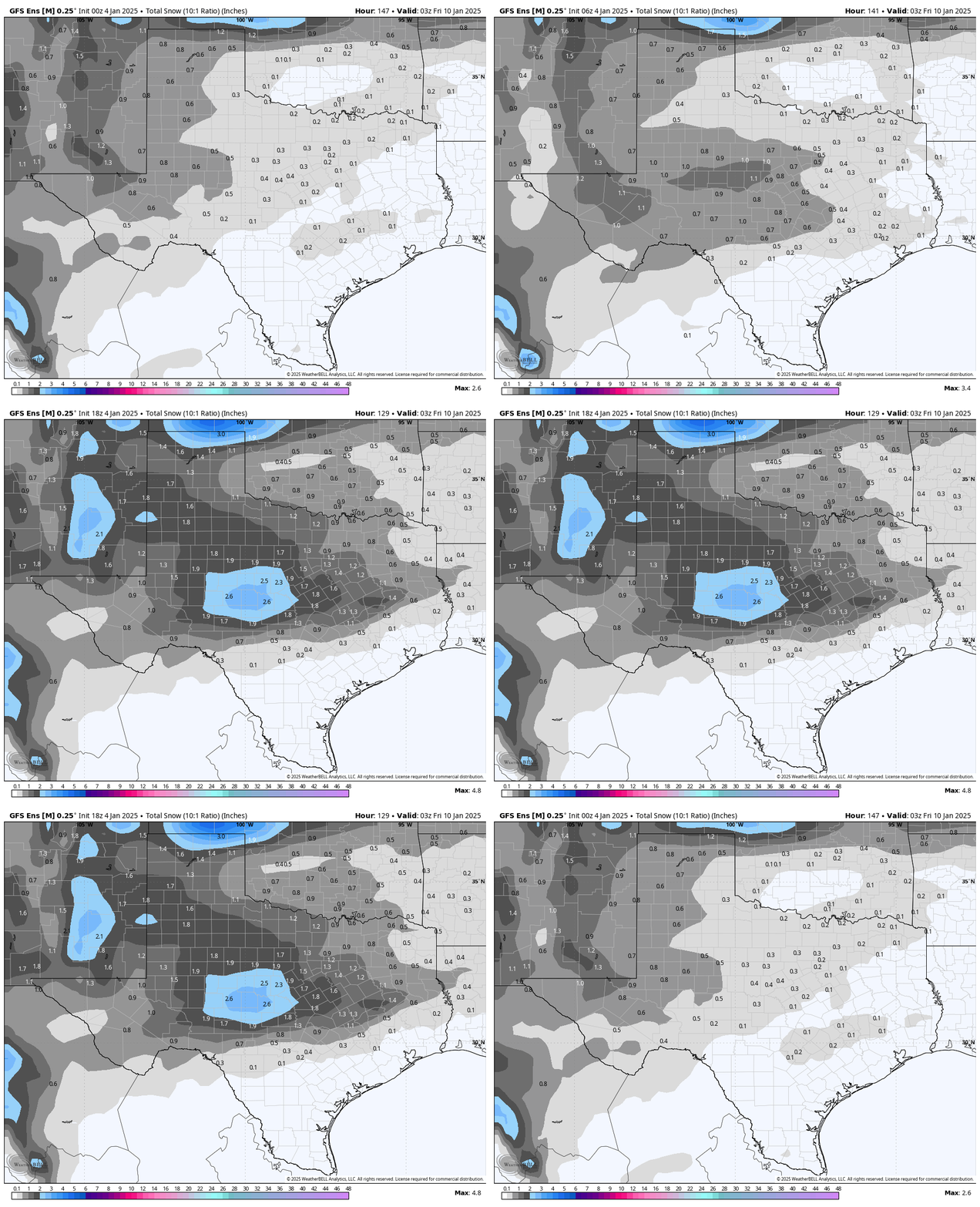
orangeblood wrote:18Z GEFS coming in much more aggressive with the storm system, now has over 1/2 of its members with a significant winter weather event this week across a big portion of Texas. Almost doubled up from 12Z

Ntxw wrote:Blizzard warnings for northeastern/eastern Kansas and just north of Kansas City. Quite a show up there.


cheezyWXguy wrote:txtwister78 wrote:The irony is we're getting perhaps a piece of energy from the developing main low to possibly come out faster and potentially bring some snow further south across CTX and the HC and then from there as you wait for the main system to come out, it's really a race against time because 18z while a few degrees colder also warms dew points faster with all the moisture overtaking the state out of the SW and so it's nowhere near as bullish across DFW as the Euro is. Still some things to sort out as we have another time period to watch Wednesday afternoon into evening via the models.
In addition to this, I’ve noticed that the last couple runs of the gfs have a secondary lobe at 500mb that revolves around the back side of our system as it starts to kick out towards us. I don’t know the ins and outs of why this results in a less favorable outcome, but I do notice that the runs that show this do result in lower accumulations or a greater coverage of cold rain, while the runs that show a weaker or nonexistent secondary lobe do not. I also can see that the gfs is on its own at this time with this development, and the cmc, icon, and euro don’t show it, and all give ntx a more favorable outcome. I guess this is something to watch.

Users browsing this forum: Brent, Stratton23 and 83 guests