 The posts in this forum are NOT official forecast and should not be used as such. They are just the opinion of the poster and may or may not be backed by sound meteorological data. They are NOT endorsed by any professional institution or


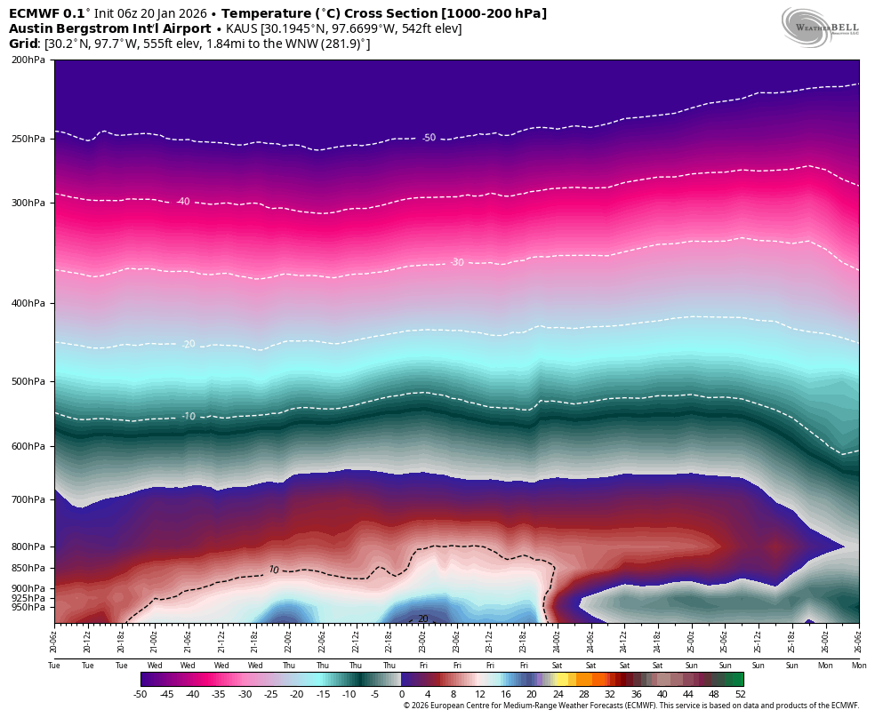
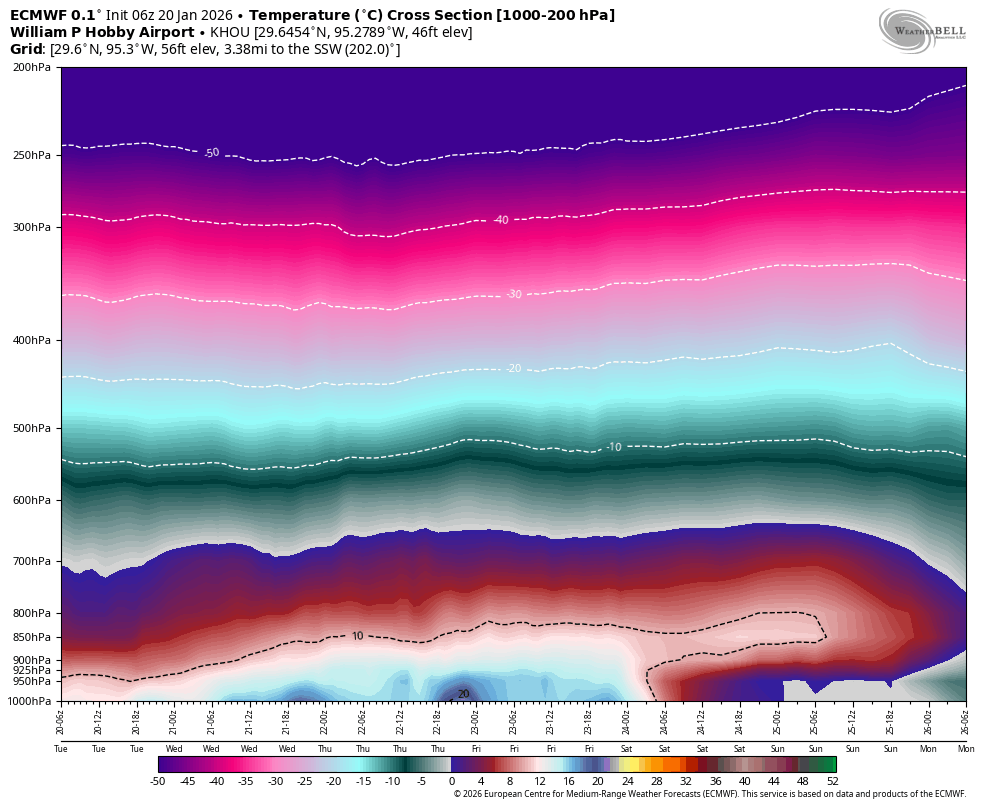
I plotted the 00Z models and 00Z snow and ZR forecasts (GFS & EC). As for temps in Houston, the Canadian remains way, way colder than any other model (blue lines) - down to 13F Mon and 14F Tue. General consensus is Houston temps dropping to freezing early Sunday morning and hovering in the 32-35 deg range all day Sunday. Precip ends by Sunday PM and temps drop to 26-29 on Monday. Possibly another light freeze Tuesday (31-33). This is for central Houston. Locations closer to GLS Bay may be a couple degrees warmer (except during the precip).
GFS Precip:
Freezing rain and sleet starting around 6am Sunday and ending by 6pm. It has 0.1 to 0.15" of ice accumulations, which is enough for some icy bridges/overpasses but not enough to cause power issues. Similar amounts SW LA to Baton Rouge area. Main core of freezing rain and sleet is from central Texas to central Louisiana to central MS, where it has 0.5" to 1.25" accumulating.
Snow starts in the TX Panhandle 9am Friday. Heaviest snow from SE New Mexico to the Red River (mostly on 9am Sat to 9am Sun). This includes 7-10" in the D-FW area. Only trace amounts down to the Waco area to north of Alexandria, LA.
ECMWF Precip:
Freezing rain and/or sleet starts Friday afternoon in north TX (not to D-FW area yet). Core of precip is just south of the D-FW area - from NW of Waco to just south of D-FW to Texarkana and along the AR/LA border to central MS. Ice totals between 1 inch and 1.75 inches in this area (severe ice storm). No freezing rain or sleet accumulations in Harris County, SW LA, or SE LA. Lower limit of ZR goes from near College Station to just south of Alexandria, LA. Just cold rain and an occasional sleet pellet for the Greater Houston area.
Heaviest snow central TX Panhandle to southern OK (north of Red River) then east to central Arkansas. Only trace amounts in the D-FW area. No snow southern Arkansas south to northern LA. Light snow extreme northern MS.
Main Differences
The main difference between the EC and GFS is with the core of ZR and snow. GFS is 75-100 miles south of the EC with both the heaviest snow and ZR/sleet. I think I'd favor the EC over the GFS, as the GFS tends to overdo such events and it may not handle the upper air pattern as well as the Euro.
https://wxman57.com/images/00ZJan20Models.jpg


 I dunno I wasn't even here the last time Tulsa had a foot haha(February 2011). That storm was apparently horrible here but it was also a full blown blizzard


