 The posts in this forum are NOT official forecast and should not be used as such. They are just the opinion of the poster and may or may not be backed by sound meteorological data. They are NOT endorsed by any professional institution or

orangeblood wrote:Stratton23 wrote:looking at the ensembles coming in now, I really dont see much in the way of a warm over the next 2-3 weeks, maybe a brief 1-2 day warmup after this next arctic front this weekend, but overall looks rather chilly these next couple of weeks, and already as we get into february the ensembles show the west coast ridging popping off into alaska again, but also a strong - NAO greenland block developing, in addition the models are trending toward possibly a big trough centered over the central US toward the end of the first week of february , all this to say is that winter is in firm control and looks to stay that way over the next 30-40 days
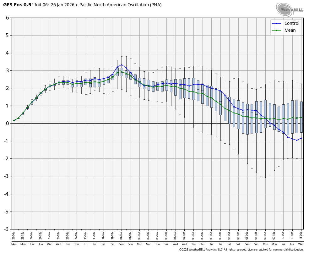
Agreed, dry cold looks to rule over the next 10 days (++PNA) but the end of week 2 is looking much better as we get the PNA to relax allowing systems to dig into the southwest US. Feb 10-20th is primed for winter weather in the south
PNA in the neutral range tends to be more favorable for the southern plains in these setups
https://images.weatherbell.com/oscillation/gfs-ensemble-all-avg/pna/box/1769407200-sGvi7DTpHHMgrb2.png
PNA too positive day 10 but relaxes end of week 2
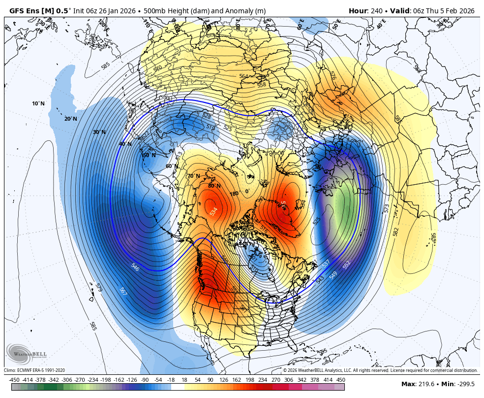
https://images.weatherbell.com/model/gfs-ensemble-all-avg/nhemi/z500_anom/1769407200/1770271200-9xsyaJdWqbE.png
Great looking 500 mb chart end of week 2
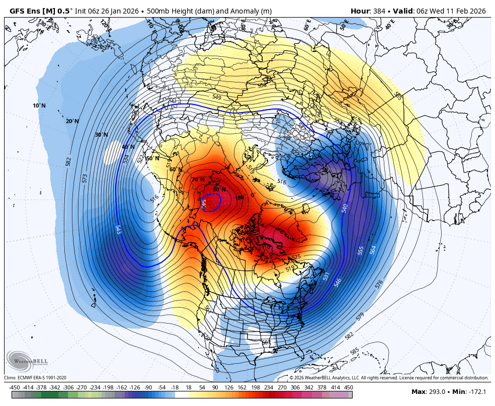
https://images.weatherbell.com/model/gfs-ensemble-all-avg/nhemi/z500_anom/1769407200/1770789600-iSf7U6I6Y8k.png
We will see for sure. Seems like the theme this winter looks good 2-3 weeks out only to go east again.


