Southern Plains winter wx thread (2009-2010)
Moderator: S2k Moderators
Forum rules
 The posts in this forum are NOT official forecast and should not be used as such. They are just the opinion of the poster and may or may not be backed by sound meteorological data. They are NOT endorsed by any professional institution or STORM2K.

The posts in this forum are NOT official forecast and should not be used as such. They are just the opinion of the poster and may or may not be backed by sound meteorological data. They are NOT endorsed by any professional institution or STORM2K.
-
Extremeweatherguy

- Category 5

- Posts: 11095
- Joined: Mon Oct 10, 2005 8:13 pm
- Location: Florida
-
random_in_okc
- Tropical Wave

- Posts: 3
- Joined: Thu Jan 28, 2010 9:39 am
-
lrak

- S2K Supporter

- Posts: 1770
- Age: 59
- Joined: Thu Jun 21, 2007 2:48 pm
- Location: Corpus Christi, TX
Re: Southern Plains winter wx thread (2009-2010)
Welcome to the forums, which airport is reporting heavy snow 
0 likes
AKA karl
Also
Personal Forecast Disclaimer:
My posts on this forum are NOT official forecast and should not be used as such. My posts are my basic observations and are definitely not backed by any "well some" meteorological knowledge. For official information, please refer to the NHC and NWS products.
Also
Personal Forecast Disclaimer:
My posts on this forum are NOT official forecast and should not be used as such. My posts are my basic observations and are definitely not backed by any "well some" meteorological knowledge. For official information, please refer to the NHC and NWS products.
-
random_in_okc
- Tropical Wave
- Posts: 3
- Joined: Thu Jan 28, 2010 9:39 am
Re: Southern Plains winter wx thread (2009-2010)
lrak wrote:Welcome to the forums, which airport is reporting heavy snow
will rogers
0 likes
-
Extremeweatherguy
- Category 5
- Posts: 11095
- Joined: Mon Oct 10, 2005 8:13 pm
- Location: Florida
No significant accumulations here just south of OKC, but it has been snowing on and off for most of the morning. It is mainly just drizzle right now but it looks like another snow band is moving in as I type this. Behind this band though it seems like a decent break may be on the way, with the question becoming what develops later today? The forecast calls for more significant snow bands later this afternoon, but I guess we will just have to wait and see what happens.
0 likes


-
vbhoutex

- Storm2k Executive

- Posts: 29145
- Age: 74
- Joined: Wed Oct 09, 2002 11:31 pm
- Location: Cypress, TX
- Contact:
Re:
RNGR wrote:thats either super heavy rain, false return, or CRAZY snow around Little Rock.. temps look to be around freezing
Probably a mix of sleet and snow. Normally when we see yellow like that on radar in a cold regime it that we think would produce snow it is sleet.
0 likes
Skywarn, C.E.R.T.
Please click below to donate to STORM2K to help with the expenses of keeping the site going:

Please click below to donate to STORM2K to help with the expenses of keeping the site going:
-
Extremeweatherguy
- Category 5
- Posts: 11095
- Joined: Mon Oct 10, 2005 8:13 pm
- Location: Florida
Beyond today's system, Thursday is starting to also look quite interesting in terms of winter weather. For the southern half of Oklahoma, the upcoming system on Thursday has the potential to be much more significant than the current storm IMO. The 12z GFS is generating snowfall totals of 5.1" in Oklahoma City, 6.6" in Norman, and 4.3" in Ardmore during the day on Thursday. Areas south of the Red River into north Texas might get hit the hardest though. The GFS is showing upwards of 8" in parts of that region! Needless to say, amounts that high in north Texas would be fairly incredible.
Overall, here is a nice summary of what to expect...
~ Another system is looking likely to impact the southern plains on Thursday.
~ Snow is the most likely precipitation type north of I-20 with rain/snow/sleet mixing possible all the way to I-10 deep into Texas.
~ For areas south of I-40, the Thursday storm will likely be more significant than today's.
~ Some areas between I-20 and I-40 could pick up over 6" of snow, with a few 8"+ areas not out of the question, especially south of the Red River.
Stay tuned!
0 likes
-
Extremeweatherguy
- Category 5
- Posts: 11095
- Joined: Mon Oct 10, 2005 8:13 pm
- Location: Florida
As for the current storm --> We are getting another nice little snow band now south of OKC. No significant accumulations here yet though, and it looks like time might be running out for much more than a dusting or possibly up to an inch from this storm. Just north of here though, towards downtown OKC and north and west of the city, it is a different story though. Many in that area have already picked up 1-2"+ today based on various reports I have seen..most of that due to the extremely heavy band they experienced earlier this morning.
0 likes
-
Extremeweatherguy
- Category 5
- Posts: 11095
- Joined: Mon Oct 10, 2005 8:13 pm
- Location: Florida
The Norman NWS just decided to cancel the WWA for our area.
All in all this system was not too exciting for my part of town. We might still pull off a dusting before it is all over with, but even that looks questionable with temperatures still just above freezing. In the end it looks like the models (GFS and NAM) were actually fairly accurate in their output for our area over the last few days. They were a little too warm, but overall their forecast of little to no snow accumulation seems to have played out pretty well (except for those few spots that happened to receive the 1-2"+ amounts with this morning's heavy band).
All in all this system was not too exciting for my part of town. We might still pull off a dusting before it is all over with, but even that looks questionable with temperatures still just above freezing. In the end it looks like the models (GFS and NAM) were actually fairly accurate in their output for our area over the last few days. They were a little too warm, but overall their forecast of little to no snow accumulation seems to have played out pretty well (except for those few spots that happened to receive the 1-2"+ amounts with this morning's heavy band).
0 likes
-
Extremeweatherguy
- Category 5
- Posts: 11095
- Joined: Mon Oct 10, 2005 8:13 pm
- Location: Florida
18z model cobb output snowfall totals for the late week storm...
18z NAM (through 12am Friday)
Oklahoma City, OK = 4.3"
Norman, OK = 2.6"
Ardmore, OK = 1.9"
Fort Worth, TX = 1.0"
Dallas, TX = 1.1"
18z GFS
Oklahoma City, OK = 0.8"
Norman, OK = 1.0"
Ardmore, OK = 0.8"
Fort Worth, TX = 0.0"
Dallas, TX = 0.0"
http://www.meteor.iastate.edu/~ckarsten ... index.html
UPDATE: The 00z models look much less promising for Oklahoma, showing just some flurries with may be a few areas of very light accumulations (dusting to 1").
Last edited by Extremeweatherguy on Mon Feb 08, 2010 11:06 pm, edited 1 time in total.
0 likes

-
Extremeweatherguy
- Category 5
- Posts: 11095
- Joined: Mon Oct 10, 2005 8:13 pm
- Location: Florida
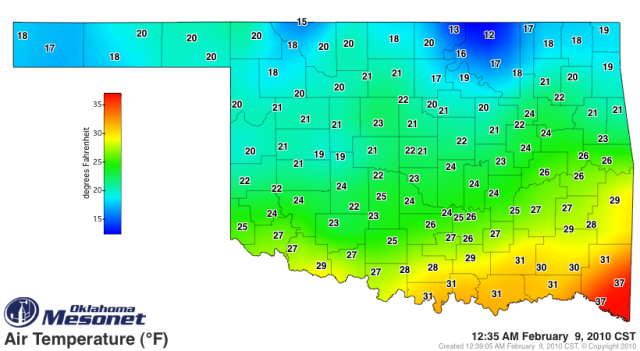
It got very chilly here tonight after the strong front pushed through. We went from low-mid 30s for most of the day down to temperatures in the lower 20s now with wind chills in the single digits!
Brrr.
By sunrise we will probably be into the teens with wind chills hovering in the vicinity 0-5F. Winter is obviously nowhere near over for the southern plains just yet!
Brrr.
By sunrise we will probably be into the teens with wind chills hovering in the vicinity 0-5F. Winter is obviously nowhere near over for the southern plains just yet!
0 likes


Contrary, euro and canadian looks wetter\colder compared to the GFS and NAM. Though I have difficulty reading those models. Correct me if Im wrong.
0 likes
The above post and any post by Ntxw is NOT an official forecast and should not be used as such. It is just the opinion of the poster and may or may not be backed by sound meteorological data. It is NOT endorsed by any professional institution including Storm2k. For official information, please refer to NWS products.
Help support Storm2K!
-
BlueIce
- S2K Supporter
- Posts: 194
- Age: 37
- Joined: Mon Sep 01, 2008 10:05 pm
- Location: Oklahoma City, Oklahoma
Re:
msstateguy83 wrote:this looks HUGE EWG i have to agree. i also think portions of nw tx could even get in on this... i would expect this to rival the christmas eve blizzard!
Swing and a miss,
0 likes
-
Extremeweatherguy
- Category 5
- Posts: 11095
- Joined: Mon Oct 10, 2005 8:13 pm
- Location: Florida
Looking at the 00z NAM, it appears as though the Thursday event still needs to be watched very closely across the southern half of Oklahoma. The latest run is developing some decent snow bands from the I-40 corridor southward during the Thursday afternoon through Friday morning period. Depending on where and if these bands set up, some parts of the state could potentially pick up a couple of inches of snow out of this.
12PM THURS (simulated radar):

6PM THURS (simulated radar):

12AM FRI (simulated radar):

6AM FRI (simulated radar):

Storm QPF:

If a 10:1 snow ratio played out and there was no melting, then that would equate to 3-8" of snow near the Red River, and 1-5" of snow between the Red River and I-40. Areas north of I-40 would generally get an inch or less.
12PM THURS (simulated radar):
6PM THURS (simulated radar):
12AM FRI (simulated radar):
6AM FRI (simulated radar):
Storm QPF:
If a 10:1 snow ratio played out and there was no melting, then that would equate to 3-8" of snow near the Red River, and 1-5" of snow between the Red River and I-40. Areas north of I-40 would generally get an inch or less.
0 likes
-
Extremeweatherguy
- Category 5
- Posts: 11095
- Joined: Mon Oct 10, 2005 8:13 pm
- Location: Florida
The 00z GFS is not quite as impressive as the NAM for Oklahoma, but still shows the potential for some good snows in the counties bordering the Red River. Up here closer to I-40 it looks like the GFS is just showing a few flurries or very light snow showers at best, with perhaps only a dusting of accumulation or less in most places.

0 likes
EWG take a look at the energy coming down from Canada associated with the potential clipper mentioned for the northeast. GFS is having a hard time with it. HPC few days ago mentioned this effecting the mid-atlantic region with this storm's track. NAM had this feature mingling with the southern storm at the red river valley. Could be interesting.
Last edited by Ntxw on Tue Feb 09, 2010 11:26 pm, edited 1 time in total.
0 likes
The above post and any post by Ntxw is NOT an official forecast and should not be used as such. It is just the opinion of the poster and may or may not be backed by sound meteorological data. It is NOT endorsed by any professional institution including Storm2k. For official information, please refer to NWS products.
Help support Storm2K!
Help support Storm2K!
-
Extremeweatherguy
- Category 5
- Posts: 11095
- Joined: Mon Oct 10, 2005 8:13 pm
- Location: Florida
-
Extremeweatherguy
- Category 5
- Posts: 11095
- Joined: Mon Oct 10, 2005 8:13 pm
- Location: Florida
The latest NAM looks slightly less favorable for significant snows (more than a dusting of accumulation) reaching I-40, however it does still indicate a chance of accumulating snows as you get closer to the Red River..
24-hr QPF valid 6am Friday:

If this run played out exactly, then the southern two tiers of counties bordering the Red River could perhaps pick up 2-3+ inches of snow during the day on Thursday. Further north, toward I-40, it would be mostly just some scattered flurries or light snow showers during the late afternoon and evening with most areas only picking up an inch or less of accumulation. North of I-40 the snow intensity would drop off dramatically, with only a few flurries here and there and no accumulations (expect may be a dusting in the eastern part of the state).
24-hr QPF valid 6am Friday:
If this run played out exactly, then the southern two tiers of counties bordering the Red River could perhaps pick up 2-3+ inches of snow during the day on Thursday. Further north, toward I-40, it would be mostly just some scattered flurries or light snow showers during the late afternoon and evening with most areas only picking up an inch or less of accumulation. North of I-40 the snow intensity would drop off dramatically, with only a few flurries here and there and no accumulations (expect may be a dusting in the eastern part of the state).
0 likes
Who is online
Users browsing this forum: No registered users and 124 guests