Texas winter wx thread (2009-2010)

Winter Weather Discussion

Moderator: S2k Moderators

Forum rules

The posts in this forum are NOT official forecast and should not be used as such. They are just the opinion of the poster and may or may not be backed by sound meteorological data. They are NOT endorsed by any professional institution or STORM2K.

Help Support Storm2K
Message
Author
User avatar
srainhoutx
S2K Supporter
S2K Supporter
Posts: 6919
Age: 67
Joined: Sun Jan 14, 2007 11:34 am
Location: Haywood County, NC
Contact:

Re: Texas winter wx thread (2009-2010)

#7661 Postby srainhoutx » Fri Feb 19, 2010 11:02 am

Portastorm wrote:
srainhoutx wrote:You can already see that a supressed solution is coming via the 12Z GFS. The NAM shifts everything S in CA and it appears the GFS is following the trend as well. :wink:


Yep srainhoutx, even through 78 hrs, the 12z GFS is looking a lot like its 0z run. I like the trend! :cheesy:


MODEL DIAGNOSTIC DISCUSSION
NWS HYDROMETEOROLOGICAL PREDICTION CENTER CAMP SPRINGS MD
1031 AM EST FRI FEB 19 2010

VALID FEB 19/1200 UTC THRU FEB 23/0000 UTC


...SEE NOUS42 KWNO ADMNFD FOR THE STATUS OF THE UPPER AIR
INGEST...

12Z NAM EVALUATION

ANY INITIALIZATION ERRORS WITH THE NAM DO NOT APPEAR TO
SIGNIFICANTLY IMPACTS ITS SOLUTION.

...SHORTWAVE TROUGH EXITING THE CNTRL PLAINS...

SURFACE AND UPPER AIR PREDICTIONS OF THIS SYSTEM ARE COMPARABLE
AMONG THE GUIDANCE...INCLUDING THE NAM...WITH THE SYSTEM QUICKLY
DE-AMPLIFYING AS IT REACHES THE OHIO VALLEY BY SATURDAY...

...SHORTWAVE TROUGH OVER THE W. GULF OF MEXICO...

THE NAM IS SIMILAR TO THE 06Z GFS AND 00Z ECMWF AS THE SYSTEM
PROGRESSES ACROSS THE REMAINDER OF THE GULF OF MEXICO AND FLORIDA
BY SATURDAY...WITH MOSTLY DETAIL DIFFERENCES TO CONSIDER.

...UPPER LOW REACHING S. CALIFORNIA SAT...
...LOW PRESSURE MOVING FROM THE S. PLAINS TO THE OH VALLEY
SUN/MON...

THE NAM HAS TRENDED CONSIDERABLY FARTHER SOUTH REACHING
CALIFORNIA/ARIZONA FROM 24 HRS AGO AND NOW SHOWS GOOD AGREEMENT
WITH THE 06Z GFS/00Z ECMWF TRACKING ACROSS THE SOUTHERN ROCKIES
THROUGH SAT NGT. LATER AS THE LOW REACHES THE PLAINS...BECAUSE THE
GFS IS FARTHER SOUTH WITH THE EVOLVING UPPER TROUGH OVER THE N.
ROCKIES...IT PRODUCES STRONGER MID/UPPER LEVEL CONFLUENCE
DOWNSTREAM...
THUS CAUSING THE GFS TO PRODUCE A WEAKER AND GENERALLY MORE
SUPPRESSED SURFACE LOW TRACK THROUGH THE PLAINS/MID/WEST/OHIO
VALLEY LATER IN THE PERIOD. OTHERWISE...THE NAM IS STRONGER AND
SLIGHTLY NORTH OF THE ECMWF TRACKING THE LOW ACROSS THESE
REGIONS...BUT OTHERWISE SIMILAR IN SPEED.

...UPPER LOW EVOLVING OVER THE N. ROCKIES/GREAT BASIN SAT-MON...

THE NAM IS SIMILAR TO THE 00Z ECMWF IN ALLOWING A SMALL UPPER LOW
TO FORM OVER IDAHO BY SATURDAY THEN DRIFT WESTWARD BENEATH THE
WESTERN CANADIAN UPPER HIGH BEFORE MERGING WITH A SECOND UPPER LOW
THAT REACHES N. CALIFORNIA EARLY MONDAY. THE MAIN DIFFERENCE
BETWEEN THE SOLUTIONS DEVELOPS LATE IN THE PERIOD...WITH THE NAM
MAINTAINING A STRONGER LOW OVER CALIFORNIA AND THE GREAT BASIN AND
MOVING IT MORE SOUTHWARD BY 84 HRS COMPARED TO THE ECMWF.
MEANWHILE...THE 06Z GFS IS WEAKER AND MORE EASTWARD WITH THE LOW
FORMING OVER IDAHO AND INCORPORATES LITTLE IF ANY OF THE LOW
APPROACHING CALIFORNIA. THE GFS ALSO SPLITS THE WEAK LOW INTO TWO
COMPONENTS LATE IN THE PERIOD...WITH THE MOST SOUTHWARD COMPONENT
REACHING ARIZONA BY LATE MONDAY.

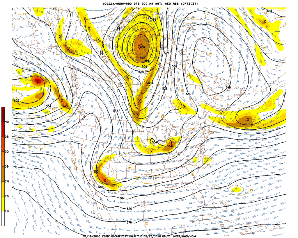
...MODEL TREND GRAPHICS AT
http://WWW.HPC.NCEP.NOAA.GOV/HTML/MODEL2.SHTML...

...500 MB FORECASTS AT
http://WWW.HPC.NCEP.NOAA.GOV/H5PREF/H5PREF.SHTML...

JAMES
0 likes   
Carla/Alicia/Jerry(In The Eye)/Michelle/Charley/Ivan/Dennis/Katrina/Rita/Wilma/Ike/Harvey

Member: National Weather Association
Wx Infinity Forums
http://wxinfinity.com/index.php

Facebook.com/WeatherInfinity
Twitter @WeatherInfinity

User avatar
Ntxw
Storm2k Moderator
Storm2k Moderator
Posts: 22791
Joined: Wed Oct 21, 2009 6:34 pm
Location: DFW, Texas

#7662 Postby Ntxw » Fri Feb 19, 2010 11:03 am

Someone is about to get blasted via the GFS...oh the agony! *hints at Portastorm*
0 likes   
The above post and any post by Ntxw is NOT an official forecast and should not be used as such. It is just the opinion of the poster and may or may not be backed by sound meteorological data. It is NOT endorsed by any professional institution including Storm2k. For official information, please refer to NWS products.

  Help support Storm2K!
Help Support Storm2K

Nederlander
S2K Supporter
S2K Supporter
Posts: 1250
Joined: Sat Jul 19, 2008 4:28 pm
Location: Conroe, TX

Re: Texas winter wx thread (2009-2010)

#7663 Postby Nederlander » Fri Feb 19, 2010 11:05 am

looking slightly wetter than the previous run through 90 hrs.. this requires so much patience lol
0 likes   

User avatar
Portastorm
Storm2k Moderator
Storm2k Moderator
Posts: 9914
Age: 63
Joined: Fri Jul 11, 2003 9:16 am
Location: Round Rock, TX
Contact:

Re:

#7664 Postby Portastorm » Fri Feb 19, 2010 11:06 am

Ntxw wrote:Someone is about to get blasted via the GFS...oh the agony! *hints at Portastorm*


Dude ... if I get a snowmageddon next week, everyone's invited to my house for a big party!! :lol: Of course, I'll have to run this idea past HQ (the wife) first. :wink:

(Portastorm eagerly awaiting more of the 12z GFS run)
0 likes   

User avatar
Ntxw
Storm2k Moderator
Storm2k Moderator
Posts: 22791
Joined: Wed Oct 21, 2009 6:34 pm
Location: DFW, Texas

Re: Texas winter wx thread (2009-2010)

#7665 Postby Ntxw » Fri Feb 19, 2010 11:06 am

Doesn't look too different from 0z. We now have a stretch of runs to use as somewhat consistency! Not Quite snowmageddon for Austin, but enough to make your winter. Of course it could change between now and then :wink:. Area between DFW to Waco looks prime from the latest GFS runs.

Image

Image

Image
Last edited by Ntxw on Fri Feb 19, 2010 11:10 am, edited 3 times in total.
0 likes   
The above post and any post by Ntxw is NOT an official forecast and should not be used as such. It is just the opinion of the poster and may or may not be backed by sound meteorological data. It is NOT endorsed by any professional institution including Storm2k. For official information, please refer to NWS products.


  Help support Storm2K!

Help Support Storm2K


User avatar
srainhoutx
S2K Supporter
S2K Supporter
Posts: 6919
Age: 67
Joined: Sun Jan 14, 2007 11:34 am
Location: Haywood County, NC
Contact:

Re: Texas winter wx thread (2009-2010)

#7666 Postby srainhoutx » Fri Feb 19, 2010 11:06 am

PNA holds... :cheesy:

Image
0 likes   
Carla/Alicia/Jerry(In The Eye)/Michelle/Charley/Ivan/Dennis/Katrina/Rita/Wilma/Ike/Harvey

Member: National Weather Association
Wx Infinity Forums
http://wxinfinity.com/index.php

Facebook.com/WeatherInfinity
Twitter @WeatherInfinity

User avatar
Portastorm
Storm2k Moderator
Storm2k Moderator
Posts: 9914
Age: 63
Joined: Fri Jul 11, 2003 9:16 am
Location: Round Rock, TX
Contact:

Re: Texas winter wx thread (2009-2010)

#7667 Postby Portastorm » Fri Feb 19, 2010 11:09 am

Yeah, I totally agree guys ... it looks A LOT like the 0z run.

I would guess the area from Midland/Odessa southeast to San Antonio, northeast to Houston's northern 'burbs up to Tyler and back west to Midland/Odessa all would see at least some wintry precip if this verifies.
0 likes   

Nederlander
S2K Supporter
S2K Supporter
Posts: 1250
Joined: Sat Jul 19, 2008 4:28 pm
Location: Conroe, TX

Re: Texas winter wx thread (2009-2010)

#7668 Postby Nederlander » Fri Feb 19, 2010 11:11 am

very nice consistency with the few runs.. would like to see the ECMWF jump on board and push this thing a little further south..
0 likes   

User avatar
Ntxw
Storm2k Moderator
Storm2k Moderator
Posts: 22791
Joined: Wed Oct 21, 2009 6:34 pm
Location: DFW, Texas

Re: Texas winter wx thread (2009-2010)

#7669 Postby Ntxw » Fri Feb 19, 2010 11:13 am

Nederlander wrote:very nice consistency with the few runs.. would like to see the ECMWF jump on board and push this thing a little further south..


I'm rootin for ya. I think the best chance for that would be a gulf low\trough forming off the Texas coast. This run doesn't quite show that yet. Who knows it could happen!
0 likes   
The above post and any post by Ntxw is NOT an official forecast and should not be used as such. It is just the opinion of the poster and may or may not be backed by sound meteorological data. It is NOT endorsed by any professional institution including Storm2k. For official information, please refer to NWS products.


  Help support Storm2K!

Help Support Storm2K


User avatar
srainhoutx
S2K Supporter
S2K Supporter
Posts: 6919
Age: 67
Joined: Sun Jan 14, 2007 11:34 am
Location: Haywood County, NC
Contact:

Re: Texas winter wx thread (2009-2010)

#7670 Postby srainhoutx » Fri Feb 19, 2010 11:15 am

Looks mighty chilly as well behind the storm. Triple phaser is not out of the question for points E of TX via the GFS.
0 likes   
Carla/Alicia/Jerry(In The Eye)/Michelle/Charley/Ivan/Dennis/Katrina/Rita/Wilma/Ike/Harvey

Member: National Weather Association
Wx Infinity Forums
http://wxinfinity.com/index.php

Facebook.com/WeatherInfinity
Twitter @WeatherInfinity

WacoWx
Category 2
Category 2
Posts: 664
Joined: Mon Dec 28, 2009 4:14 pm
Location: NOT Waco, TX ----> Dallas, TX

Re: Texas winter wx thread (2009-2010)

#7671 Postby WacoWx » Fri Feb 19, 2010 11:16 am

Shoot, Hillsboro is just a hop skip and a jump away. but then again, so is Austin. Portastorm, lets root for a HUGE storm centered over Salado so we both get in on the action! :P
0 likes   

User avatar
Portastorm
Storm2k Moderator
Storm2k Moderator
Posts: 9914
Age: 63
Joined: Fri Jul 11, 2003 9:16 am
Location: Round Rock, TX
Contact:

Re: Texas winter wx thread (2009-2010)

#7672 Postby Portastorm » Fri Feb 19, 2010 11:17 am

WacoWx wrote:Shoot, Hillsboro is just a hop skip and a jump away. but then again, so is Austin. Portastorm, lets root for a HUGE storm centered over Salado so we both get in on the action! :P


There you go WacoWx ... brilliant idea!
0 likes   

User avatar
Ntxw
Storm2k Moderator
Storm2k Moderator
Posts: 22791
Joined: Wed Oct 21, 2009 6:34 pm
Location: DFW, Texas

#7673 Postby Ntxw » Fri Feb 19, 2010 11:18 am

srainhoutx wrote:Looks mighty chilly as well behind the storm. Triple phaser is not out of the question for points E of TX via the GFS.


I bet JB is going to hammer away on this morning's vids with the GFS run using his idea of a Dallas to DC winter track/cold :lol: . His hype has been fed well this winter.
Last edited by Ntxw on Fri Feb 19, 2010 11:20 am, edited 1 time in total.
0 likes   
The above post and any post by Ntxw is NOT an official forecast and should not be used as such. It is just the opinion of the poster and may or may not be backed by sound meteorological data. It is NOT endorsed by any professional institution including Storm2k. For official information, please refer to NWS products.


  Help support Storm2K!

Help Support Storm2K


Weatherdude20

Re: Texas winter wx thread (2009-2010)

#7674 Postby Weatherdude20 » Fri Feb 19, 2010 11:19 am

WacoWx wrote:Shoot, Hillsboro is just a hop skip and a jump away. but then again, so is Austin. Portastorm, lets root for a HUGE storm centered over Salado so we both get in on the action! :P


Off topic, I visit Salado alot, cute town! Lol, I didn't know people knew much about it, much less refrenced it lol.
0 likes   

Nederlander
S2K Supporter
S2K Supporter
Posts: 1250
Joined: Sat Jul 19, 2008 4:28 pm
Location: Conroe, TX

Re: Texas winter wx thread (2009-2010)

#7675 Postby Nederlander » Fri Feb 19, 2010 11:20 am

Ntxw wrote:
Nederlander wrote:very nice consistency with the few runs.. would like to see the ECMWF jump on board and push this thing a little further south..


I'm rootin for ya. I think the best chance for that would be a gulf low\trough forming off the Texas coast. This run doesn't quite show that yet. Who knows it could happen!


Well im ok with the amount of moisture we have to work with.. cold air just isnt quite getting down.. this looks to be our best shot here in far se tx...
Image

114 hr. (tue night/wed morning)
Last edited by Nederlander on Fri Feb 19, 2010 11:23 am, edited 2 times in total.
0 likes   

User avatar
wxman57
Moderator-Pro Met
Moderator-Pro Met
Posts: 22985
Age: 67
Joined: Sat Jun 21, 2003 8:06 pm
Location: Houston, TX (southwest)

Re: Texas winter wx thread (2009-2010)

#7676 Postby wxman57 » Fri Feb 19, 2010 11:21 am

txagwxman wrote:Impulse weak? GFS has 3-4" of snow south of DFW on Tuesday. The GFS is plenty cold for snow on Tue, it is the other models that we are having problems (ECMWF/GEM).


I'm just looking at the 06Z GFS raw data that forecasts less than 0.1" liquid precip at DFW on Tue-Wed. 12Z run looks a good bit wetter up there.
0 likes   

WacoWx
Category 2
Category 2
Posts: 664
Joined: Mon Dec 28, 2009 4:14 pm
Location: NOT Waco, TX ----> Dallas, TX

Re: Texas winter wx thread (2009-2010)

#7677 Postby WacoWx » Fri Feb 19, 2010 11:21 am

Weatherdude20 wrote:
WacoWx wrote:Shoot, Hillsboro is just a hop skip and a jump away. but then again, so is Austin. Portastorm, lets root for a HUGE storm centered over Salado so we both get in on the action! :P


Off topic, I visit Salado alot, cute town! Lol, I didn't know people knew much about it, much less refrenced it lol.


yet still off-topic, GREAT beef jerky at Robertsons. Everyone should do themselves a favor and GET SOME!
0 likes   

msstateguy83

#7678 Postby msstateguy83 » Fri Feb 19, 2010 11:22 am

i jump on alot of bandwagons when i believe in a storm iam just not feeling this one yet
that far south GFS might be showing it but lets see if the ecmwf and a few more runs later into the weekend but the confidence for me just is not there yet for a major winter storm that far south at this point, that could change but we shall see :wink: dont give up though central texas folks it could happen!
0 likes   

User avatar
Ntxw
Storm2k Moderator
Storm2k Moderator
Posts: 22791
Joined: Wed Oct 21, 2009 6:34 pm
Location: DFW, Texas

#7679 Postby Ntxw » Fri Feb 19, 2010 11:22 am

:uarrow: I'd think a place like that would be famous for salads...road trip anyone?! Anything beef in Texas is king.
0 likes   
The above post and any post by Ntxw is NOT an official forecast and should not be used as such. It is just the opinion of the poster and may or may not be backed by sound meteorological data. It is NOT endorsed by any professional institution including Storm2k. For official information, please refer to NWS products.


  Help support Storm2K!

Help Support Storm2K


User avatar
wxman22
Category 5
Category 5
Posts: 1498
Joined: Mon Jan 30, 2006 12:39 am
Location: Wichita Falls, TX
Contact:

Re: Texas winter wx thread (2009-2010)

#7680 Postby wxman22 » Fri Feb 19, 2010 11:25 am

12z GFS snow accumulations.

Image
0 likes   


Return to “Winter Weather”

Who is online

Users browsing this forum: No registered users and 11 guests