Possible severe weather Outbreak for southeast
Moderator: S2k Moderators
Forum rules

The posts in this forum are NOT official forecast and should not be used as such. They are just the opinion of the poster and may or may not be backed by sound meteorological data. They are NOT endorsed by any professional institution or STORM2K.
-
Weatherfreak14

- Category 5

- Posts: 1381
- Joined: Sat Sep 24, 2005 3:40 pm
- Location: Beaufort, SC
- Contact:
Possible severe weather Outbreak for southeast
I live in Sc and tuesday they are predicting a potiental major severe weather outbreak for Ga, SC, NC, and VA. Most likely in GA and SC. As all this weather is moving into alabama as we speak. And they predict another tornado outbreak also. Any comments. 
0 likes
-
Skywatch_NC

- Category 5
- Posts: 10949
- Joined: Wed Feb 05, 2003 9:31 pm
- Location: Raleigh, NC
- Contact:
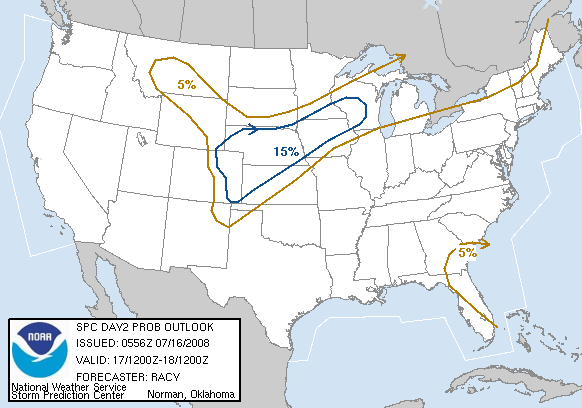
http://www.spc.noaa.gov/products/outloo ... 00_any.gif
15% chance for SC, NC and VA. 5% for parts of GA and FL.
Eric
15% chance for SC, NC and VA. 5% for parts of GA and FL.
Eric
0 likes
-
Weatherfreak14
- Category 5
- Posts: 1381
- Joined: Sat Sep 24, 2005 3:40 pm
- Location: Beaufort, SC
- Contact:


-
Weatherfreak14
- Category 5
- Posts: 1381
- Joined: Sat Sep 24, 2005 3:40 pm
- Location: Beaufort, SC
- Contact:
arkess7 wrote::uarrow: uggg I hope everything is ok......i was watching TWC today about the tornados in arkansas yesterday.........just awful......this month has been crazy for tornados
and in Indiana earlier this month!!!
if it isnt hurricanes its always something else!!!!
Yep hurricanes, and NOW tornados. Hopefully the storms here will come in the morning with less instilbility.
0 likes
-
WindRunner

- Category 5
- Posts: 5803
- Age: 35
- Joined: Fri Jul 29, 2005 8:07 pm
- Location: Warrenton, VA, but Albany, NY for school
- Contact:
-
Brent
- S2K Supporter

- Posts: 38759
- Age: 37
- Joined: Sun May 16, 2004 10:30 pm
- Location: Tulsa Oklahoma
- Contact:
TORNADO ON THE GROUND.
SEVERE WEATHER STATEMENT
NATIONAL WEATHER SERVICE BIRMINGHAM AL
740 PM CST MON NOV 28 2005
ALC037-123-290200-
/O.CON.KBMX.TO.W.0182.000000T0000Z-051129T0200Z/
COOSA AL-TALLAPOOSA AL-
740 PM CST MON NOV 28 2005
...A TORNADO WARNING REMAINS IN EFFECT UNTIL 800 PM CST FOR WEST
CENTRAL TALLAPOOSA AND SOUTHEASTERN COOSA COUNTIES...
AT 740 PM CST...NATIONAL WEATHER SERVICE IS RECEIVING REPORTS OF A
TORNADO ON THE GROUND CROSSING THE COOSA COUNTY LINE NEAR EQUALITY.
THIS TORNADO WAS LOCATED 17 MILES SOUTHWEST OF WIND CREEK STATE
PARK...OR ABOUT 10 MILES SOUTH OF ROCKFORD...MOVING NORTHEAST AT 40
MPH.
THE TORNADO WILL BE NEAR...
8 MILES WEST OF WIND CREEK STATE PARK AND 9 MILES SOUTHWEST OF
ALEXANDER CITY BY 800 PM CST
THIS IS A DANGEROUS SITUATION!
0 likes
#neversummer


-
Weatherfreak14
- Category 5
- Posts: 1381
- Joined: Sat Sep 24, 2005 3:40 pm
- Location: Beaufort, SC
- Contact:
-
Skywatch_NC
- Category 5
- Posts: 10949
- Joined: Wed Feb 05, 2003 9:31 pm
- Location: Raleigh, NC
- Contact:
Special Weather Statement
Statement as of 6:11 AM EST on November 29, 2005
... A few severe storms are possible today...
Showers and scattered thunderstorms will move quickly northward
through central North Carolina today through early this evening...
ahead of a cold front moving in from the west. While the
atmospheric instability will be weak today due to the abundant
cloud cover over the area... winds in the lower and middle levels
of the atmosphere will be strong and shifting... and a storm or
two may become strong enough to produce damaging wind gusts over
50 mph... as well as a threat of isolated tornadoes. The threat
for a few severe storms will be highest between 11 AM and 6 PM...
and will be possible anywhere across central North Carolina.
People across the area should closely monitor weather conditions
throughout the day... through NOAA Weather Radio or other media
outlets... or on the internet at weather.Gov. Make a quick plan
of the actions you would take if severe weather develops.
The cold front... and the threat of severe storms... will sweep
east out of the area by late this evening.
Last edited by Skywatch_NC on Tue Nov 29, 2005 11:18 am, edited 1 time in total.
0 likes
-
Weatherfreak14
- Category 5
- Posts: 1381
- Joined: Sat Sep 24, 2005 3:40 pm
- Location: Beaufort, SC
- Contact:
Return to “USA & Caribbean Weather”
Who is online
Users browsing this forum: AnnularCane, Cpv17, cstrunk, txtwister78 and 134 guests