June 26th severe weather.

U.S. & Caribbean Weather Discussions and Severe Weather Events

Moderator: S2k Moderators

Forum rules

The posts in this forum are NOT official forecast and should not be used as such. They are just the opinion of the poster and may or may not be backed by sound meteorological data. They are NOT endorsed by any professional institution or STORM2K.

Help Support Storm2K
Message
Author
Sunshine™
Tropical Wave
Tropical Wave
Posts: 7
Joined: Sun May 30, 2010 9:45 pm

June 26th severe weather.

#1 Postby Sunshine™ » Sat Jun 26, 2010 6:44 pm

Just thought I'd share with you some of my images so far today.

I predicted this storm would become tornadic, and it did a short time later.

Image
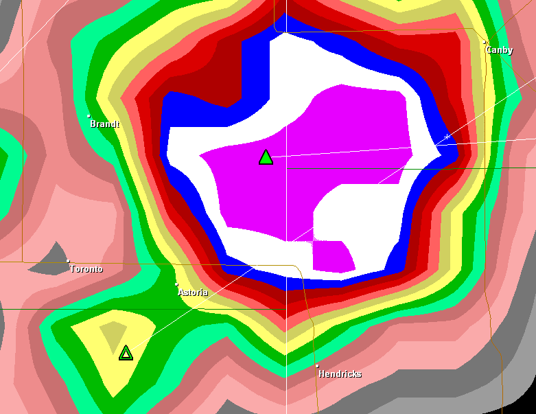
Same storm that had the giant hail-core, this time with hook-echo.
Image
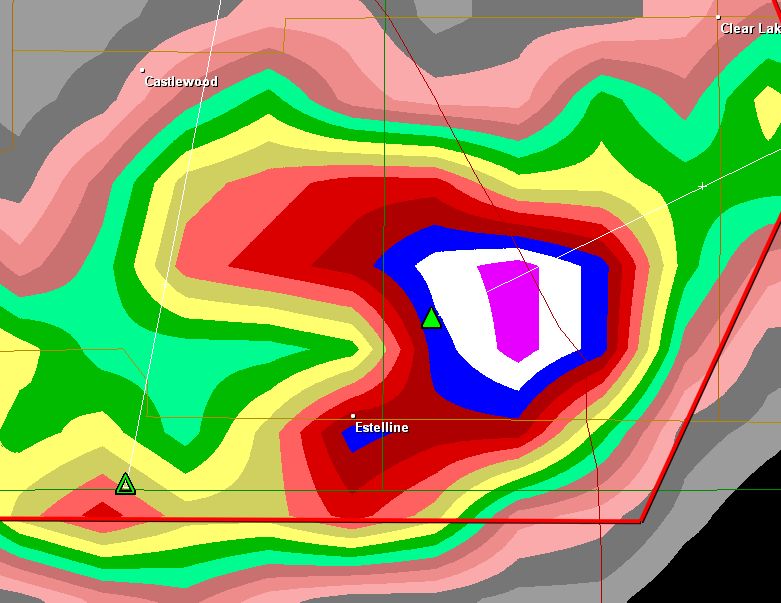
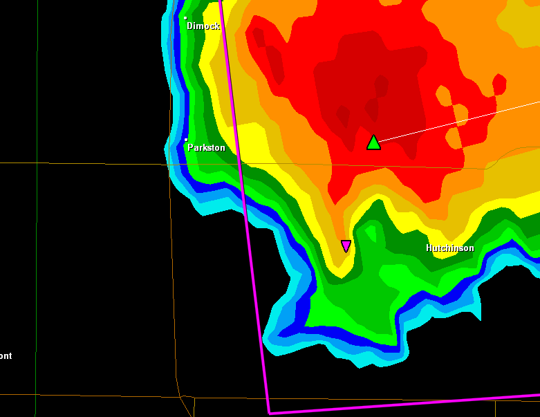
Still the same storm, no hook-echo, giant hail-core is still there though.
Image

Image
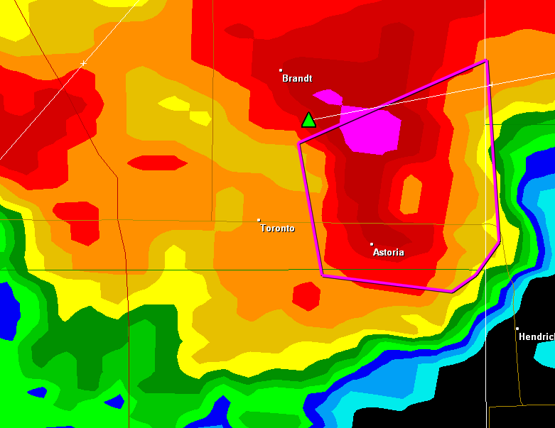
New storm, beginning of rotation.
Image
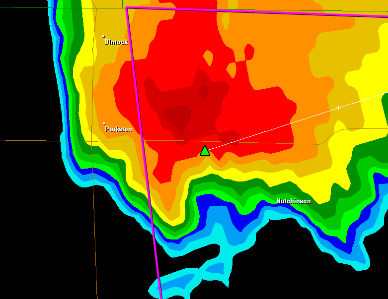
Hook-echo formed quite fast.
Image
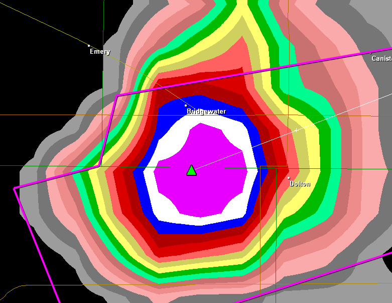
Same storm, hail-core within north-part of the storm.


I was lucky enough to catch 2 pretty nice images also.
Image
Image

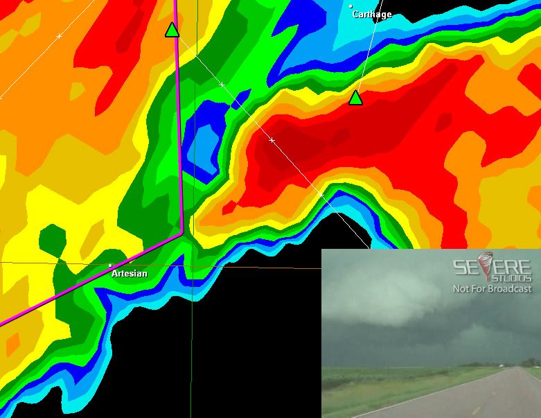
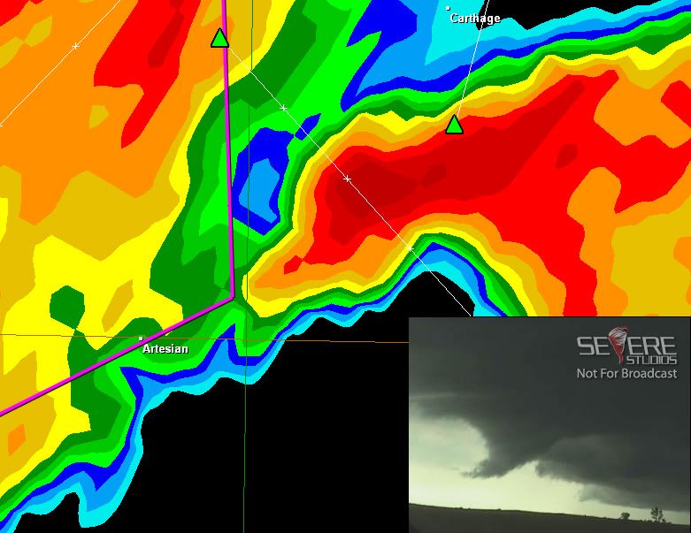
Both of those were from the area north of the tornado warning, that area wasn't warned until about 10 minutes after the funnel was spotted, Kenny Allen was the one streaming.
0 likes   

User avatar
Bunkertor
Category 5
Category 5
Posts: 3397
Joined: Tue May 09, 2006 3:48 pm

#2 Postby Bunkertor » Sat Jun 26, 2010 6:46 pm

OK, CAPE isn´t everything ....

Image
0 likes   

Sunshine™
Tropical Wave
Tropical Wave
Posts: 7
Joined: Sun May 30, 2010 9:45 pm

Re:

#3 Postby Sunshine™ » Sat Jun 26, 2010 6:51 pm

Bunkertor wrote:OK, CAPE isn´t everything ....

Image


They predicted a 15% of tornadoes, and not one has touched down so far.

The only tornado touchdown was a brief tornado in North Dakota for about 2 minutes they said.
0 likes   


Return to “USA & Caribbean Weather”

Who is online

Users browsing this forum: 869MB, Brent, rwfromkansas and 36 guests