from the CPC...
Code: Select all
HAZARDS


Strong thunderstorms, along with their attendant hazards (heavy rain, localized floods, and strong damaging winds), are possible across the Eastern Seaboard states from Florida to southern New Jersey on March 15th.


The long-term drought continues in the West, with little relief expected during this Assessment period.


DETAILED SUMMARY


For Monday Mar 15 - Wednesday Mar 17, 2004: A well organized frontal system over the Ohio Valley and Appalachia is projected to slide off the Atlantic coast early Monday. Computer models have shown uncertainty as to the partitioning of energy between the Gulf States (with an associated subtropical jet and squall line), and the primary low pressure center heading northeastward through the Ohio Valley and eastern Great Lakes region (producing primarily rain). The possibility of strong storms extends from Florida northward to New Jersey. If the model guidance is correct, and the cold front sweeps off the coast before the time of maximum diurnal heating, that would help to limit the intensity of any strong thunderstorms that do form. Strong low-level southerly flow is forecast across this region in the warm sector, along with a negatively tilted upper trough.

From the SPC...
Code: Select all
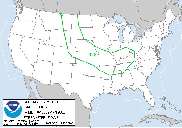
DAY 3 CONVECTIVE OUTLOOK
   NWS STORM PREDICTION CENTER NORMAN OK
   0144 AM CST SAT MAR 13 2004

   VALID 151200Z - 161200Z

   ...NO SVR TSTM AREAS FORECAST...

   BROAD UPPER TROUGH WILL REMAIN OVER THE NORTH CENTRAL UNITED STATES
   ON MONDAY...WITH STRONG SHORTWAVE TROUGH MOVING FROM THE NORTHERN
   ROCKIES INTO THE MID MS VALLEY.  ETA/GFS SOLUTION DIFFER FOR THIS
   SYSTEM...WITH ETA SHOWING MORE AMPLITUDE AND GREATER LOW LEVEL
   CYCLOGENESIS OVER MO/KY.  THIS RESULTS IN A RATHER LARGE AREA OF
   CONVECTIVE PRECIP IN THE ETA OVER EASTERN OK/MO/AR/LA. IF THIS
   SCENARIO DEVELOPS...SUFFICIENT VERTICAL SHEAR AND MUCAPE VALUES
   AROUND 1000 J/KG WOULD BE SUFFICIENT FOR ISOLATED STRONG/SEVERE
   STORMS.  HOWEVER THE GFS SOLUTION SHOWS A WEAKER SYSTEM AND A LOWER
   POTENTIAL FOR VIGOROUS CONVECTION.  DUE TO MODEL UNCERTAINTIES...
   WILL NOT OUTLOOK A SEVERE AREA AT THIS TIME.