Plains Tornado Outbreak 4/14-15

U.S. & Caribbean Weather Discussions and Severe Weather Events

Moderator: S2k Moderators

Forum rules

The posts in this forum are NOT official forecast and should not be used as such. They are just the opinion of the poster and may or may not be backed by sound meteorological data. They are NOT endorsed by any professional institution or STORM2K.

Help Support Storm2K
Message
Author
RL3AO
Moderator-Pro Met
Moderator-Pro Met
Posts: 16308
Joined: Thu Jun 14, 2007 10:03 pm
Location: NC

Re: Plains Tornado Outbreak 4/14-15

#1261 Postby RL3AO » Sun Apr 15, 2012 5:42 pm

OverlandHurricane wrote:I'm surprised that the SPC went as far north with the MN watch as they did. Where I've been all day (Big Lake and Elk River, the SE portions of Sherburne County and on the northwest flank of the MSP mstro), it's been 52 degrees, scattered showers, and a howling wind out of the northeast all day.
.


Go about 20 miles south and its in the 70s with a south wind.
0 likes   

User avatar
Dave
Retired Staff
Retired Staff
Posts: 13442
Age: 74
Joined: Tue Aug 01, 2006 3:57 pm
Location: Milan Indiana
Contact:

#1262 Postby Dave » Sun Apr 15, 2012 5:42 pm

(6:41 PM) DMX: Creston [Union Co, IA] nws storm survey reports TORNADO at 14 Apr, 07:00 PM CDT -- nws storm survey confirmed strong ef2 tornado. the tornado began about one and a half miles east of cromwell and tracked northeastward through the far northwest portion of creston. the greater regional medical center and southwestern community college sustained ef2 damage...with the worst damage occurring to the green hills educational center. the tornado continued tracking northeast and damaged a few farmsteads northeast of creston.

============================
(6:41 PM) DMX: 3 E NEW Virginia [Warren Co, IA] nws storm survey reports TORNADO at 14 Apr, 07:55 PM CDT -- brief ef1 tornado confirmed by nws damage survey. the tornado touched down three miles east of new virginia and tracked one mile to the east before dissipating. the tornado severely damaged several farm outbuildings and flipped several camper trailers. time estimated from radar.
0 likes   

User avatar
Dave
Retired Staff
Retired Staff
Posts: 13442
Age: 74
Joined: Tue Aug 01, 2006 3:57 pm
Location: Milan Indiana
Contact:

#1263 Postby Dave » Sun Apr 15, 2012 5:44 pm

BULLETIN - EAS ACTIVATION REQUESTED
TORNADO WARNING
NATIONAL WEATHER SERVICE TWIN CITIES/CHANHASSEN MN
543 PM CDT SUN APR 15 2012

THE NATIONAL WEATHER SERVICE IN THE TWIN CITIES HAS ISSUED A

* TORNADO WARNING FOR...
WESTERN CARVER COUNTY IN EAST CENTRAL MINNESOTA...
EASTERN MCLEOD COUNTY IN CENTRAL MINNESOTA...
SOUTH CENTRAL WRIGHT COUNTY IN CENTRAL MINNESOTA...

* UNTIL 615 PM CDT

* AT 538 PM CDT...RADAR INDICATED A STORM CAPABLE OF PRODUCING A
TORNADO. THE MOST DANGEROUS PART OF THE STORM WAS NEAR PLATO...OR
OVER PLATO...AND MOVING NORTH AT 45 MPH.

* LOCATIONS IN THE WARNING INCLUDE...
PLATO...
NORWOOD/YOUNG AMERICA...
HAMBURG...
GLENCOE...
LESTER PRAIRIE...
NEW GERMANY...
MAYER...
WINSTED...

PRECAUTIONARY/PREPAREDNESS ACTIONS...

WHEN A TORNADO WARNING IS ISSUED BASED ON RADAR...IT MEANS THAT
STRONG ROTATION HAS BEEN DETECTED IN THE STORM. A TORNADO MAY ALREADY
BE ON THE GROUND...OR IS EXPECTED TO DEVELOP SHORTLY.
0 likes   

CrazyC83
Professional-Met
Professional-Met
Posts: 34001
Joined: Tue Mar 07, 2006 11:57 pm
Location: Deep South, for the first time!

#1264 Postby CrazyC83 » Sun Apr 15, 2012 5:49 pm

I wonder if they will go up to EF5 for the Ellsworth tornado? The indicators seem to suggest there is a good case for it...
0 likes   

User avatar
Dave
Retired Staff
Retired Staff
Posts: 13442
Age: 74
Joined: Tue Aug 01, 2006 3:57 pm
Location: Milan Indiana
Contact:

#1265 Postby Dave » Sun Apr 15, 2012 5:55 pm

CARVER MN-MCLEOD MN-WRIGHT MN-
553 PM CDT SUN APR 15 2012

...A TORNADO WARNING REMAINS IN EFFECT FOR SOUTH CENTRAL WRIGHT...
NORTHEASTERN MCLEOD AND NORTHWESTERN CARVER COUNTIES UNTIL 615 PM
CDT...

AT 547 PM CDT...TRAINED WEATHER SPOTTERS REPORTED A ROTATING WALL
CLOUD.
THIS STORM WAS LOCATED NEAR LESTER PRAIRIE...OR 18 MILES
EAST OF HUTCHINSON...MOVING NORTH AT 45 MPH.

LOCATIONS IMPACTED INCLUDE...
WINSTED.

PRECAUTIONARY/PREPAREDNESS ACTIONS...

TO REPEAT...DOPPLAR RADAR INDICATED A STORM CAPABLE OF PRODUCING A
TORNADO. TAKE COVER NOW.
0 likes   

User avatar
Dave
Retired Staff
Retired Staff
Posts: 13442
Age: 74
Joined: Tue Aug 01, 2006 3:57 pm
Location: Milan Indiana
Contact:

#1266 Postby Dave » Sun Apr 15, 2012 5:56 pm

MESOSCALE DISCUSSION 0553
NWS STORM PREDICTION CENTER NORMAN OK
0554 PM CDT SUN APR 15 2012

AREAS AFFECTED...E CNTRL MN...INCLUDING THE MINNEAPOLIS/ST. PAUL
METROPOLITAN AREA...PARTS OF NW WI

CONCERNING...TORNADO WATCH 178...

VALID 152254Z - 160030Z

THE SEVERE WEATHER THREAT FOR TORNADO WATCH 178 CONTINUES.

IT IS NOT CLEAR THAT TORNADOES WILL BE PARTICULARLY LONG-LIVED...
BUT THEY MAY BE IMPACTING THE MORE DENSELY POPULATED MINNEAPOLIS/
ST. PAUL AREA DURING THE NEXT FEW HOURS.


VIGOROUS CONVECTION...WITHIN A BAND OF STRONGER DIFFERENTIAL
CYCLONIC VORTICITY ADVECTION TO THE NORTHEAST OF THE MID-LEVEL
CYCLONE LIFTING ACROSS THE MID MISSOURI VALLEY...WILL GRADUALLY
SHIFT EASTWARD ACROSS EAST CENTRAL AND SOUTHEAST MINNESOTA BETWEEN
NOW AND 01-02Z. LATEST GUIDANCE SUGGESTS THAT STRONG LOW-LEVEL
SHEAR/STORM-RELATIVE HELICITY IS GENERALLY CONFINED TO AREAS ALONG
AND TO THE COOL SIDE OF THE EAST-WEST ORIENTED WARM FRONT ACROSS
EAST CENTRAL MINNESOTA INTO NORTHWEST WISCONSIN. AND THE LOW-LEVEL
ENVIRONMENT RAPIDLY BECOMES STABLE WITH NORTHWARD EXTEND ACROSS AND
TO THE NORTH OF THE WARM FRONT. HOWEVER...A NARROW CORRIDOR TO THE
NORTH OF THE FRONT...WHICH EXTENDS ACROSS THE MINNEAPOLIS/ST. PAUL
AREA...APPEARS CONDUCIVE TO ADDITIONAL TORNADIC DEVELOPMENT AS
STORMS EMBEDDED WITHIN 50-60+ KT SOUTHERLY DEEP LAYER MEAN FLOW MOVE
ACROSS THE BOUNDARY LATE THIS AFTERNOON.
0 likes   

User avatar
Dave
Retired Staff
Retired Staff
Posts: 13442
Age: 74
Joined: Tue Aug 01, 2006 3:57 pm
Location: Milan Indiana
Contact:

#1267 Postby Dave » Sun Apr 15, 2012 6:01 pm

BULLETIN - EAS ACTIVATION REQUESTED
TORNADO WARNING
NATIONAL WEATHER SERVICE LITTLE ROCK AR
601 PM CDT SUN APR 15 2012

THE NATIONAL WEATHER SERVICE IN LITTLE ROCK HAS ISSUED A

* TORNADO WARNING FOR...
SOUTHEASTERN VAN BUREN COUNTY IN NORTH CENTRAL ARKANSAS...
NORTH CENTRAL FAULKNER COUNTY IN CENTRAL ARKANSAS...
NORTHEASTERN CONWAY COUNTY IN CENTRAL ARKANSAS...
WESTERN CLEBURNE COUNTY IN NORTH CENTRAL ARKANSAS...

* UNTIL 630 PM CDT

* AT 558 PM CDT...NATIONAL WEATHER SERVICE DOPPLER RADAR INDICATED A
SEVERE THUNDERSTORM CAPABLE OF PRODUCING A TORNADO. THIS SEVERE
STORM WAS LOCATED NEAR TWIN GROVES...OR 16 MILES SOUTH OF CLINTON.
DOPPLER RADAR SHOWED THIS SEVERE STORM MOVING NORTHEAST AT 55 MPH.

* LOCATIONS IN THE PATH OF THIS DANGEROUS STORM INCLUDE...
GREERS FERRY LAKE... FAIRFIELD BAY... WHIPPLE...
TWIN GROVES... GUY... GREERS FERRY...
FAIRFIELD BAY MARINA... FAIRBANKS...
DAMASCUS... CHOCTAW REC AREA... WOODROW...
SOUTHSIDE... PRIM... PEARSON...
MORGANTON... MARTINVILLE... HIGDEN...
BROWNSVILLE...
0 likes   

CrazyC83
Professional-Met
Professional-Met
Posts: 34001
Joined: Tue Mar 07, 2006 11:57 pm
Location: Deep South, for the first time!

#1268 Postby CrazyC83 » Sun Apr 15, 2012 6:02 pm

In a major metropolitan area, even an EF2 can be quite destructive.
0 likes   

RL3AO
Moderator-Pro Met
Moderator-Pro Met
Posts: 16308
Joined: Thu Jun 14, 2007 10:03 pm
Location: NC

#1269 Postby RL3AO » Sun Apr 15, 2012 6:03 pm

Still moving almost due north. A more NE movement was expected.
0 likes   

User avatar
Dave
Retired Staff
Retired Staff
Posts: 13442
Age: 74
Joined: Tue Aug 01, 2006 3:57 pm
Location: Milan Indiana
Contact:

#1270 Postby Dave » Sun Apr 15, 2012 6:04 pm

AREA FORECAST DISCUSSION...UPDATED AVIATION
NATIONAL WEATHER SERVICE ST LOUIS MO
603 PM CDT SUN APR 15 2012

.SHORT TERM...
ISSUED AT 303 PM CDT SUN APR 15 2012
(TONIGHT)

NEXT EIGHT HOURS WILL BE QUITE ACTIVE ACROSS THE AREA AS THE COLD
FRONT OVERTAKES THE DRYLINE THAT IS CURRENTLY LOCATED ALONG THE
MISSOURI/KANSAS BORDER AND MARCHES THE LINE OF CONVECTION EAST. VERY
FAVORABLE SHEAR VALUES AND SUFFICIENT INSTABILITY WILL ALLOW BOWING
SEGMENTS AND LEWP STRUCTURES WITHIN THE LINE. BELIEVE PRIMARY THREAT
WILL BE DAMAGING WIND GIVEN +50KTS LOCATED 2-3KFT ABOVE GROUND PER
VAD WIND PROFILE...BUT STRONG LOW LEVEL SHEAR AND STORM RELATIVE
HELICITY VALUES...DUE TO SLIGHTLY BACKED SURFACE WINDS...SUGGEST AN
INCREASED THREAT OF MESOVORTEX TORNADOES.


WILL KEEP WIND ADVISORY GOING TIL 03Z GIVEN ABILITY OF STRONGER
SHOWERS TO MIX ADVISORY WINDS TO THE SURFACE.

LINE OF CONVECTION WILL EXIT STAGE EAST AROUND 06Z...WITH A
TEMPORARY CLEARING OF THE SKY BEFORE POST FRONTAL STRATUS SWEEPS
INTO THE NORTHERN CWA BY DAYBREAK.
0 likes   

WeatherGuesser
Category 5
Category 5
Posts: 2672
Joined: Tue Jun 29, 2010 6:46 am

#1271 Postby WeatherGuesser » Sun Apr 15, 2012 6:12 pm

It could get interesting in my area if that line in Arkansas holds together for a few more hours. I need rain, but I don't need severe.
0 likes   

User avatar
Dave
Retired Staff
Retired Staff
Posts: 13442
Age: 74
Joined: Tue Aug 01, 2006 3:57 pm
Location: Milan Indiana
Contact:

#1272 Postby Dave » Sun Apr 15, 2012 6:19 pm

Image
0 likes   

User avatar
OverlandHurricane
S2K Supporter
S2K Supporter
Posts: 58
Joined: Thu Aug 28, 2008 4:50 pm
Location: Minnesota

Re: Plains Tornado Outbreak 4/14-15

#1273 Postby OverlandHurricane » Sun Apr 15, 2012 6:22 pm

RL3A0, yes I know. At home it was 50, here at the U of M it's a very muggy 64. Surprised I didn't drive through a storm on the way here.
0 likes   

CrazyC83
Professional-Met
Professional-Met
Posts: 34001
Joined: Tue Mar 07, 2006 11:57 pm
Location: Deep South, for the first time!

#1274 Postby CrazyC83 » Sun Apr 15, 2012 6:24 pm

MESOSCALE DISCUSSION 0554
NWS STORM PREDICTION CENTER NORMAN OK
0612 PM CDT SUN APR 15 2012

AREAS AFFECTED...NRN IL

CONCERNING...SEVERE POTENTIAL...WATCH POSSIBLE

VALID 152312Z - 160015Z

PORTIONS OF NRN IL ARE BEING MONITORED FOR A POSSIBLE WW.
CONSIDERABLE UNCERTAINTY REGARDING TSTM INTENSITY/COVERAGE
EXISTS...BUT CONVECTIVE TRENDS ARE BEING CLOSELY MONITORED.

ISOLATED TSTMS HAVE DEVELOPED OVER THE PAST HR SW OF THE CHICAGO
METRO AREA...WITHIN A BROAD LOW-LEVEL WAA REGIME AHEAD OF A STRONG
CNTRL PLAINS CYCLONE. A LACK OF DISCERNABLE MESOSCALE BOUNDARIES IS
LEADING TO LARGELY UNFOCUSED DEVELOPMENT OF NEW
CONVECTION...YIELDING CONSIDERABLE UNCERTAINTY TO EVOLUTION AND
EVENTUAL COVERAGE OF THE POTENTIAL THREAT. HOWEVER...THE ENVIRONMENT
ACROSS THIS AREA IS STRONGLY SHEARED /0-1 KM BULK SHEAR NEAR 30 KTS
PER LOT VWP/...SUPPORTIVE OF DMGG WIND GUSTS AND PERHAPS A TORNADO
SHOULD CONVECTION CONTINUE TO INTENSIFY. FORECAST MODEL GUIDANCE
ALSO INDICATES LLJ SHOULD CONTINUE TO STRENGTHEN THROUGH AT LEAST
04Z...WHILE STORMS WILL HAVE THE POTENTIAL TO REMAIN NEAR SFC-BASED.
INSTABILITY REMAINS SOMEWHAT OF A LIMITING FACTOR /NEAR 1000 J/KG
MLCAPE PER RUC OBJECTIVE ANALYSIS/ AS WIDESPREAD STRATUS OBSERVED ON
VISIBLE SATELLITE LOOP HAS LIKELY LIMITED DIABATIC HEATING SOMEWHAT.
CONVECTIVE TRENDS WILL CONTINUE TO BE MONITORED FOR ISSUANCE OF A
POTENTIAL WW.

..ROGERS.. 04/15/2012


ATTN...WFO...LOT...ILX...MKX...DVN...

LAT...LON 41678750 41168765 40588772 40358867 40349024 41179038
42159006 42508929 42448813 42268780 41678750
0 likes   

CrazyC83
Professional-Met
Professional-Met
Posts: 34001
Joined: Tue Mar 07, 2006 11:57 pm
Location: Deep South, for the first time!

#1275 Postby CrazyC83 » Sun Apr 15, 2012 6:44 pm

MESOSCALE DISCUSSION 0555
NWS STORM PREDICTION CENTER NORMAN OK
0629 PM CDT SUN APR 15 2012

AREAS AFFECTED...PORTIONS OF MIDDLE TEXAS COASTAL AREAS AND ADJACENT
COASTAL PLAIN

CONCERNING...SEVERE POTENTIAL...WATCH UNLIKELY

VALID 152329Z - 160100Z

THE NEED FOR A WATCH IS NOT CURRENTLY ANTICIPATED...BUT TRENDS WILL
CONTINUE TO BE MONITORED FOR THE POSSIBILITY OF AN INCREASING SEVERE
THREAT.

LOCALLY ENHANCED CONVERGENCE ASSOCIATED WITH THE INTERSECTION OF AN
INLAND ADVANCING SEA-BREEZE AND SOUTHEASTWARD ADVANCING WEAK COLD
FRONT APPEARS TO HAVE BEEN THE INITIATING MECHANISM FOR ISOLATED
INTENSE CONVECTIVE DEVELOPMENT TO THE SOUTHWEST OF VICTORIA. THIS
IS BEING SUPPORTED BY FAIRLY LARGE CAPE OF 2000-3000+ J/KG...IN THE
PRESENCE OF HIGH BOUNDARY LAYER MOISTURE AND STEEP MID-LEVEL LAPSE
RATES. DEEP LAYER SHEAR BENEATH 30-50 KT SOUTHERLY 500 MB FLOW IS
AT LEAST MARGINALLY SUFFICIENT FOR SUBSTANTIVE MID-LEVEL UPDRAFT
ROTATION. AIDED BY A FOCUSED AREA OF ENHANCED LOWER/MID
TROPOSPHERIC WARM ADVECTION...ACTIVITY MAY PERSIST AT LEAST ANOTHER
SEVERAL HOURS. IT IS NOT CLEAR THAT A SUBSTANTIAL INCREASE IN
COVERAGE WILL OCCUR...BUT THE RISK FOR LARGE HAIL COULD
CONTINUE...ALONG WITH SOME POTENTIAL FOR AN ISOLATED
TORNADO...PERHAPS EVENTUALLY A LOCALIZED STRONG DOWNBURST...MAINLY
WEST/NORTHWEST OF CORPUS CHRISTI THROUGH 00-02Z.

..KERR.. 04/15/2012


ATTN...WFO...CRP...

LAT...LON 28159774 28559756 28759725 28589692 28129706 27899744
27969772 28159774
0 likes   

User avatar
Dave
Retired Staff
Retired Staff
Posts: 13442
Age: 74
Joined: Tue Aug 01, 2006 3:57 pm
Location: Milan Indiana
Contact:

#1276 Postby Dave » Sun Apr 15, 2012 6:45 pm

AIRPORT WEATHER WARNING
NATIONAL WEATHER SERVICE TWIN CITIES/CHANHASSEN MN
640 PM CDT SUN APR 15 2012

...AIRPORT WEATHER WARNING FOR WIND GUSTS TO 35 KNOTS UNTIL 745
PM...

A FAST MOVING LINE OF THUNDERSTORMS WILL MOVE ACROSS MSP
BETWEEN 650 AND 745 PM THIS EVENING. EXPECT WINDS TO GUST TO 35
KNOTS FROM THE SOUTHWEST AHEAD OF THIS LINE OF STORMS. SMALL
HAIL OF PEA TO PERHAPS ONE HALF INCH IS ALSO POSSIBLE.
0 likes   

jaybonz
Tropical Wave
Tropical Wave
Posts: 1
Joined: Sun Apr 15, 2012 6:09 am

Re: Plains Tornado Outbreak 4/14-15

#1277 Postby jaybonz » Sun Apr 15, 2012 9:25 pm

Here’s a list of storm shelters. I hope this list is helpful to you. It’s best that people call first to make sure a storm shelter is open and that they can be accommodated (ex. space limitation or wheelchair accessible). Generally, pets are not allowed.

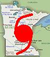
Special Alert for Woodward, Oklahoma: Due to the massive storm damage in Woodward, Oklahoma after a tornado touched down on April 15, 2012, a shelter has been set up at The Living Word Fellowship Church for anyone needing a place to stay. The address is 1310 Oklahoma Ave., Woodward, OK 73801 Tele: (580) 256-1844 or 580 256-8314

The Red Cross is also working with the church to help with the relief effort. They will have volunteers driving from Oklahoma City to Woodward, Ok with cots, water, food, & medical supplies. The Red Cross asked that people do not bring any donations at this time. They will let the public know when they are ready to accept donations on behalf of the storm victims.


Bethany public storm shelters
Bethany Earl Harris Elementary School, 4311 N Asbury St, Bethany, OK 73008 Tele: (405) 789-6673

Deaconess at Bethany, 7600 NW 23rd ST, Bethany, OK 73008 Tele : (405) 604-4000

Bethany First Church of Nazarene, 6789 NW 39th Expy, Bethany, OK 73008
Tele: 405-789-2050


Del City pubic storm shelter
City Hall, 3701 SE 15th Street, Del City, Ok. 73115 Tele: 405-677-5741


Forest Park public storm shelter
City of Forest Park Fire Station, 4203 N Coltrane Rd, Oklahoma City, OK 73121
Tele: (405) 427-1313


Geronimo public storm shelter
This storm shelter is at a public school that is always open.
225 Iowa St, Geronimo, OK, 73543 Tele: (580) 355-3160 or (580) 355-3801


Lawton public storm shelters
Shoemaker Center, Lawton Public Schools 753 Ft. Sill Blvd. Lawton, OK 73507 (N of Lawton High School) Tele: 580-585-6407

Galilee Missionary Baptist Church 7 N.E. Bell (Dr. L.K. Jones) Avenue Lawton, OK 73507 Tele: (580) 353-0683


Midwest City has three public storm shelters. (The shelters open when the city sounds the storm warning sirens.)
The Reed Center, 5800 Will Rogers, Midwest City, OK 73110 Tele: 405-741-7333

The lower level of City Hall, City Hall, 100 N. Midwest Boulevard, Midwest City, Ok 73110 Tele: 405-732-2281

The Fire Station 5 basement, 801 S. Westminister Rd., Midwest City, OK 73110 Tele: 405-732-2281


Norman public storm shelters
The Irving Recreation Center 125 Vicksburg Ave, Norman, OK 73071 Tele: 405-366-5472 or 405-292-9774 (not FEMA rated)

The Whittier Recreation Center 2000 W Brooks St, Norman, OK 73069 Tele: 405-321-1600 or 405-292-9703
(not FEMA rated).

Cleveland Elementary School, 500 N Sherry Ave, Norman, OK 73069 Tele: (405) 366-5875

Little Axe High School, 2000 NE 168TH Ave, Norman, OK 73026 Tele: (405) 329-1612

Those whose homes were damaged can seek temporary housing at St. Stephen United Methodist Church, 1801 W. Brooks St. (N.W. corner of Brooks and McGee), Norman, OK 73069 Tele: 405-321-4988


Shawnee public storm shelters
The basement of Shawnee City Hall, 16 W 9th St, Shawnee, OK 748011 (405) 273-1250

The basement room at Shawnee Fire Station No. 3 on 306 East MacArthur Street, Shawnee, OK 74804 (405) 878-1671 will be available during severe storms.


Stillwater has public storm shelters on the Oklahoma State University campus
OSU Graduate College
202 Whitehurst
Stillwater, OK 74078-1019
(405) 744-6368

THE OSU POLICE WILL OPEN THE TWO BUILDING SHELTERS BELOW TO THE GENERAL PUBLIC IN CASE OF
STORM ACTIVITY AFTER REGULAR WEEKDAY HOURS. (Use caution in traveling to these buildings.)
AG HALL (corner of Farm Road and Monroe): The south entrance at the east end is wheelchair accessible.
ENGINEERING SOUTH (east of the Library): This basement is wheelchair accessible, but only by elevator.
NOTE: THE STUDENT UNION IS NO LONGER AN OFFICIAL TORNADO SHELTER
Taking pets into storm shelters is discouraged because of space limitation for citizens seeking shelter.
If local radio is available, keep tuned to KOSU-FM (91.7 MHz), KSPI-FM (93.7 MHz), KVRO-FM (98.1 MHz), or KGFY-FM (105.5 MHz) for storm details.
The "All Clear" signal is given over FM radio and NOT the storm sirens
Stillwater Emergency Center broadcasts storm alerts over local cable, not satellite TV.


Warr Acres has three public storm shelters (call city hall with inquires)
City Hall (Access from storm doors on north side), Warr Acres City Hall, 5930 NW 49th Street, Warr Acres, OK 73122 (405) 789-2892

Cherokee Hills Park, 5551 NW 66th ST, Oklahoma City, OK 73132 (405) 789-2892

Grandma’s Park, NW 40th West of MacArthur, (405) 789-2892


Best Regards,
jaybonz
0 likes   

User avatar
Texas Snowman
Storm2k Moderator
Storm2k Moderator
Posts: 6151
Joined: Fri Jan 25, 2008 11:29 am
Location: Denison, Texas

#1278 Postby Texas Snowman » Mon Apr 16, 2012 5:49 pm

Fatality number in Woodward increased to six today - one of the critically injured patients injured in the tornado succumbed to their injuries.
0 likes   
The above post and any post by Texas Snowman is NOT an official forecast and should not be used as such. It is just the opinion of the poster and may or may not be backed by sound meteorological data. It is NOT endorsed by any professional institution including storm2k.org. For official information, please refer to NWS products.


Return to “USA & Caribbean Weather”

Who is online

Users browsing this forum: Cpv17, Google Adsense [Bot] and 33 guests