Insane stuff. EF-3? Or EF-4?
https://mobile.twitter.com/tornadotrack ... 8182576128
Texas Spring 2016
Moderator: S2k Moderators
Forum rules

The posts in this forum are NOT official forecast and should not be used as such. They are just the opinion of the poster and may or may not be backed by sound meteorological data. They are NOT endorsed by any professional institution or STORM2K.
-
Texas Snowman

- Storm2k Moderator

- Posts: 6197
- Joined: Fri Jan 25, 2008 11:29 am
- Location: Denison, Texas
Re: Texas Spring 2016
0 likes
The above post and any post by Texas Snowman is NOT an official forecast and should not be used as such. It is just the opinion of the poster and may or may not be backed by sound meteorological data. It is NOT endorsed by any professional institution including storm2k.org. For official information, please refer to NWS products.

Re: Texas Spring 2016
Texas Snowman wrote:Insane stuff. EF-3? Or EF-4?
https://mobile.twitter.com/tornadotrack ... 8182576128
I would guess EF4. There have been some photos of cleaned areas. It's difficult to say EF5 unless a civil building or something well built was in the way. Total destruction we see is usually EF3 and EF4. To get EF5 you will need engineering perspective of something well built, hard to see with the naked eye just viewing. If the storm that hit near and around wynnewood and moreso east of there, hit a population center then EF5 could be possible.
0 likes
The above post and any post by Ntxw is NOT an official forecast and should not be used as such. It is just the opinion of the poster and may or may not be backed by sound meteorological data. It is NOT endorsed by any professional institution including Storm2k. For official information, please refer to NWS products.
Help support Storm2K!
Re: Texas Spring 2016
This is the point today where if there was an EF4-EF5 possibility southeast of Wynnewood would be a good candidate. That goes up there with the EF5's in terms of size and look.
https://www.youtube.com/watch?v=BIcOCs0e0R8
https://www.youtube.com/watch?v=BIcOCs0e0R8
0 likes
The above post and any post by Ntxw is NOT an official forecast and should not be used as such. It is just the opinion of the poster and may or may not be backed by sound meteorological data. It is NOT endorsed by any professional institution including Storm2k. For official information, please refer to NWS products.
Help support Storm2K!
Help support Storm2K!
-
gboudx

- S2K Supporter

- Posts: 4090
- Joined: Thu Sep 04, 2003 1:39 pm
- Location: Rockwall, Tx but from Harvey, La
Re: Texas Spring 2016
That nado is insane. I would be panicked to be that close, but would be awestruck by it's power and beauty. Closest I ever got to one was about 100' from a water spout, which is not exactly the same thing.
0 likes

Re: Texas Spring 2016
Several models are indicating storms developing this afternoon across the Hill Country and north, northeast along the I-35 corridor into North Texas. CAPE is forecasted to be extreme on the order of 4,000-6,000 J/Kg. Low-level shear looks meager, so the main threat should be large hail and damaging winds. However, with such extreme instability, nothing can be ruled out.


0 likes
Re: Texas Spring 2016
Cluster of thunderstorms this afternoon in Central Texas, mainly Austin and San Antonio some could be severe and/or tornadic though nothing like yesterday mainly wind and hail. Northern fringe could clip DFW. -EPO is about the take hold of the pattern across North America. NW flow will be fronts and evening/overnight MCS' throughout the next week.
Also yesterday if you go back and look from the SPC among other data, was not set up as a major tornado outbreak, there was elevated risk in southern Oklahoma. However as we have seen countless times, the early morning cluster of thunderstorms that tracked north and east of DFW along the Red River and southern Oklahoma left an airflow boundary just north of the Red River which fueled and drove those massive tornados. Nothing really came out of the dry line
Also yesterday if you go back and look from the SPC among other data, was not set up as a major tornado outbreak, there was elevated risk in southern Oklahoma. However as we have seen countless times, the early morning cluster of thunderstorms that tracked north and east of DFW along the Red River and southern Oklahoma left an airflow boundary just north of the Red River which fueled and drove those massive tornados. Nothing really came out of the dry line
0 likes
The above post and any post by Ntxw is NOT an official forecast and should not be used as such. It is just the opinion of the poster and may or may not be backed by sound meteorological data. It is NOT endorsed by any professional institution including Storm2k. For official information, please refer to NWS products.
Help support Storm2K!
Help support Storm2K!
-
Texas Snowman
- Storm2k Moderator
- Posts: 6197
- Joined: Fri Jan 25, 2008 11:29 am
- Location: Denison, Texas
Re: Texas Spring 2016
Jarrell F5 came on a day when expectations weren't terribly high, no?
0 likes
The above post and any post by Texas Snowman is NOT an official forecast and should not be used as such. It is just the opinion of the poster and may or may not be backed by sound meteorological data. It is NOT endorsed by any professional institution including storm2k.org. For official information, please refer to NWS products.
-
Texas Snowman
- Storm2k Moderator
- Posts: 6197
- Joined: Fri Jan 25, 2008 11:29 am
- Location: Denison, Texas
Re: Texas Spring 2016
From Wikipedia:
"In the early morning hours of May 27, a large mesoscale convective complex developed over Eastern Oklahoma and Western Arkansas. A "gravity wave" or outflow boundary was generated by this system and stalled out over Central Texas. This was oriented from the northeast to the southwest, causing the movement of the supercells later on to be to the southwest, along with most of the tornadoes, which is extremely unusual. Also unusual on this day was the low wind shear and extreme instability."
"In the early morning hours of May 27, a large mesoscale convective complex developed over Eastern Oklahoma and Western Arkansas. A "gravity wave" or outflow boundary was generated by this system and stalled out over Central Texas. This was oriented from the northeast to the southwest, causing the movement of the supercells later on to be to the southwest, along with most of the tornadoes, which is extremely unusual. Also unusual on this day was the low wind shear and extreme instability."
0 likes
The above post and any post by Texas Snowman is NOT an official forecast and should not be used as such. It is just the opinion of the poster and may or may not be backed by sound meteorological data. It is NOT endorsed by any professional institution including storm2k.org. For official information, please refer to NWS products.
Re: Texas Spring 2016
Texas Snowman wrote:From Wikipedia:
"In the early morning hours of May 27, a large mesoscale convective complex developed over Eastern Oklahoma and Western Arkansas. A "gravity wave" or outflow boundary was generated by this system and stalled out over Central Texas. This was oriented from the northeast to the southwest, causing the movement of the supercells later on to be to the southwest, along with most of the tornadoes, which is extremely unusual. Also unusual on this day was the low wind shear and extreme instability."
I believe so. Jarrell moved so strange in that the cell was moving southwest, opposite of what you typically expect likely riding a boundary. The slow movement due to the unusual nature intensified duration of locations hit by the strong winds.
0 likes
The above post and any post by Ntxw is NOT an official forecast and should not be used as such. It is just the opinion of the poster and may or may not be backed by sound meteorological data. It is NOT endorsed by any professional institution including Storm2k. For official information, please refer to NWS products.
Help support Storm2K!
Help support Storm2K!
-
Texas Snowman
- Storm2k Moderator
- Posts: 6197
- Joined: Fri Jan 25, 2008 11:29 am
- Location: Denison, Texas
Re: Texas Spring 2016
Sobering couple of reads about the May 1997 Jarrell F5 and the 27 fatalities that occurred. Always have been amazed at the extreme ground scouring and the complete destruction that took place. Wonder what the wind speeds actually were?
https://extremeplanet.me/2012/06/26/aer ... tographed/
https://stormstalker.wordpress.com/2012/11/23/jarrell/
https://extremeplanet.me/2012/06/26/aer ... tographed/
https://stormstalker.wordpress.com/2012/11/23/jarrell/
0 likes
The above post and any post by Texas Snowman is NOT an official forecast and should not be used as such. It is just the opinion of the poster and may or may not be backed by sound meteorological data. It is NOT endorsed by any professional institution including storm2k.org. For official information, please refer to NWS products.
-
Texas Snowman
- Storm2k Moderator
- Posts: 6197
- Joined: Fri Jan 25, 2008 11:29 am
- Location: Denison, Texas
Re: Texas Spring 2016
Ntxw wrote:I believe so. Jarrell moved so strange in that the cell was moving southwest, opposite of what you typically expect likely riding a boundary. The slow movement due to the unusual nature intensified duration of locations hit by the strong winds.
Up to three minutes according to one of the links above.
0 likes
The above post and any post by Texas Snowman is NOT an official forecast and should not be used as such. It is just the opinion of the poster and may or may not be backed by sound meteorological data. It is NOT endorsed by any professional institution including storm2k.org. For official information, please refer to NWS products.
Re: Texas Spring 2016
NWS Norman @NWSNorman 22m22 minutes ago
1117am - we can confirm at least EF3 damage with the tornado west of I-35 near Katie (SW of Wynnewood).
The area of cleaned foundations, and the very large wedge, I think was southeast of Wynnewood closer to Sulphur so lets see what they find later out that way.
1117am - we can confirm at least EF3 damage with the tornado west of I-35 near Katie (SW of Wynnewood).
The area of cleaned foundations, and the very large wedge, I think was southeast of Wynnewood closer to Sulphur so lets see what they find later out that way.
0 likes
The above post and any post by Ntxw is NOT an official forecast and should not be used as such. It is just the opinion of the poster and may or may not be backed by sound meteorological data. It is NOT endorsed by any professional institution including Storm2k. For official information, please refer to NWS products.
Help support Storm2K!
Help support Storm2K!

-
Texas Snowman
- Storm2k Moderator
- Posts: 6197
- Joined: Fri Jan 25, 2008 11:29 am
- Location: Denison, Texas
Re: Texas Spring 2016
0 likes
The above post and any post by Texas Snowman is NOT an official forecast and should not be used as such. It is just the opinion of the poster and may or may not be backed by sound meteorological data. It is NOT endorsed by any professional institution including storm2k.org. For official information, please refer to NWS products.
Re: Texas Spring 2016
TWC channel showed some damage from yesterday one house was whipped off its foundation.
0 likes
-
Texas Snowman
- Storm2k Moderator
- Posts: 6197
- Joined: Fri Jan 25, 2008 11:29 am
- Location: Denison, Texas
Re: Texas Spring 2016
@NWSNorman -- Noon - survey teams have found EF3 damage with the large tornado in Garvin/Murray counties east of I-35. Surveys ongoing.
0 likes
The above post and any post by Texas Snowman is NOT an official forecast and should not be used as such. It is just the opinion of the poster and may or may not be backed by sound meteorological data. It is NOT endorsed by any professional institution including storm2k.org. For official information, please refer to NWS products.
-
Texas Snowman
- Storm2k Moderator
- Posts: 6197
- Joined: Fri Jan 25, 2008 11:29 am
- Location: Denison, Texas
Re: Texas Spring 2016
From the Twitter feed of KOCO met Brad Sowder in OKC:
@KOCOBrad -- From the home swept on cam in Wynnewood. This only seen in the most violent tornadoes. @NWSNorman
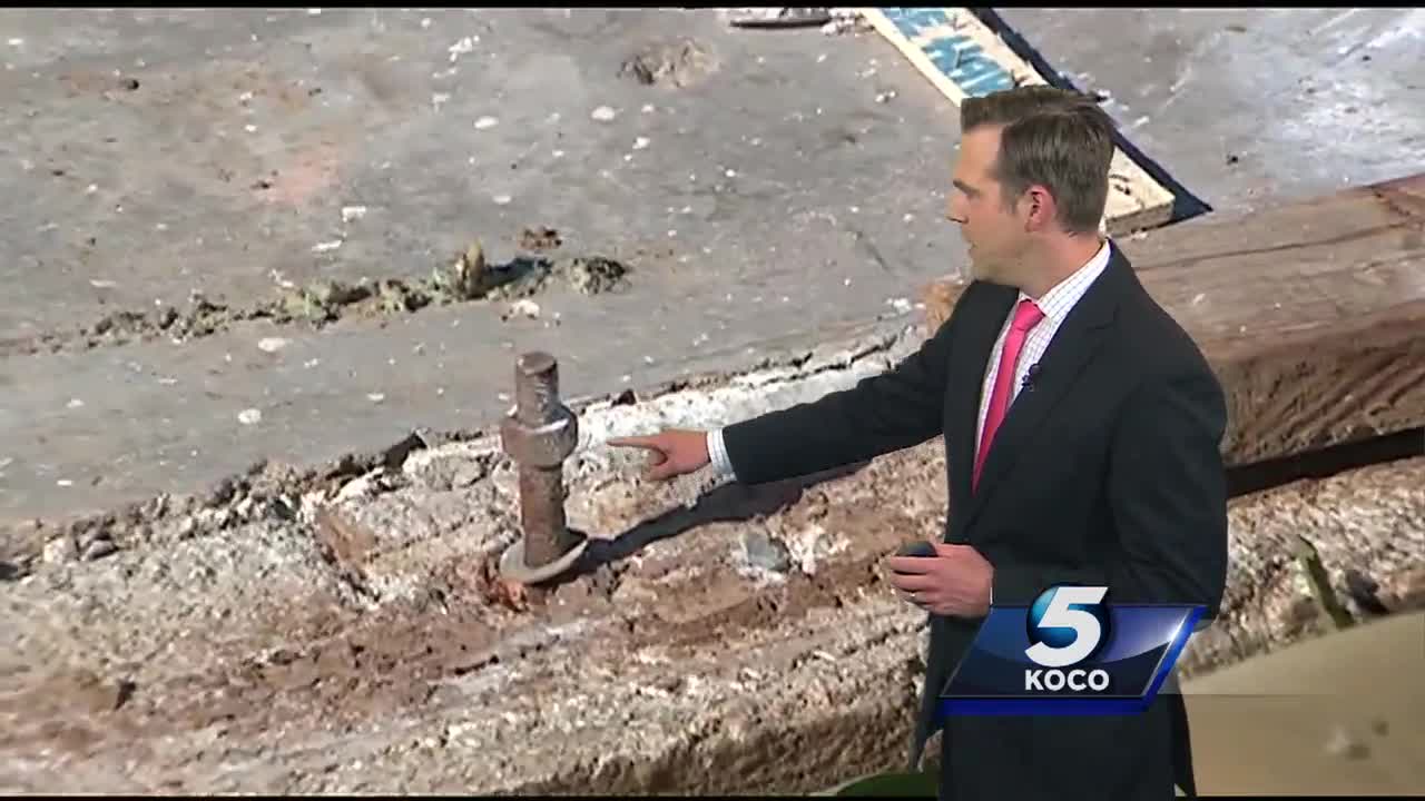
@KOCOBrad -- From the home swept on cam in Wynnewood. This only seen in the most violent tornadoes. @NWSNorman
0 likes
The above post and any post by Texas Snowman is NOT an official forecast and should not be used as such. It is just the opinion of the poster and may or may not be backed by sound meteorological data. It is NOT endorsed by any professional institution including storm2k.org. For official information, please refer to NWS products.
Re: Texas Spring 2016
Temps are rising and well into the mid 80s here with dews 70+. Question for today is, at least at DFW, is how far north storms will fire. South of here definitely bears watching. Big hailers?

0 likes
The above post and any post by Ntxw is NOT an official forecast and should not be used as such. It is just the opinion of the poster and may or may not be backed by sound meteorological data. It is NOT endorsed by any professional institution including Storm2k. For official information, please refer to NWS products.
Help support Storm2K!
Help support Storm2K!
-
Texas Snowman
- Storm2k Moderator
- Posts: 6197
- Joined: Fri Jan 25, 2008 11:29 am
- Location: Denison, Texas
Re: Texas Spring 2016
@NWSNorman -- Survey teams also found a 12 mile long damage path associated with an anti-cyclonic tornado from N of Sulphur to N of Roff.
0 likes
The above post and any post by Texas Snowman is NOT an official forecast and should not be used as such. It is just the opinion of the poster and may or may not be backed by sound meteorological data. It is NOT endorsed by any professional institution including storm2k.org. For official information, please refer to NWS products.
-
Texas Snowman
- Storm2k Moderator
- Posts: 6197
- Joined: Fri Jan 25, 2008 11:29 am
- Location: Denison, Texas
Re: Texas Spring 2016
One chaser directed NWS Norman to some damage he said appeared to be EF-4 in northern Murray County. NWS said they had not made it to that location yet.
Chaser noted that if the big wedge had literally been five miles further south, communities of Davis and Sulphur might be gone.
That's only 55 miles NW of where I live.
Chaser noted that if the big wedge had literally been five miles further south, communities of Davis and Sulphur might be gone.
That's only 55 miles NW of where I live.
0 likes
The above post and any post by Texas Snowman is NOT an official forecast and should not be used as such. It is just the opinion of the poster and may or may not be backed by sound meteorological data. It is NOT endorsed by any professional institution including storm2k.org. For official information, please refer to NWS products.
Return to “USA & Caribbean Weather”
Who is online
Users browsing this forum: 869MB, Stratton23, Yukon Cornelius and 108 guests