http://twitter.com/NWSWPC/status/1264665115951009792
Florida Weather
Moderator: S2k Moderators
Forum rules

The posts in this forum are NOT official forecast and should not be used as such. They are just the opinion of the poster and may or may not be backed by sound meteorological data. They are NOT endorsed by any professional institution or STORM2K.
-
toad strangler

- S2K Supporter

- Posts: 4546
- Joined: Sun Jul 28, 2013 3:09 pm
- Location: Earth
- Contact:
Re: Florida Weather
0 likes
My Weather Station
https://www.wunderground.com/dashboard/pws/KFLPORTS603
https://www.wunderground.com/dashboard/pws/KFLPORTS603


Re: Florida Weather
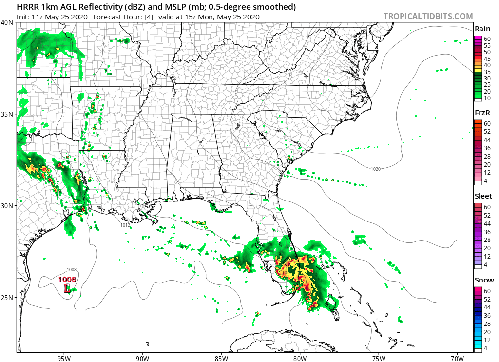
toad strangler wrote:http://twitter.com/NWSWPC/status/1264665115951009792?s=20
I'll believe all the hype about a washout holiday weekend once I see it.
Here in Tampa Bay it been nothing but a few spritzes and does not reflect what the radar has been showing.
Dry air above causing an issue with virga.
0 likes
-
toad strangler
- S2K Supporter
- Posts: 4546
- Joined: Sun Jul 28, 2013 3:09 pm
- Location: Earth
- Contact:
Re: Florida Weather
MetroMike wrote:toad strangler wrote:http://twitter.com/NWSWPC/status/1264665115951009792?s=20
I'll believe all the hype about a washout holiday weekend once I see it.
Here in Tampa Bay it been nothing but a few spritzes and does not reflect what the radar has been showing.
Dry air above causing an issue with virga.
This is more of an E coast event as far as higher rainfall goes it seems to me.
0 likes
My Weather Station
https://www.wunderground.com/dashboard/pws/KFLPORTS603
https://www.wunderground.com/dashboard/pws/KFLPORTS603
Re: Florida Weather
toad strangler wrote:MetroMike wrote:toad strangler wrote:http://twitter.com/NWSWPC/status/1264665115951009792?s=20
I'll believe all the hype about a washout holiday weekend once I see it.
Here in Tampa Bay it been nothing but a few spritzes and does not reflect what the radar has been showing.
Dry air above causing an issue with virga.
This is more of an E coast event as far as higher rainfall goes it seems to me.
Apparently even though the NWS calls for heavy rainfall next 24 hrs.in this area.
0 likes
Re: Florida Weather
It's a tough call as far as heavy rain is concerned. the flood watches look well placed as the east coast often does well in such onshore events. we may not get much here in west central florida. we will have to wait and see. no matter what, our weather is really missing the mark at a time of the year it is often near perfection. Alberto screwed things up a couple years ago too so we're on a bad streak..
0 likes
-
gatorcane

- S2K Supporter
- Posts: 23708
- Age: 48
- Joined: Sun Mar 13, 2005 3:54 pm
- Location: Boca Raton, FL
Re: Florida Weather
Very windy and squally here in coastal SE Florida. I am out by the beach and it looks like a tropical storm in the saualls.
0 likes
-
SFLcane

- S2K Supporter
- Posts: 10281
- Age: 48
- Joined: Sat Jun 05, 2010 1:44 pm
- Location: Lake Worth Florida
Re: Florida Weather
gatorcane wrote:Very windy and squally here in coastal SE Florida. I am out by the beach and it looks like a tropical storm in the saualls.
Actually a non event here in Broward everything missed the mainland. We should dry out this afternoon.
0 likes
-
toad strangler
- S2K Supporter
- Posts: 4546
- Joined: Sun Jul 28, 2013 3:09 pm
- Location: Earth
- Contact:
Re: Florida Weather
1.50" on the nose in Saint Luce West at 9AM this morning. Much more to come seemingly.
0 likes
My Weather Station
https://www.wunderground.com/dashboard/pws/KFLPORTS603
https://www.wunderground.com/dashboard/pws/KFLPORTS603
-
gatorcane
- S2K Supporter
- Posts: 23708
- Age: 48
- Joined: Sun Mar 13, 2005 3:54 pm
- Location: Boca Raton, FL
Re: Florida Weather
May actually get some clearing across SE Florida later this afternoon. While we ended up with a lot of rain, nowhere near the 10-14 inches the Euro was showing.
0 likes
-
gatorcane
- S2K Supporter
- Posts: 23708
- Age: 48
- Joined: Sun Mar 13, 2005 3:54 pm
- Location: Boca Raton, FL
Re: Florida Weather
Not over yet for South Florida albeit with some uncertainty. Great technical discussion from NWS Miami:
000
FXUS62 KMFL 251528
AFDMFL
Area Forecast Discussion
National Weather Service Miami FL
1128 AM EDT Mon May 25 2020
.Mesoscale Update...
Upper troughing remains prominent across the Gulf of Mexico with
a basal speed max extending east-northeast from the Bay of
Campeche into the northwest Caribbean Sea. A decaying Mesoscale
Convective Vortex (MCV) was lifting north through the Atlantic
waters, while surface troughing extended from the southern Florida
Peninsula southwest into the southern Gulf of Mexico. Given the
diffluent pattern aloft, subtle vorticity perturbations, the
remnant MCV, and the surface trough plentiful sources for lift are
evident across the area this morning. The 25.12z MFL sounding
sampled a precipitable water value of 2.19 inches, which is well
above the 90th percentile and is nearly three standard deviations
above the climatological mean. This moisture was well distributed
throughout the tropospheric column, as evident by near moist
adiabatic lapse rates sampled by the sounding and warm cloud
depths exceeding 14 kft. This environment is amply supportive of
efficient warm rain processes with rain rates nearing or
potentially exceeding 2 inches per hour. Deep moisture of tropical
origin will remain in place through tonight as additional low-
level moisture arrives via south-southeast oriented low-level
moisture transport vectors. This should maintain the concern for
enhanced precipitation efficiency into at least the evening hours.
As the remnant MCV lifts north some breaks in cloud cover are
already evident to our south/southwest where insolation (albeit
limited) has boosted MLCAPE values over 1200 J/kg. Modifying the
MFL sounding for the expected diabatic heating suggests an
increase to around 2000 J/kg is at least conditionally possible.
Our initial concern over the next several hours is the area of
rain and thunderstorms currently developing along the tail end of
the remnant MCV from extreme southeast coastal Florida towards
(and offshore of) the upper Keys. As this area lifts north the
thermodynamically supportive environment suggests a continuation
of heavy rainfall rates. The greatest uncertainty at this point is
the exact placement of the heavier rainfall axis. While it could
occur just offshore, a reasonable worst case scenario would place
an axis of moderate to heavy rainfall across the I-95 corridor of
Broward and Miami-Dade Counties through early afternoon. These
areas have already been primed for flooding potential given
widespread rain totals of 3-5 inches over the past 24 hours and
widespread reports of nuisance and street flooding already
ongoing. This area will be carefully monitored for flash flooding
potential over the next several hours.
An additional concern is the increase in low-level shear
occurring behind the MCV. RAP Analysis suggests effective shear of
25-30 kt located across the waters offshore of the upper Keys,
with this area forecast to lift north over time into the MFL
Atlantic waters (and potentially into the east coast metro areas).
Convection is already taking advantage of the increased ambient
shear, as evident by the strong mid-level rotational signature
(inbounds over 60 kt) evident on KAMX well offshore of Islamorada
at 1515z. This suggest an enhanced concern for strong waterspouts
across the Atlantic waters today, along with the potential for a
brief tornado or two over the east coast metro areas. This concern
should continue through at least the late afternoon to early
evening hours.
All weather elements were updated to reflect the current forecast
thinking with consideration for the latest radar and satellite
trends.
&&
https://forecast.weather.gov/product.ph ... glossary=0
0 likes
-
NotSparta

- Professional-Met

- Posts: 1677
- Age: 24
- Joined: Fri Aug 18, 2017 8:24 am
- Location: Naples, FL
- Contact:
Re: Florida Weather
Nothing at all today in SW FL, looks like the droughtbuster was a bust
1 likes
This post was probably an opinion of mine, and in no way is official. Please refer to http://www.hurricanes.gov for official tropical analysis and advisories.
My website, with lots of tropical wx graphics, including satellite and recon: http://cyclonicwx.com
My website, with lots of tropical wx graphics, including satellite and recon: http://cyclonicwx.com
-
AdamFirst

- S2K Supporter
- Posts: 2490
- Age: 36
- Joined: Thu Aug 14, 2008 10:54 am
- Location: Port Saint Lucie, FL
Re: Florida Weather
Heavy bands redeveloping over Miami-Dade and the upper keys pushing north. Severe warned storm skirting the coast along north Miami-Dade with a flash flood warning ongoing.
1 likes
Dolphins Marlins Canes Golden Panthers HEAT
Andrew 1992 - Irene 1999 - Frances 2004 - Jeanne 2004 - Wilma 2005 - Fay 2008 - Isaac 2012 - Matthew 2016 - Irma 2017 - Dorian 2019 - Ian 2022 - Nicole 2022 - Milton 2024
Andrew 1992 - Irene 1999 - Frances 2004 - Jeanne 2004 - Wilma 2005 - Fay 2008 - Isaac 2012 - Matthew 2016 - Irma 2017 - Dorian 2019 - Ian 2022 - Nicole 2022 - Milton 2024
-
toad strangler
- S2K Supporter
- Posts: 4546
- Joined: Sun Jul 28, 2013 3:09 pm
- Location: Earth
- Contact:
Re: Florida Weather
Up to 2.65” for the entire event in St. Lucie West.
0 likes
My Weather Station
https://www.wunderground.com/dashboard/pws/KFLPORTS603
https://www.wunderground.com/dashboard/pws/KFLPORTS603
-
toad strangler
- S2K Supporter
- Posts: 4546
- Joined: Sun Jul 28, 2013 3:09 pm
- Location: Earth
- Contact:
Re: Florida Weather
SFLcane wrote:gatorcane wrote:Very windy and squally here in coastal SE Florida. I am out by the beach and it looks like a tropical storm in the saualls.
Actually a non event here in Broward everything missed the mainland. We should dry out this afternoon.
This didn’t age well. That’s two for you recently
0 likes
My Weather Station
https://www.wunderground.com/dashboard/pws/KFLPORTS603
https://www.wunderground.com/dashboard/pws/KFLPORTS603
-
AdamFirst
- S2K Supporter
- Posts: 2490
- Age: 36
- Joined: Thu Aug 14, 2008 10:54 am
- Location: Port Saint Lucie, FL
Re: Florida Weather
Slow moving clusters of heavy showers are scraping the southeast Florida coast. Flash flood warnings are back up for eastern Broward and Palm Beach County. These bands will continue to move slowly north as the night goes on
0 likes
Dolphins Marlins Canes Golden Panthers HEAT
Andrew 1992 - Irene 1999 - Frances 2004 - Jeanne 2004 - Wilma 2005 - Fay 2008 - Isaac 2012 - Matthew 2016 - Irma 2017 - Dorian 2019 - Ian 2022 - Nicole 2022 - Milton 2024
Andrew 1992 - Irene 1999 - Frances 2004 - Jeanne 2004 - Wilma 2005 - Fay 2008 - Isaac 2012 - Matthew 2016 - Irma 2017 - Dorian 2019 - Ian 2022 - Nicole 2022 - Milton 2024
-
gatorcane
- S2K Supporter
- Posts: 23708
- Age: 48
- Joined: Sun Mar 13, 2005 3:54 pm
- Location: Boca Raton, FL
Re: Florida Weather
Copious amounts of rain here in coastal SE Palm Beach county. The Euro wasn’t lying about 10+ inches. We may just hit that.
0 likes
-
AdamFirst
- S2K Supporter
- Posts: 2490
- Age: 36
- Joined: Thu Aug 14, 2008 10:54 am
- Location: Port Saint Lucie, FL
Re: Florida Weather
Severe Weather Statement
National Weather Service Miami FL
853 PM EDT Mon May 25 2020
FLC011-260130-
/O.CON.KMFL.TO.W.0004.000000T0000Z-200526T0130Z/
Broward FL-
853 PM EDT Mon May 25 2020
...A TORNADO WARNING REMAINS IN EFFECT UNTIL 930 PM EDT FOR SOUTHERN
BROWARD COUNTY...
At 853 PM EDT, a severe thunderstorm capable of producing a tornado
was located over Royal Palm Ranches, or near Pembroke Pines, moving
northeast at 15 mph.
HAZARD...TORNADO.
SOURCE...Radar indicated rotation.
IMPACT...Expect damage to mobile homes, roofs, and vehicles. Tree
damage is likely.
Locations impacted include...
Pembroke Pines, Hollywood, Miramar, Davie and Hallandale.
0 likes
Dolphins Marlins Canes Golden Panthers HEAT
Andrew 1992 - Irene 1999 - Frances 2004 - Jeanne 2004 - Wilma 2005 - Fay 2008 - Isaac 2012 - Matthew 2016 - Irma 2017 - Dorian 2019 - Ian 2022 - Nicole 2022 - Milton 2024
Andrew 1992 - Irene 1999 - Frances 2004 - Jeanne 2004 - Wilma 2005 - Fay 2008 - Isaac 2012 - Matthew 2016 - Irma 2017 - Dorian 2019 - Ian 2022 - Nicole 2022 - Milton 2024
-
gatorcane
- S2K Supporter
- Posts: 23708
- Age: 48
- Joined: Sun Mar 13, 2005 3:54 pm
- Location: Boca Raton, FL
Re: Florida Weather
Looks like another round of convection and heavy rain building over the Everglades and heading towards metro SE Florida. This is no bueno with all of the rain that has fallen here. It has literally rained over 6 hours straight here in my locale today and that doesn’t count heavy rains earlier this morning and yesterday.
2 likes
Return to “USA & Caribbean Weather”
Who is online
Users browsing this forum: snownado, SnowyOwl31, South Texas Storms, Stratton23, wxman22 and 52 guests